Ticker for October 8, 2021
MESONET TICKER ... MESONET TICKER ... MESONET TICKER ... MESONET TICKER ...
October 8, 2021 October 8, 2021 October 8, 2021 October 8, 2021
One of THOSE days
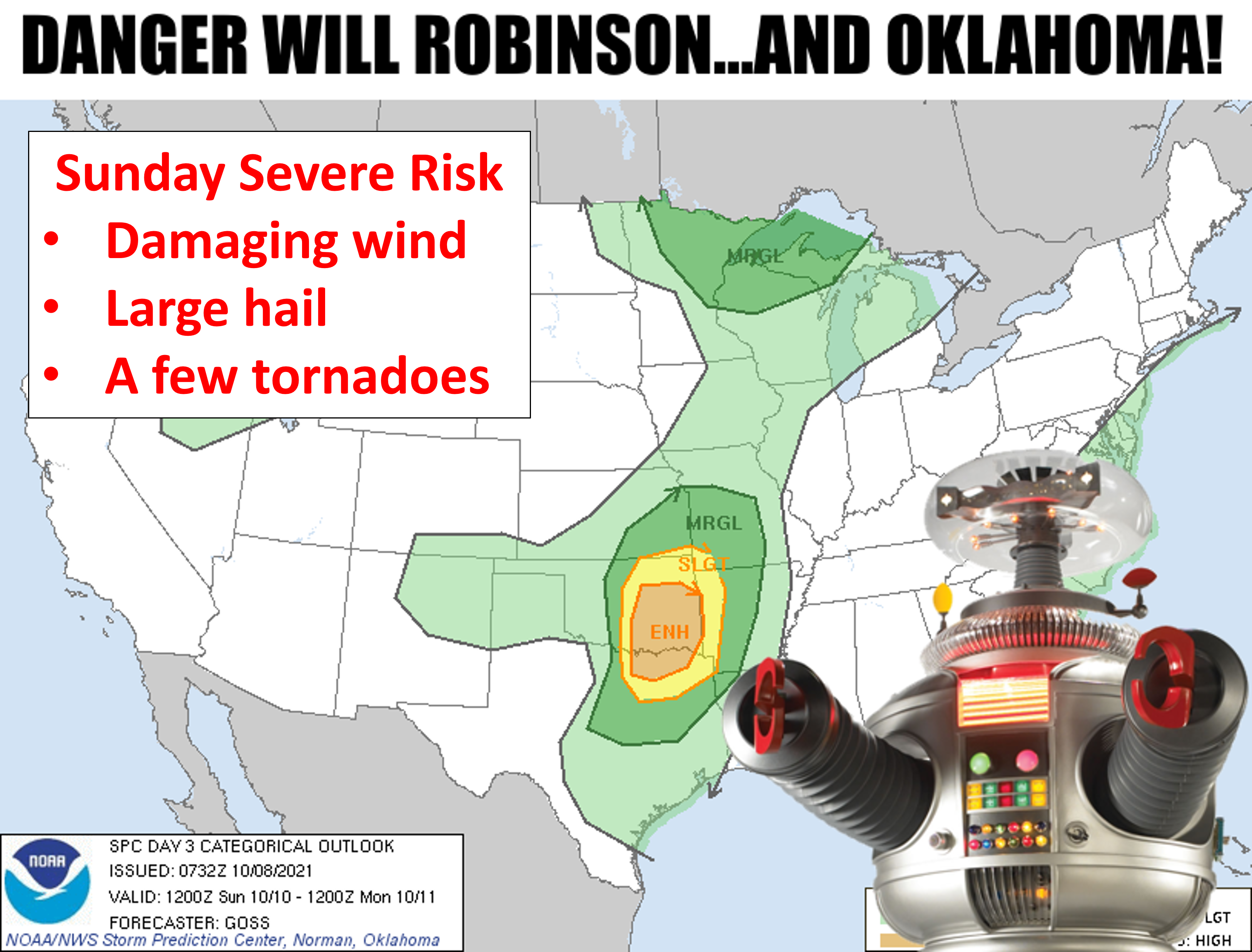
Hmm, to get the meme's reference you have to be old, or incredibly nerdy, so I
figure I have half my audience covered. For all you young, cool people...Google.
But yes, Sunday is going to be on of THOSE days in Oklahoma when the wind comes
sweeping down the Plain and blows you all the way to Mars. Why, you'd be LOST IN
SPACE? Harumph! I had to work it in there sometime.
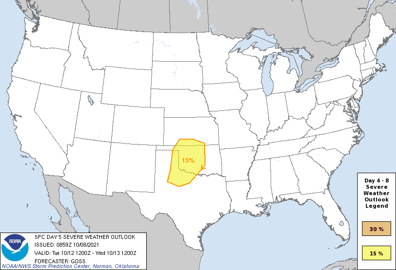
The setup will be sort of classic with a strong upper-trough and a cold front
entering the area, and a dryline. Storms should form along the dryline Sunday
afternoon, quickly go severe and begin to rotate forming supercells, with a window
of tornadic opportunity, then form a squall line and march across eastern
Oklahoma. Here are a few graphics from our local NWS offices giving their view.
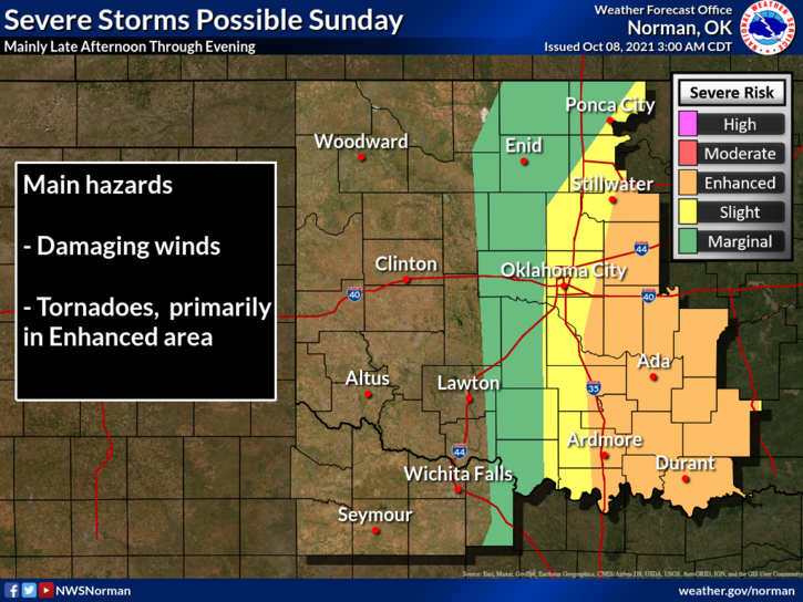
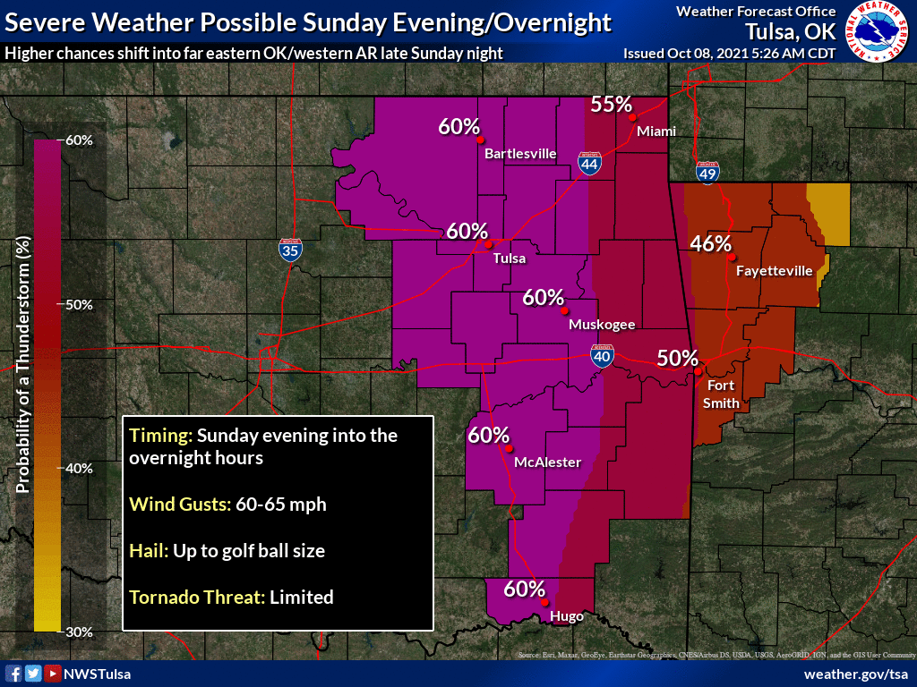
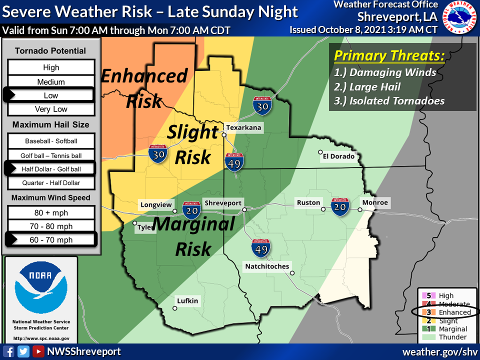
Then we'll get a break on Monday with a mild October day, then possibly do the
whole shebang over again on Tuesday with another severe weather outbreak
possible.
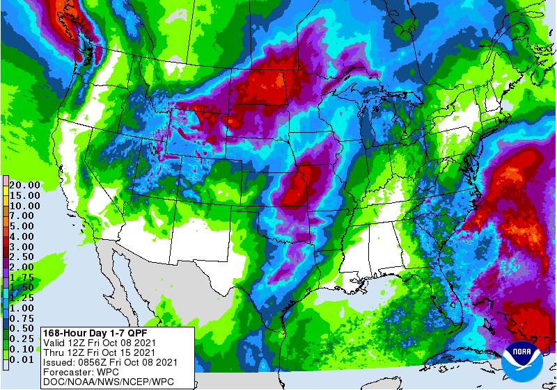
Along the way we're gonna get some much needed rain across central and eastern
Oklahoma, but probably not enough across western Oklahoma. This can certainly
change for the better, especially for next week's storms, but we'll just have
to wait and see.
As for today and tomorrow, as is often the case in advance of a big system
and cold front, we're gonna have gusty south winds kicking up the temperatures,
and in this case, we're talking possible record highs.
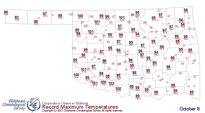
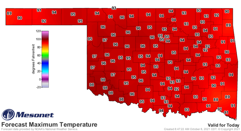
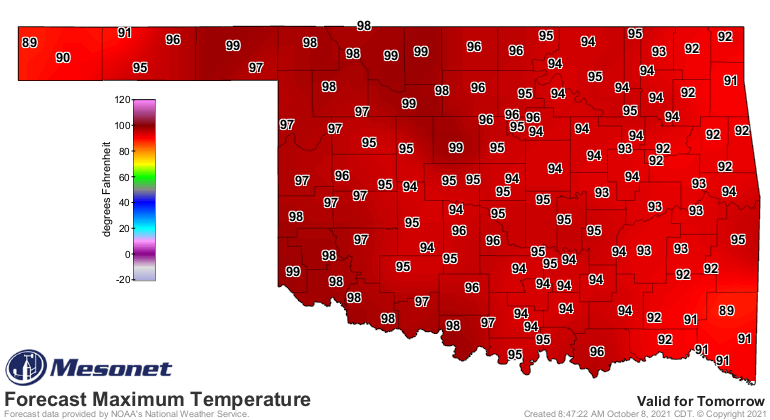
The highest temperature ever recorded on an Oct. 8 in Oklahoma is 103 degrees
at Walters down in SW OK in 1979. I don't think we'll quite get there, but
a triple-digit temperature or two is not out of the question.
All of this is sort of the same info we had the last time we Tocked, but with
just a bit more clarity AND insanity. We have something for just about everyone
in the next 5 days...severe weather (BOO!), a mild fall day on Monday (BOO!),
record heat Friday and Saturday (YAY!), and rain (YAY!).
That's Oklahoma.
Gary McManus
State Climatologist
Oklahoma Mesonet
Oklahoma Climatological Survey
(405) 325-2253
gmcmanus@Mesonet.org
October 8 in Mesonet History
| Record | Value | Station | Year |
|---|---|---|---|
| Maximum Temperature | 100°F | GRA2 | 2021 |
| Minimum Temperature | 22°F | ELRE | 2000 |
| Maximum Rainfall | 5.94 inches | VINI | 2009 |
Mesonet records begin in 1994.
Search by Date
If you're a bit off, don't worry, because just like horseshoes, “almost” counts on the Ticker website!