Ticker for October 7, 2021
MESONET TICKER ... MESONET TICKER ... MESONET TICKER ... MESONET TICKER ...
October 7, 2021 October 7, 2021 October 7, 2021 October 7, 2021
Autumn?
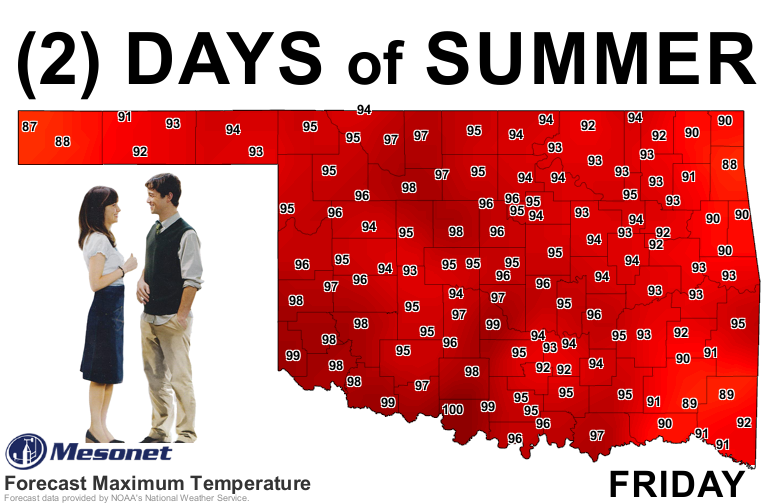
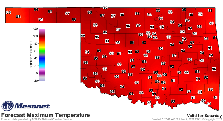
Yeah, it's gonna be hot tomorrow and Saturday. Record-breaking hot in some (many?)
cases. But remember, if Tom hadn't gone through those 500 days of Summer, he never
would have met Autumn. You get where I'm coming from? Don't worry about it,
nobody does. Not even the world's best psychiatrists. And I'm not sure Tom met
severe thunderstorms and tornadoes the day after he met Autumn, either. The severe
threat on Sunday has already ramped up according to SPC's DAY 4!! severe outlook.
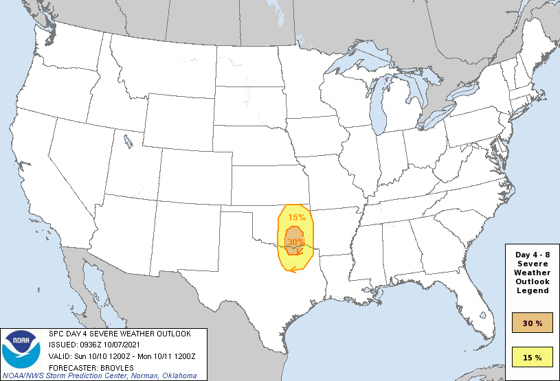
I don't know how often you see a 30% severe risk area on a Day 4 map in the fall,
but I'm gonna guess it's somewhat uncommon. Again, just a guess. That area across
the eastern half of the state, but especially southeast Oklahoma, should be on
the lookout Sunday evening into early morning Monday for all modes of severe
weather: large hail, severe winds, tornadoes, and Gary Busey.
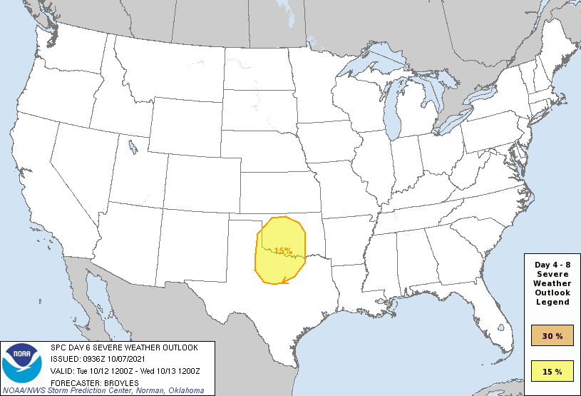
Tuesday is also looking stormy for much of the state. Still a ways off to be
pinpointing the exact threat area just yet, but keep those storm shelters cleaned
out just in case. Don't put your boxes and dead bodies back in until after next
week, maybe. Again, all modes of severe weather look possible.
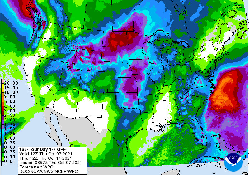
One good thing from these storms is that lots of rain is starting to show up
on the 7-day forecast map, especially across eastern Oklahoma. Nearly all
areas of the state need it, so we'll take it and hope the severe weather is
tame.
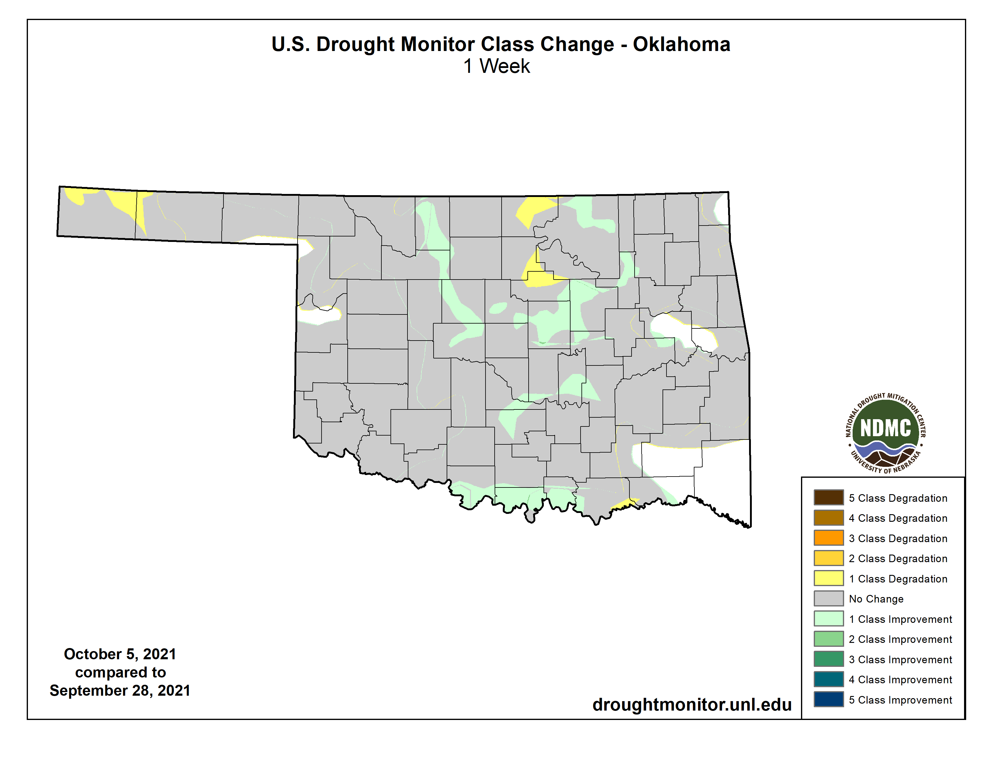
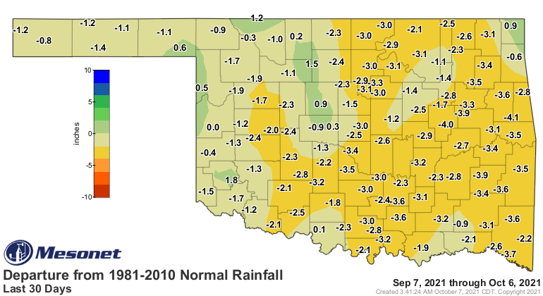
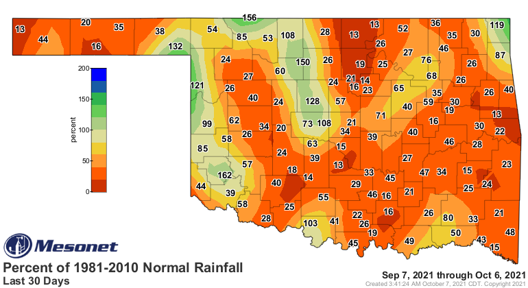
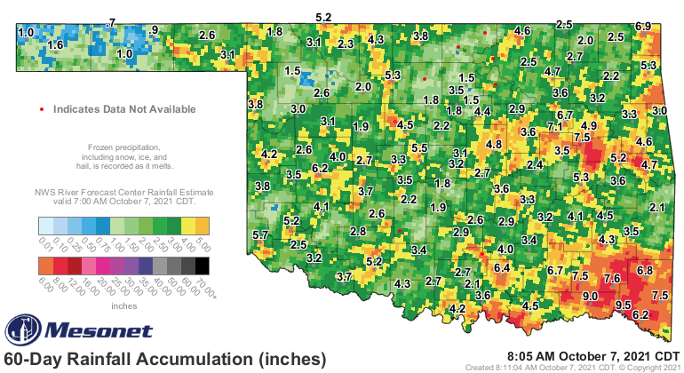
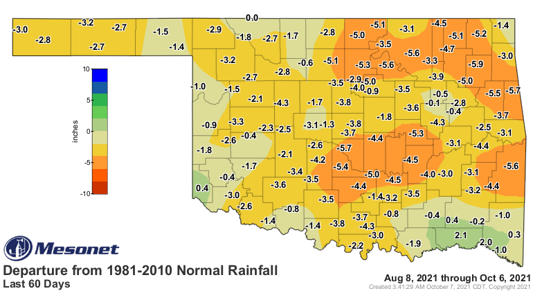
This week's Drought Monitor shows the need for that rainfall pretty clearly. We
had some targeted improvements where the heaviest rains fell last week, but
we also had some areas get worse.
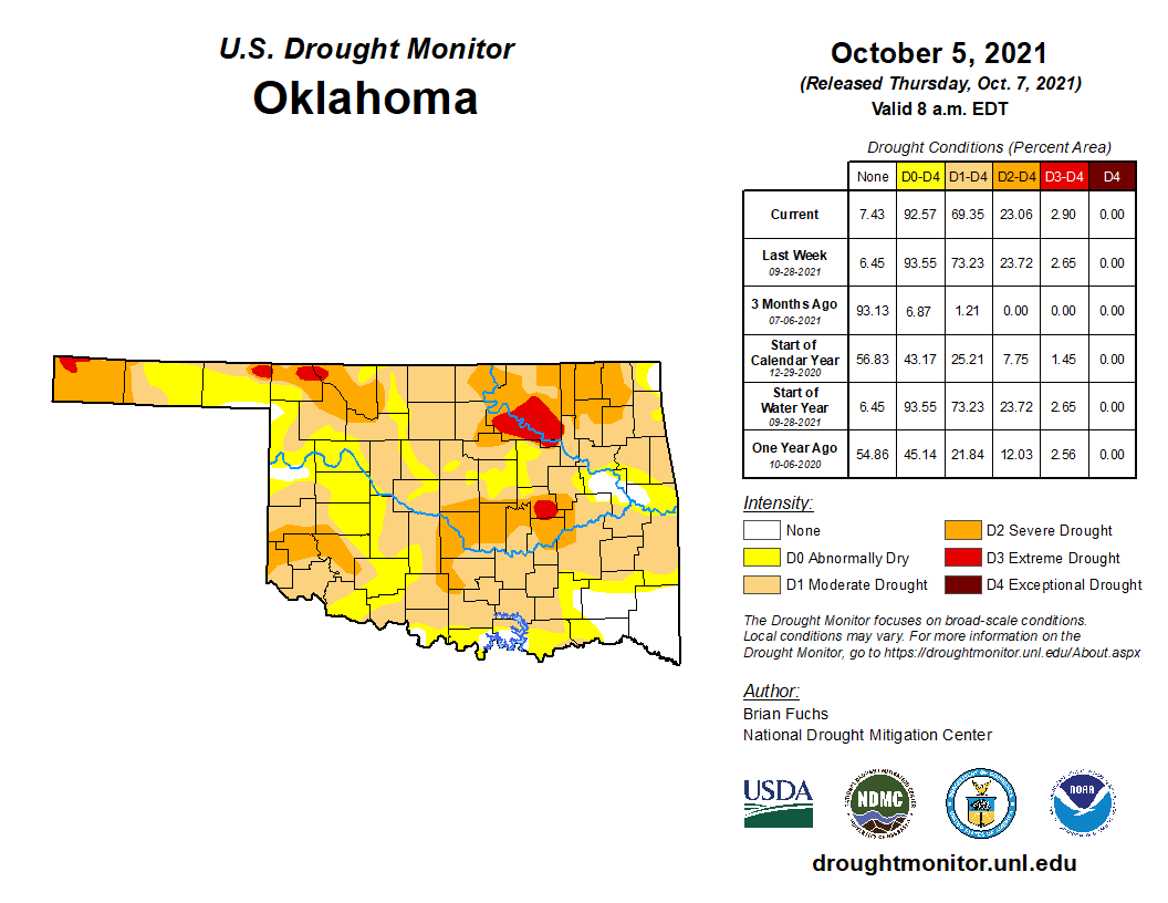
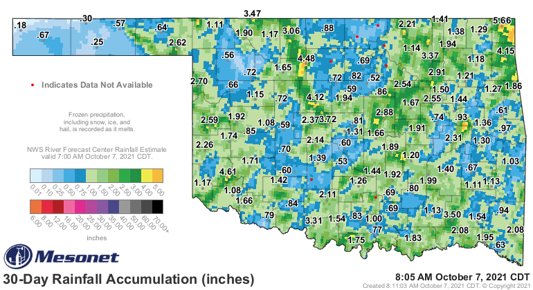
I know there will be some out there that think the drought map is a bit
overblown, especially since the last bout of rains was pretty widespread, but
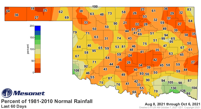
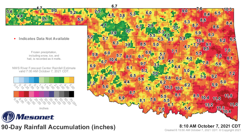
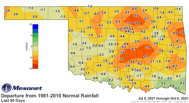
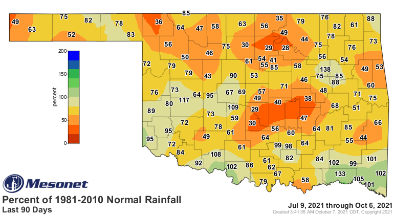
a look at the 30-, 60- and 90-day rain maps shows just how dry we are as we
go out to the past 3 months, especially the last 2 when the heat has been 5-15
degrees above normal for extended periods of time.
And always good to remember if you're not seeing the drought impact your life
and/or livelihood, there is possibly somebody else in other circumstances that
could be.
Now as we look just a bit farther out, the rain outlook is looking more
favorable for next week, although I'm pretty sure this is mostly based on the
storms of Tuesday, but Wednesday could being more moisture as well.
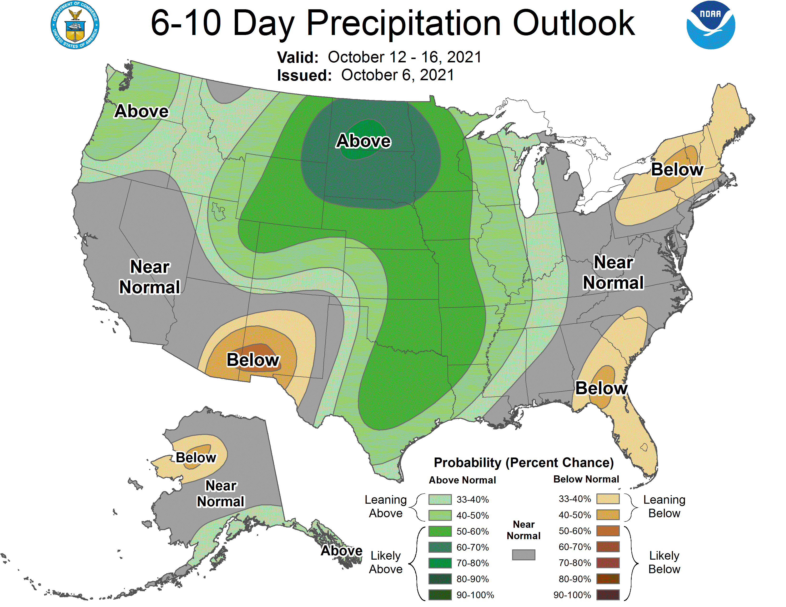
Now go get those storm shelters cleaned out, dust off your severe weather
preparedness plans, and then we can look forward to our new annual Halloween
ice storm.
Gary McManus
State Climatologist
Oklahoma Mesonet
Oklahoma Climatological Survey
(405) 325-2253
gmcmanus@mesonet.org
October 7 in Mesonet History
| Record | Value | Station | Year |
|---|---|---|---|
| Maximum Temperature | 99°F | WAUR | 2014 |
| Minimum Temperature | 26°F | SEIL | 2012 |
| Maximum Rainfall | 5.79 inches | HOBA | 2018 |
Mesonet records begin in 1994.
Search by Date
If you're a bit off, don't worry, because just like horseshoes, “almost” counts on the Ticker website!