Ticker for October 6, 2021
MESONET TICKER ... MESONET TICKER ... MESONET TICKER ... MESONET TICKER ...
October 6, 2021    October 6, 2021    October 6, 2021    October 6, 2021


Be vewy vewy careful


Oh no, not another "it's going to be hot then mild then hot again post!" Yeah,
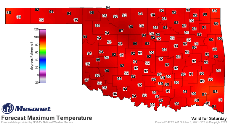
I heard that in my head when I saw the forecast highs for Saturday.


Oh no, it's going to be hot then mild then hot again! Drats, I just couldn't help
myself. But it's that time of year when we see the jet stream start to dip down
into our neck of the woods again and we get those clashes between air masses,
return moisture from the Gulf of Mexico, and favorable winds to see storms fire
up and start to rotate. Not quite spring-style storms, but what would be
considered our *secondary* severe weather season here in the fall. But as they
like to say, severe weather season is year-round in Oklahoma. I don't even know
who "they" are, but "they" say lots of generalized statements like that, such as:
don't eat the first snow of the season, don't go swimming within 30 minutes of
eating, don't think about your hair too much or it will fall out.

ONE OF THOSE IS TRUE, DANGIT!

But here's the deal...the truth of the matter is we can get big storms any time
of the year in Oklahoma, but there are certain times of the year we'd *expect*
them a bit more often and fall is one of those times.

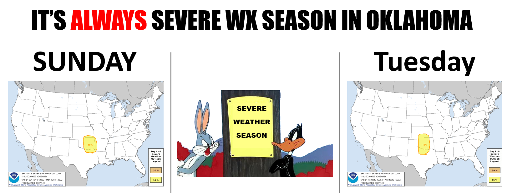
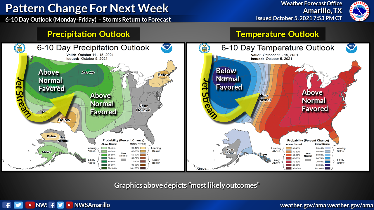
So here's the setup, an upper-level trough will move through the area and
possibly kick up some storms with the possibility of large hail and high winds.
There will also be a conditional tornado threat, depending on the setup as
the day unfolds. Then we get to do it all over again on Tuesday, possibly. Our
friends at NWS Amarillo help us out with a graphic describing the setup.
Remember, if you don't order an entree, we'll have to charge you for this
setup.


We will see chances for near-record temperatures on Friday and Saturday in
parts of the state....dare say a hunnert or two?


It would be a bit unusual to see triple-digit temps that late in the season,
but not unheard of, certainly. On Saturday, Oct. 9, for instance, there have
been 3 100s historically (not 300s, thank goodness), 101 degrees at Frederick
in 1979 at the top. Heck, the latest triple-digit temperatures on record for
Oklahoma were on Oct. 17, 2016, when a slew of stations across the NW part of
the state got up to 102. We had some 100s in 1972 on that late date as well.

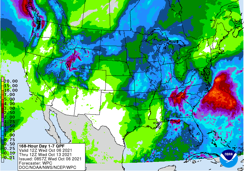
As for the rain, which some parts of the state desperately need, we're more
likely to see the heavier amounts across eastern Oklahoma. But this could
change if the regions for those storms change a little bit. The Tuesday storms
are just getting on the 7day rain forecast, so maybe we'll fill a bit more
out to the west.


At any rate, time to be weather aware. If those storm shelters have filled up
with bugs, dead mice, or water...best get them ready. Might as well fill up
those swimming pools for this weekend as well and stay sunburn aware.

Gary McManus
State Climatologist
Oklahoma Mesonet
Oklahoma Climatological Survey
(405) 325-2253
gmcmanus@mesonet.org
October 6 in Mesonet History
| Record | Value | Station | Year |
|---|---|---|---|
| Maximum Temperature | 95°F | FREE | 2016 |
| Minimum Temperature | 27°F | KENT | 2013 |
| Maximum Rainfall | 7.75 inches | JAYX | 2019 |
Mesonet records begin in 1994.
Search by Date
If you're a bit off, don't worry, because just like horseshoes, “almost” counts on the Ticker website!