Ticker for October 4, 2021
MESONET TICKER ... MESONET TICKER ... MESONET TICKER ... MESONET TICKER ...
October 4, 2021 October 4, 2021 October 4, 2021 October 4, 2021
SeasonGames
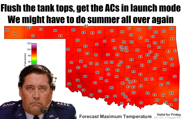
I knew we weren't done with the 90s, and I'm not talking about acid washed jeans,
either (come on, that was horrible back then, why bring it back??). Turns out
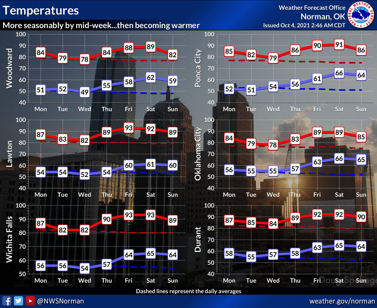
the 90s weren't done with us either. Watch for a cool first half of the week with
highs on the seasonable side, then sometime around Thursday the strong southerly
winds kick in and we go back to summer. And while those 90s down in the SW are
much warmer than normal, they're nowhere close to the all time record highs for
the day, which are up in the 100s back on Oct. 8, 1979.
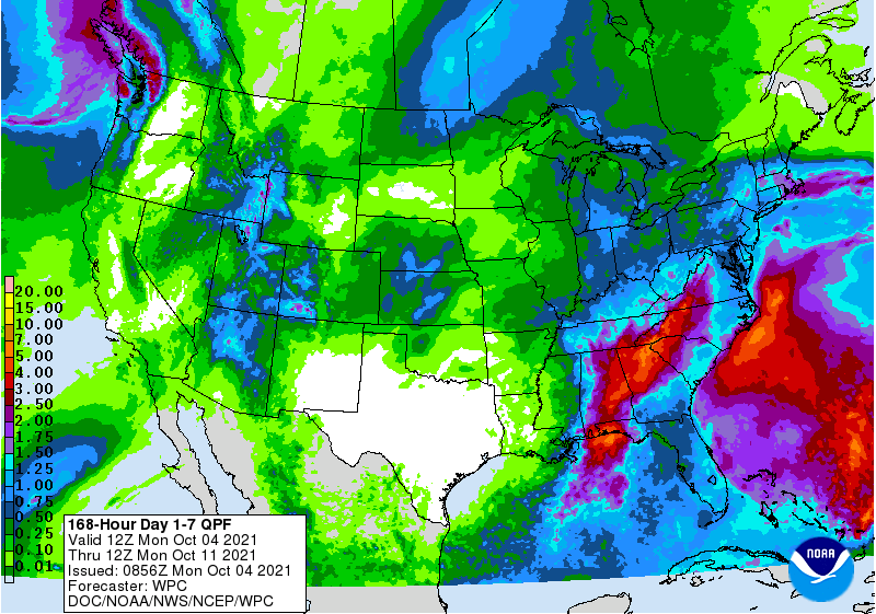
No chance for rain until maybe late into the weekend with another low pressure
system, but that's a ways away and will definitely need some fine tuning. Not a
lot showing up on the 7-day rain forecast just yet, but at least the map isn't
all white, like my legs.
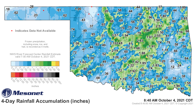
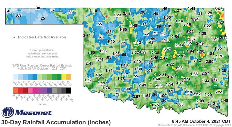
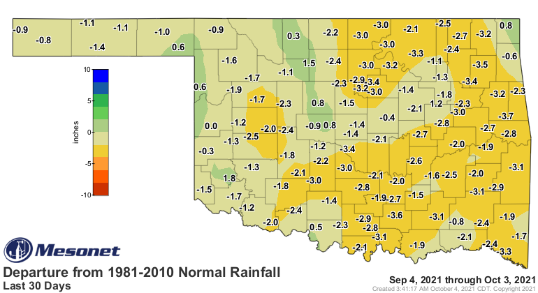
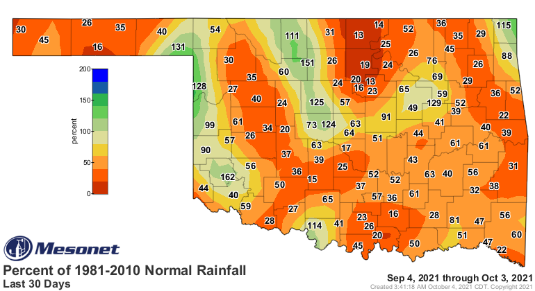
The good news is that we did get a good dose of moisture for parts of the state,
but as you can see, many spots still need more. A large part of the state is
still hurting at 30-60 days with some significant deficits.
It looks like we might have some chances for those showers to continue into
next week, but also the above normal temperatures. Above normal
temps this time of year doesn't mean upper 80s and 90s, necessarily, but it does
for this weekend at least.
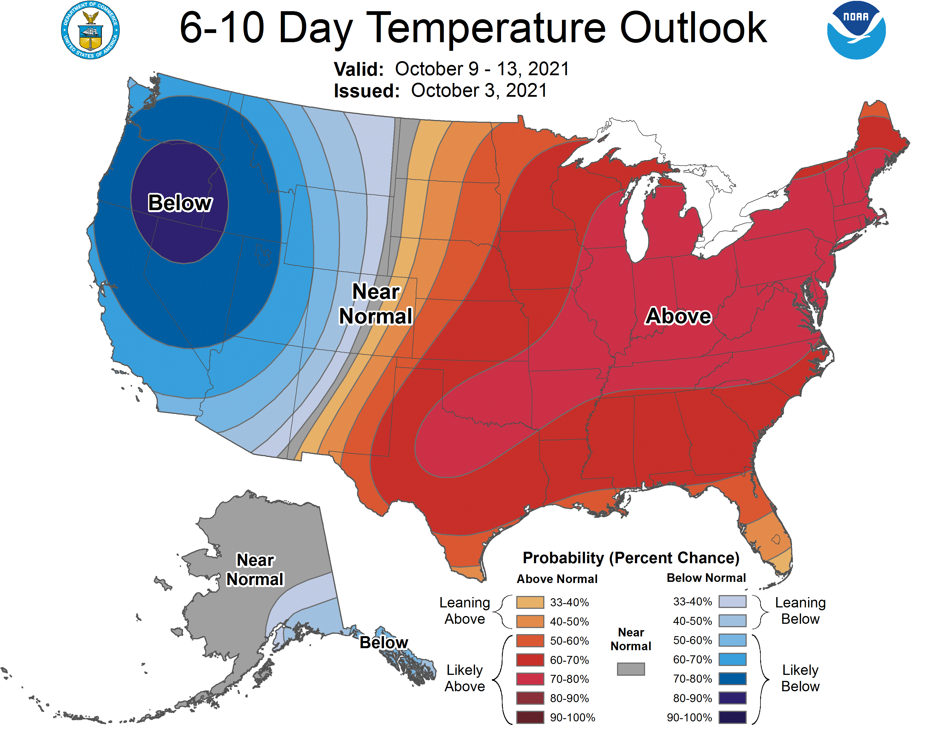
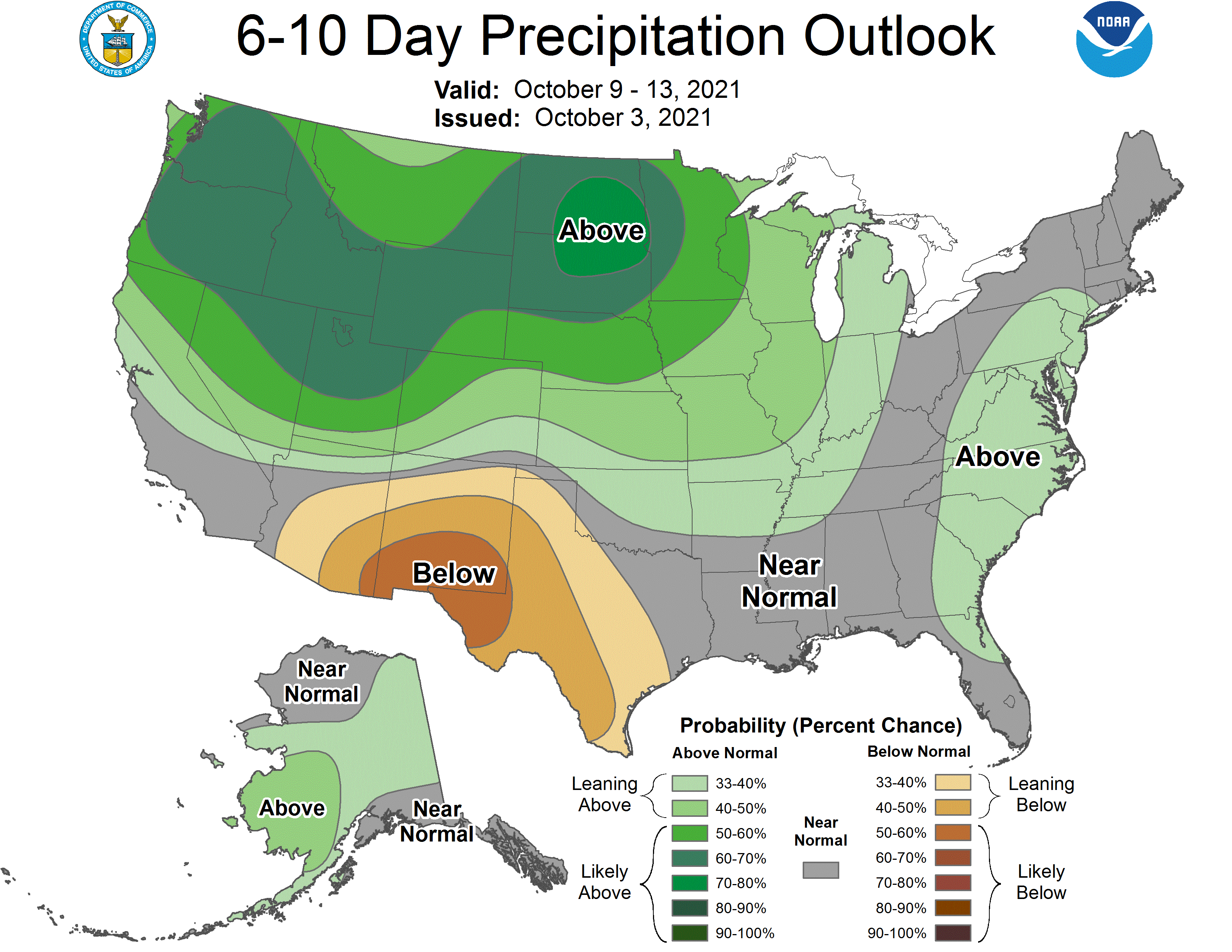
Maybe that large area of cold air to the west means a big trough headed our way
down the road?
Gary McManus
State Climatologist
Oklahoma Mesonet
Oklahoma Climatological Survey
(405) 325-2253
gmcmanus@mesonet.org
October 4 in Mesonet History
| Record | Value | Station | Year |
|---|---|---|---|
| Maximum Temperature | 99°F | WALT | 2000 |
| Minimum Temperature | 29°F | OILT | 2010 |
| Maximum Rainfall | 7.72 inches | PAWN | 2017 |
Mesonet records begin in 1994.
Search by Date
If you're a bit off, don't worry, because just like horseshoes, “almost” counts on the Ticker website!