Ticker for October 1, 2021
MESONET TICKER ... MESONET TICKER ... MESONET TICKER ... MESONET TICKER ...
October 1, 2021 October 1, 2021 October 1, 2021 October 1, 2021
Rain Alone
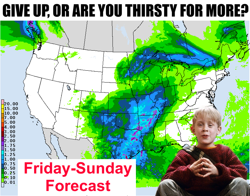
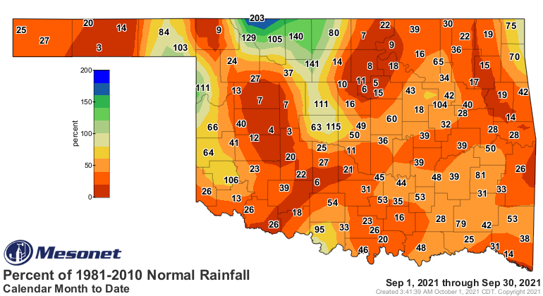
I'm guessing more, amirite? I mean, this map looks okay for some, but pretty
darned pitiful for most (I SEE YOU WESTERN OKLAHOMA!).
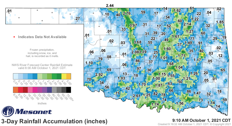
I really thought we would have reset this entire map by now. We still could, I
guess, but again, fool me once...
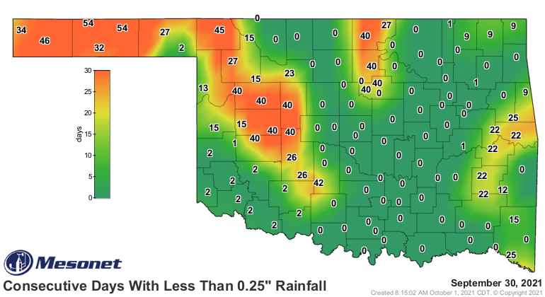
I guess the good news is the first map does show SOME rain statewide, and surely
that's not the only fall precip event we will experience. Of course, we said that
last year and darned if it was true, right up to the significant ice storm just
in time for Halloween. But, there is additional hope for October, with their
outlooks showing increased odds of above normal precipitation for the month, and
the October drought outlook shows improvement everywhere west of the Panhandle.
With that serving as a good segue, I now present to you the September weather
review and October look-ahead.
_______________________________________________________________________________
Drought Makes September Push
Oct. 1, 2021
The 17th warmest and driest September in Oklahoma since records began in 1895
allowed drought to flourish during the month. Categorized as “flash drought,”
its rapid onset and intensification occur when abnormally high temperatures and
below normal precipitation persist for an extended period. Most often a warm
season phenomenon, abundant sunshine and strong winds can also aid in its
progression. Those are precisely the conditions Oklahoma experienced when
previously abundant rains tapered off during early August and sweltering heat
returned shortly thereafter. That weather pattern continued until relief
finally arrived on the month’s final two days, bringing widespread rains and
more seasonable temperatures.
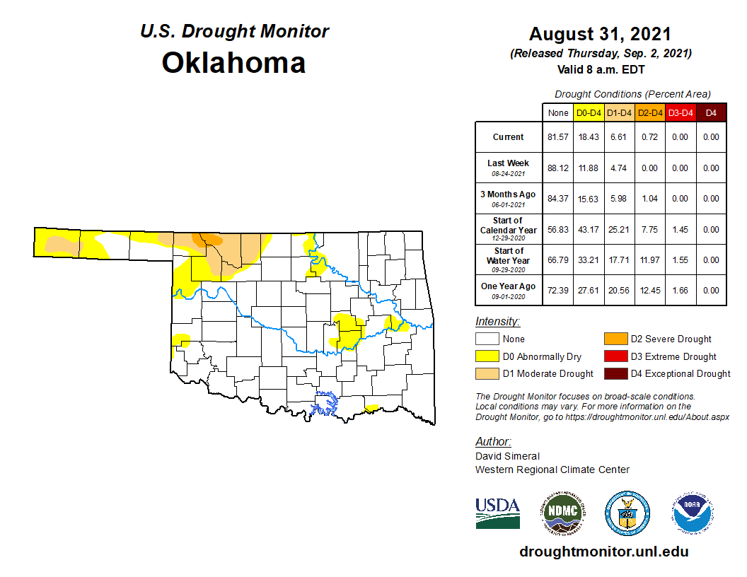
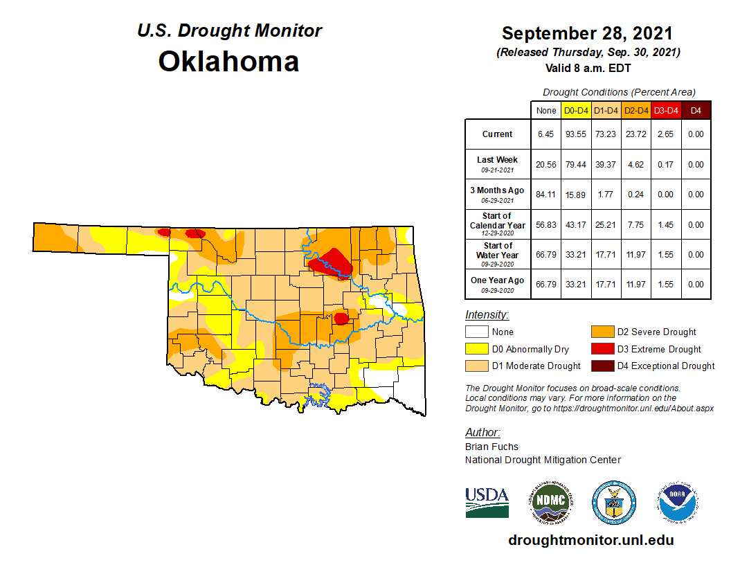
According to the U.S. Drought Monitor, more than 73% of Oklahoma was
experiencing drought conditions by the end of September, a 67% increase since
the end of August and the state’s highest percentage since Feb. 20, 2018. Of
that 73%, 49% was considered moderate drought, 21% severe, and 3% extreme. The
Drought Monitor’s intensity scale slides from moderate-severe-extreme-
exceptional, with exceptional being the worst classification.
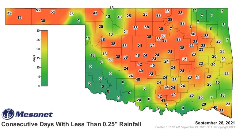
Several Mesonet sites had only received a hundredth of an inch of rain for the
month before relief arrived on the 29th. Tulsa had gone 80 consecutive days
without at least a quarter-inch of moisture before its streak was interrupted
on that same date. Reports received by the Oklahoma Climatological Survey from
across the state detailed dry stock ponds, cattle receiving supplemental feed
months earlier than normal, and flagging crops due to the arid conditions. The
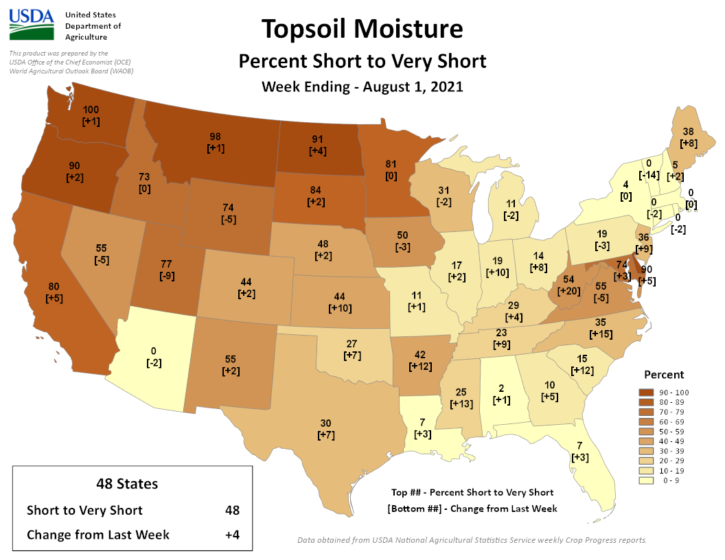
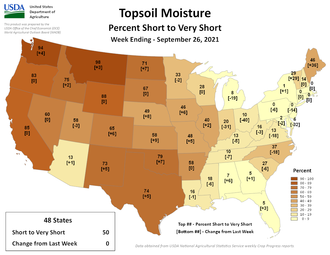
USDA reported 79% of the state’s topsoils were “short to very short” of
moisture on Sept. 26, a 52% increase since the beginning of August. The
late-month relief was expected to reduce Oklahoma’s drought footprint on the
first U.S. Drought Monitor report of October.
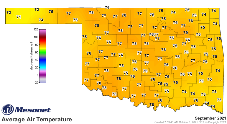
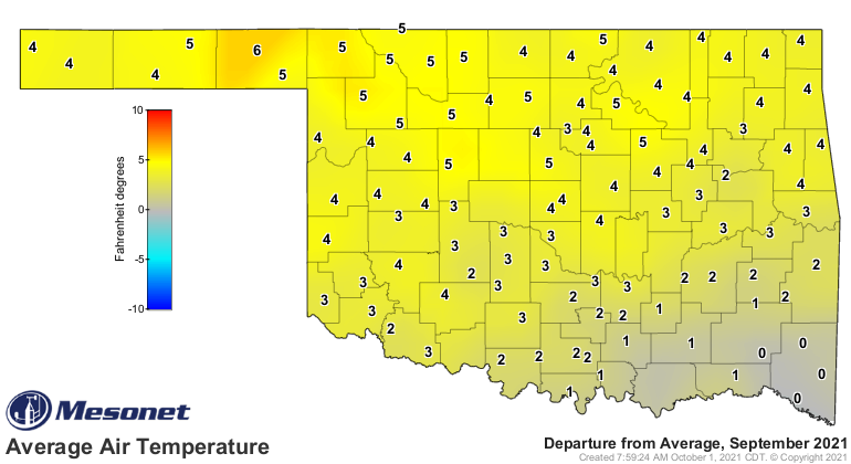
According to preliminary data from the Oklahoma Mesonet, the statewide average
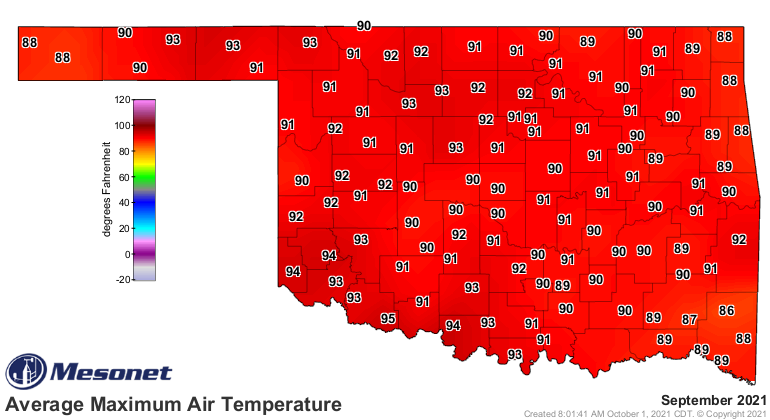
temperature finished at 76.3 degrees, 3.4 degrees above normal. Triple-digit
temperatures were more common early in the month, although they occurred as
late as the 20th. Buffalo’s 107 degrees on Sept. 11 led the Mesonet’s high
temperature readings, with Eva and Boise City’s 38 degrees capturing the lowest
temperature prize. Heat index values amongst the Mesonet’s 120 sites rose to
105 degrees or above 228 times during September, topped by Idabel’s 111 degrees
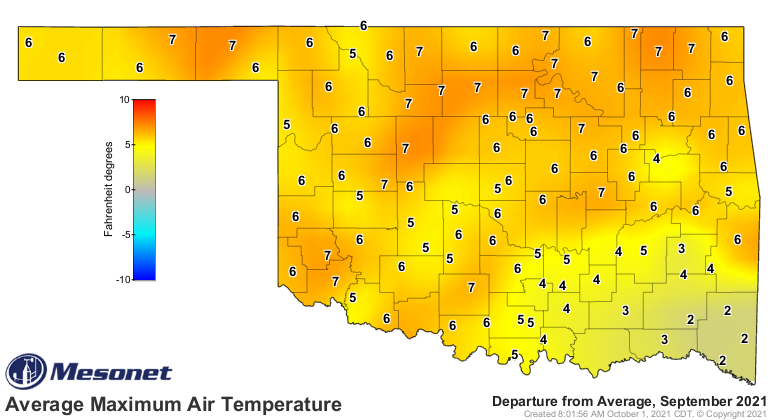
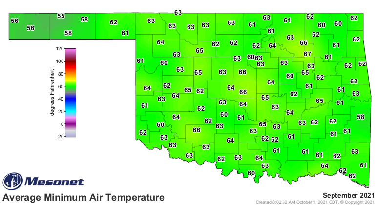
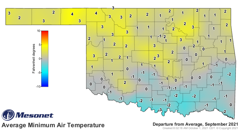
on Sept. 1. Average daily high temperatures were much more above normal than
low temperatures, which in some cases were actually below normal. The statewide
average January-September temperature remained on the cool side at 62.8 degrees,
1 degree below normal and ranked as the 51st coolest on record.
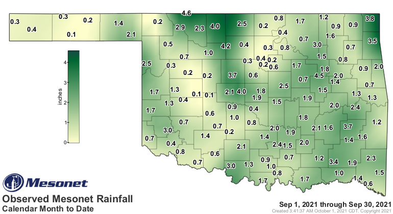
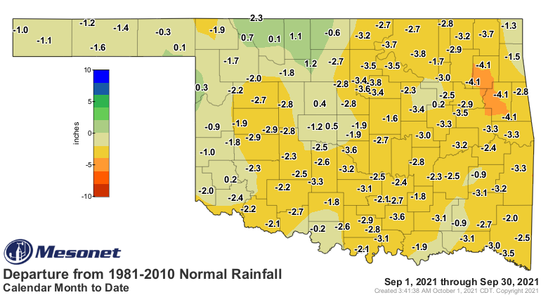
The statewide average rainfall total was 1.37 inches as measured by the
Mesonet, 1.95 inches below normal. Despite the late-month moisture, nearly the
entire state suffered deficits of 1-3 inches during September. Fifty-two
Mesonet sites failed to record at least an inch of rainfall, and only 29
reported at least 2 inches. The May Ranch Mesonet site in far northern Woods
County recorded the highest total at 4.58 inches. Goodwell had the month’s
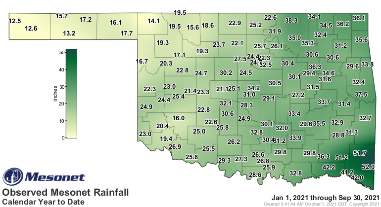
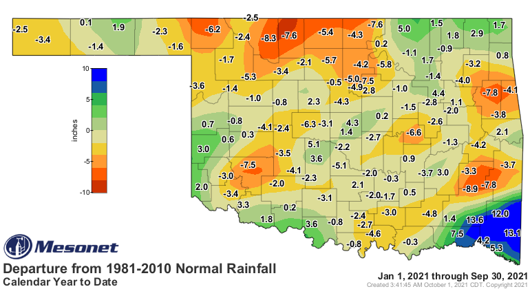
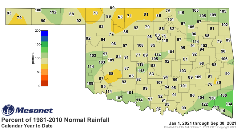
lowest total with 0.05 inches. The January-September statewide average remained
below normal by 0.68 inches at 27.92 inches, the 54th wettest such period on
record.
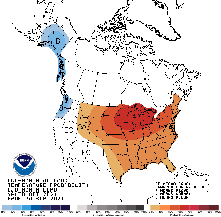
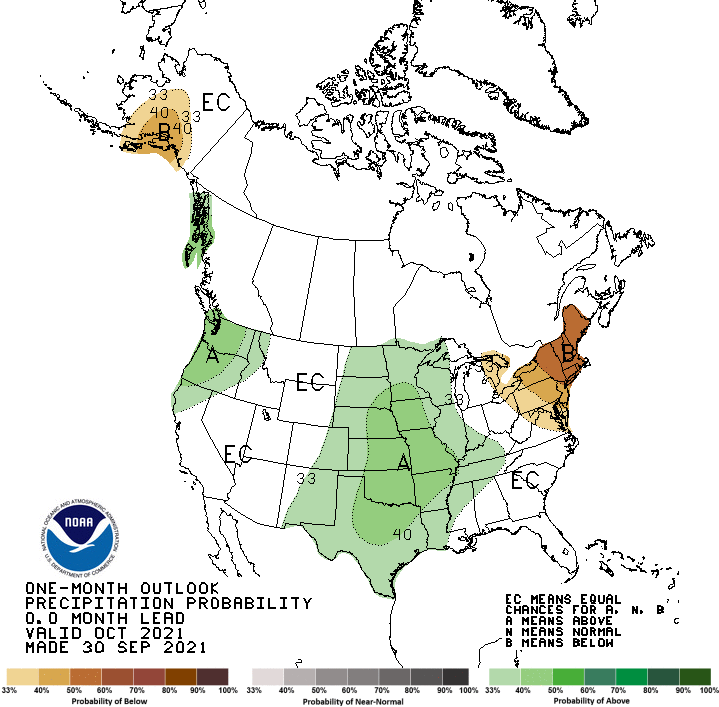
Hope for further drought relief could arrive in October according to the
temperature and precipitation outlooks from the Climate Prediction Center with
increased odds of above normal temperatures and precipitation for much of the
United States, including Oklahoma. The odds for a wetter October are a bit
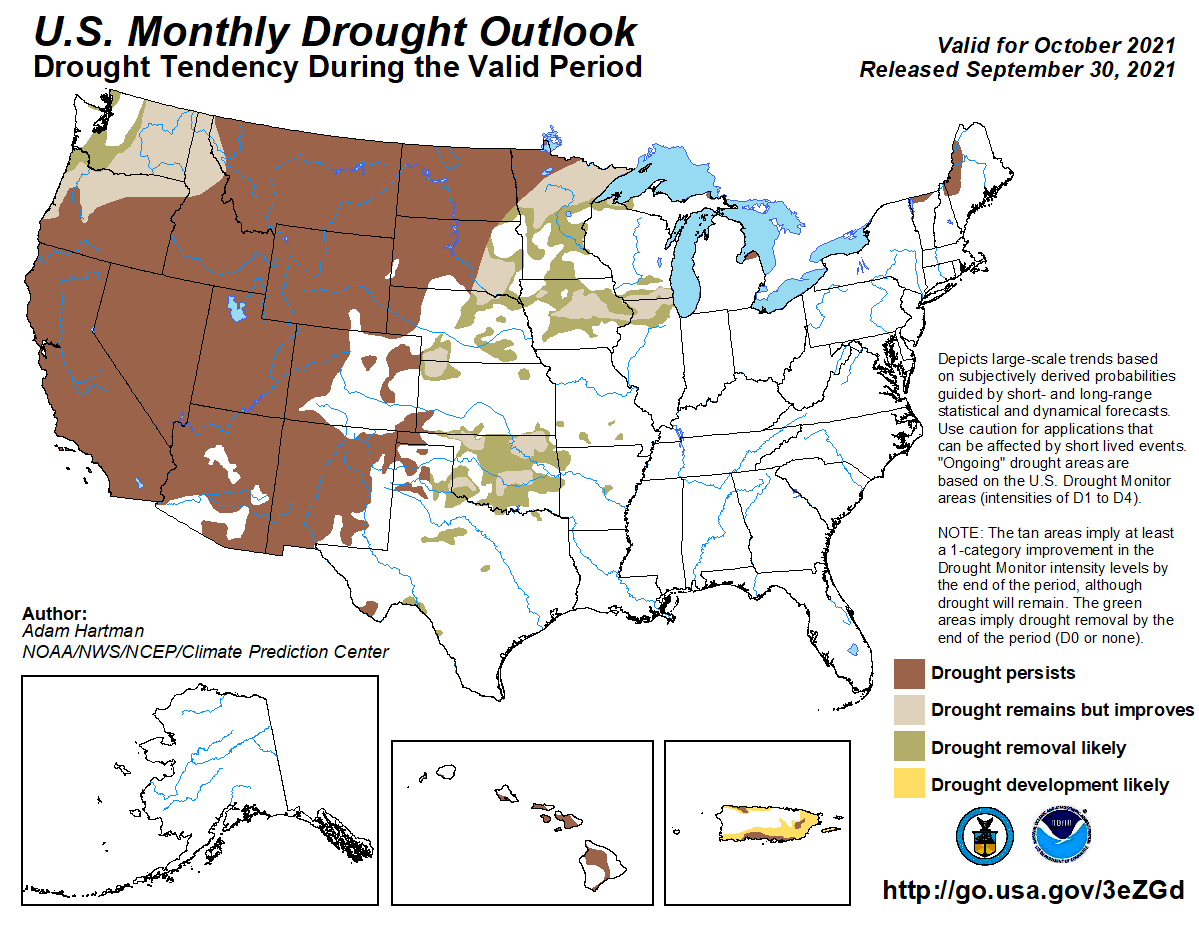
lower for the Panhandle. CPC’s October drought outlook indicates many of the
areas impacted by dry conditions during September will see improvement or
removal of drought by the end of October, save for the western Panhandle where
drought is expected to persist or intensify.
Gary McManus
State Climatologist
Oklahoma Mesonet
Oklahoma Climatological Survey
(405) 325-2253
gmcmanus@mesonet.org
October 1 in Mesonet History
| Record | Value | Station | Year |
|---|---|---|---|
| Maximum Temperature | 99°F | SLAP | 2000 |
| Minimum Temperature | 34°F | KENT | 2009 |
| Maximum Rainfall | 3.52 inches | ERIC | 1998 |
Mesonet records begin in 1994.
Search by Date
If you're a bit off, don't worry, because just like horseshoes, “almost” counts on the Ticker website!