Ticker for September 16, 2021
MESONET TICKER ... MESONET TICKER ... MESONET TICKER ... MESONET TICKER ...
September 16, 2021 September 16, 2021 September 16, 2021 September 16, 2021
As scheduled
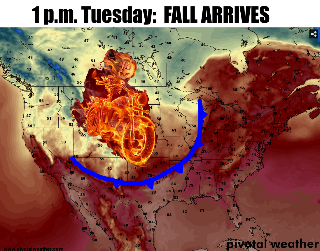
AHA! As I've been touting (denying) for over a week now, the big cold front that
looked so promising finally looks locked in. See, my attempts at a jinx to force
it to happen worked. Actually, the laws of fluid dynamics and other such physical
forces caused it to happen, but that makes it not about me, so we can't have that.
As we look at that model output, let's remember that is just one model's depiction
of events early next week. We're probably safer saying "sometime around
Tuesday/Wednesday, a big cold front is going to barge its way through the state
and push this month of finally-brutal summer out of here."
Okay, so let's say that. However, those same forecast models are also pointing to
it getting hot again after that, but you know how these things work. The sun is
getting lower in the sky, and daylight hours (and therefore the suns ability to
impart its energy to our part of the globe) are getting shorter. Each cold front
will help to modify the ground and air around us, so if summer does return, it
shouldn't be quite as dreadful as before. We can see the impact of our fall cold
front starting to show up on the 7-day forecasts from our NWS friends, at least.
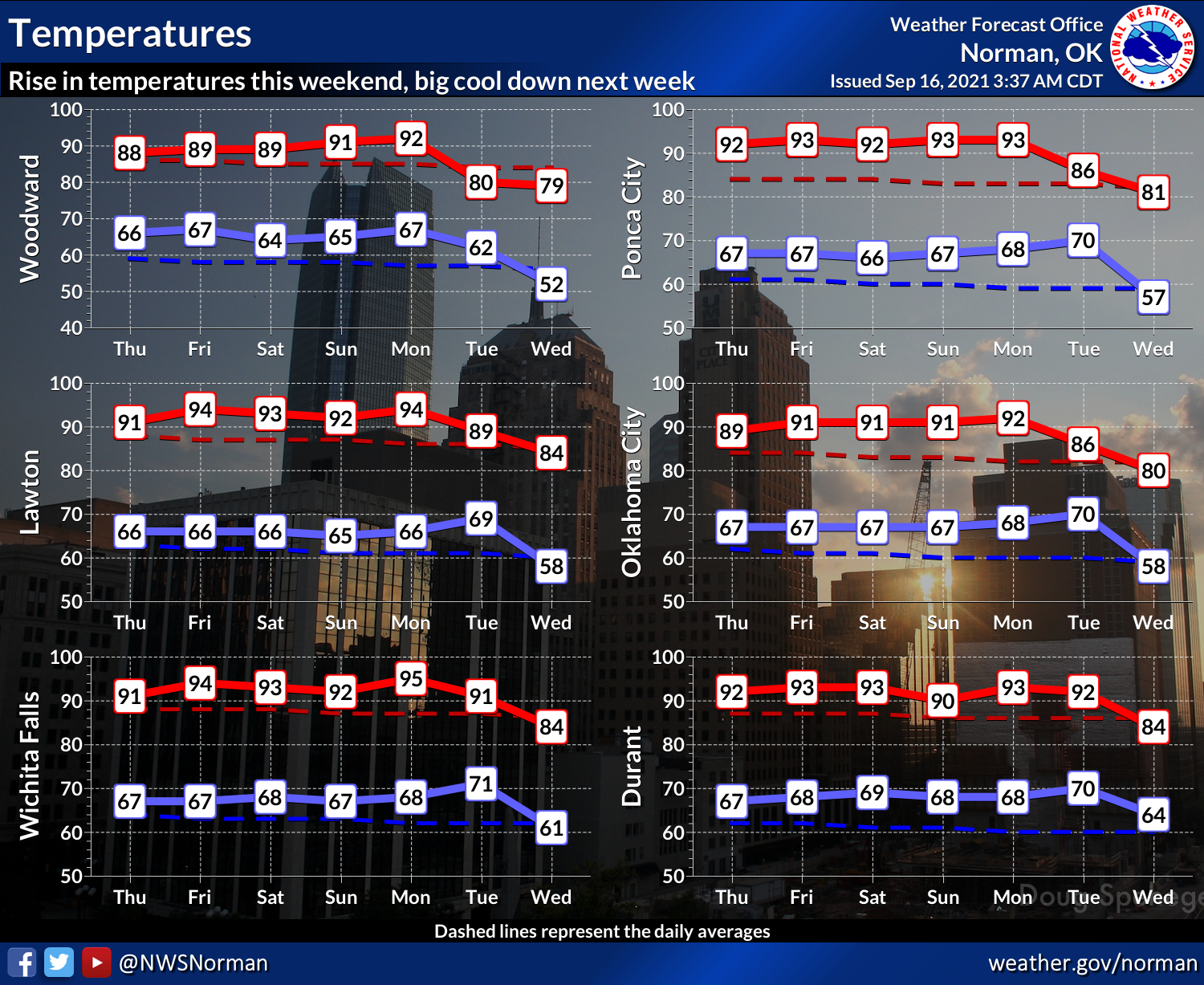
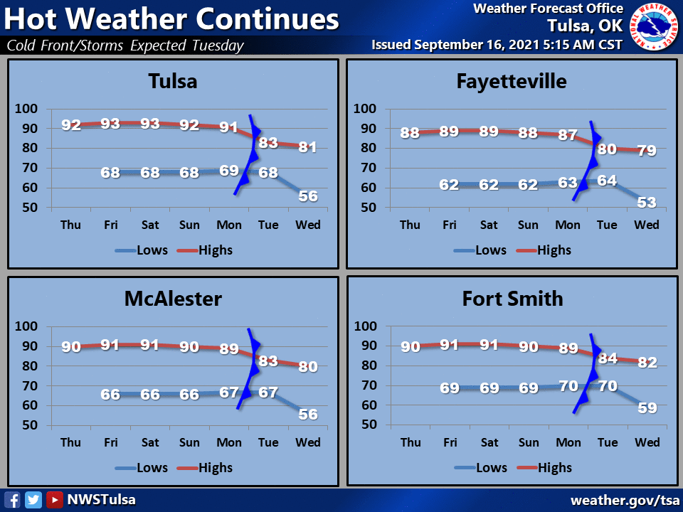
Should be able to add a day or two onto the end of that with pleasurable temps.
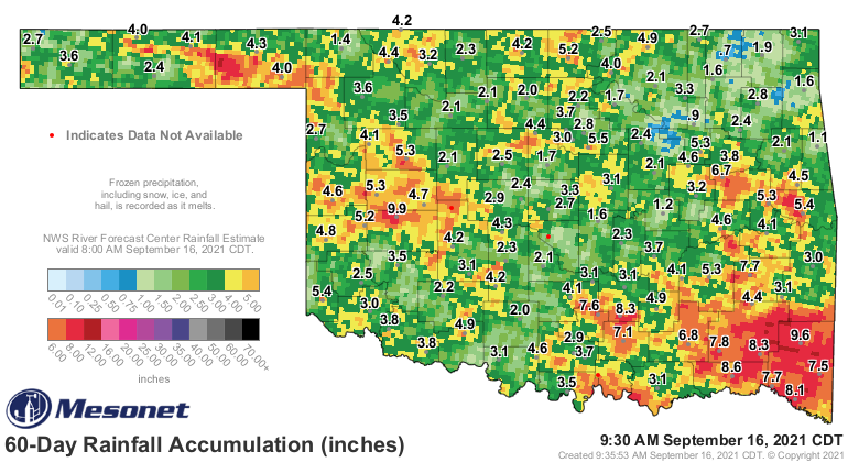
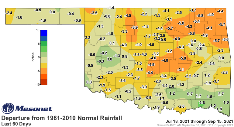
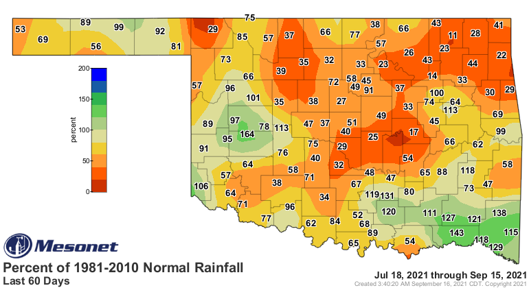
What we really need is rain, however, because we're smack dab in the middle of
a flash drought situation. The sudden onset of heat about a month ago, coupled
with a dearth (Okie to English translation: "lack") of moisture have spelled
rapid drought development. Check out the 60-day rainfall maps, if you dare. They
ain't pretty.
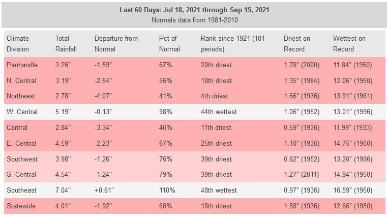
This shows up on this week's Drought Monitor map as lots of not-so-pretty
colors.
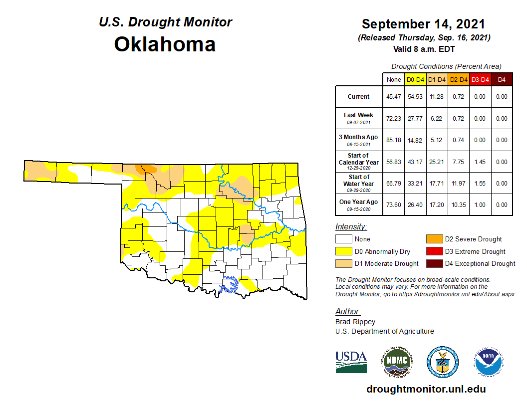
The 11.28% of the state considered in drought (at least D1) is the most we've
seen in the state since May 11 of this year. We have a ton of the state in
the not-quite-drought category of "Abnormally Dry," however, in danger of
turning into drought should beneficial rains not arrive. Our next best hope for
rain would be with that front next week.
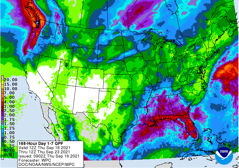
Yeah, that's not nearly enough. There's still hope there, however. The exact
setup that will occur with the front's passage isn't known yet, so hopefully
we'll add some more moisture for it to work with. I'm afraid CPC's drought
outlook isn't bullish on hope, however. And this goes through the end of the
year. Again, another thing that ain't pretty.
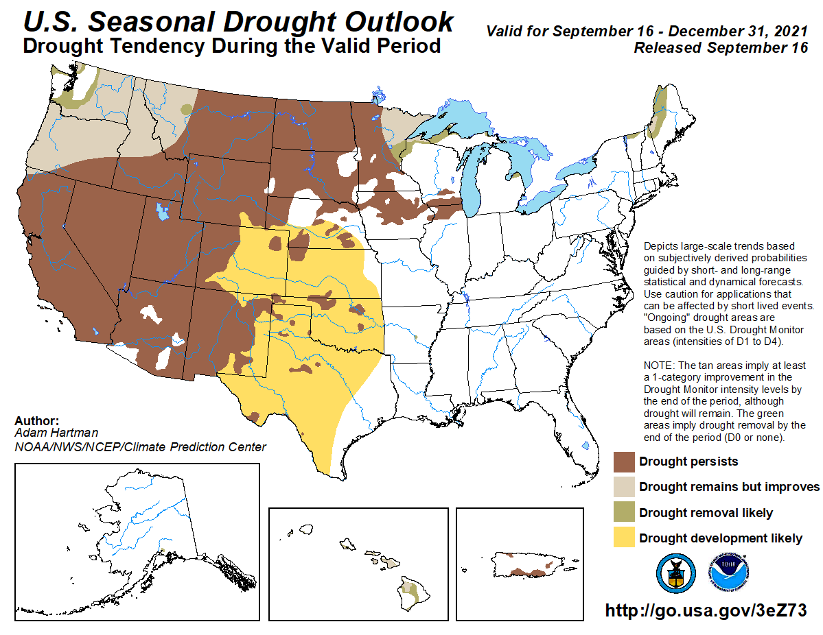
That indicates that the entire state will be under drought conditions by the
end of the year. That would not be good at all. Their reasoning:
"Many locations across Texas, Arkansas, and Oklahoma are experiencing
1-3 inch deficits in the last 30 days, with pockets of 3-4 inch
deficits for parts of central and northeastern Oklahoma. Oklahoma
and Texas typically experience a secondary maximum in rainfall during
October. However, given the warmer and drier signals in the extended
and long ranges coupled with the antecedent dryness across the western
and northern portions of the Southern Region, there is an increased
risk for broad drought development."
These are the outlooks they're talking about, for the October-December time
frame.
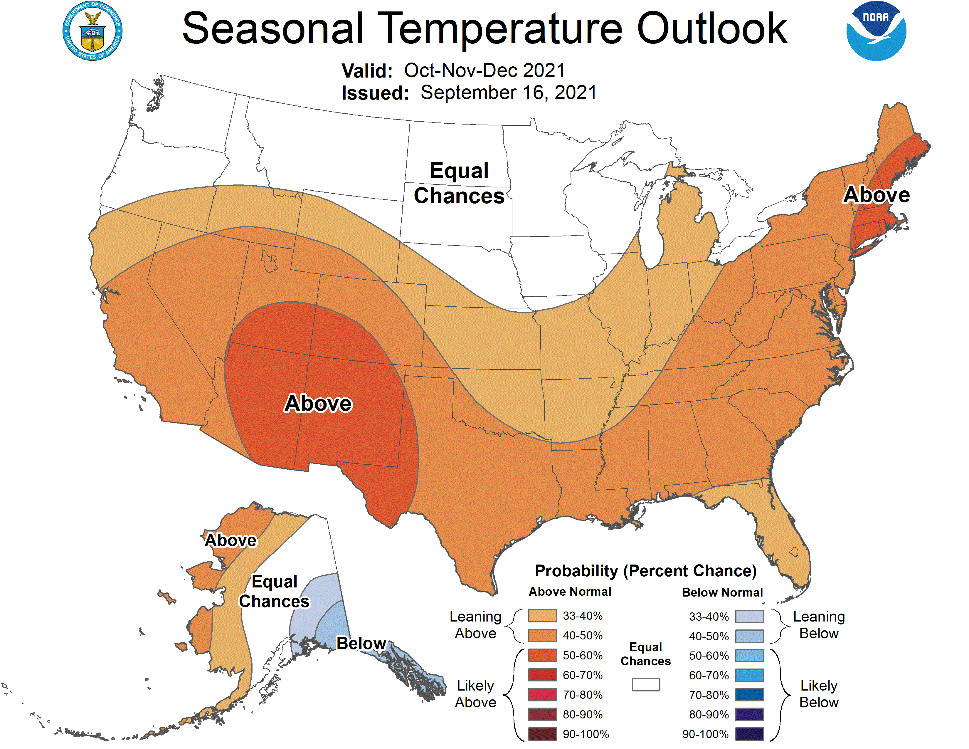
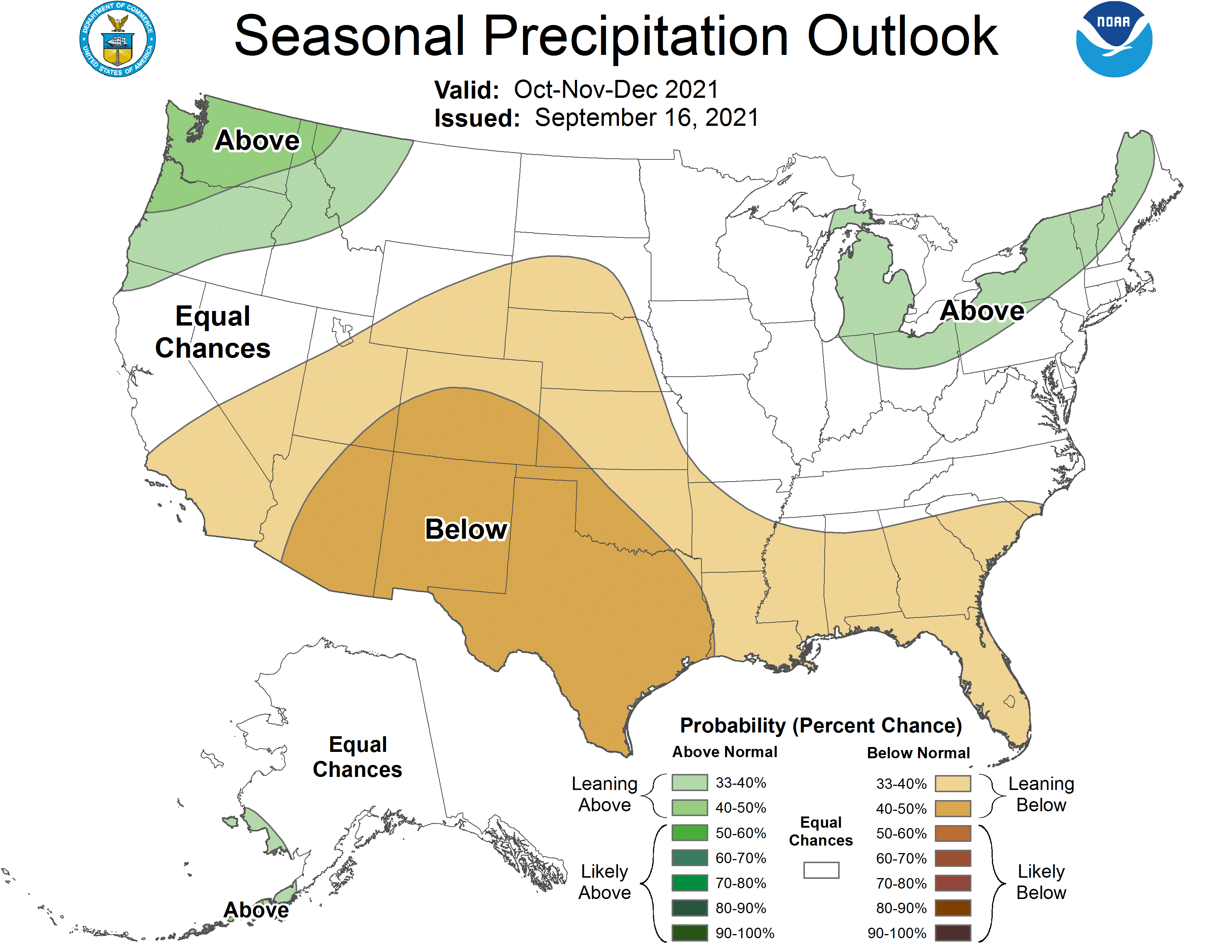
Those show increased odds for above normal temperatures and below normal precip
for the entire state through the end of the year, but especially for the SW
third-to-half of the state, including the Panhandle. The outlooks for next
month alone are about the same as well.
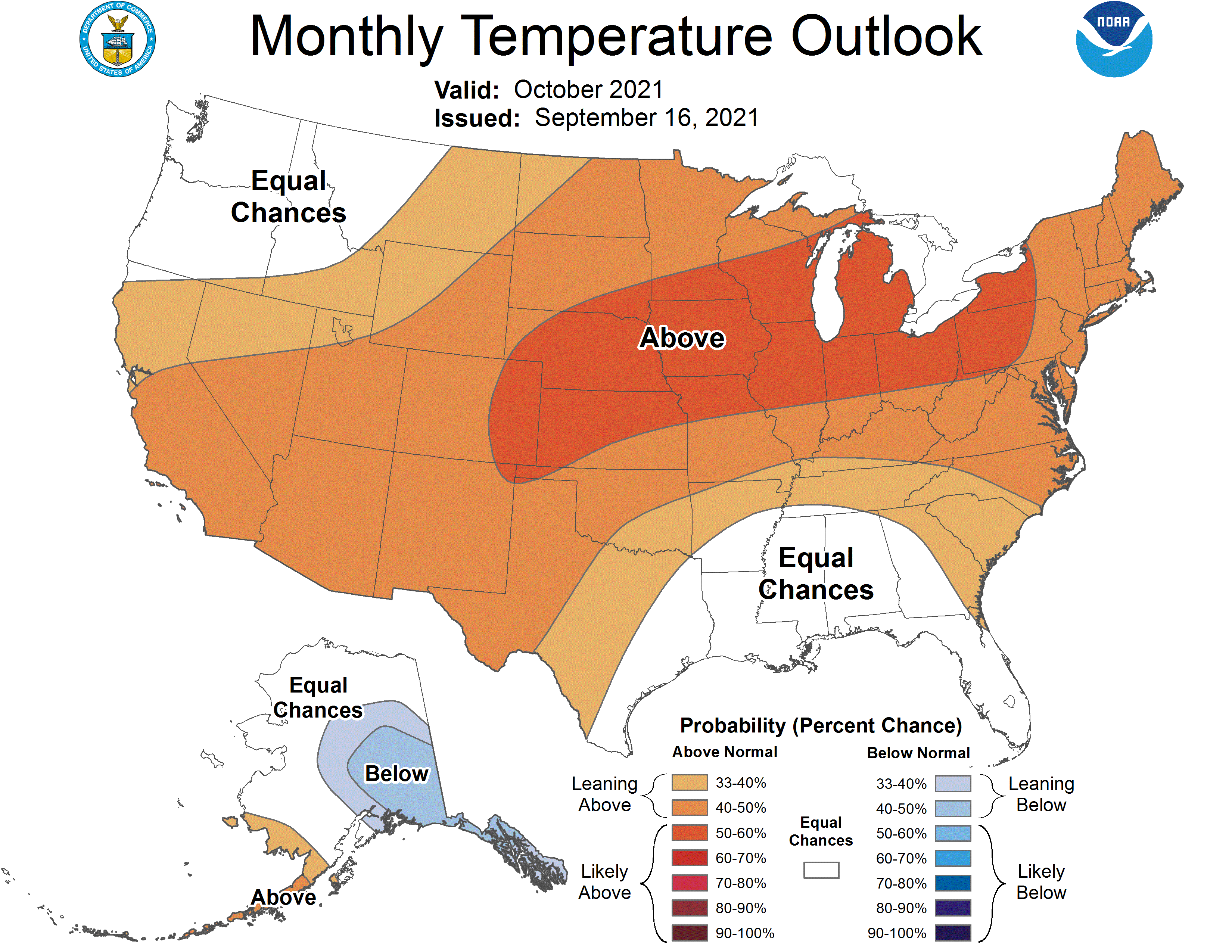
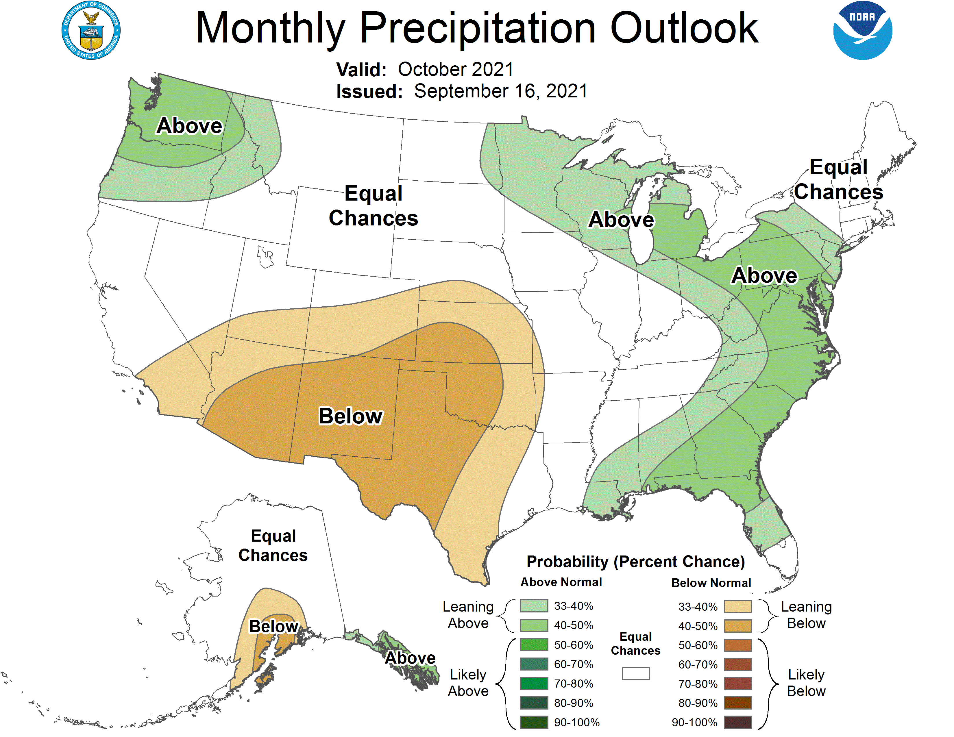
Again, nothing set in stone despite these outlooks. They do get a bit better
at this time of year, especially when ENSO is acting up like this year and
almost promising us a La Nina episode again.
At any rate, dust off the light sweaters, at least for a few days next week.
Gary McManus
State Climatologist
Oklahoma Mesonet
Oklahoma Climatological Survey
(405) 325-2253
gmcmanus@mesonet.org
September 16 in Mesonet History
| Record | Value | Station | Year |
|---|---|---|---|
| Maximum Temperature | 102°F | WALT | 1997 |
| Minimum Temperature | 37°F | KENT | 2012 |
| Maximum Rainfall | 3.52 inches | BURB | 2013 |
Mesonet records begin in 1994.
Search by Date
If you're a bit off, don't worry, because just like horseshoes, “almost” counts on the Ticker website!