Ticker for September 7, 2021
MESONET TICKER ... MESONET TICKER ... MESONET TICKER ... MESONET TICKER ...
September 7, 2021 September 7, 2021 September 7, 2021 September 7, 2021
The Great State Cold Front of Oklahoma
I don't know about you, but...no, really, I don't know about you. Not sure I want
to. I have enough problems of my own, pondering great questions like Ho-Hos vs.
Ding Dongs (Ho-Hos...duh!), Cheez-its vs. Cheese Nips (Cheese Nips...duh!), or
John McClane vs. James Dalton (John McClane...I won't "duh" you on that one,
Dalton would be acceptable, although I thought he'd be bigger). Now where was I?
Oh yeah, I don't know about you, but I'm finally over the blast furnace heat we've
had over the last few weeks. Now the intermittent brushes with milder, drier air
that we've seen have been awesome, but the heat seems to come back more intense
each time, even as those extremes should be coming down closer to September-ish
levels.
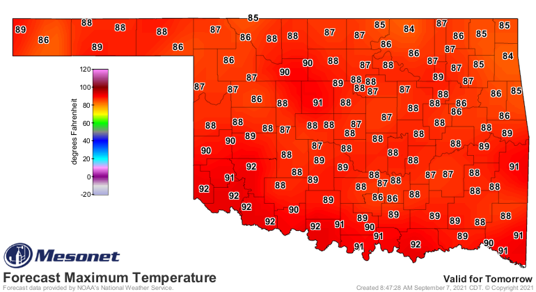
We will get a taste of that tomorrow on the backside of a cold front poised to
our north as we Tick. Check out our forecast highs for tomorrow.
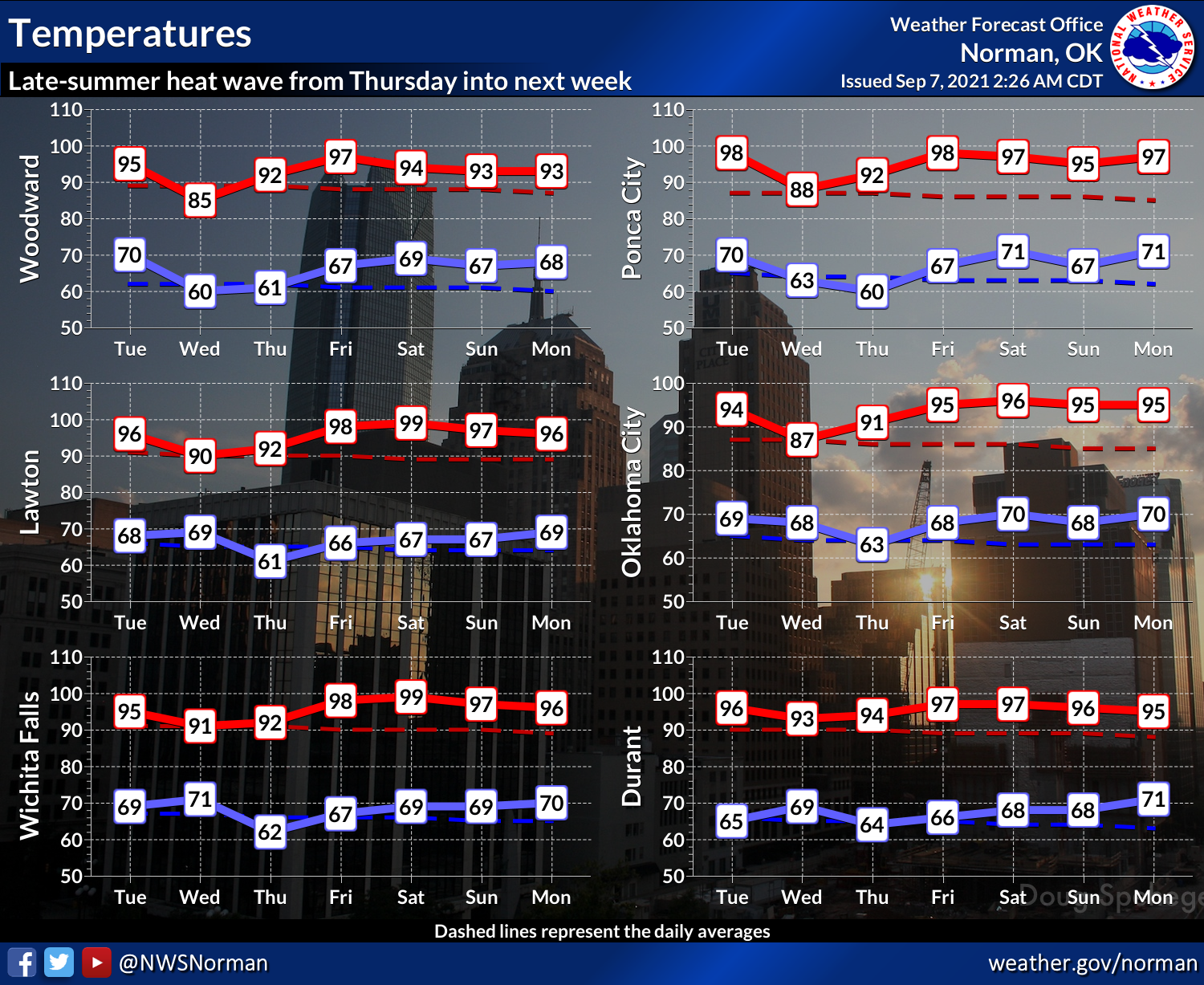
And while we will be right back to the blast furnace heat in time for the
weekend, at least the air should remain a bit drier, so less of that pressure
cooker heat. Still, we're right back into the fire after tomorrow.
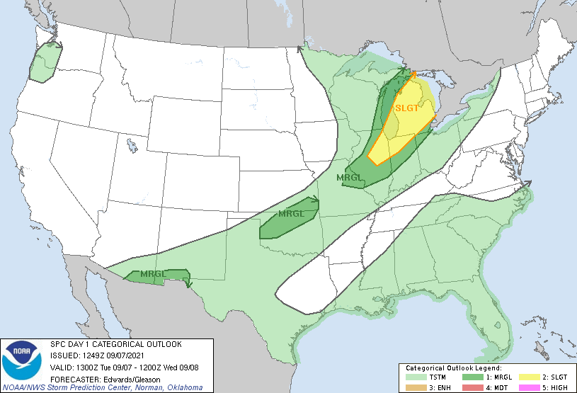
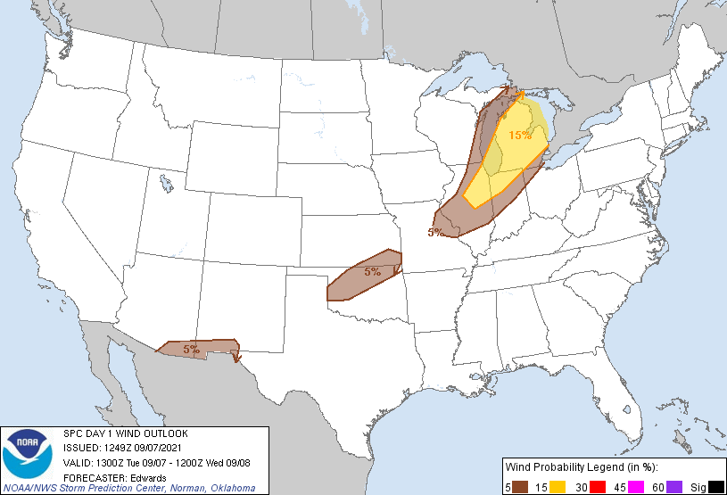
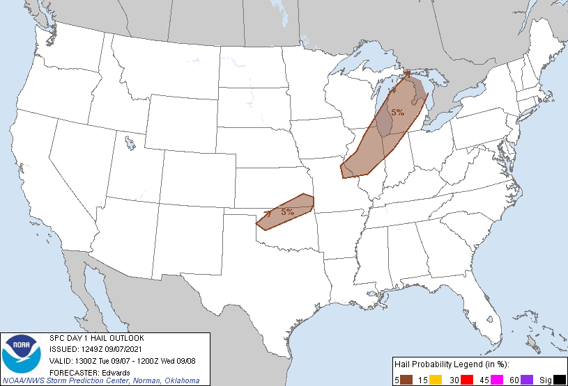
The front does have a chance to kick off some showers and storms as it wanders
through the state tonight. So far just a marginal risk of severe weather from
SPC, but there could be some increased chances conditional on what happens as
the convective environment evolves throughout the day. So far, just a chance
of some high winds and large hail, but nothing to get too worked up about.
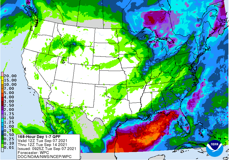
And not much in the way of rainfall. After today, we stay high and dry mostly
for the next week.
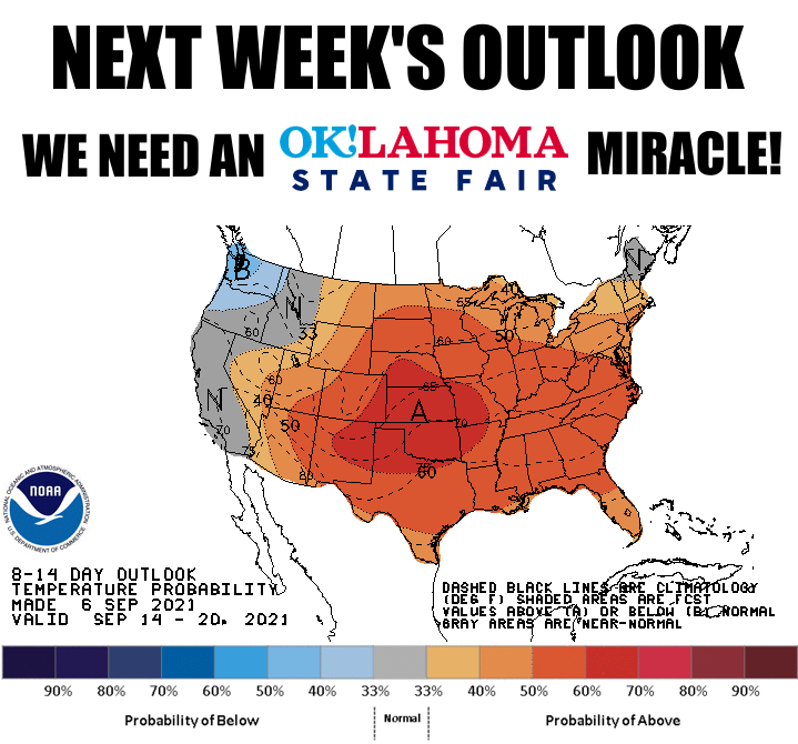
Now we start to look towards next week. Yesterday's CPC outlooks are pretty
grim, but can they stand up to the miracle weather changer that is the Great
State Fair of Oklahoma? Some models are starting to point towards a shift
to more northerly flow later next week, which could bring more opportunities
for cold fronts.
Now I'm not going to say the State Fair has anything to do with it, and it's
not locked in yet...but come on. We're all Okies here, we know what's going on.
Gary McManus
State Climatologist
Oklahoma Mesonet
Oklahoma Climatological Survey
(405) 325-2253
gmcmanus@mesonet.org
September 7 in Mesonet History
| Record | Value | Station | Year |
|---|---|---|---|
| Maximum Temperature | 109°F | BURN | 2023 |
| Minimum Temperature | 39°F | BRIS | 2011 |
| Maximum Rainfall | 4.46″ | BURB | 1995 |
Mesonet records begin in 1994.
Search by Date
If you're a bit off, don't worry, because just like horseshoes, “almost” counts on the Ticker website!