Ticker for August 25, 2021
MESONET TICKER ... MESONET TICKER ... MESONET TICKER ... MESONET TICKER ...
August 25, 2021 August 25, 2021 August 25, 2021 August 25, 2021
Tropical Tantalization
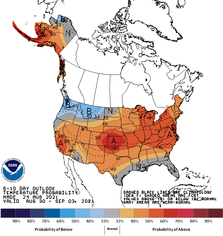
As we set basking in the glory of all that is an August summer month in Oklahoma
(yes, I'm pausing for the cursing...let me know when you're done), I'm afraid
I'm gonna have to tell you that we're not quite done with that yet. Highs for the
next couple of days will remain above normal with heat index values well into
the triple-digits (for those folks without actual air temperatures that high,
so don't get too cocky). A cold front will arrive for the weekend with somewhat
more seasonable weather, but if nothing else changes, we could go right back into
the fire after that.
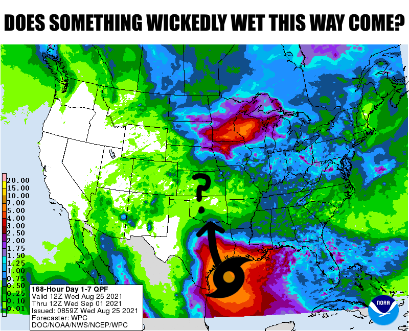
But here's the deal...as you see in the 7-day rain forecast above, a great
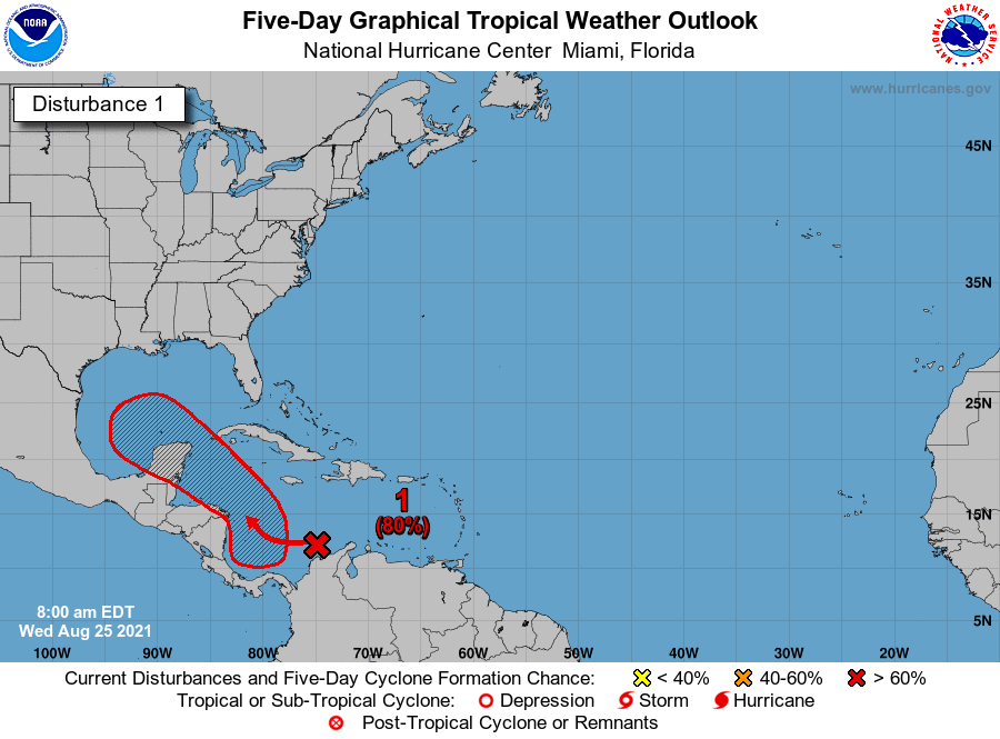
equalizer is lurking in the tropical atlantic. Right now it's called Invest 99L
(TURN THOSE MACHINES BACK ON! SELL!!). The National Hurricane Center sees an
80% chance for this disturbance to form into an actual tropical cyclone within
5 days. And it looks more and more likely it will move into the Gulf of Mexico
on its journey.
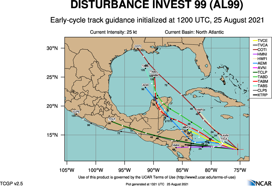
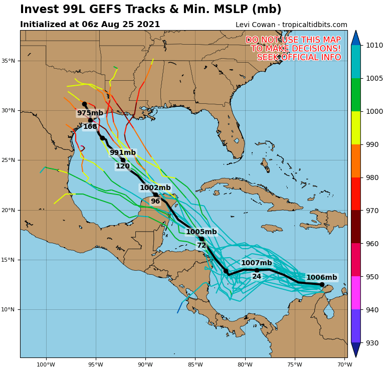
Our friends at the NWS office in Shreveport, which covers McCurtain County here
in Oklahoma, have certainly taken notice of the storm.
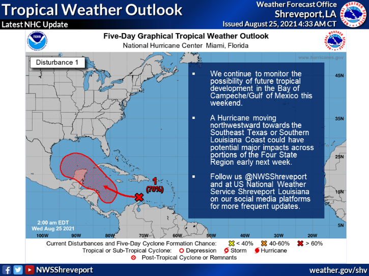
Now obviously there is still a ton of uncertainty here, from it's actual
formation into a tropical storm to where it moves to what impacts it would
bring, which is highly dependent upon the strength the storm achieves. So
consider this just a lookie loo moment, weather style. Much can happen between
now and next Tuesday-Thursday when this would possibly come into play.
Still, until then just continue the course as we play out the last month (2
months, 3 months, 2 weeks???) of summer. One thing we know is that with La Nina
coming back into play, that often can signal a more active Atlantic hurricane
season, so this might be just the beginning of our watchful eyes to the south
and east.
Or not.
Gary McManus
State Climatologist
Oklahoma Mesonet
Oklahoma Climatological Survey
(405) 325-2253
gmcmanus@mesonet.org
August 25 in Mesonet History
| Record | Value | Station | Year |
|---|---|---|---|
| Maximum Temperature | 109°F | FREE | 2024 |
| Minimum Temperature | 46°F | BEAV | 2010 |
| Maximum Rainfall | 4.69″ | MEDI | 2017 |
Mesonet records begin in 1994.
Search by Date
If you're a bit off, don't worry, because just like horseshoes, “almost” counts on the Ticker website!