Ticker for August 26, 2021
MESONET TICKER ... MESONET TICKER ... MESONET TICKER ... MESONET TICKER ...
August 26, 2021 August 26, 2021 August 26, 2021 August 26, 2021
Strike three
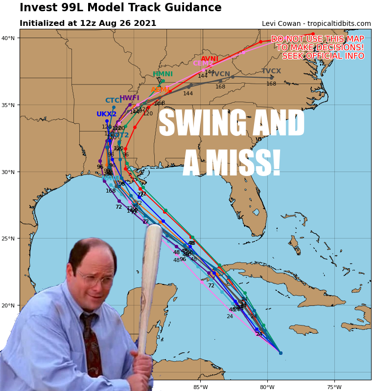
So the Invest 99L whatchamacallit (a cluster of storms, a tropical disturbance,
a tropical wave, a Gary Busey {hey, why not?}) now appears likely to form a
tropical storm in the next couple of days, and will PROBABLY strengthen into a
hurricane after that, and will PROBABLY hit a little more east than west. That's
a lot of probablys, so there is still a bit of uncertainty. The track depends
on what the mid-level ridge of high pressure over the SE does. If that ridge slides
to the west or strengthens, then the track will be further west, guided by the
clockwise rotation around that ridge. Or if the high pressure ridge weakens or
slides east, then the track will move east. But right now, signs point towards
a more easterly track. Fortunately for us, that will keep the tropical system's
impacts away from Oklahoma. I say fortunately because unless you really need
rain, tropical style rains really aren't good for much except flooding. Now
we know the far NW really needs some rain. Drought up that way is expanding,
intensifying, and really shows up on the 60-day rainfall maps.
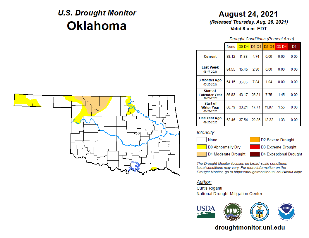
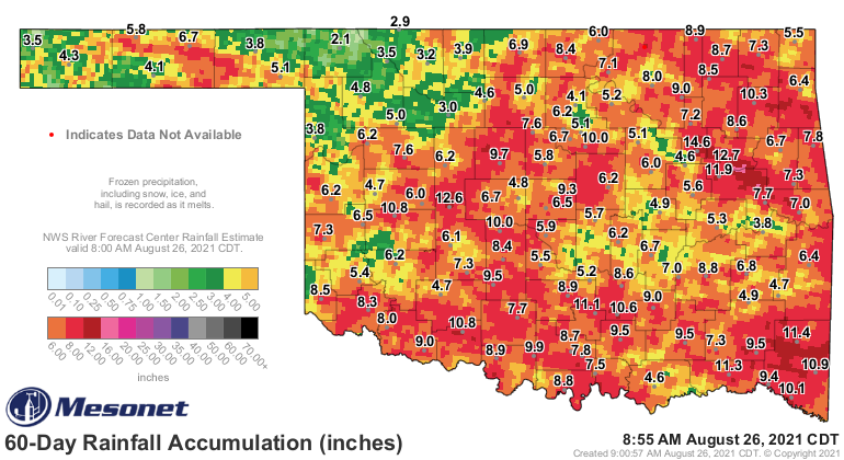
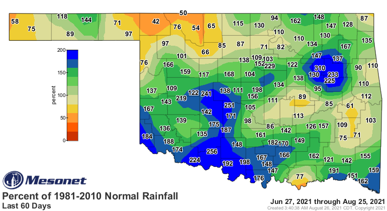
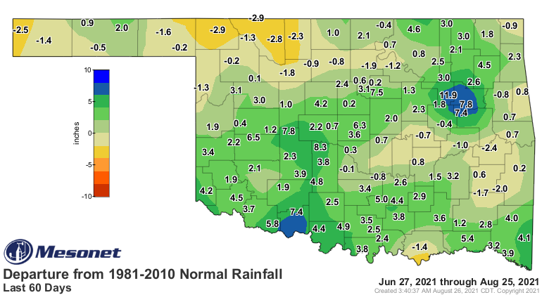
You can now see the problem with a tropical system--its remnants--coming our way.
Lots of areas have had enough rain over that time frame. Now it has gotten
a bit dry in the 30-day time frame, but hey, that's August. What we need in
the northwest is a nice MCS or two to form up in the High Plains and move
down our way. Mother Nature pulls a drought on you, you pull a MCS. That's the
Oklahoma way! (No morgues needed, Sean Connery)! For right now, however, that
drought up NW does look a bit Untouchable. The heat dome over us will break
down a little bit, maybe allow some showers and a few storms, but it appears to
strengthen again early next week. Rain prospects look pretty low for awhile,
and prospects for a continuance of summer well into September appear high.
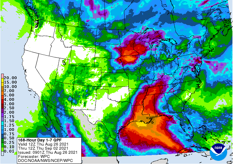
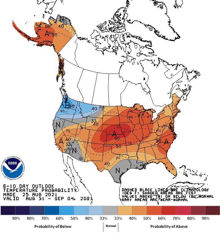
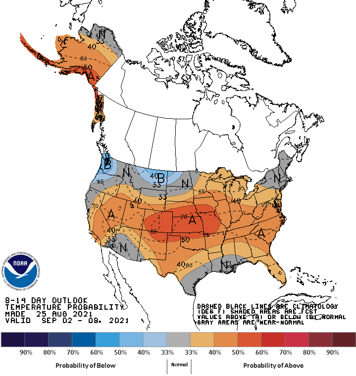
With La Nina possibly on the way, we can assume an active Atlantic hurricane
season, so not our first miss from a wayward hurricane, probably. But we are
assuming, and you know what assuming can do...make you look really dumb (HA!
Thought you had me there, didn't ya!).
Gary McManus
State Climatologist
Oklahoma Mesonet
Oklahoma Climatological Survey
(405) 325-2253
gmcmanus@mesonet.org
August 26 in Mesonet History
| Record | Value | Station | Year |
|---|---|---|---|
| Maximum Temperature | 110°F | WAUR | 2023 |
| Minimum Temperature | 46°F | SEIL | 2010 |
| Maximum Rainfall | 5.24″ | BROK | 2020 |
Mesonet records begin in 1994.
Search by Date
If you're a bit off, don't worry, because just like horseshoes, “almost” counts on the Ticker website!