Ticker for August 23, 2021
MESONET TICKER ... MESONET TICKER ... MESONET TICKER ... MESONET TICKER ...
August 23, 2021 August 23, 2021 August 23, 2021 August 23, 2021
Evil index
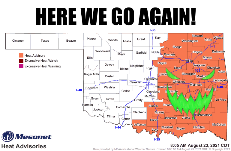
Okay, we barely have time to Tock, so just a quick Tick to start your Monday off
wrong. The heat is back and it looks like it is here to stay for awhile, befitting
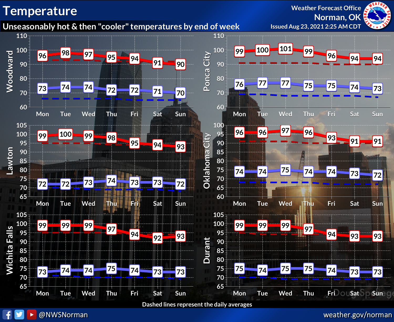
the last week of August. It will cool off a little bit later in the week, but
still hot. Just not AS hot.
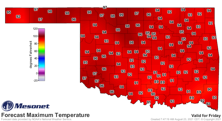
Friday, for instance, is an example of "not quite as hot," which isn't really
much comfort.
And this blast of summer is gonna come with little chance of rain.
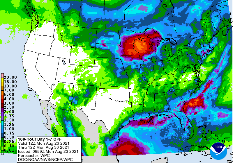
But we've just had a good dose of rain over the last week, at least some did, which
will serve to kick up those heat index values.
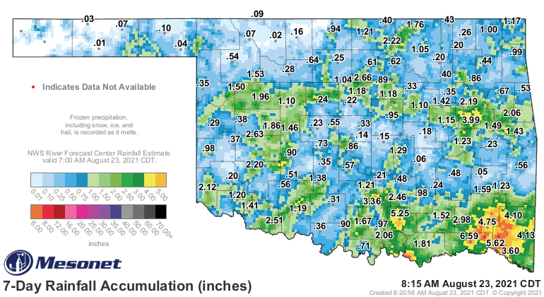
Still waiting for our next big weather change to show up. Until it does, the
heat dome/death ridge still holds Oklahoma in its grip.
Now won't that make that first big September cold front that much more
satisfying? Just have to make it until then.
Gary McManus
State Climatologist
Oklahoma Mesonet
Oklahoma Climatological Survey
(405) 325-2253
gmcmanus@mesonet.org
August 23 in Mesonet History
| Record | Value | Station | Year |
|---|---|---|---|
| Maximum Temperature | 113°F | ALTU | 2024 |
| Minimum Temperature | 52°F | NOWA | 2009 |
| Maximum Rainfall | 5.40″ | BEAV | 2019 |
Mesonet records begin in 1994.
Search by Date
If you're a bit off, don't worry, because just like horseshoes, “almost” counts on the Ticker website!