Ticker for July 15, 2021
MESONET TICKER ... MESONET TICKER ... MESONET TICKER ... MESONET TICKER ...
July 15, 2021 July 15, 2021 July 15, 2021 July 15, 2021
Go ahead and autumn already
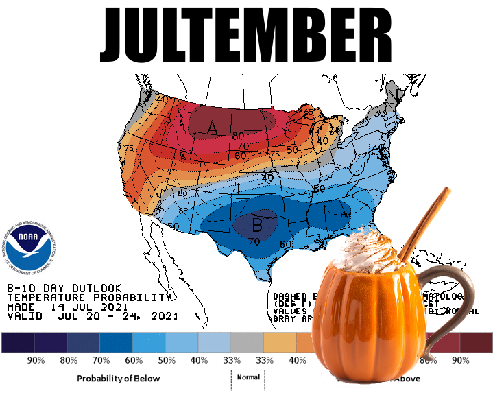
Is there really any point to wondering if summer is going to go all 2011 on us?
Each 6-10 and 8-14 day CPC temperature outlook continues to keep us in early
fall mode, and there doesn't appear to be much in the way of cooling off this
uncool cool pattern anytime soon and heating us back up to proper summer mode.
Even as we go out to August, the tendency is for the region to see cool and wet
weather, at least across the eastern portion of the state. Not much sign of a
warm signal for the 3-month August-October period either, except for the western
half of the state. Check out the latest CPC outlooks.
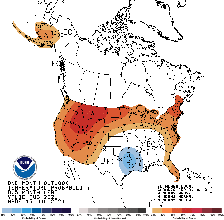
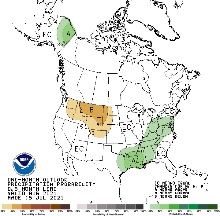
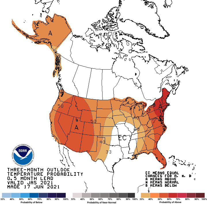
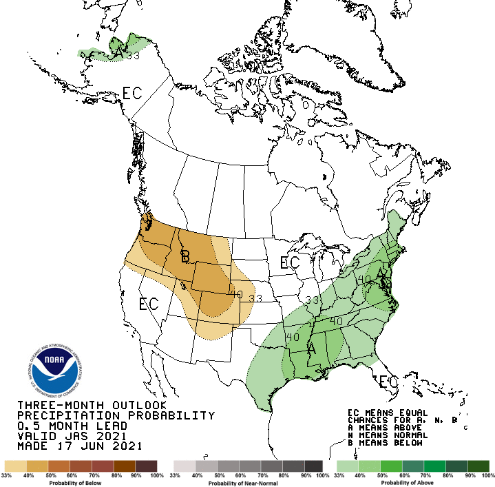
The white regions marked "EC" stand for Equal Chances of above-, below-, and
near-normal temperatures and precipitation. I just feel if there was an
indication of that big heat dome from the West shifting over into the Southern
Plains, it'd be showing up by now. But here's the deal...that could still
happen for sure. All it take is for the next model run to show it, then a
subsequent run, then a runaway train of indications, and these maps could change
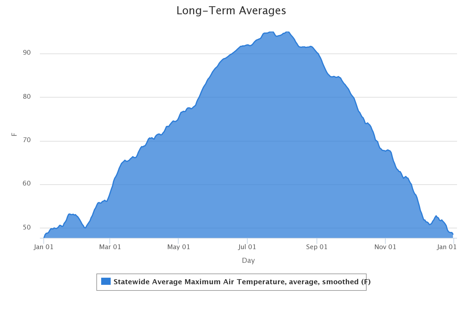
in a hurry...that isn't showing up just yet. But remember, our temperatures
normally peak sometime in late July through early August before starting their
march down into fall and eventually winter. It's as inevitable as losing your
hair. Oh, you haven't lost yours? Well maybe you'll get 90s in January too,
smart guy!
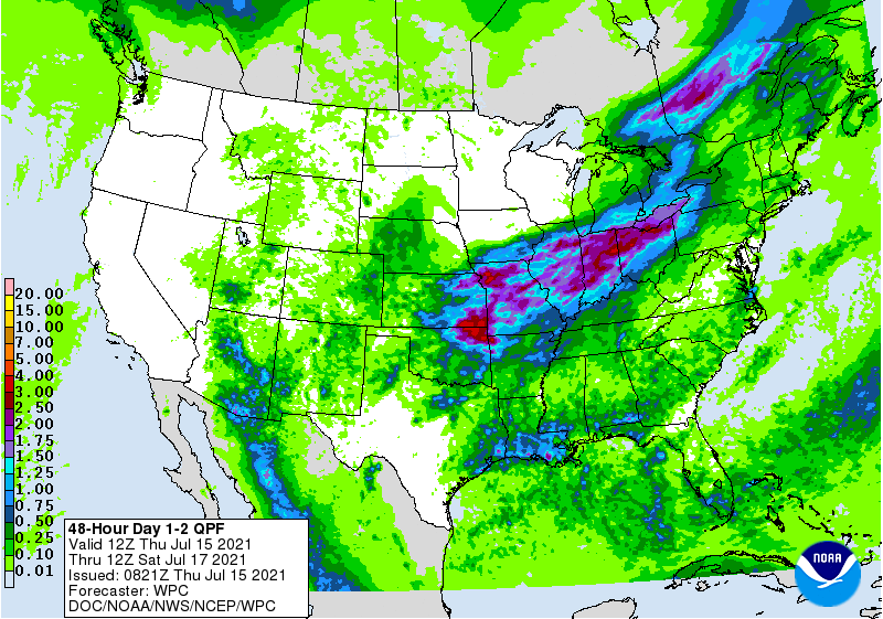
We do have a bit of standard if not a bit mild Oklahoma summer fare in store for
the rest of this week before we see another big cold front on Sunday, sure
to bring yet another chance of rain and our trip back into September mode. But
first we have to get by the rain tonight and tomorrow, which looks heaviest
up across north central and northeastern Oklahoma.
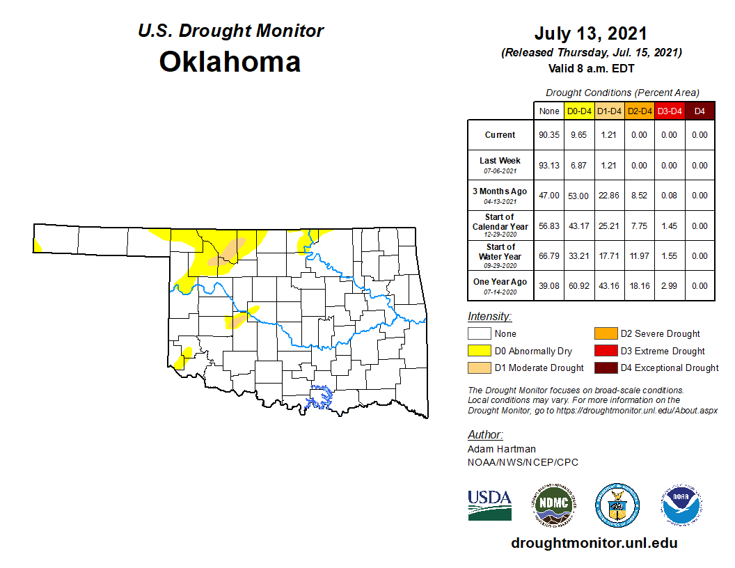
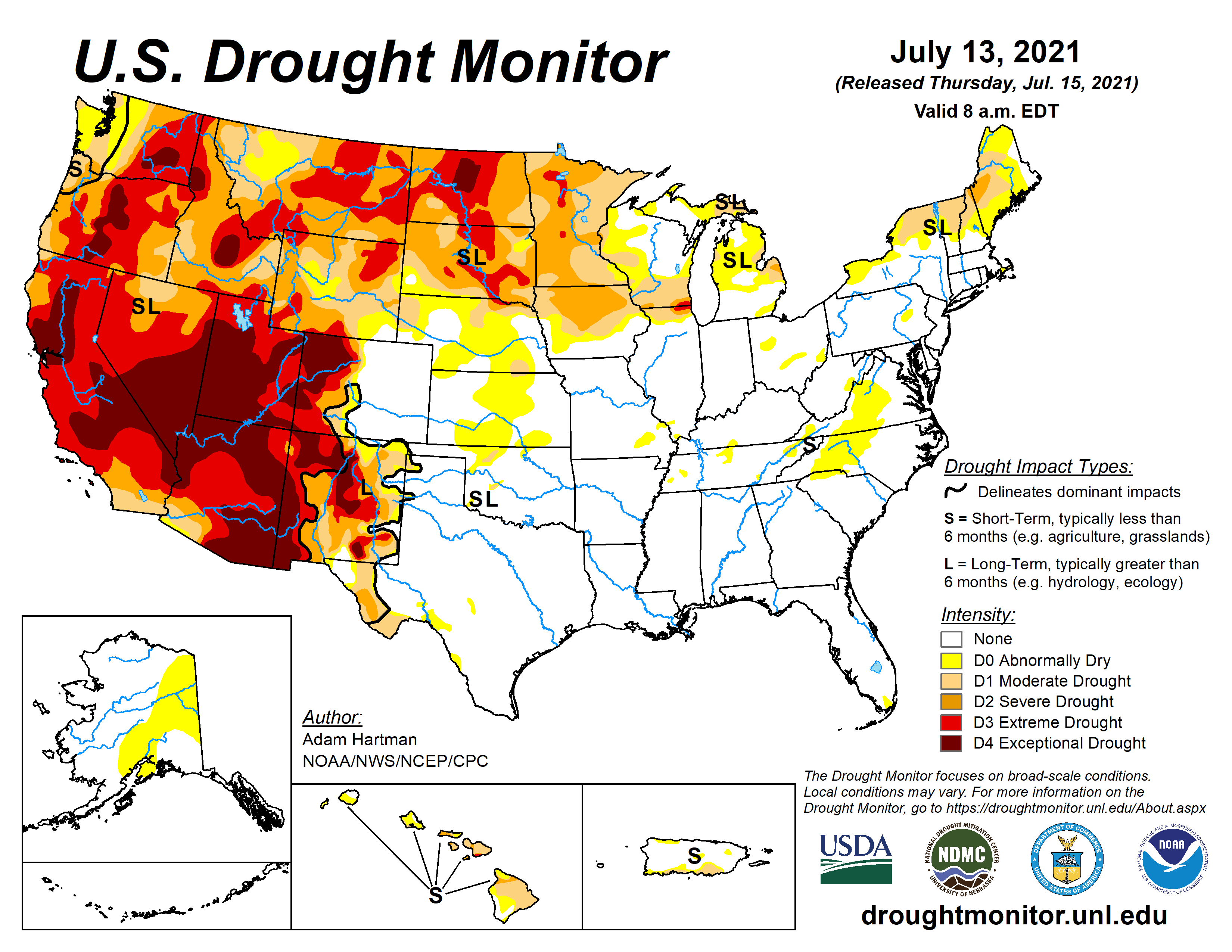
We do need the rain, just a bit farther west up across northwestern Oklahoma.
We could use a smidge from down in Jackson County up into Canadian County as
well, as shown by the latest U.S. Drought Monitor report.
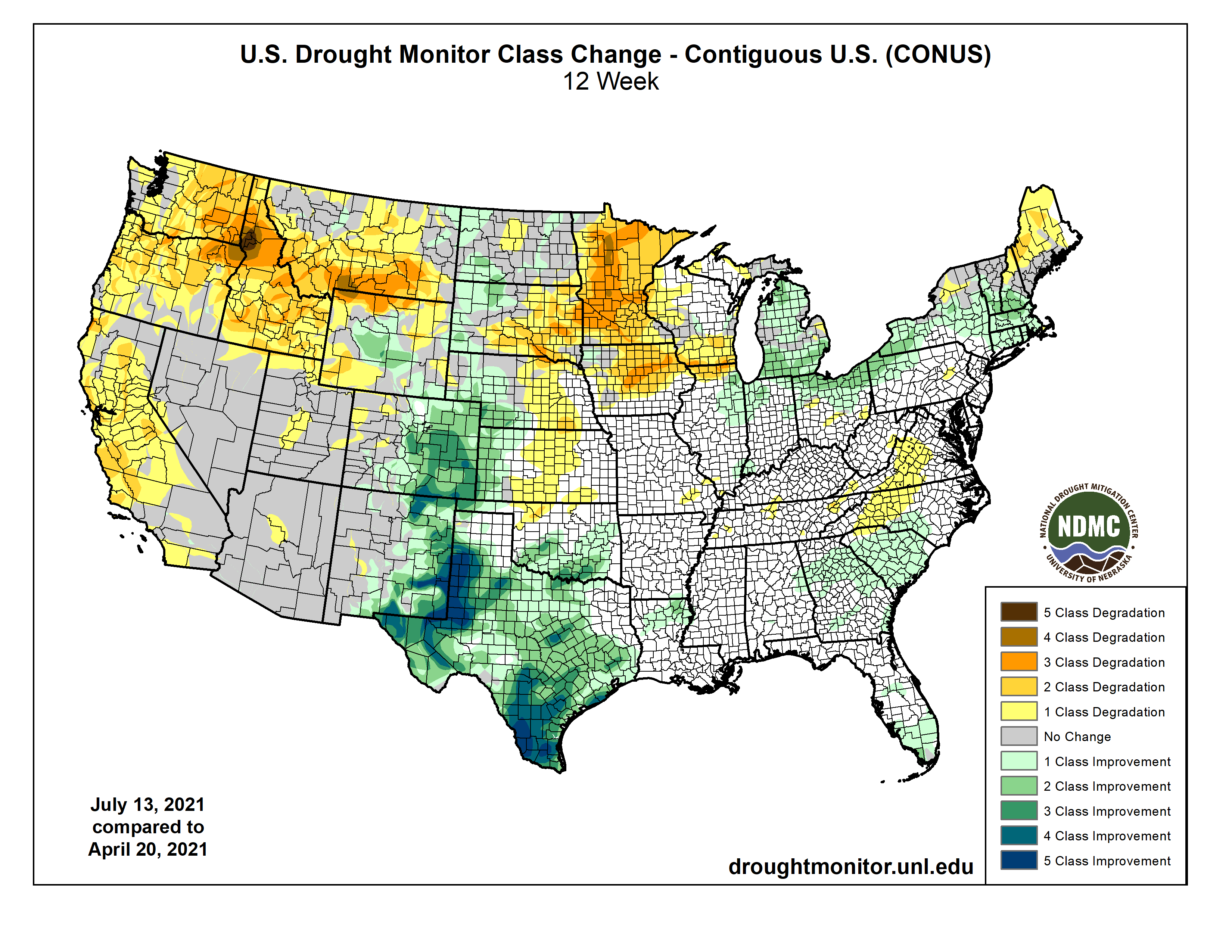
We've actually had tremendous changes across Oklahoma and really much of the
Southern Plains over the last 3 months. Not much help out West, or in the
Northern Plains. Northern Oklahoma is in a bit of a tough spot as well.
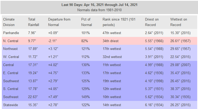
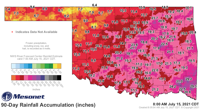
We can look at the past 3 months of rainfall in the state to easily see where
the problem areas lie, and let's be honest, the thin mint Blizzard from DQ
is really the best new Blizzard flavor we've seen in years...BUT ALSO, those
areas that have seen too much rain across the state would consider themselves
to lie in a problem area as well. Some of the rainfall has been somewhat
historic.
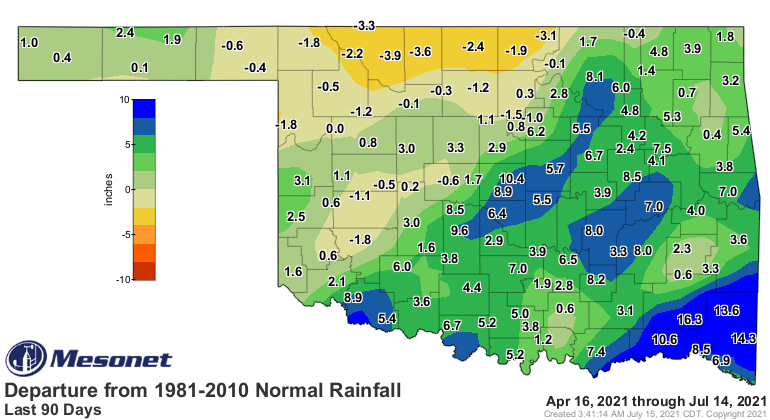
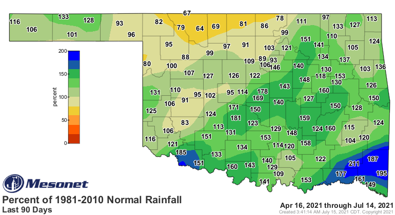
So as we look over the next 7 days worth of rainfall, I'm betting some of those
areas are saying "We're full, move along."

So we've skipped summer this year thus far, at least the typical long slog of
mid- to upper 90s we're used to. Never discount August, however. It can and has
been the month where cool summers go to die.
Gary McManus
State Climatologist
Oklahoma Mesonet
Oklahoma Climatological Survey
(405) 325-2253
gmcmanus@mesonet.org
July 15 in Mesonet History
| Record | Value | Station | Year |
|---|---|---|---|
| Maximum Temperature | 111°F | FREE | 2011 |
| Minimum Temperature | 52°F | FORA | 2014 |
| Maximum Rainfall | 3.28″ | KENT | 2017 |
Mesonet records begin in 1994.
Search by Date
If you're a bit off, don't worry, because just like horseshoes, “almost” counts on the Ticker website!