Ticker for June 30, 2021
MESONET TICKER ... MESONET TICKER ... MESONET TICKER ... MESONET TICKER ...
June 30, 2021 June 30, 2021 June 30, 2021 June 30, 2021
Rainy V
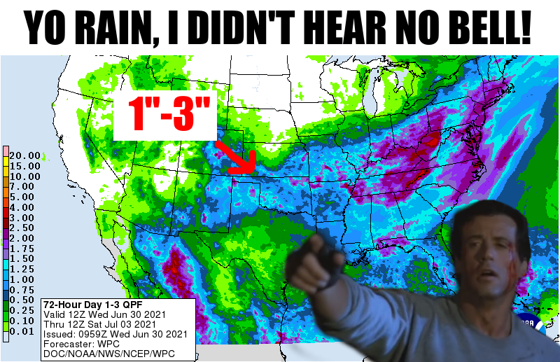
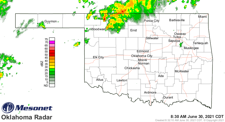
No, it's not done raining yet. The pugilist out front shoulda told ya. Or the
current radar image.
For the I-44 corridor, it has been one of the rainiest 5-day periods on record
for those folks. But let's be honest, hair is WAY overrated, but also too...not
everybody has been a part of the current moisture bounty.
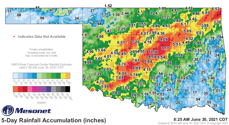
Parts of the northwest and southeast sections of the state have received less
than an inch, and when you're talking places like Hugo and Goodwell, less than
a tenth of an inch. So when we see the chance for 1-3 inches of additional
rainfall over the next few days before this crazy diagonal-centric rain pattern
is over, let's hope those areas get more of the heavier totals. When we start to
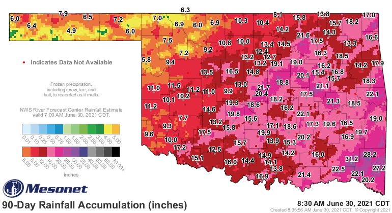
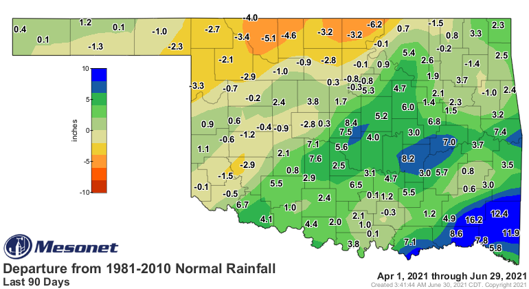
look at the longer-term rain deficits, those have definitely started to shrink.
We still have some pretty significant deficits up in the far north, so those
targeted rains this morning will help even further.
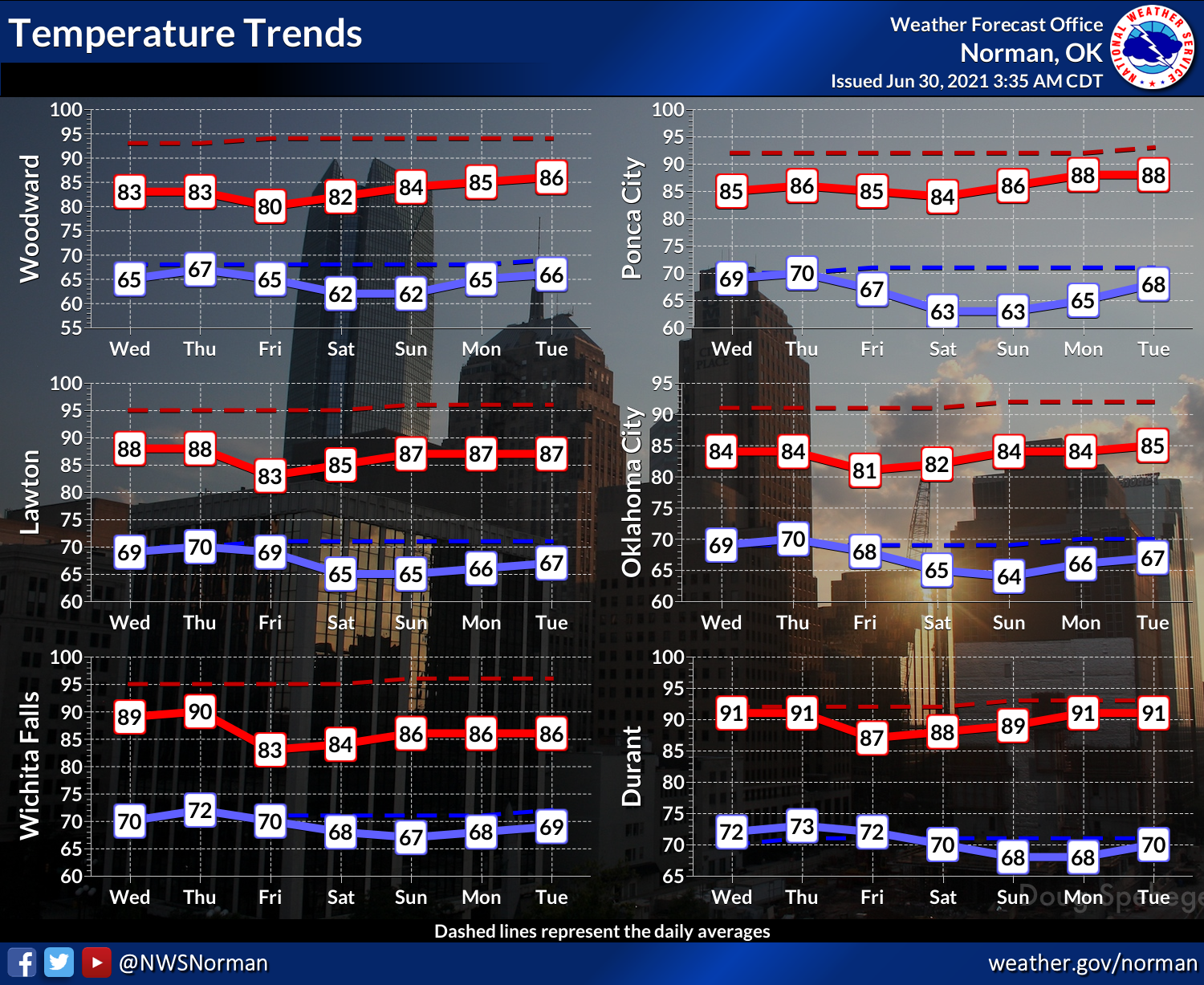
We should calm down as we get into the weekend to more of a summertime "low chance
of showers and storms each day" type of pattern. But we still don't see any
sort of huge heat dome building our way just yet. I don't have this graphic
for other parts of the state, but the Norman NWS office gives us an idea of
temperatures for the next 7 days.
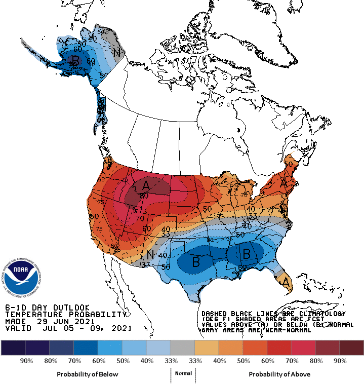
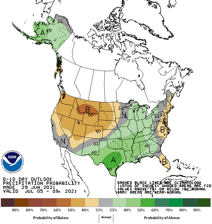
And it looks like we may delay the cat days (CATS RULE, DOGS DROOL!) of summer
for just a bit longer.
Gary McManus
State Climatologist
Oklahoma Mesonet
Oklahoma Climatological Survey
(405) 325-2253
gmcmanus@mesonet.org
June 30 in Mesonet History
| Record | Value | Station | Year |
|---|---|---|---|
| Maximum Temperature | 109°F | HOOK | 2012 |
| Minimum Temperature | 55°F | SEIL | 2008 |
| Maximum Rainfall | 5.07″ | BUFF | 1999 |
Mesonet records begin in 1994.
Search by Date
If you're a bit off, don't worry, because just like horseshoes, “almost” counts on the Ticker website!