Ticker for July 1, 2021
MESONET TICKER ... MESONET TICKER ... MESONET TICKER ... MESONET TICKER ...
July 1, 2021 July 1, 2021 July 1, 2021 July 1, 2021
Jultember?
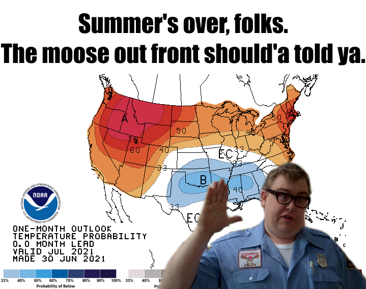
Now this is partially in jest, of course. I mean, we still have summer scheduled
for August 13 at 1:03 pm through August 17 at 11:43 pm. And man, is it ever going
to be HOT! But otherwise, summer is just not in the cards this year. We did have
a bit between June 9-24 (read the June summary below...I dare ya!) where it got
up into the 90s and 100s. Remember the oppressive heat? Oh how glorious it was.
Then the cold front on the 25th and the bottom dropped out once again.
Here's the deal, though...remember, I said "in jest." the first week or so of
July looks cool, and that along with some abundant soil moisture is expected to
keep the month's temperatures a bit below normal. Could end up being warmer than
expected, but this is how these things usually go. We're still seeing indications
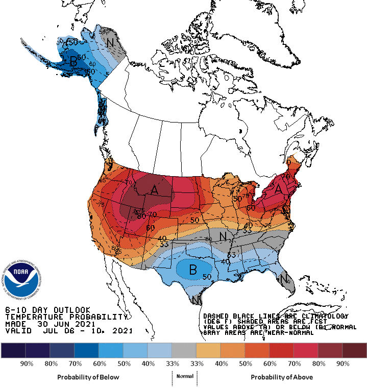
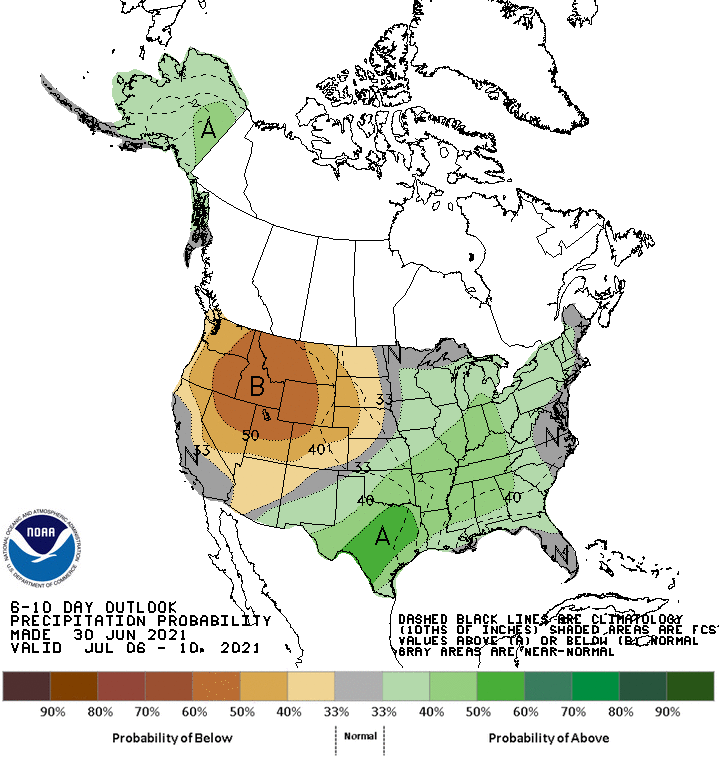
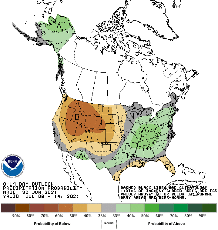
of mild, wet weather from CPC out through the July 10 time frame, but things
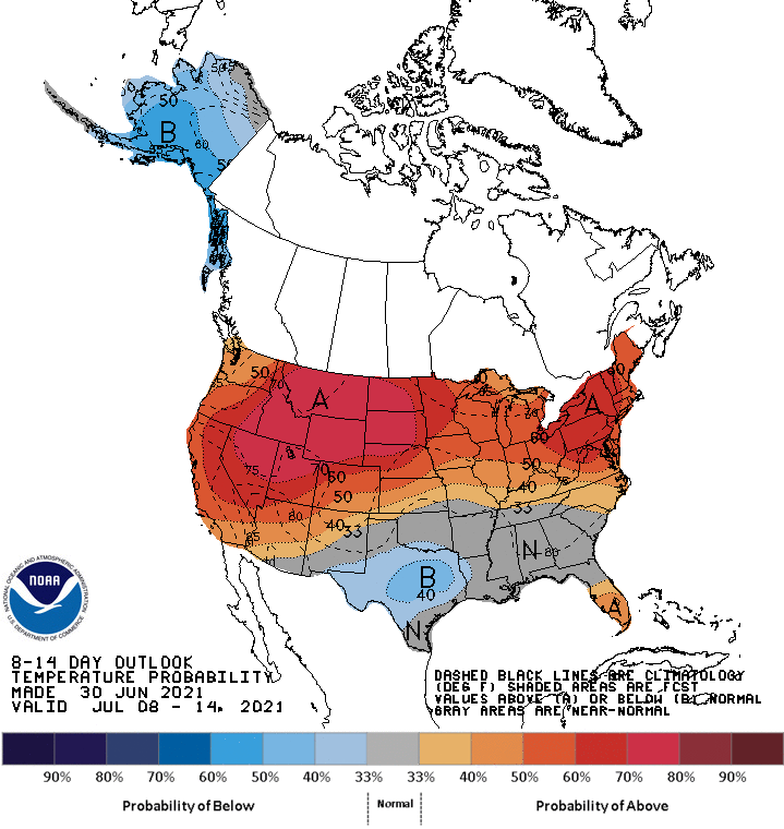
start to lessen a bit after that when the weather pattern starts to possibly change.
We flatten that ridge out West that has brought them the record-shattering heat
just a bit and get rid of some of the ongoing precipitation here in the Southern
Plains.
July 6-10
---------
July 8-14
---------
By the way, 121 degrees in Canada? CANADA? That's hotter than we've ever been
in Oklahoma (120 degrees)! That's pretty ridiculous. We're an intense drought
and long-term heat dome from such treatment, but we tried that in 2011 and we
only got up to 115.
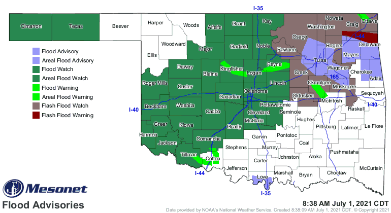
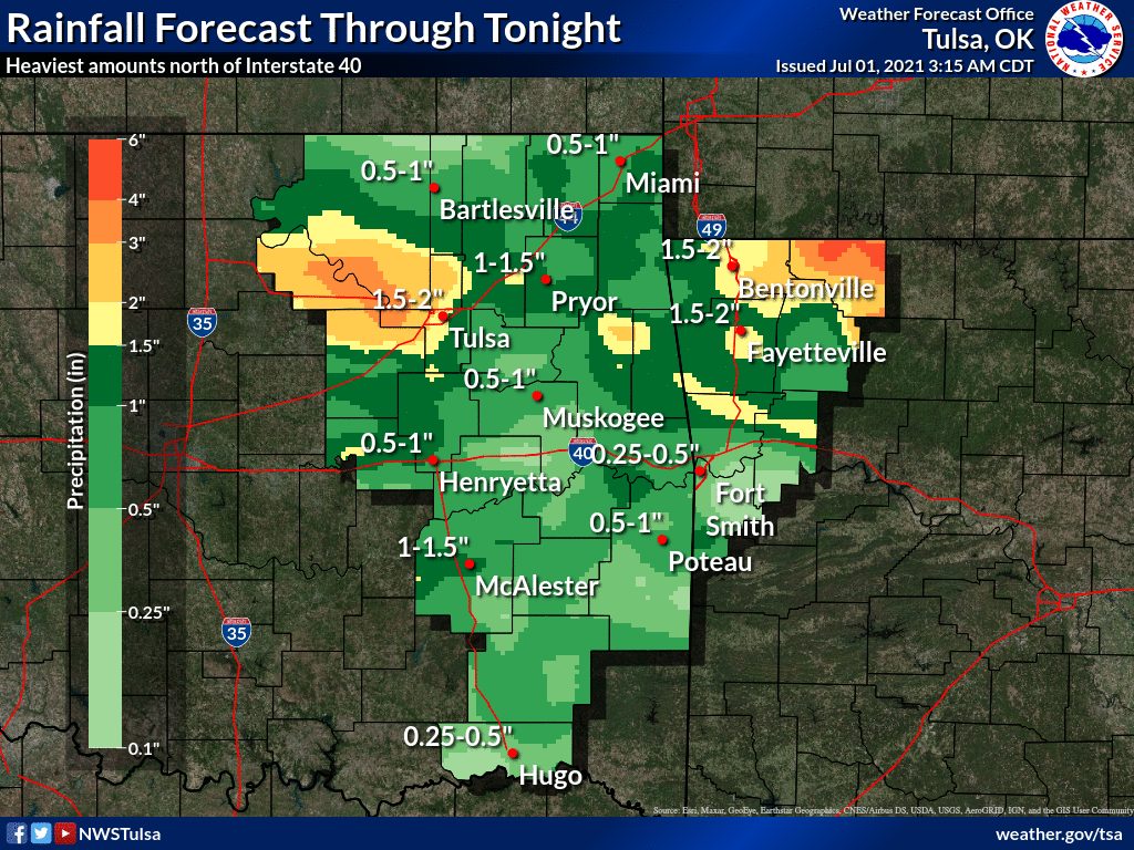
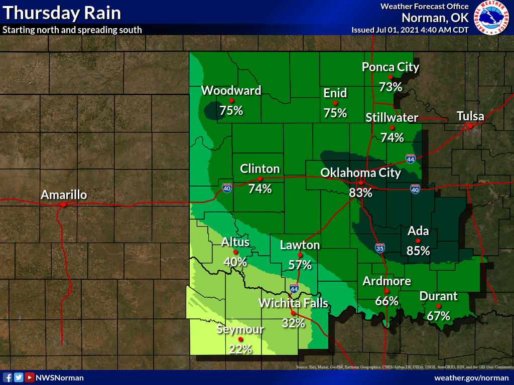
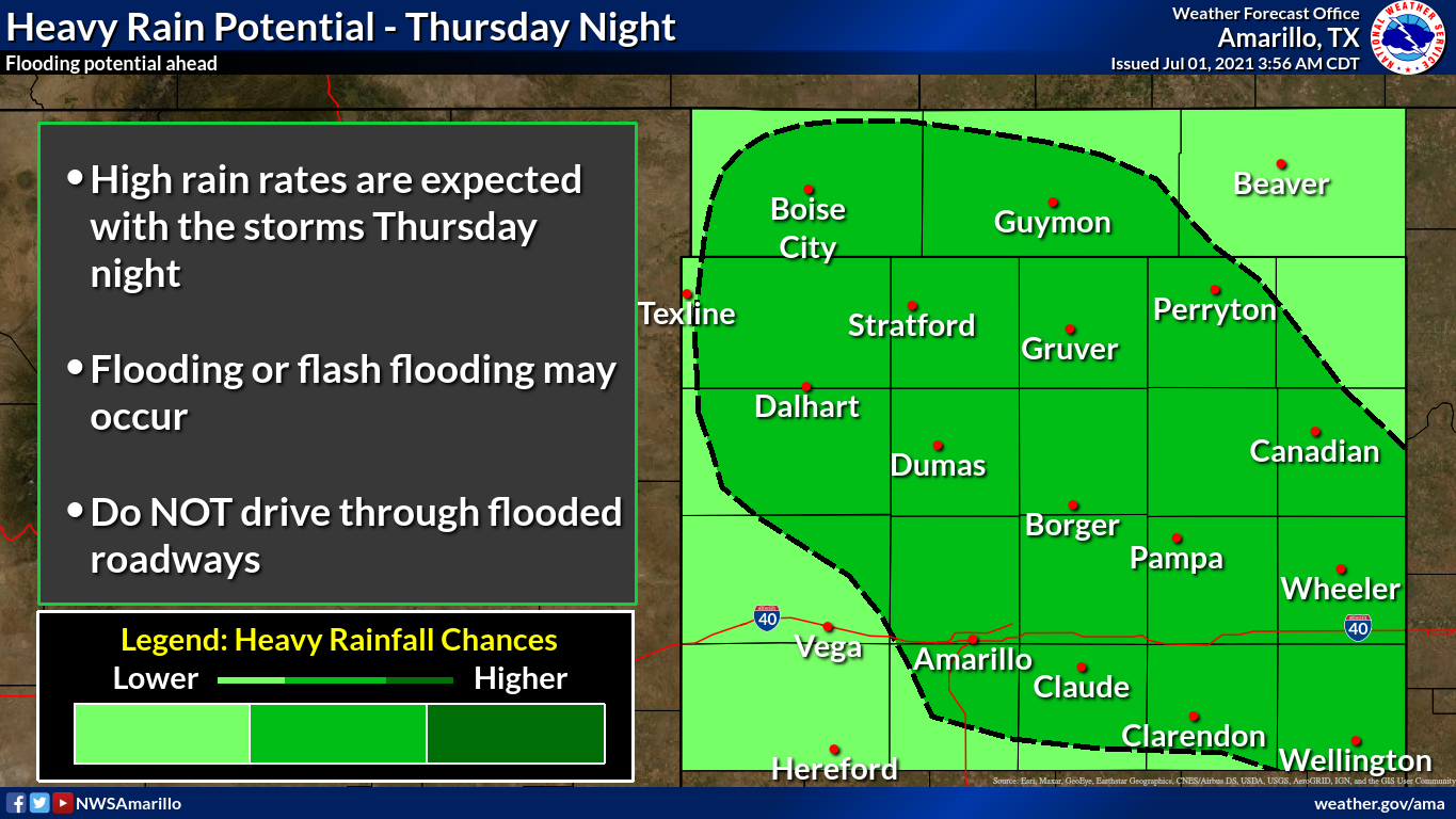
ANYWAY, we have more rain coming today and tonight, with possible flooding.
Of course we do, since it's JULY NOW! Just what you'd expect from a July 1,
right? Another cold front coming in, more May-ish weather (without the tornadoes
and all that jazz, but then again we didn't have many this May either).
At least July 4 looks presentable, if not a bit CHILLY for my liking. Rain
chances are low, but there will be some around probably.
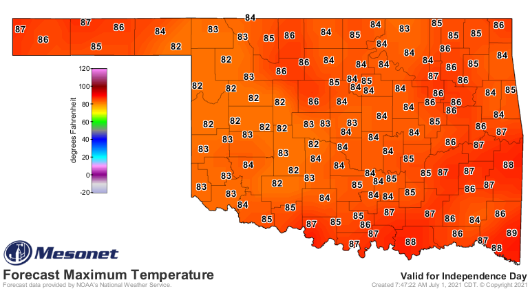
I don't know what to say...the mild-summer mongers win out this year it would
appear. If you put a pool in this year, don't worry. You can always swim in it
in November when it's 83 degrees out. Or August 13-17.
-------------------------------------------------------------------------------
June Sees Summer Swoon
July 1, 2021
A slow start to summer gave way to sweltering heat through the middle of June
before once again succumbing to mild, wet weather to end the month.
There were occasional bouts with severe weather—mostly high winds and large
hail—although flooding was a common concern as well. Winds of up to 75 mph hit
Snyder overnight on June 7, producing widespread damage to the town. The
Oklahoma Mesonet site at Boise City measured winds in excess of 65 mph for 25
consecutive minutes the evening of June 12. Several homes reported significant
roof damage, and the high school gym’s roof was partially blown off. Nearly 100
power poles were destroyed between Balko and Elmwood the evening of the 24th
due to estimated winds of up to 95 mph. The Mesonet site at Hooker measured a
wind gust of 85 mph on the 25th associated with severe storms in the area that
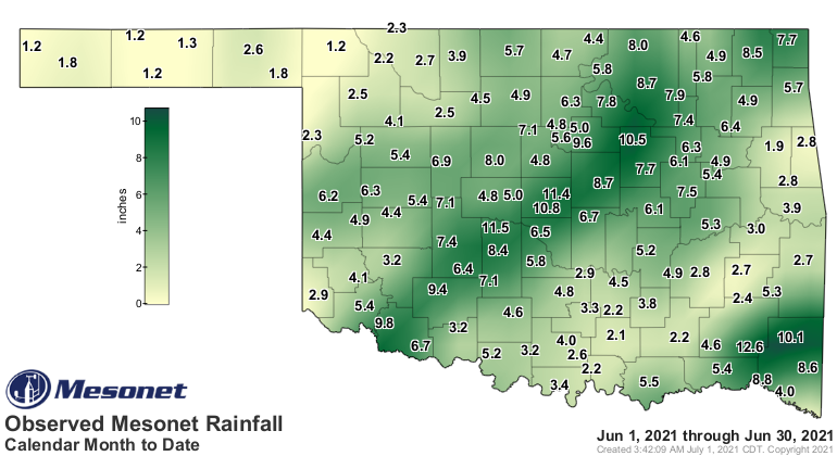
toppled trucks on local highways. Unusually heavy rains along the Interstate-44
corridor June 25-30 produced widespread totals of 6-8 inches, and more than a
foot of rain in some locations. A volunteer observer near Lawton reported 12.32
inches of rain during that period, and 14.29 inches for the month's highest
total. Heavy downpours on the 27th inundated areas of central Oklahoma with
flash flooding, resulting in numerous water rescues from stalled vehicles.
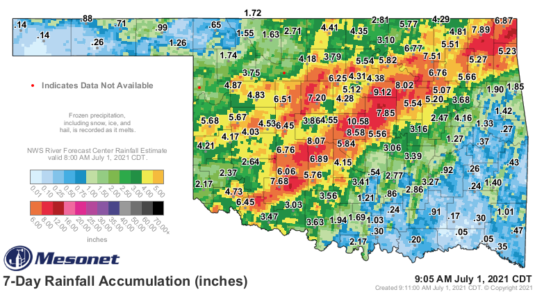
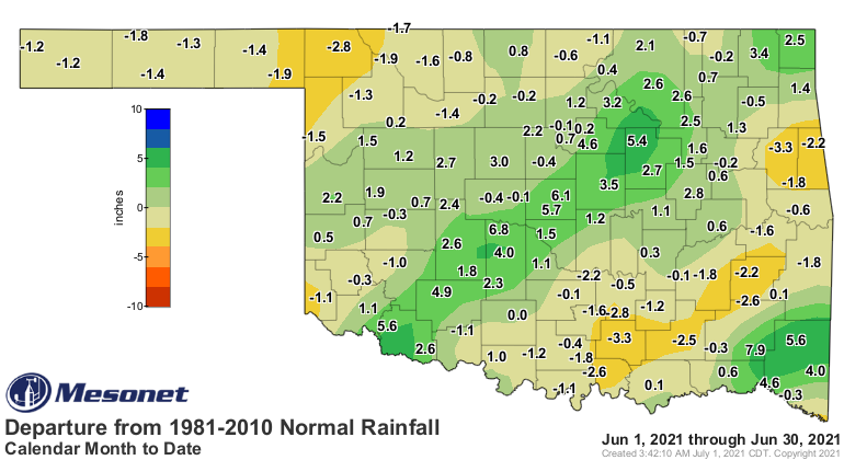
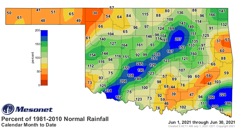
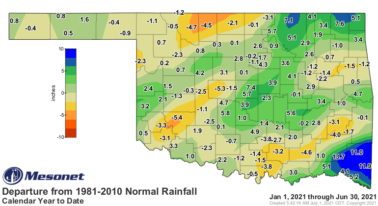
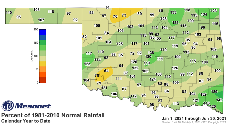
The statewide average rainfall total was 4.97 inches according to preliminary
data from the Oklahoma Mesonet. That ranked the month as the 34th wettest June
since records began in 1895, 0.45 inches above normal. The extreme wet
conditions along the I-44 corridor, with totals 4-6 inches above normal, were
countered by dry weather that plagued much of the rest of the state. The far
southeast was also considerably wetter than normal with surpluses of 6-8 inches.
Cloudy led the Mesonet sites with 12.62 inches of rain during the month, but the
central Oklahoma stations at Minco and Spencer were close behind with 11.46
and 11.36 inches, respectively. Thirty-nine of the Mesonet’s 120 sites recorded
at least six inches of rain during June. Kenton reported 1.2 inches for the
month’s lowest total. Another seven sites also recorded less than two inches.
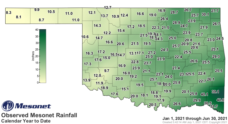
The first six months of the year ended 0.83 inches above normal with a
statewide average of 19.86 inches, the 39th wettest January-June period on
record for Oklahoma.
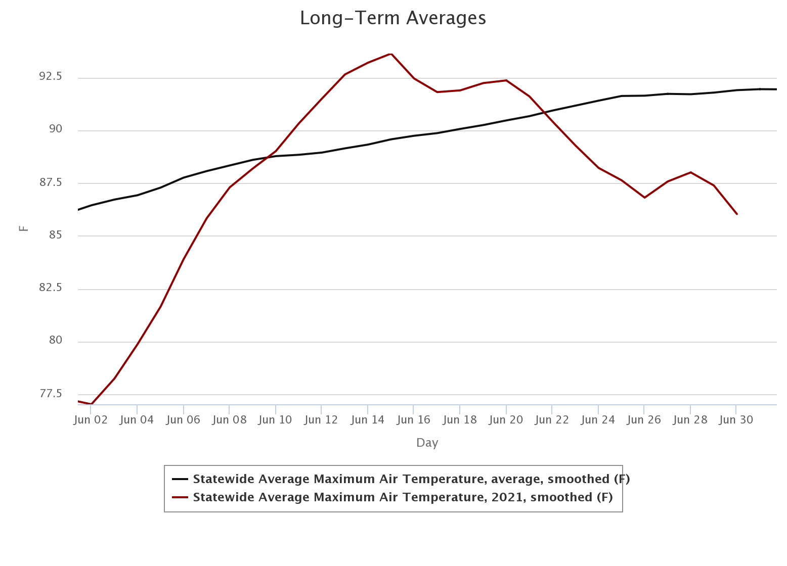
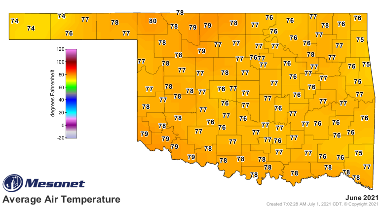
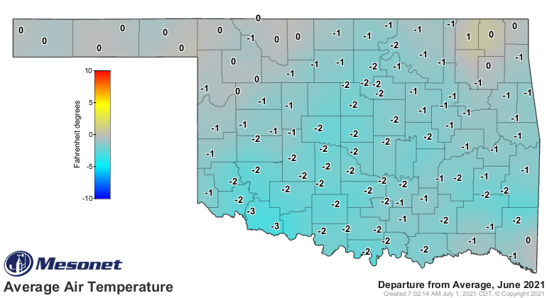
The statewide average temperature still managed to come out on the warm side
during June, despite the extended mild weather that bookended the month. The
statewide average finished at 77.1 degrees, 0.6 degrees above normal, and ranked
as the 59th warmest June on record. Much of the middle of the month was
dominated by oppressively hot weather, fueled by high humidity. The Mesonet
sites at Eva and Goodwell recorded June’s highest readings of 107 degrees on
the 23rd, while Boise City reported the lowest temperature of 47 degrees on
June 2. Heat index values soared into the low 110s during June’s second week,
topping out at 113 degrees on the 11th. The Mesonet’s 120 sites reported heat
index values of at least 105 degrees 369 times during the month, but none
coming before June 9 or after June 25. The first six months of the year fell
1.3 degrees below normal with a statewide average of 54.5 degrees, the 36th
coolest such period on record.
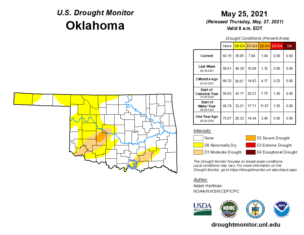
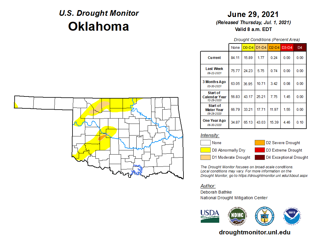
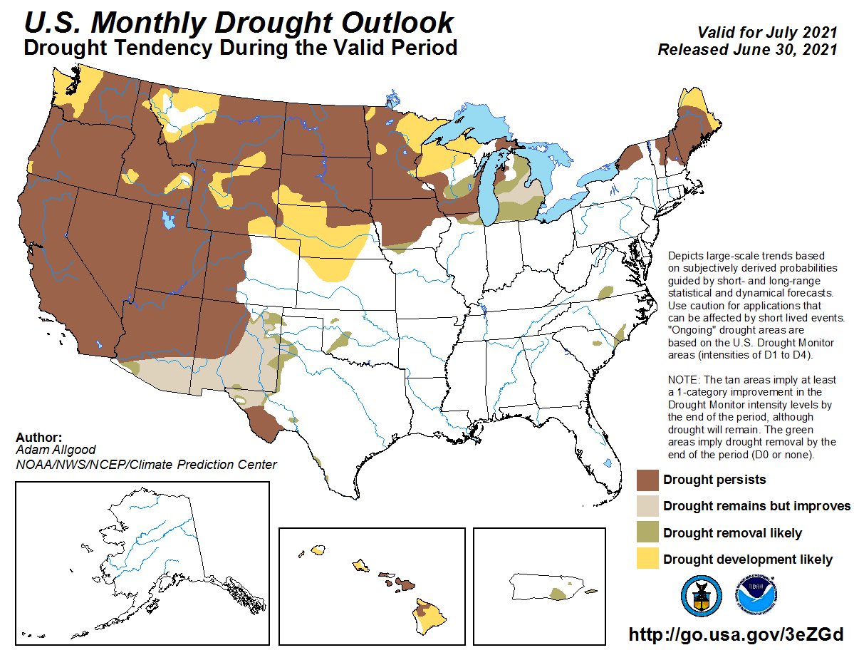
Drought coverage across Oklahoma continued to shrink during June, decreasing
from 8 percent of the state in late May to less than 2 percent at the beginning
of July. Prospects for complete removal from the state appear favorable
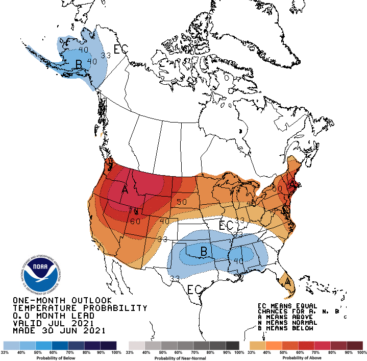
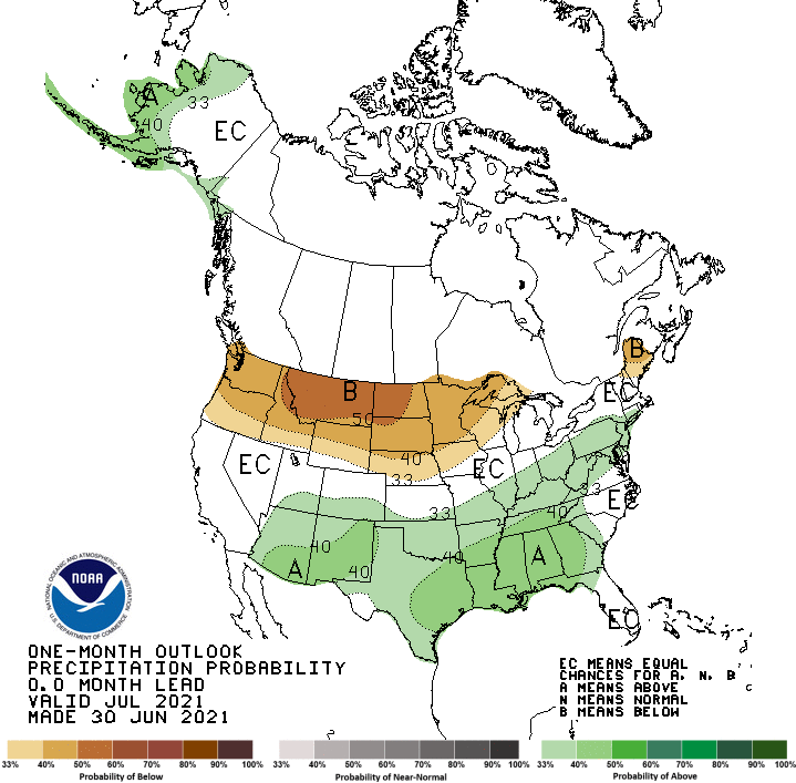
according to the July outlooks from the Climate Prediction Center (CPC).
Increased odds for above normal precipitation and below normal temperatures
cover virtually the entire state, with even greater chances of below normal
temperatures across the southern two-thirds of Oklahoma. The possible reduction
in heat and increase in moisture lends confidence in complete drought removal
across the state by the end of July, as depicted in CPC’s monthly drought
outlook.
Gary McManus
State Climatologist
Oklahoma Mesonet
Oklahoma Climatological Survey
(405) 325-2253
gmcmanus@mesonet.org
July 1 in Mesonet History
| Record | Value | Station | Year |
|---|---|---|---|
| Maximum Temperature | 110°F | ALVA | 1997 |
| Minimum Temperature | 50°F | EVAX | 2017 |
| Maximum Rainfall | 5.82 inches | PAWN | 2016 |
Mesonet records begin in 1994.
Search by Date
If you're a bit off, don't worry, because just like horseshoes, “almost” counts on the Ticker website!