Ticker for June 24, 2021
MESONET TICKER ... MESONET TICKER ... MESONET TICKER ... MESONET TICKER ...
June 24, 2021 June 24, 2021 June 24, 2021 June 24, 2021
Are ya ready?
Sorry for the late Ticker, I was waiting with bated breath (I used to have baited
breath then I figured out I was using the wrong end of the toothbrush) for all
the new data to come in. Well, not really. That's just weatherperson-ese for "I
was busy doing something else." But on we Tick, so we can all Tock later. Tons
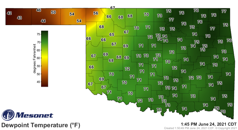
(no, literally) of moisture have streamed up into the state, setting the dewpoints
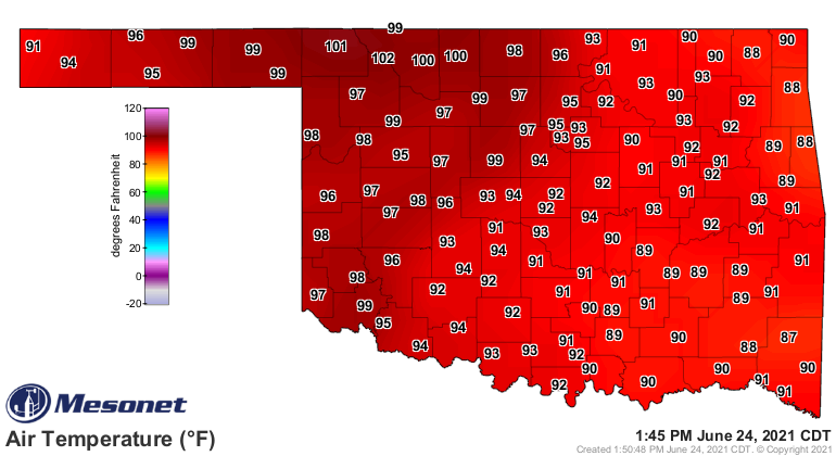
into the SOUPS ON range, which combined with our air temperatures have made for
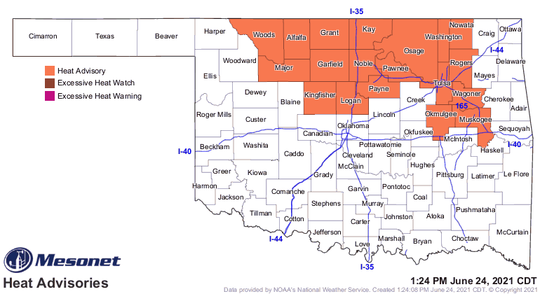
a steamy start to the day--enough so that we have a heat advisory in effect for
much of north central Oklahoma.
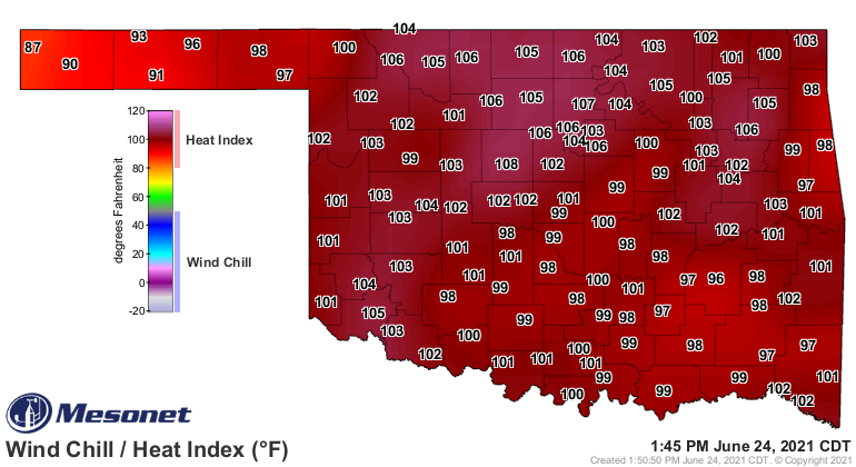
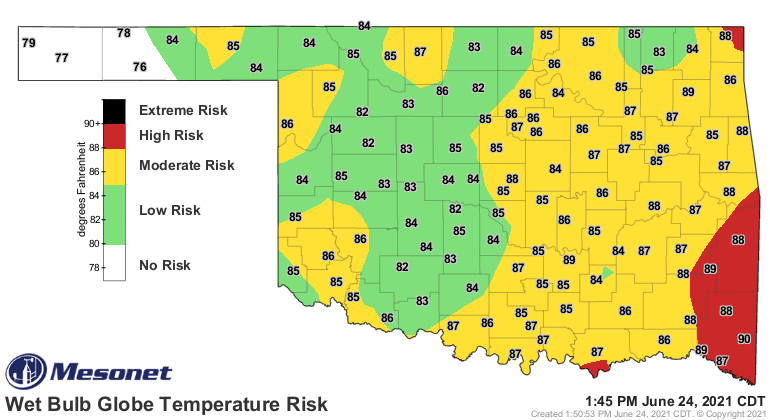
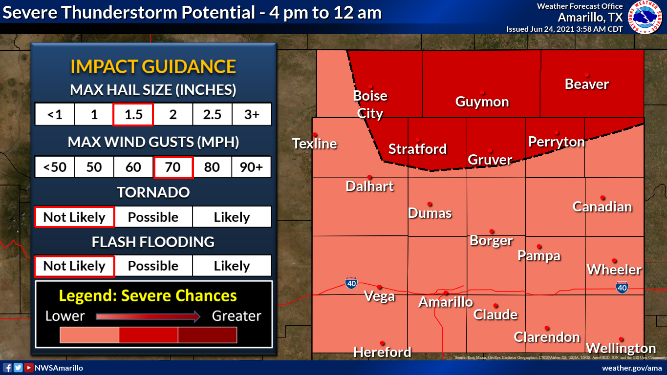
That's going to be the setup for the next couple of days, until we see that
unusually strong cold front--for late June--bust into the state late on Saturday
and bring a real chance for rain. There'll be a few fits and
starts (that was my band name in college, and also how my car ran) before the
big rain chances begin on Friday night with a pre-frontal wind shift and then
Saturday as the front arrives and stalls out.
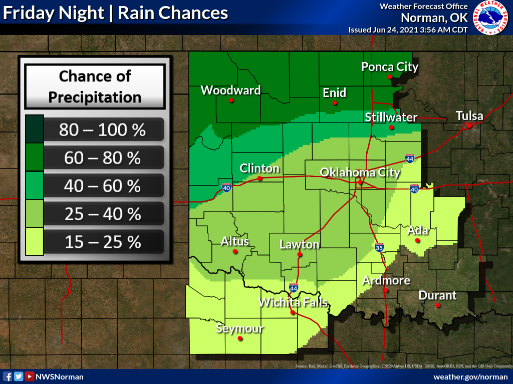
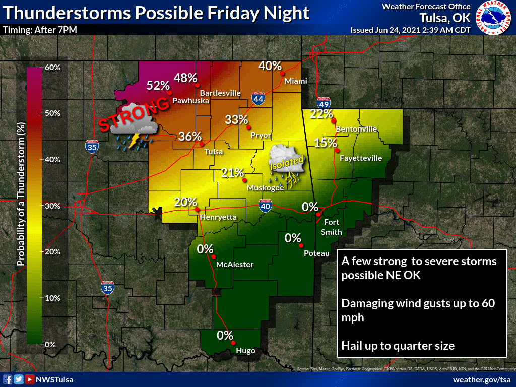
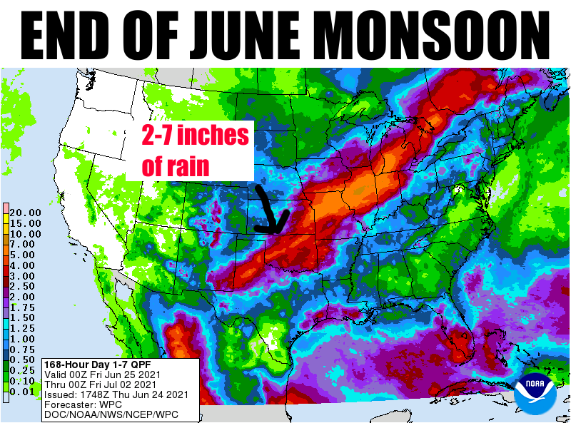
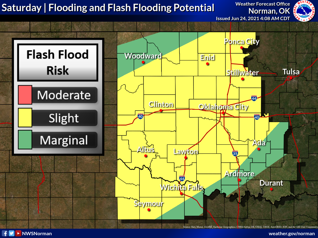
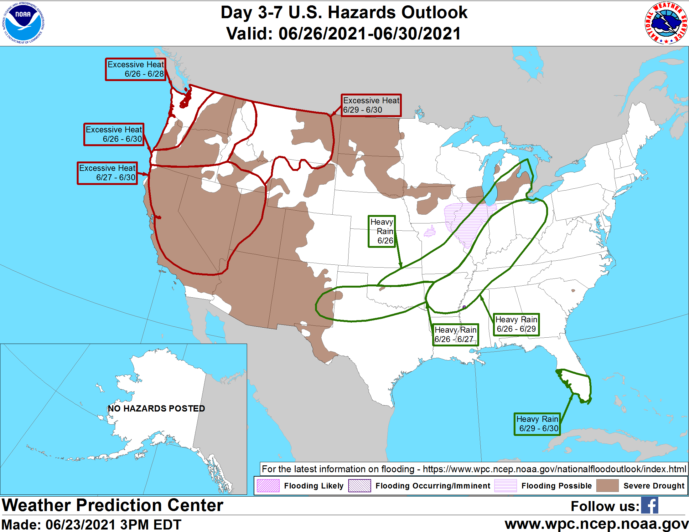
After that, the southern conveyor belt of moisture will continue, with lots
of rain chances, and heavy rain at that. We're going to possibly see flooding
rains for parts of the state, depending on where everything shakes out.
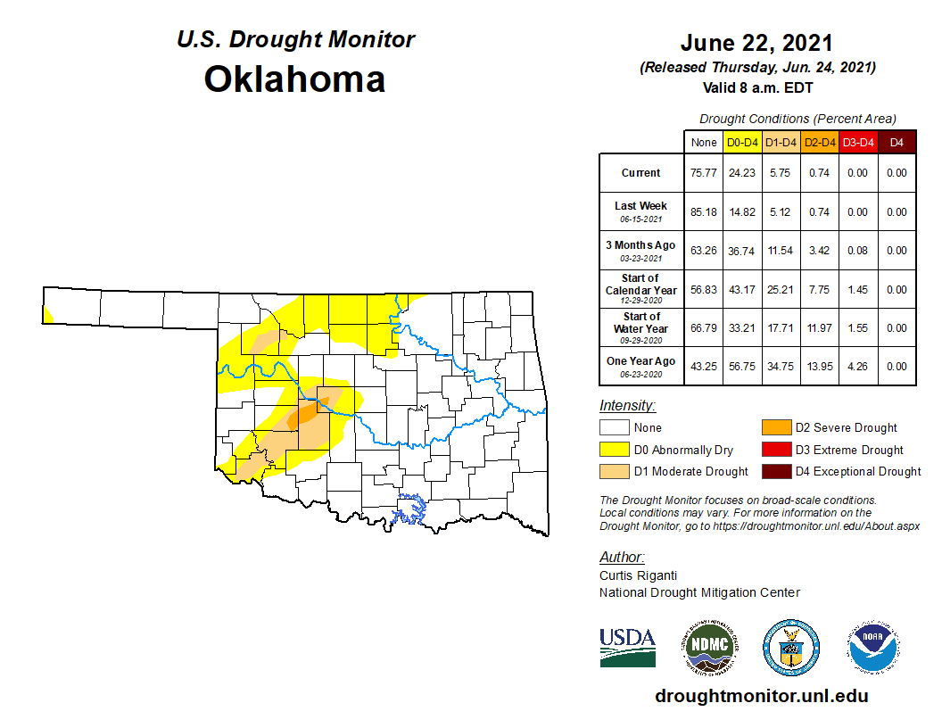
And for some of us, especially across part of northwestern and then southwest
into central Oklahoma, some good rains are sorely needed.
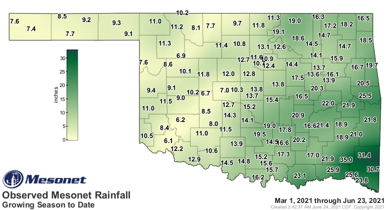
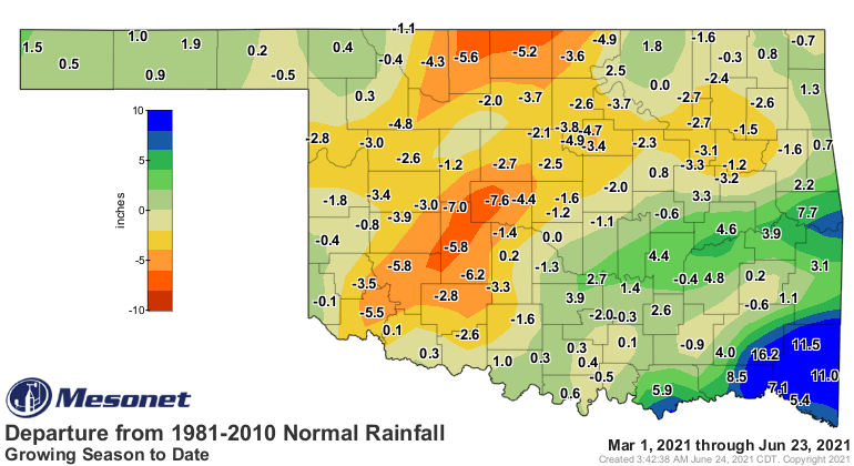
These are areas that are seeing drought develop and persist due to the prolonged
deficits.
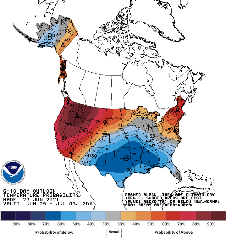
We'll also get help on the temperatures, with an extended period of mild weather
just in time for July.
While we're mild, however, the Pacific Northwest will be baking in temperatures
they've never recorded before, up in the 110-range for some. My guess is that
Mt. Rainier is going to get pretty crowded considering there aren't a lot of
air conditioners in that part of the country.
Gary McManus
State Climatologist
Oklahoma Mesonet
Oklahoma Climatological Survey
(405) 325-2253
gmcmanus@mesonet.org
June 24 in Mesonet History
| Record | Value | Station | Year |
|---|---|---|---|
| Maximum Temperature | 108°F | HOLL | 2011 |
| Minimum Temperature | 45°F | BOIS | 2019 |
| Maximum Rainfall | 5.37″ | FAIR | 2018 |
Mesonet records begin in 1994.
Search by Date
If you're a bit off, don't worry, because just like horseshoes, “almost” counts on the Ticker website!