Ticker for June 22, 2021
MESONET TICKER ... MESONET TICKER ... MESONET TICKER ... MESONET TICKER ...
June 22, 2021 June 22, 2021 June 22, 2021 June 22, 2021
The ConJuneing
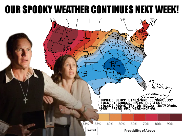
Hey, I'm not saying there's something supernatural about our weather this year,
especially as we've gotten into "sprummer," that iridescent line between
Oklahoma's spring and summer weather, when we seemed to go from early spring to
mid-summer and then back to mid-spring again yesterday and this morning.
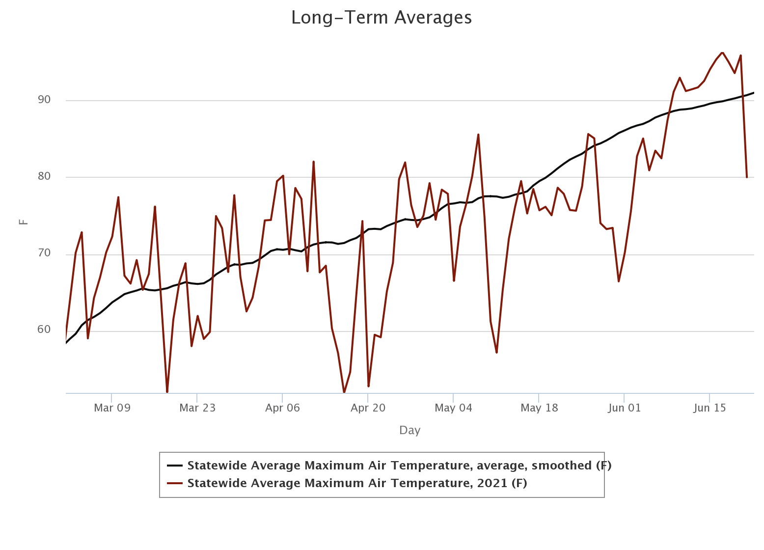
How cool was it yesterday? Well, let me tell you. Please? PLEASE LET ME TELL YOU!
Oh, sorry, thought you were saying no. It was cool enough that we saw some record
lows and record low max temperatures broken across portions of the state.
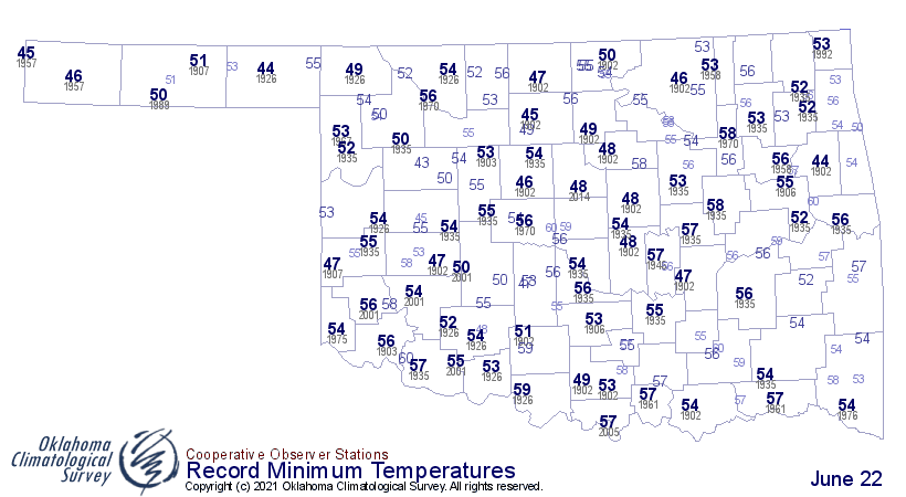
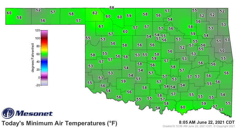
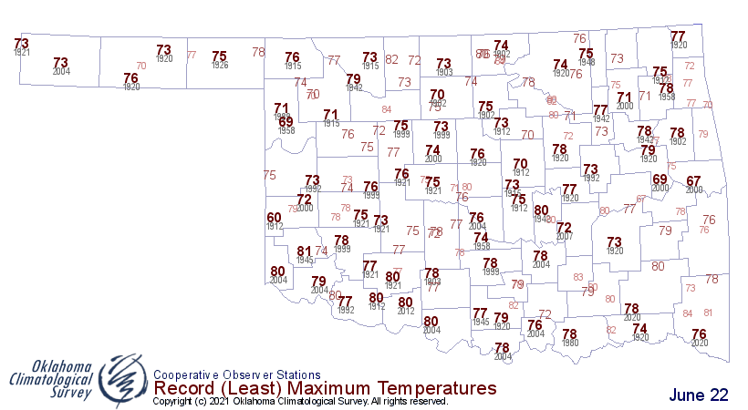
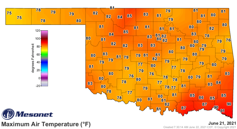
Keep in mind that some of yesterday's max temperatures came right after midnight
yesterday as the front approached. So if you were in bed around that time, you
went to bed during a hot summer day and woke up the next morning in April. The
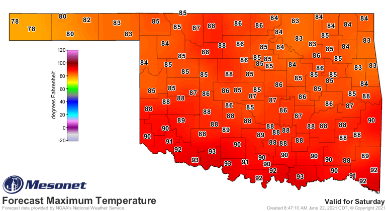
kicker is we'll have a nice day today with highs in the 80s, but then summer
returns with a vengeance through Friday before we see another front that will
drop us back down into enjoyable territory once again, with much drier air.
Here are a few select forecast maps for the period.
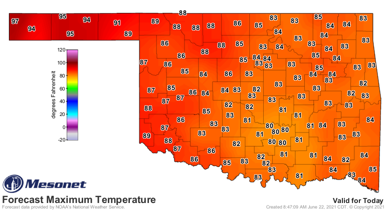
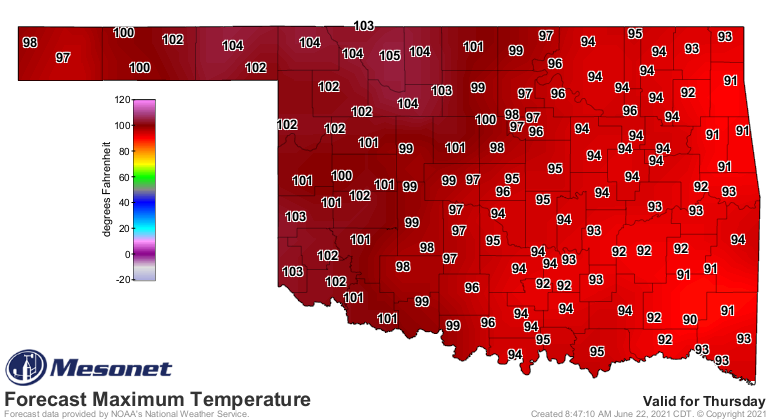
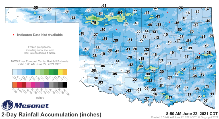
That front will come with a chance of rain late this week into the next, so
here we go again. We had some lovely moisture from the last one.
So good luck figuring out the rest of the summer. My bet?
More spooky weather!
Gary McManus
State Climatologist
Oklahoma Mesonet
Oklahoma Climatological Survey
(405) 325-2253
gmcmanus@mesonet.org
June 22 in Mesonet History
| Record | Value | Station | Year |
|---|---|---|---|
| Maximum Temperature | 104°F | TIPT | 1998 |
| Minimum Temperature | 49°F | BOIS | 2004 |
| Maximum Rainfall | 4.73″ | MANG | 1999 |
Mesonet records begin in 1994.
Search by Date
If you're a bit off, don't worry, because just like horseshoes, “almost” counts on the Ticker website!