Ticker for May 27, 2021
MESONET TICKER ... MESONET TICKER ... MESONET TICKER ... MESONET TICKER ...
May 27, 2021 May 27, 2021 May 27, 2021 May 27, 2021
Prognosis Negative
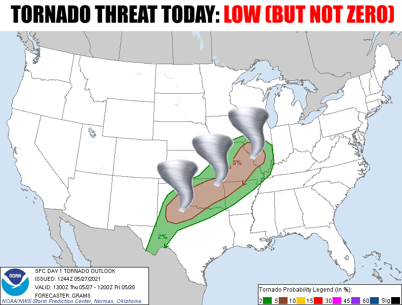
Are ya like me (seek help)...do ya get nervous on May mornings when you wake up
to condensation on the inside of your windows and you know a cold front is coming
your way? Yep, it's one of them there days in Oklahoma where you know the
ingredients for a severe weather outbreak are lurking outside those windows. Now
there are lots of things that can foul things up...like early convection and
lining out too quickly, but that brings other problems, like outflow boundaries
which can trigger more severe weather, or widespread straight-line wind damage.
Out in Buffalo, we worried about parabolic wind damage, but we're different that
way. At any rate, today is a day to stay weather aware, basically form now until
well into the evening.
The offending cold front (in more ways than one...come on summer!!) is just now
entering the Panhandle, and will sweep across the state throughout the day.
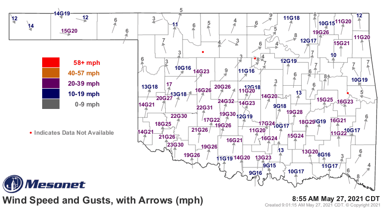
Now unfortunately, this is starting out pretty scrambled, and it is a complex
forecast situation. Ain't they all? But this one particularly so, so (oooh, an
offending double-so...throw the flag!!) we're just going to have to go with the
flow on this one, so to speak, and watch the evolution as it occurs. We know
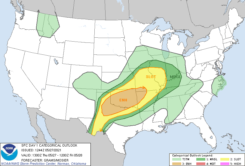
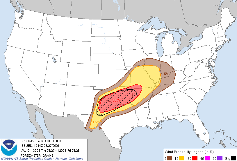
one of the big threats will be large-to-gigantic hail and straight-line winds,
and the SPC outlook gives us an idea of what to expect.
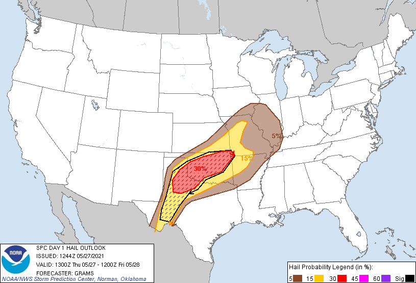
GO TO HAIL, HAIL! Can I say that? If I can't, I won't, but there you go. Flash
flooding will be another threat, especially in those areas where the ground
is already saturated. I'll go ahead and count my lawn as one of those areas,
and I have the muddy lawn mower wheels to prove it.
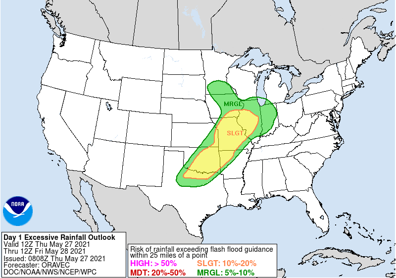
There's not really much to say after all of that, except THERE CAN BE ONLY ONE!
But this isn't Highlander, and I've always felt there could be at least two or
more, which would make for a really bad movie, but I digress.
It's gonna get hot again ahead of the front where the sun's out. That's the
trade off with all this rain...doesn't matter what the temperature does as we
transition to summer. When the sun is out, it will get steamy hot! Like
yesterday where we saw some 90s but mostly 80s, but the heat index approached
or hit 100 in a lot of areas.
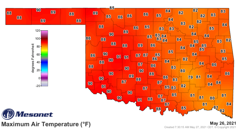
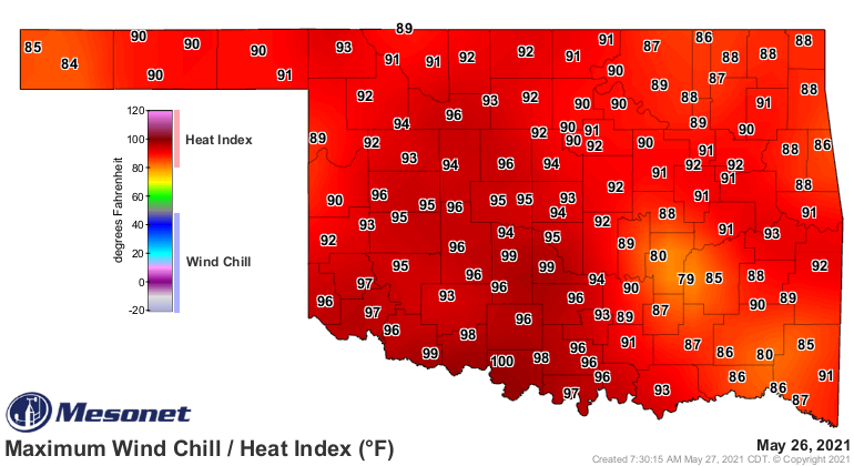
If you were outside yesterday, it was HOT, no matter what the thermometer said,
and it was a shock to the system after all the cool, cloudy weather we had. So
watch for that today later on. If you have clouds, you'll be in somewhat
better conditions. The stormy weather should subside after tonight, at least the
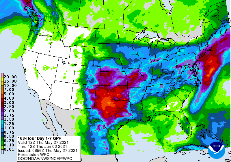
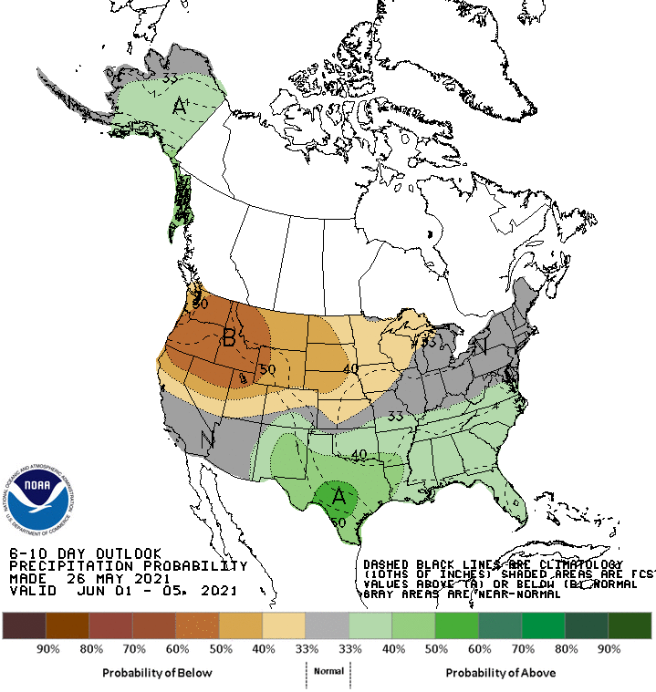
high-end severe threat. But the story doesn't end there as we face another
chance for heavy rains next week. Oh, and more cool weather, of course.
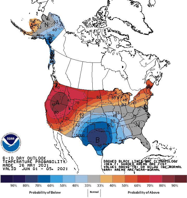
Cool in June is okay, I guess...more so than in May. But the heat index will
eventually come calling to collect.
Gary McManus
State Climatologist
Oklahoma Mesonet
Oklahoma Climatological Survey
(405) 325-2253
gmcmanus@mesonet.org
May 27 in Mesonet History
| Record | Value | Station | Year |
|---|---|---|---|
| Maximum Temperature | 108°F | ALTU | 2011 |
| Minimum Temperature | 39°F | KENT | 2009 |
| Maximum Rainfall | 4.32 inches | HOBA | 1999 |
Mesonet records begin in 1994.
Search by Date
If you're a bit off, don't worry, because just like horseshoes, “almost” counts on the Ticker website!