Ticker for April 29, 2021
MESONET TICKER ... MESONET TICKER ... MESONET TICKER ... MESONET TICKER ...
April 29, 2021 April 29, 2021 April 29, 2021 April 29, 2021
Do not pass go
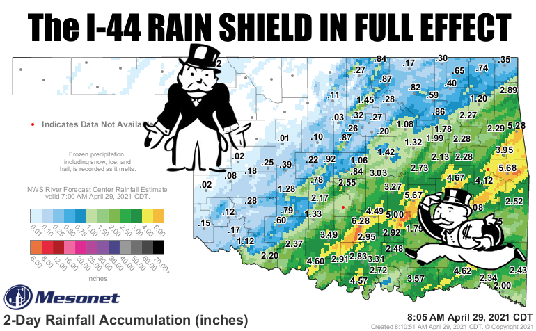
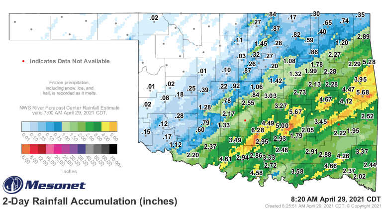
(Here's a clean map for ya).
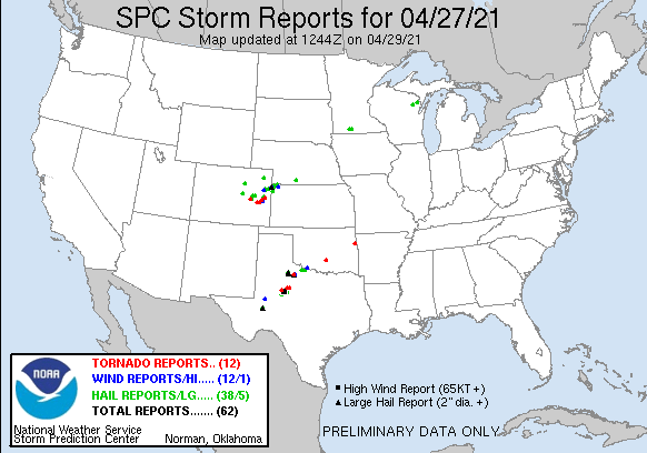
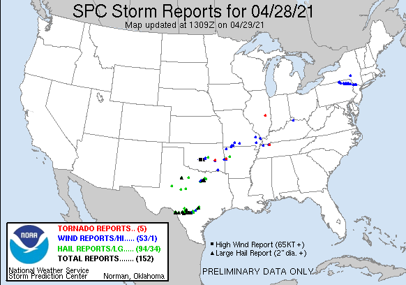
As I sat and listened to the roar of baseball size hail driven by 70 mph winds
approach Norman last night (the loudest storm roar I've experienced since my
house's quarter-mile brush with the May 20, 2013, Moore EF5), I thought to myself
"there has to be a better way!" And we merely got a glancing blow in north Norman
where I live. So from here on out, with all the power invested in me by the
American Association of State Climatologists, I hereby declare all rainfall in
Oklahoma shall fall in non-convective systems, without the hail, severe winds, a
and tornadoes. Forthwith and whatnot.
We'll see if that works. Probably not. We can see the damage done from this
somewhat "ordinary" late-April severe weather system. Doesn't seem too ordinary
anymore, with the tornadoes in Indianola, Pauls Valley, and Stilwell...AND the
hail and flooding.
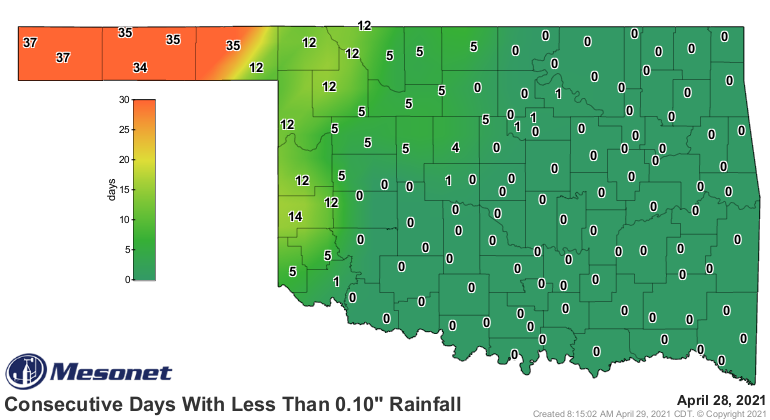
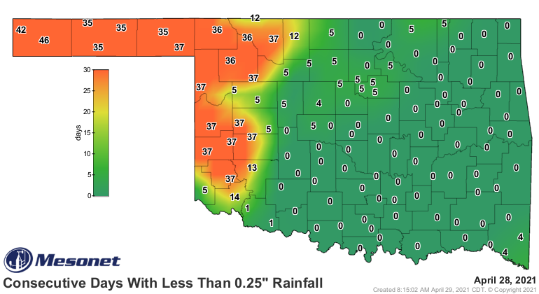
Rain was indeed a problem. And the lack thereof is BECOMING a problem. NW OK
is proceeding directly to jail. They will not pass Go, nor will they collect
$200. Put down the Super Nintendo and Sega Genesis (hip, ain't I??), kids, and
play a board game or two! If they don't get rain soon, they're headed towards
Park Place WITH a hotel (shudder). Check out just their last 30 days...it ain't
pretty.
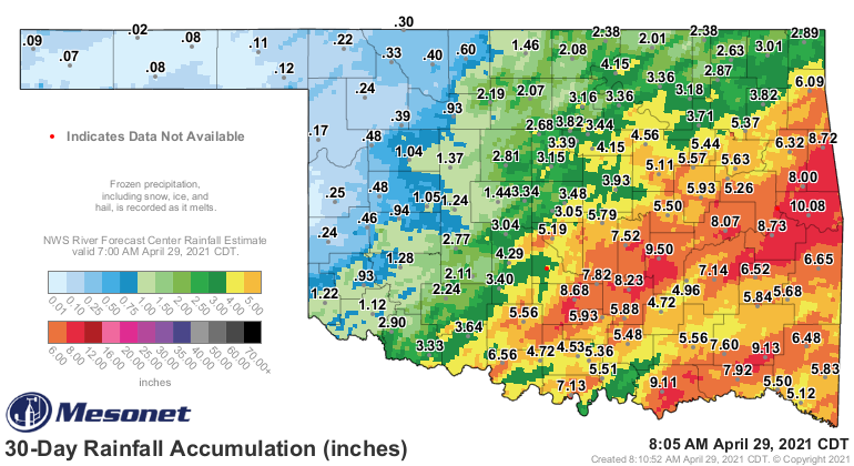
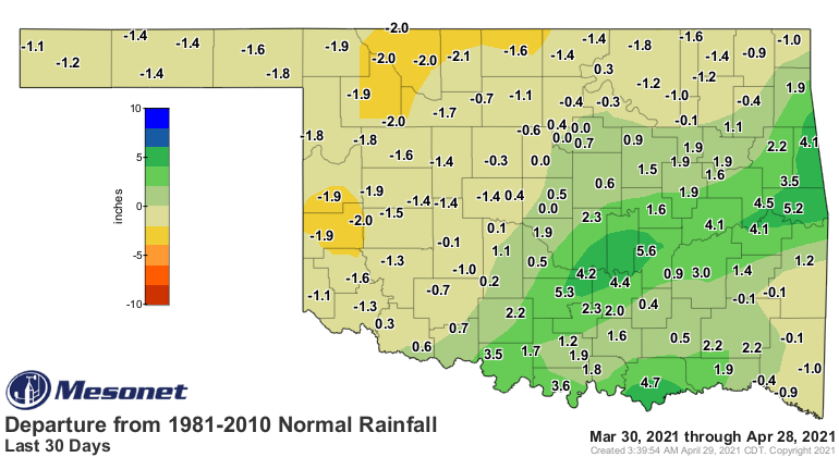
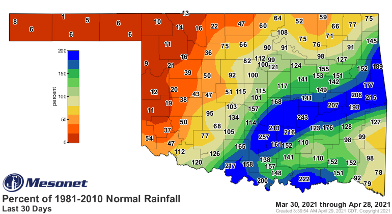
Southern Oklahoma up into east central OK has obviously made a quick comeback
over the last few days, but the NW quarter is going to deteriorate rapidly
unless they start getting some storms up that way. They have a bit more to
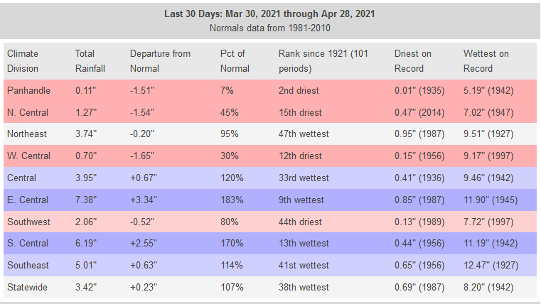
work with previously, but that is starting to wane. In fact, the Panhandle
climate division, which also includes Harper and Ellis counties for some
reason, has just experienced its second driest last 30 days on record, but the
dryness extends even farther back from that. Meanwhile, east central OK has
had their 9th wettest last 30 days.
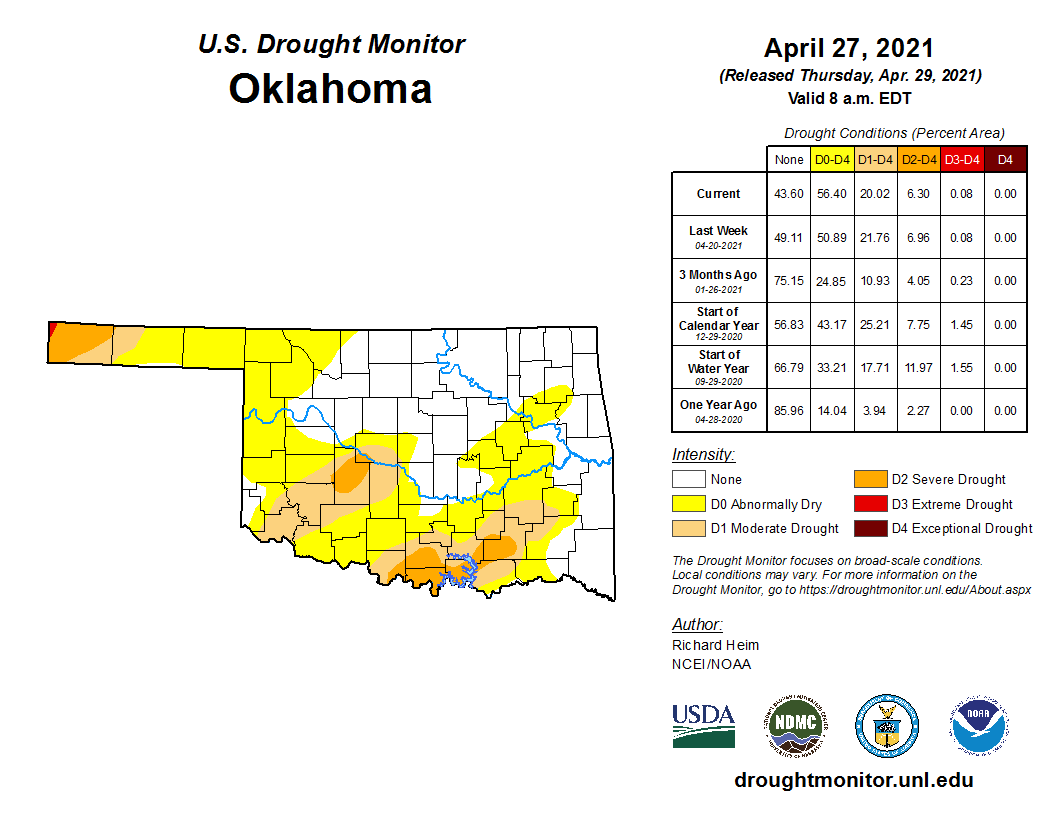
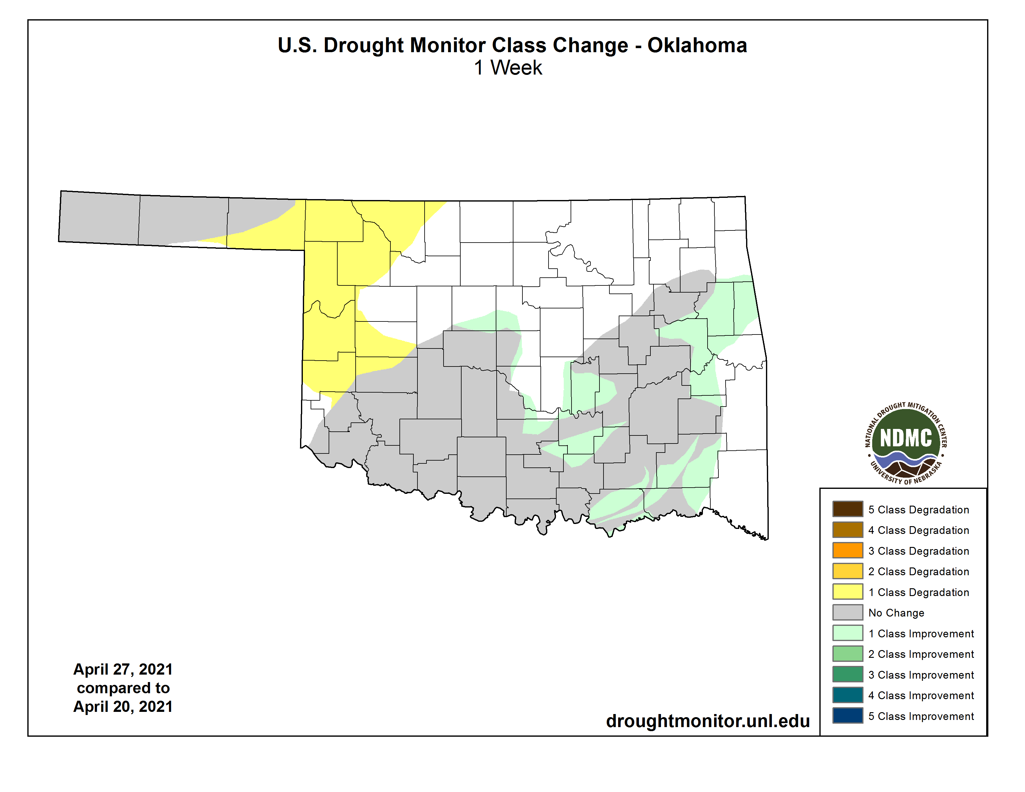
Now this new Drought Monitor map that came out this morning is already dated,
there will definitely be widespread improvements across southern OK, but you
can also see more abnormally dry conditions spreading across NW OK, a harbinger
of actual drought to come without beneficial moisture.
More rain is falling today in the SE, and there is another chance of storms
early next week. NW OK's chances ride with next week's storm system. There's a
chance they'll see SOME decent rains, but not nearly enough according to the
totals forecast.
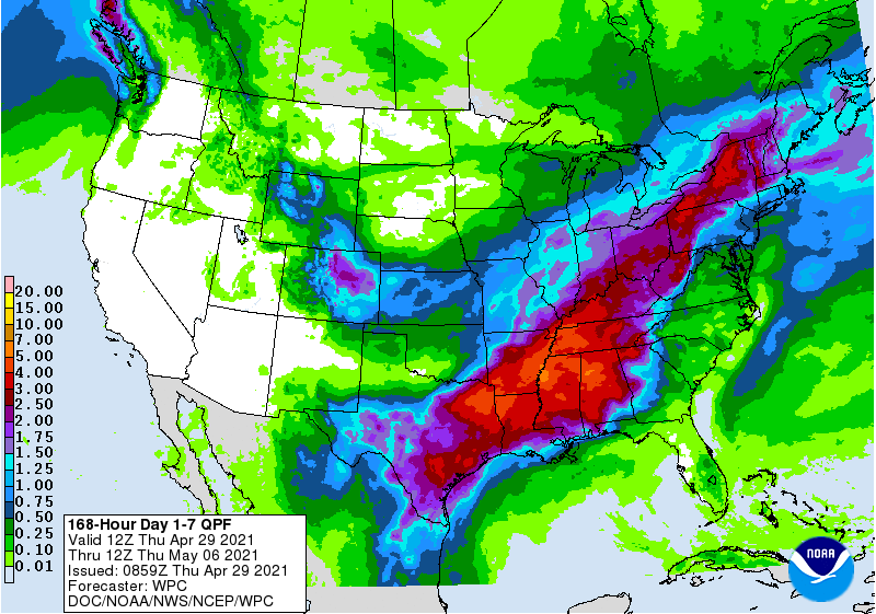
It'll be May by then, when the rain fortunes can turn around in a hurry. I think
it'll happen. It's what comes with it that can be scary.
Gary McManus
State Climatologist
Oklahoma Mesonet
Oklahoma Climatological Survey
(405) 325-2253
gmcmanus@mesonet.org
April 29 in Mesonet History
| Record | Value | Station | Year |
|---|---|---|---|
| Maximum Temperature | 100°F | ALTU | 2022 |
| Minimum Temperature | 31°F | KENT | 2017 |
| Maximum Rainfall | 12.42 inches | BURN | 2009 |
Mesonet records begin in 1994.
Search by Date
If you're a bit off, don't worry, because just like horseshoes, “almost” counts on the Ticker website!