Ticker for April 7, 2021
MESONET TICKER ... MESONET TICKER ... MESONET TICKER ... MESONET TICKER ...
April 7, 2021 April 7, 2021 April 7, 2021 April 7, 2021
Killjoy
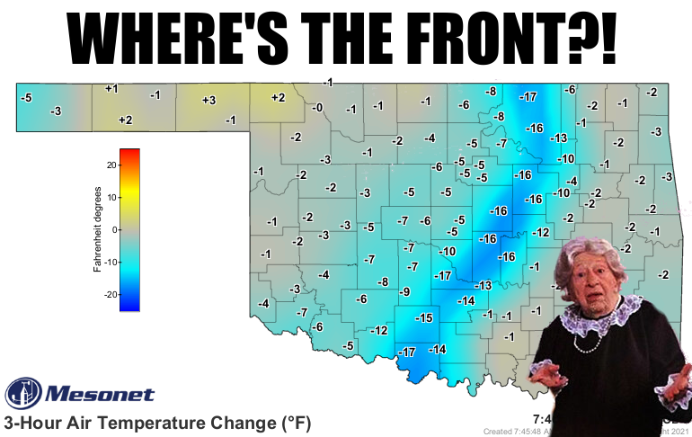
If you "get" that graphic, then you are old. If you don't get that graphic AND
you are old, well then get on the interwebs (hint...you're probably on it
reading this) with all the youngsters and google away.
On a less serious note, I have no idea why we need cold fronts. I guess to
generate storms, which gives us rain, but there are better ways to get a good
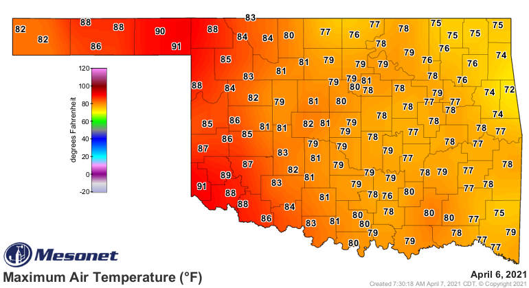
shower or two. You can see the change in temperatures from spring to almost
late-winter behind the front in our Mesonet temperature maps.
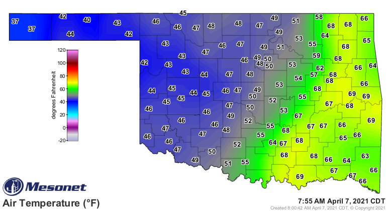
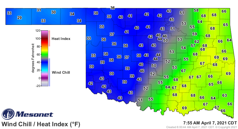
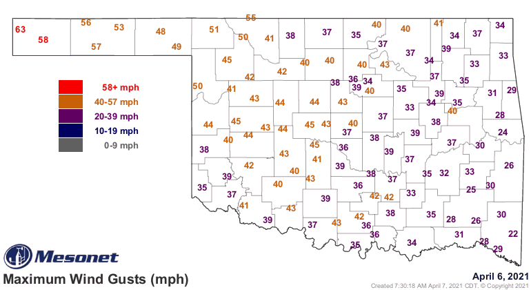
Now not that yesterday was amazing. It was nice and warm, after all, but the
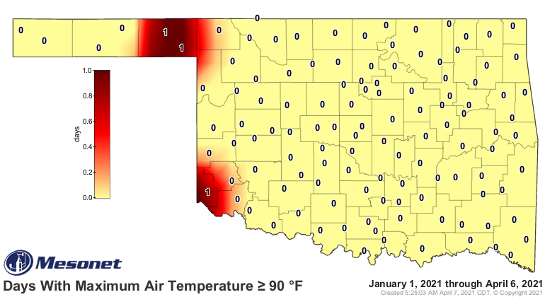
wind made for a blast furnace type of day, especially out west where we saw our
first 90s of the year in Beaver, Hollis and Slapout, so summer came to an abrupt
halt for those folks.
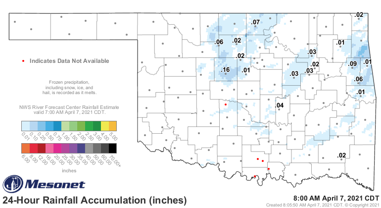
How about the rain that the front was supposed to generate? Well, don't even
bother. Maybe enough to put spots on your windshield with all the blowing dust
around.
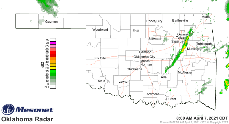
There is a line of something-or-other forming on the front as it moves to the
east, but I don't hold out much hope for bigtime rains, and some of that area
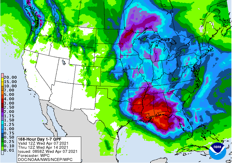
desperately needs it! Even with a few chances--minor at best--coming up, rain
totals look sparse over much of the state over the next 7 days.
Now next week there might just be some changes in store that will bring us some
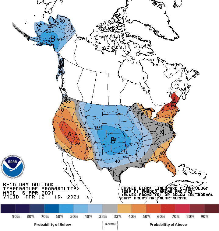
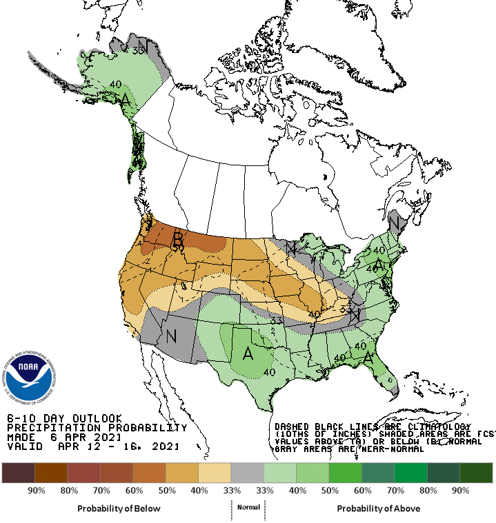
better rain chances. When you see these maps, don't panic. Well, okay, go ahead
and panic, but the increased odds of below normal temperatures (and above normal
precip) doesn't necessarily mean an arctic blast. Looks to me like we'd be
seeing a large upper-level trough over the Southern Plains area, giving us rain
and below normal (but not freezing) temps. Just as panic-worthy for a Tickerer
like me, however, would be highs in the 50s and 60s.
YIKES!
Gary McManus
State Climatologist
Oklahoma Mesonet
Oklahoma Climatological Survey
(405) 325-2253
gmcmanus@mesonet.org
April 7 in Mesonet History
| Record | Value | Station | Year |
|---|---|---|---|
| Maximum Temperature | 96°F | HOLL | 2015 |
| Minimum Temperature | 16°F | CAMA | 2009 |
| Maximum Rainfall | 6.03 inches | ANTL | 2002 |
Mesonet records begin in 1994.
Search by Date
If you're a bit off, don't worry, because just like horseshoes, “almost” counts on the Ticker website!