Ticker for March 11, 2021
MESONET TICKER ... MESONET TICKER ... MESONET TICKER ... MESONET TICKER ...
March 11, 2021 March 11, 2021 March 11, 2021 March 11, 2021
At least no snow?
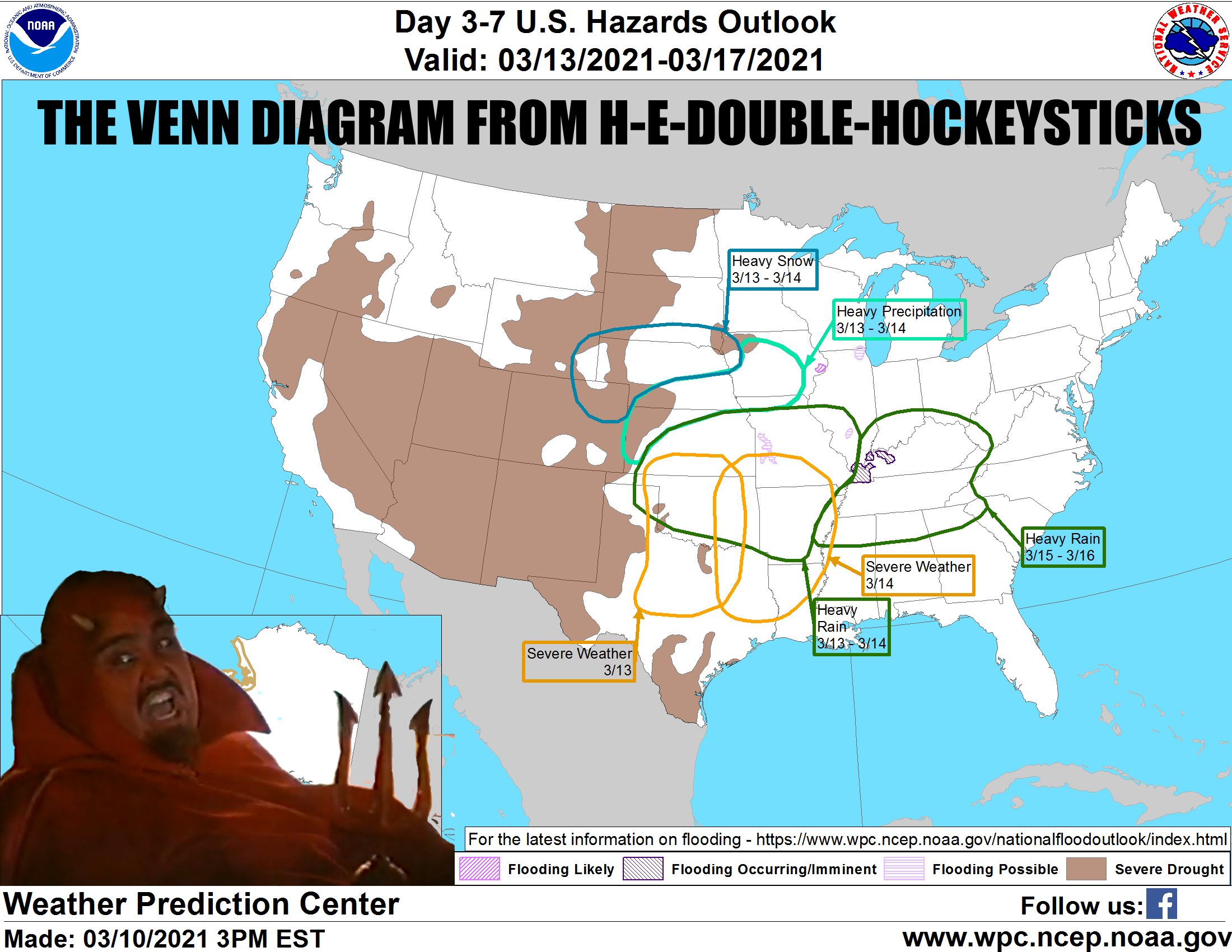
Well sure, no snow...yet. Give Mother Nature time. We're still looking at the
same setup we talked about yesterday, with severe weather possible tonight through
Sunday, with all modes of severe weather possible, including flash flooding. Wind
and hail will be the primary threats as it looks now, in addition to the heavy
rains.
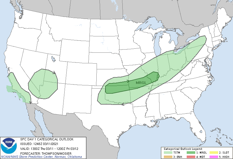
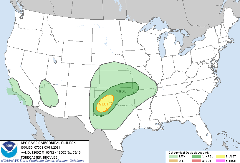
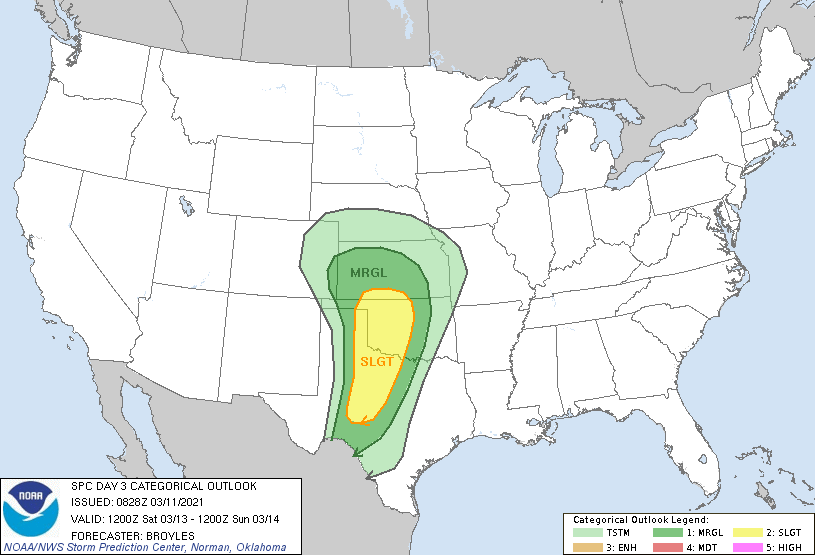
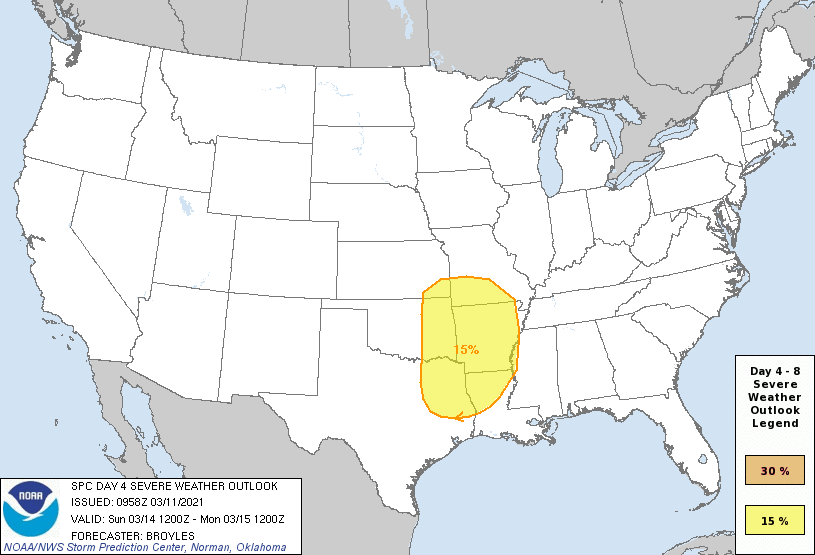
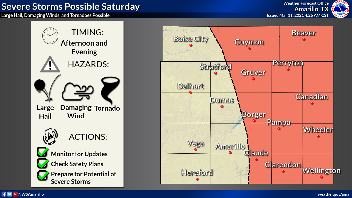
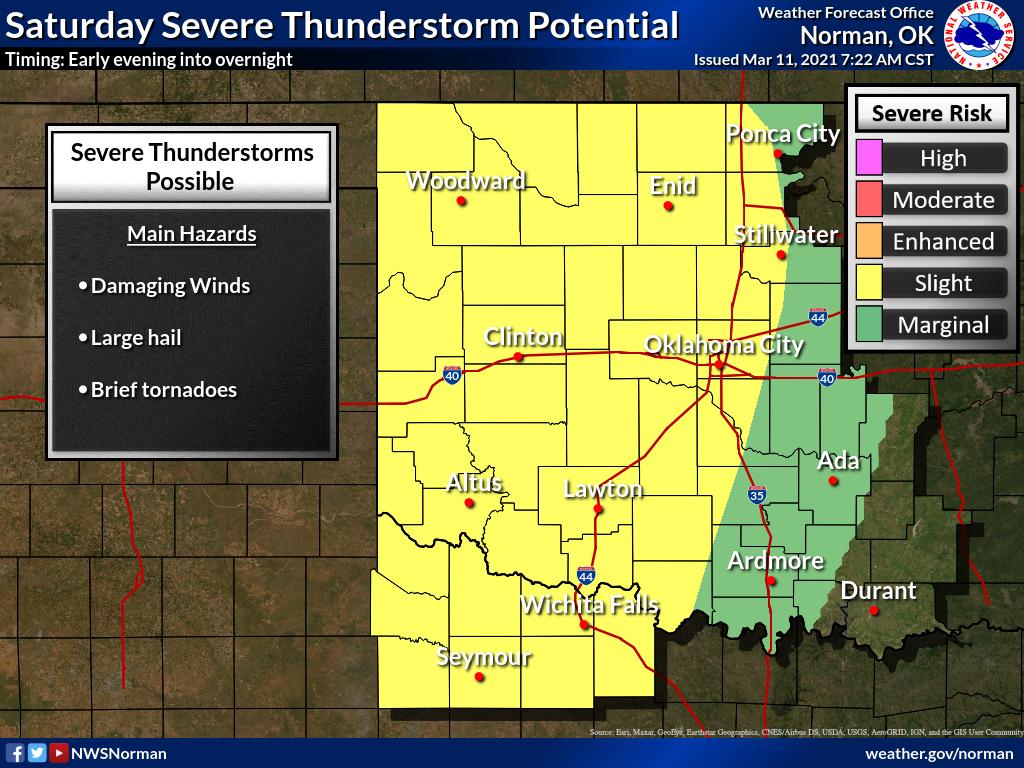
If we probe a little deeper (which you NEVER want to hear during an alien
abduction), the local NWS offices still think Saturday might be the worst day for
high-end severe weather threats.
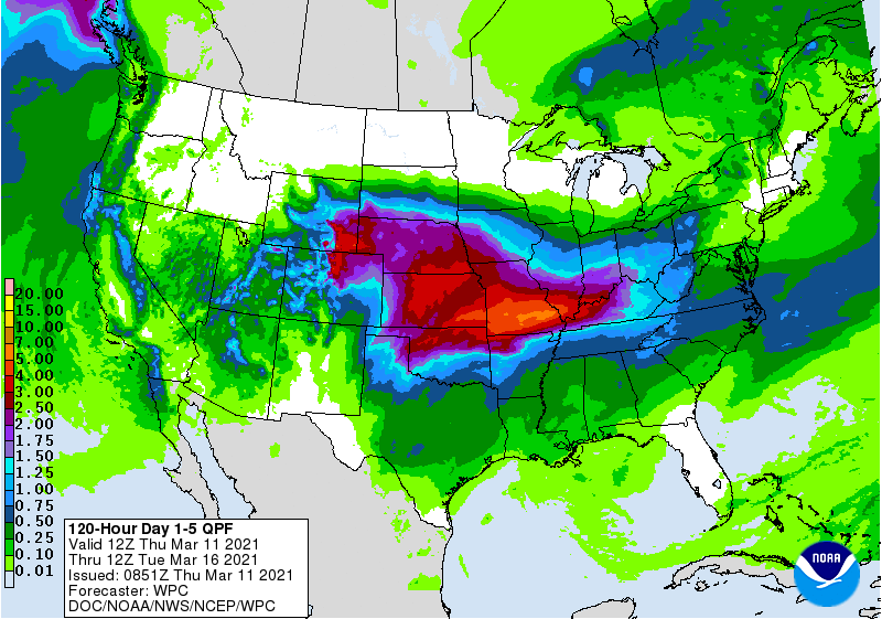
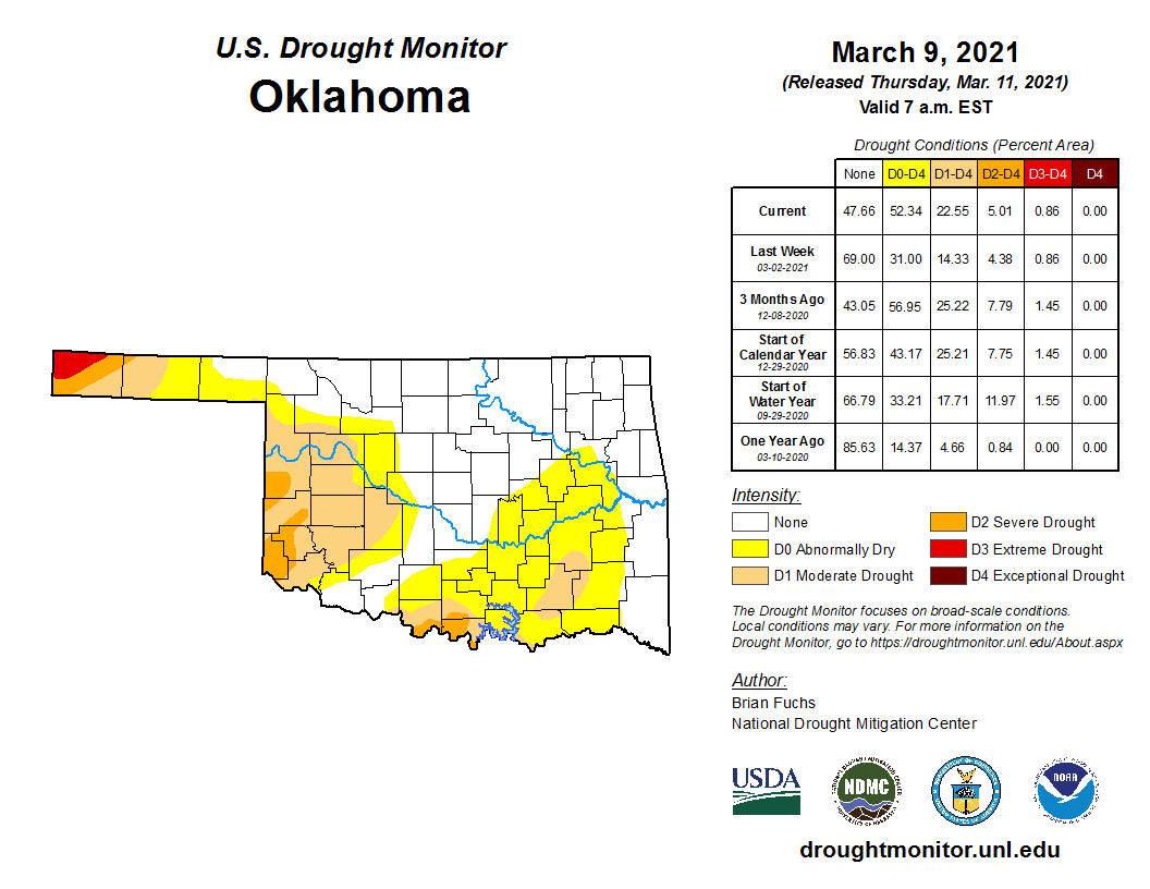
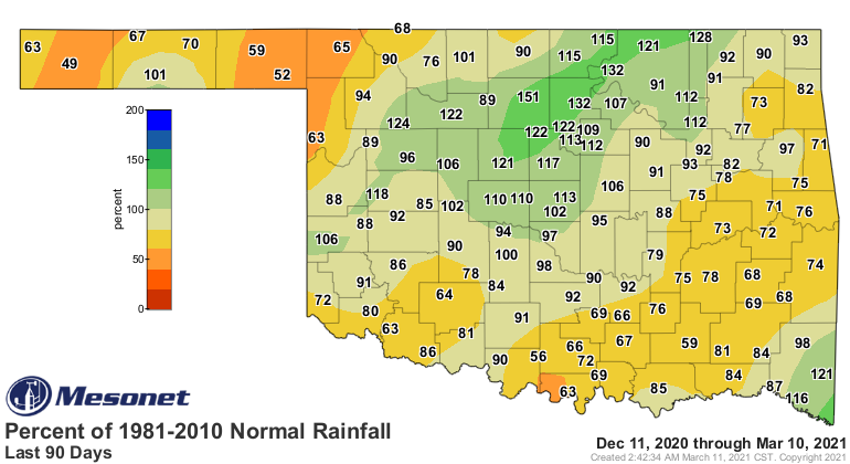
The rain is needed, but maybe not to that extent? And probably more so down
across southern Oklahoma. The western Panhandle needs theirs too, of course. We
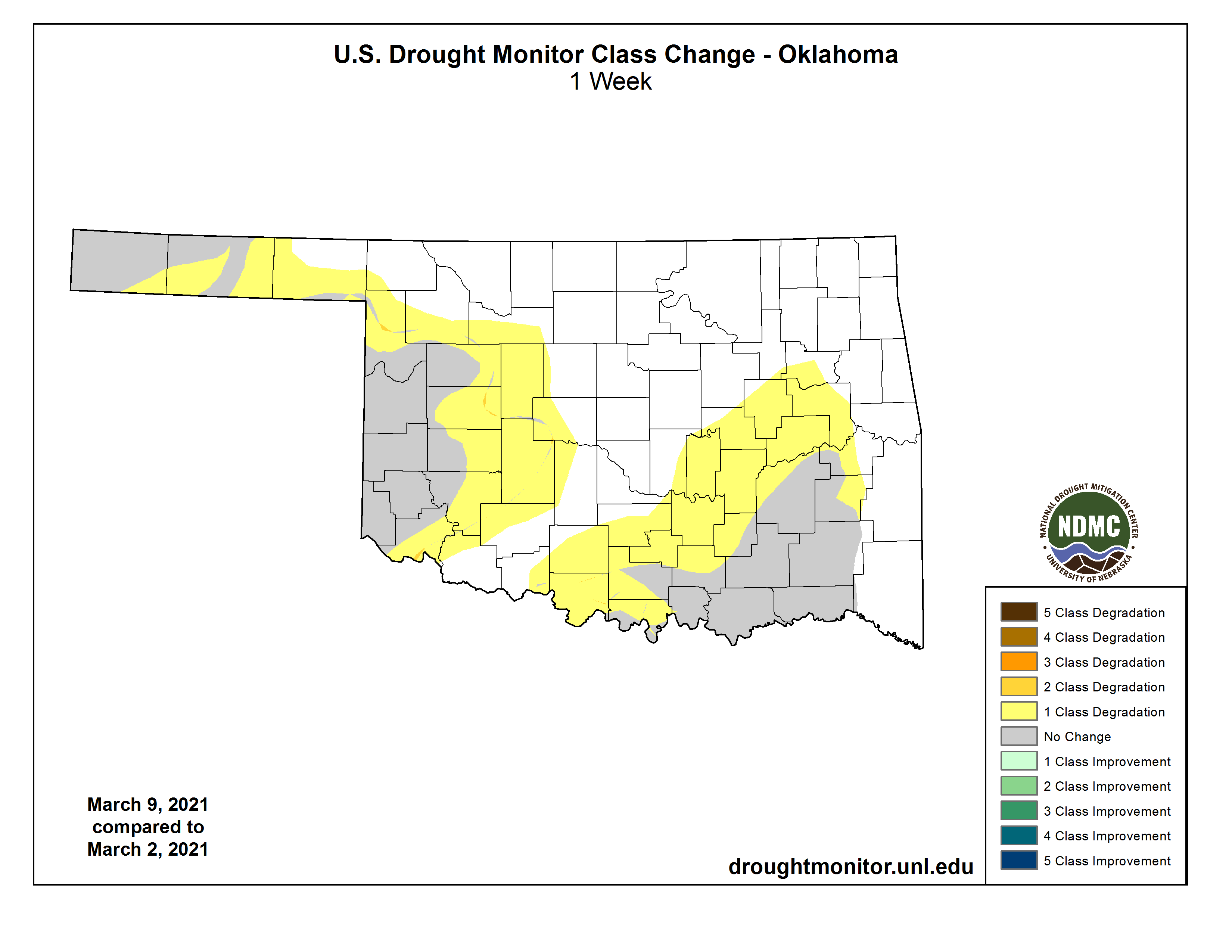
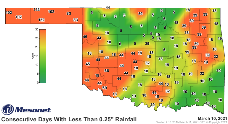
continue to see drought intensify and spread across the state. This rain should
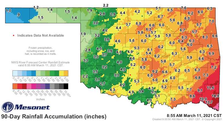
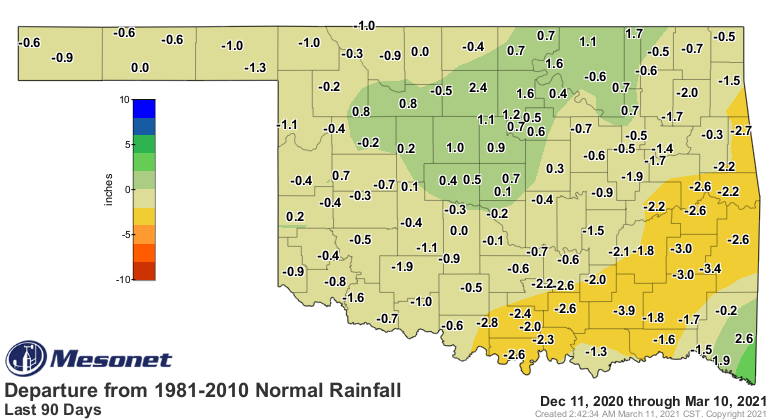
put some dents in drought's plans, at least. We have definitely started to dry
out over the last 2-3 months, despite the snows. The totals might be a tad
lower than expected due to difficulty measuring the moisture from the snow, but
impact reports we have received definitely point to a significant lack of
moisture for much of this winter over parts of the state indicated in our maps.
There is no truly cold air on the horizon. Probably still a freeze or two left
out there for us. For those in the Panhandle and far northwest, probably a good
bet you'll be cursing the cold a time or two again. More on that next week.
Gary McManus
State Climatologist
Oklahoma Mesonet
Oklahoma Climatological Survey
(405) 325-2253
gmcmanus@mesonet.org
March 11 in Mesonet History
| Record | Value | Station | Year |
|---|---|---|---|
| Maximum Temperature | 90°F | MANG | 2023 |
| Minimum Temperature | 9°F | SLAP | 1998 |
| Maximum Rainfall | 2.62″ | IDAB | 2012 |
Mesonet records begin in 1994.
Search by Date
If you're a bit off, don't worry, because just like horseshoes, “almost” counts on the Ticker website!