Ticker for February 25, 2021
MESONET TICKER ... MESONET TICKER ... MESONET TICKER ... MESONET TICKER ...
February 25, 2021 February 25, 2021 February 25, 2021 February 25, 2021
Here comes drought?
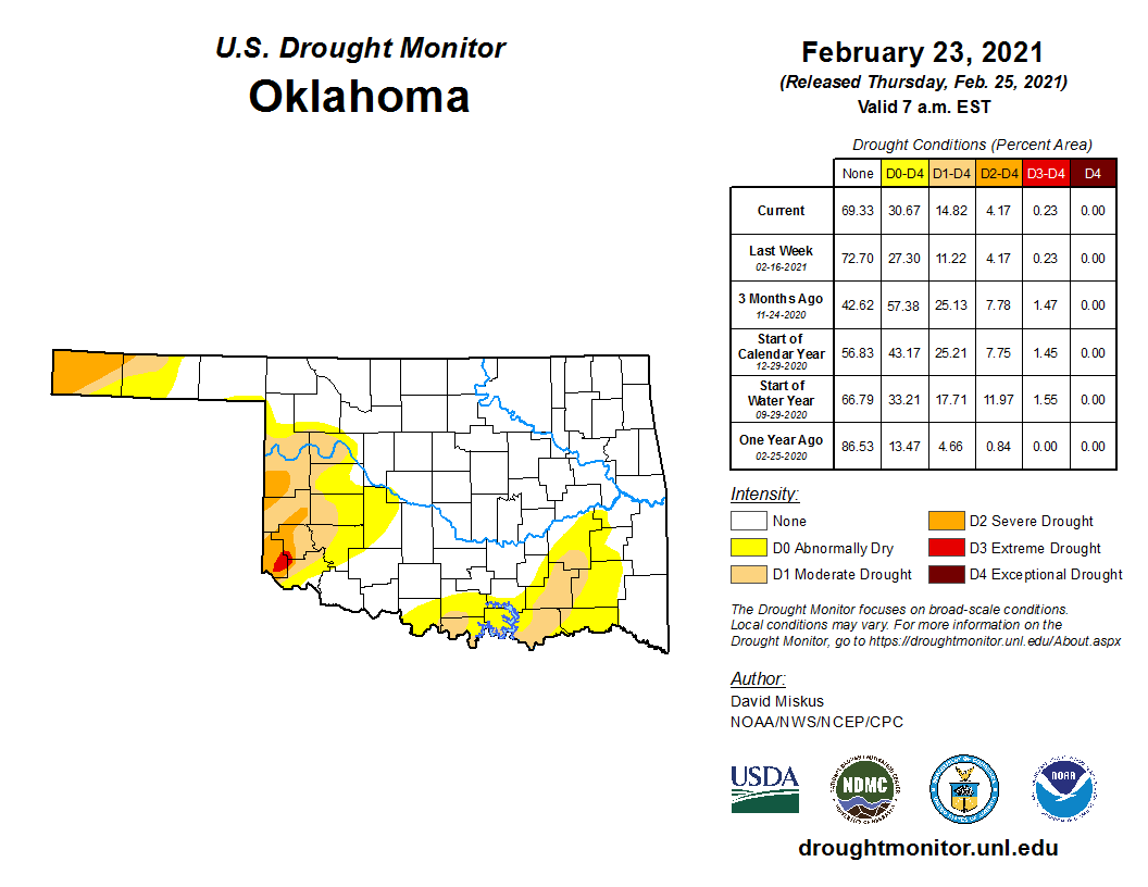
It's insidious. It sneaks up on you and only appears AFTER the damage has started
to occur. That's what makes it so difficult to track. No, I'm not talking about
what happens after Mexican fast food at (insert your favorite eatery here). I'm
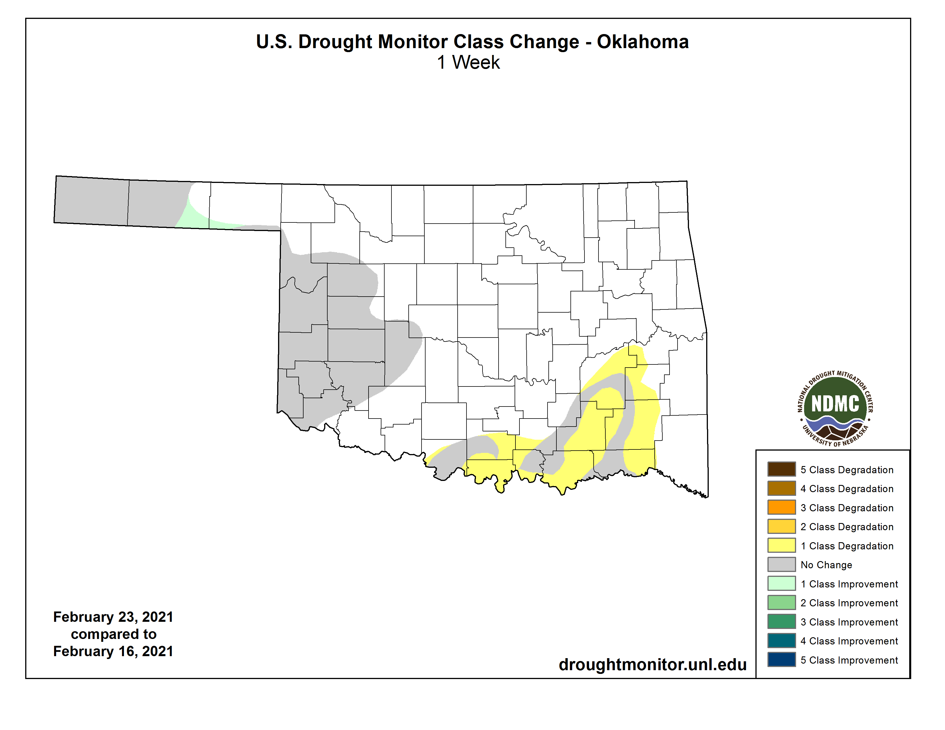
talking about drought. And sure enough, that area across south central and
southeastern Oklahoma finally had enough indicators go negative to necessitate
introduction of D1 (moderate) drought. And as we indicated yesterday, the snow
simply wasn't enough (and not wet enough) to forestall these changes. Or eliminate
drought across western Oklahoma.
The deficits in southern Oklahoma have continued to mount since La Nina, or her
impacts, came to visit last fall. Take a gander at the rainfall maps since
Oct. 1, 2020, the start of the 2020-21 Water Year.
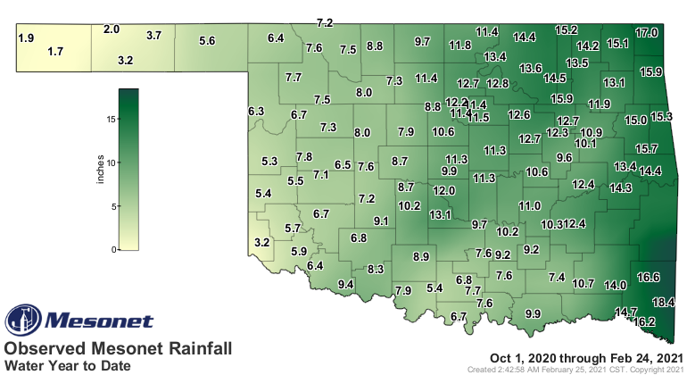
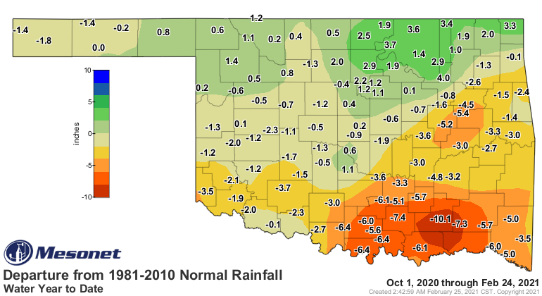
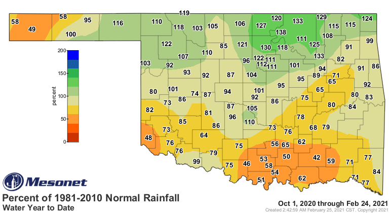
Easy to see why southern Oklahoma has been in the drought crosshairs, but also
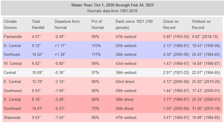
why northern sections of the state have seen drought disappear. South central
and southeastern Oklahoma have experienced their 20th and 24th driest Oct. 1-Feb.
24 on record, respectively, both more than 5 inches down on average for that
span. But you can see on the map that some of those deficits are greater than
10 inches.
A lot is hinging on these upcoming rain events tonight into Friday and then
again on Saturday. There is a goodly amount of moisture forecast for that area,
but as it usually happens, those have fizzled lately. But, there is hope at least
with these new chances.
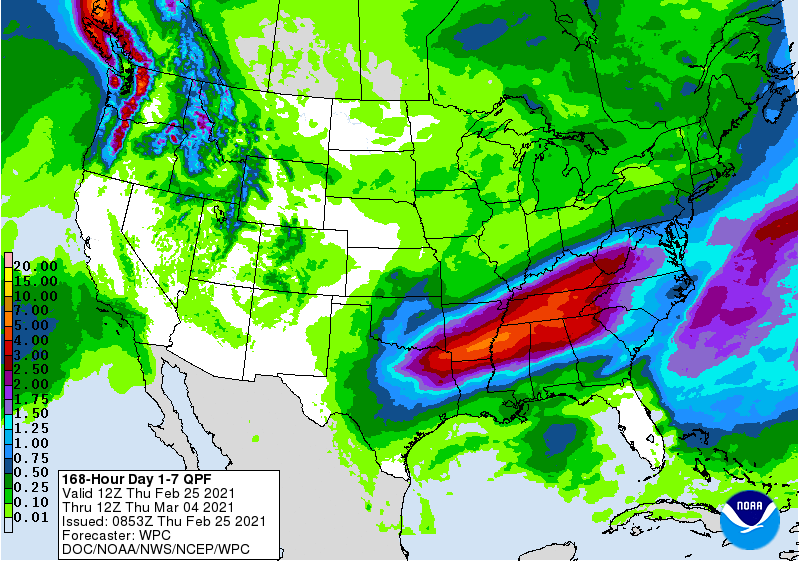
The problem is we start playing Whack-A-Drought. All that rain is now forecast
in the southeastern half of the state and the northwestern half starts going
without.
But Whack-A-Drought is better than Whack-A-Historic-Cold-Event. Or bathroom
trip.
Gary McManus
State Climatologist
Oklahoma Mesonet
Oklahoma Climatological Survey
(405) 325-2253
gmcmanus@mesonet.org
February 25 in Mesonet History
| Record | Value | Station | Year |
|---|---|---|---|
| Maximum Temperature | 85°F | HOLL | 1999 |
| Minimum Temperature | -2°F | CHER | 2003 |
| Maximum Rainfall | 1.79 inches | KIN2 | 2013 |
Mesonet records begin in 1994.
Search by Date
If you're a bit off, don't worry, because just like horseshoes, “almost” counts on the Ticker website!