Ticker for February 24, 2021
MESONET TICKER ... MESONET TICKER ... MESONET TICKER ... MESONET TICKER ...
February 24, 2021 February 24, 2021 February 24, 2021 February 24, 2021
Dry heat is next
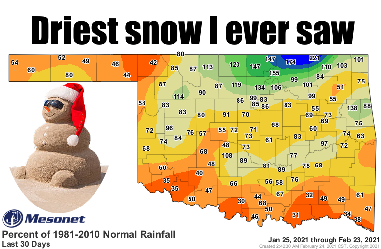
Remember sometime like a week or two ago when we got snow? Come on, concentrate.
I know it's been awhile, but it got really cold, and snowed like 10-20 inches?
Well, it did. Now how much did that snow amount to? Well, not a whole heckuva lot!
Once it all melted down, it left much of the state still on the dry side, as can
be seen from the pct of normal map, with Mr. Sand Snowman. And remember, February
is our 3rd driest month, so when you're down less than 50% of normal over the last
30 days, that's REALLY dry. However, it's sort of paradoxical (wait, let me look
that up and see if I'm using it correctly...I was) since it's REALLY dry, but
not THAT dry since February is NORMALLY dry.
Stop me before I ARBITRARILY capitalize again!
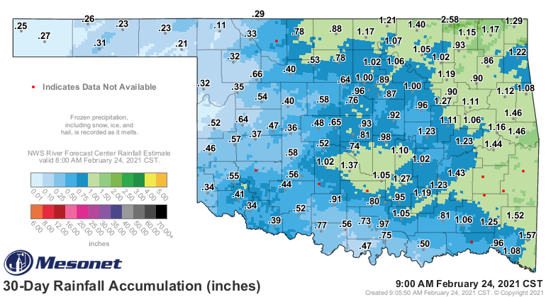
Here are the actual amounts from the gauges and gauge-massaged radar estimates
over the same time frame (and some of that is actual rain from previous systems
in late January).
And to reiterate that this dryness isn't considered too bad since we are in a
dry time of the year, look at the actual 30-day deficits.
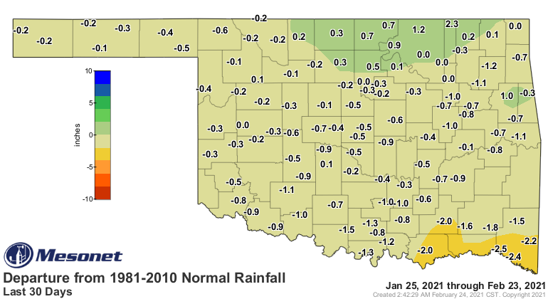
Okay, so most of the state less than an inch below normal over the last 30 days.
That area close to 2 inches below normal across south central and SE OK is
gonna leave a mark, and that's the problem. We were already dry across much
of southern and far western Oklahoma, so we did need a boost during the winter,
and you'd think all that snow would help a bit more. The best part about it was
that when it melted, it soaked into the soil instead of running off. The worst
part was that it was so dry and light, it generally blew into piles, which isn't
good if you have a nice flat field that ended up bare with drifts 6 feet high
in the bar ditches. Check out the last 14-day rain total map that contains the
liquid equivalent of that melted snow. It's okay, but it could have been better.
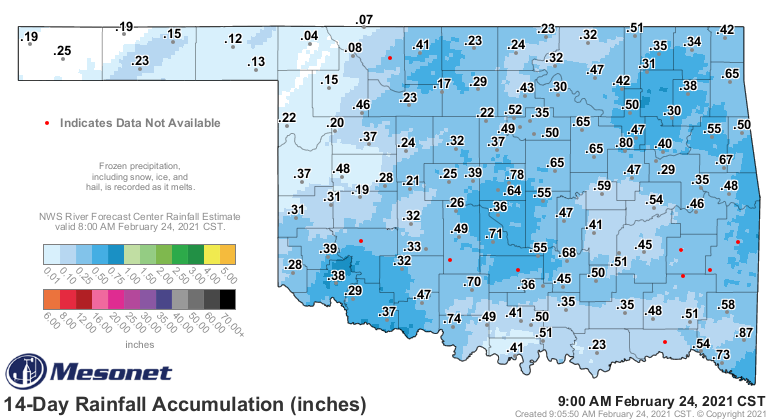
The radar estimates show less than an inch across the entire state from the
snow, and many places down in the less than a half inch colors. The good news
is that we do have a chance of rain (and snow up north) coming on Thursday,
and some of the better totals could be right there in south central and SE OK,
where it's really needed.
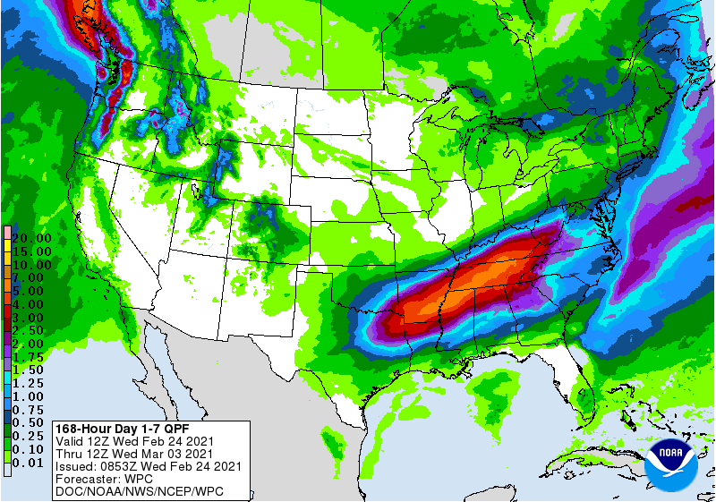
And there's no sign of another arctic blast anytime soon, so we can rest easy
for a bit on that front. However, anytime you rest easy on Oklahoma's weather,
you end up with a bumpy night soon.
Until those bumps come, however, it's relatively smooth sailing after the last
couple of weeks. Enjoy.
Gary McManus
State Climatologist
Oklahoma Mesonet
Oklahoma Climatological Survey
(405) 325-2253
gmcmanus@mesonet.org
February 24 in Mesonet History
| Record | Value | Station | Year |
|---|---|---|---|
| Maximum Temperature | 82°F | HOLL | 2002 |
| Minimum Temperature | -3°F | EVAX | 2022 |
| Maximum Rainfall | 2.61 inches | MTHE | 2018 |
Mesonet records begin in 1994.
Search by Date
If you're a bit off, don't worry, because just like horseshoes, “almost” counts on the Ticker website!