Ticker for February 1, 2021
MESONET TICKER ... MESONET TICKER ... MESONET TICKER ... MESONET TICKER ...
February 1, 2021 February 1, 2021 February 1, 2021 February 1, 2021
That's just like your opinion man
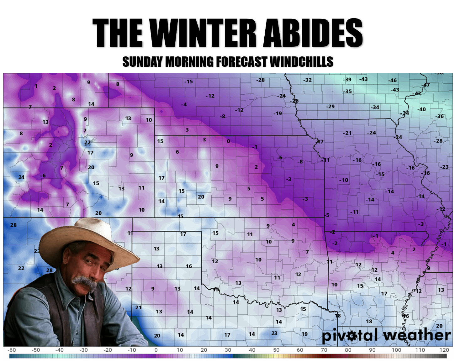
Hey, it could be worse...we could have used Walter yelling "MARK IT ZERO!" But
yes, winter does indeed abide. And no, I don't take a lot of comfort in that
(unless parkas are provided). It does look like the threat of significant snow
has diminished. YAYYYY!!!!
Oh yeah, same to you!
Otherwise, a warmup for a few days, then a front Thursday, then a REAL front
over the weekend. Very little moisture available for any type of precipitation.
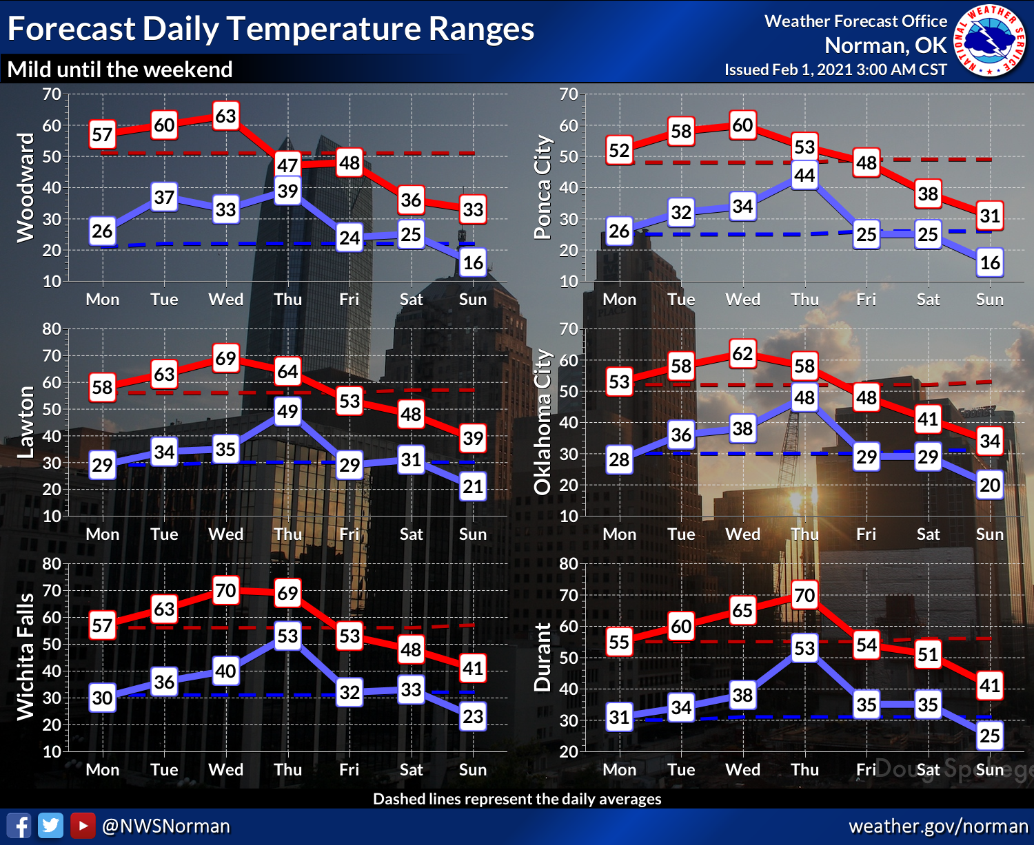
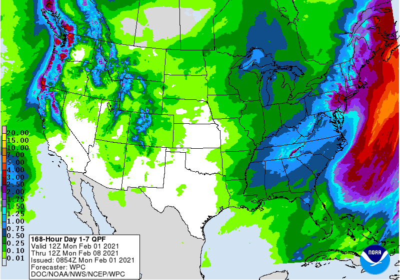
As the month goes on, we'll see more and more forecast maps like this, and
fewer of those at the top of the page.
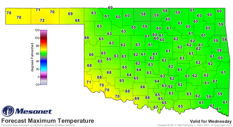
I hope.
Now let's take a look back and January, and a look forward to the rest of
February! I put the exclamation point on there to make it seem more exciting
than it really is...I hope.
----------------------------------------------------------------------------------
Warm and Wet January Greets New Year
Feb. 1, 2021
The winter storm that began the year captured January’s biggest weather headline.
The event straddled the changeover from 2020 to 2021, with as much as 10 inches
of snow falling in Vici on New Year’s Day. Reports of 4-8 inches were widespread
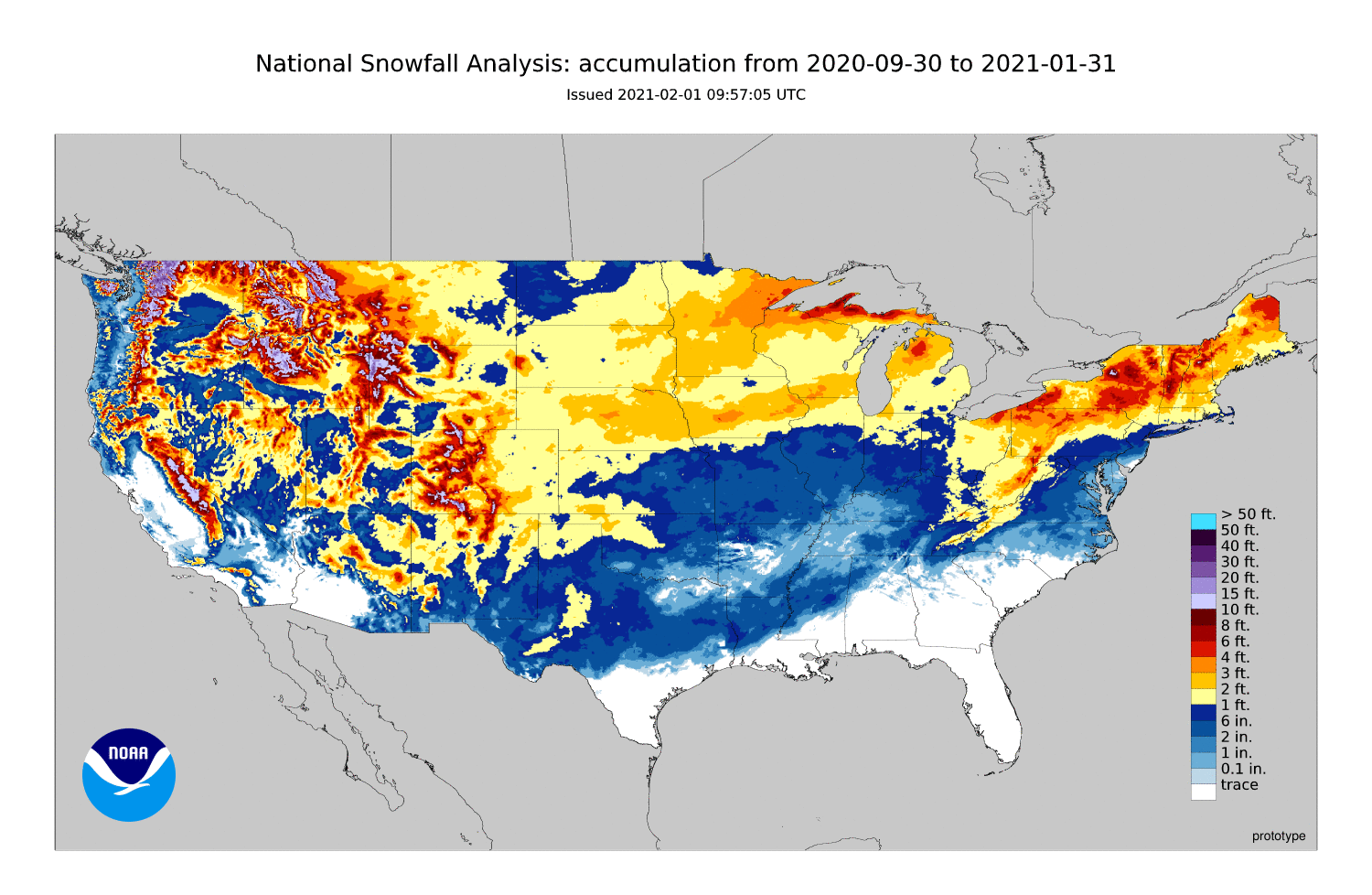
across the northwestern half of the state. Seasonal totals through January
climbed to nearly 3 feet across northwestern Oklahoma. The National Weather
Service cooperative observer at Arnett reported 34.3 inches since late October,
24.1 inches more than their entire normal seasonal total of 10.2 inches. Gate had
received 31.1 inches during that same period. Six other sites had reported at
least 20 inches of snow for the season through January, all in northwestern
Oklahoma. Outside of the northwest, Piedmont led the way with 18.6 inches.
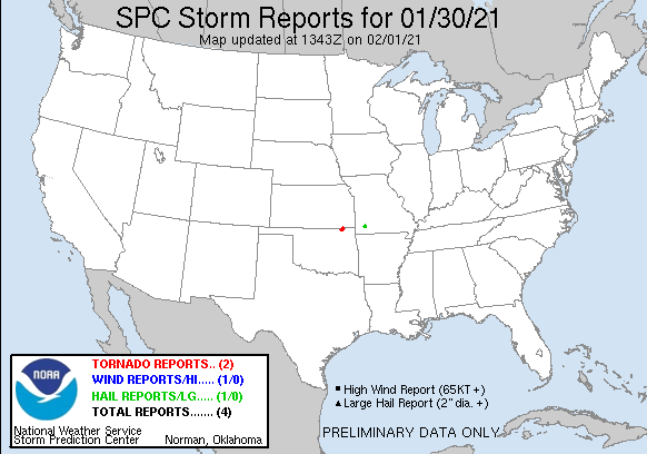
Severe weather was rare during the month, but at least two tornadoes were
spotted on the 30th in far northern Nowata County—the first two such reports of
2021 in Oklahoma.
Non-thunderstorm winds gusted up to 65 mph on the 14th, prompting a dust storm
warning for the Oklahoma Panhandle.
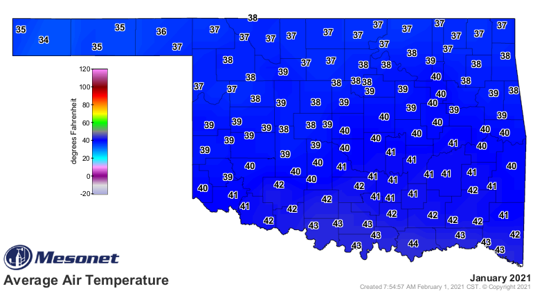
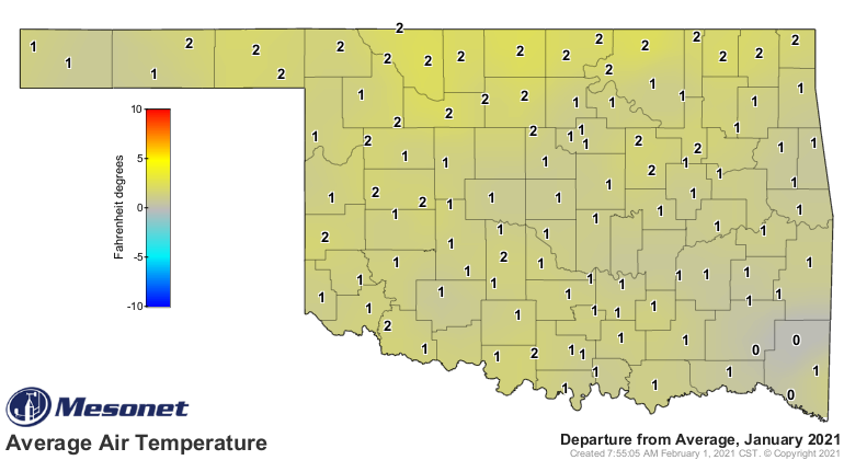
According to preliminary data from the Oklahoma Mesonet, the statewide average
temperature was 39.5 degrees for the month, 1.8 degrees above normal, to rank
as the 34th warmest January since records began in 1895. The highest reading
came on Jan. 30 when the Oklahoma Mesonet sites at Altus, Durant, and Tipton
all reached a maximum temperature of 73 degrees. The lowest temperature was 2
degrees recorded at Kenton on the 27th. Wind chills dropped to below zero on
that day across northern Oklahoma, with Hooker bottoming out at -11 degrees.
The first two months of the climatological winter, which runs December-February,
have been on the warm side at 1.9 degrees above normal. The statewide average
of 40.2 degrees ranks as the 30th warmest December-January on record.
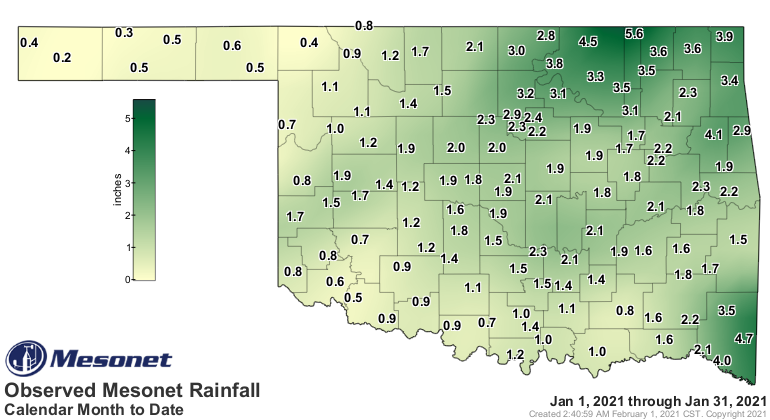
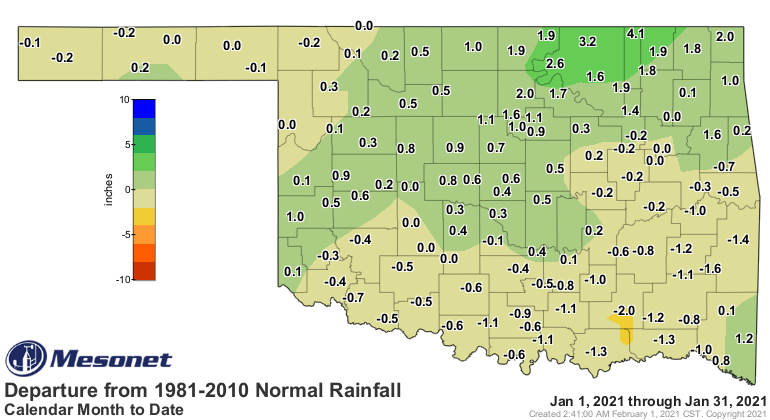
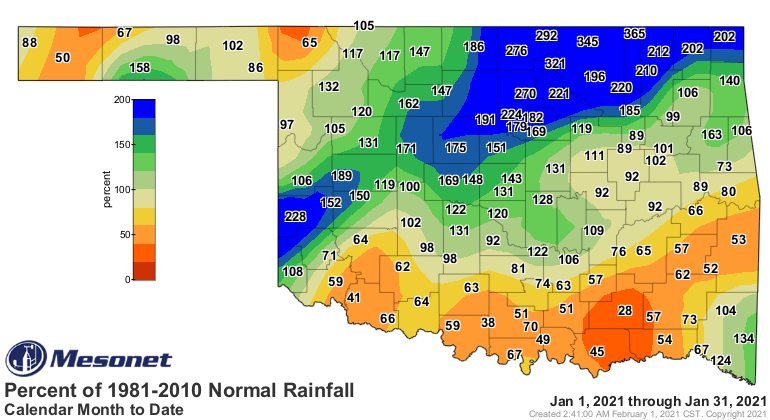
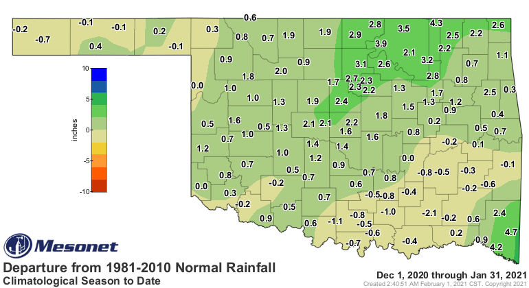
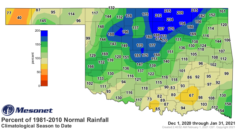
Parts of southwestern through northeastern Oklahoma experienced an unusually
wet January, thanks to the generous snowfall to start the year and three
subsequent storm systems throughout the month. Surpluses ranged from about an
inch in the southwest to a little over 4 inches in the northeast. Southern
Oklahoma saw widespread deficits of up to 1.5 inches, with smaller shortfalls
across the far northwest. Altogether, the statewide average was 1.75 inches,
0.19 inches above normal, to rank as the 44th wettest January on record.
Northeastern, north central, and west central Oklahoma enjoyed their 12th, 16th,
and 17th wettest Januarys on record, respectively. South central Oklahoma
suffered a deficit of 0.74 inches to rank as their 47th driest January on
record. The Mesonet site at Copan led the state with 5.58 inches while Boise
City brought up the rear with 0.24 inches. Forty-two Mesonet sites received at
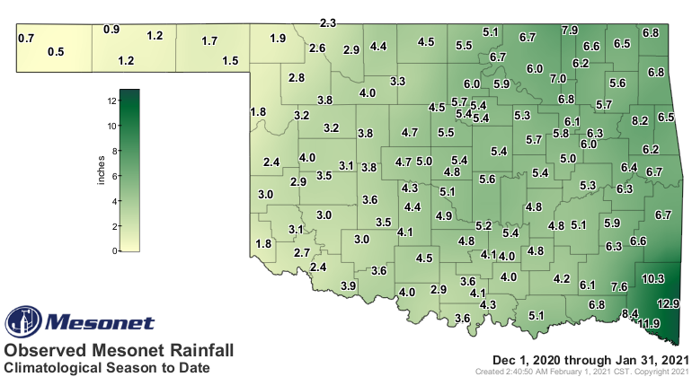
least 2 inches of precipitation for the month. The first two months of winter
were the 21st wettest on record with a statewide average of 4.34 inches, 0.72
inches above normal.
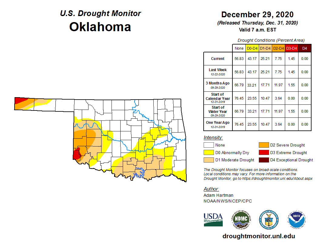
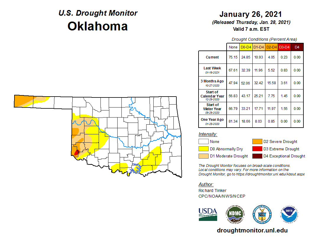
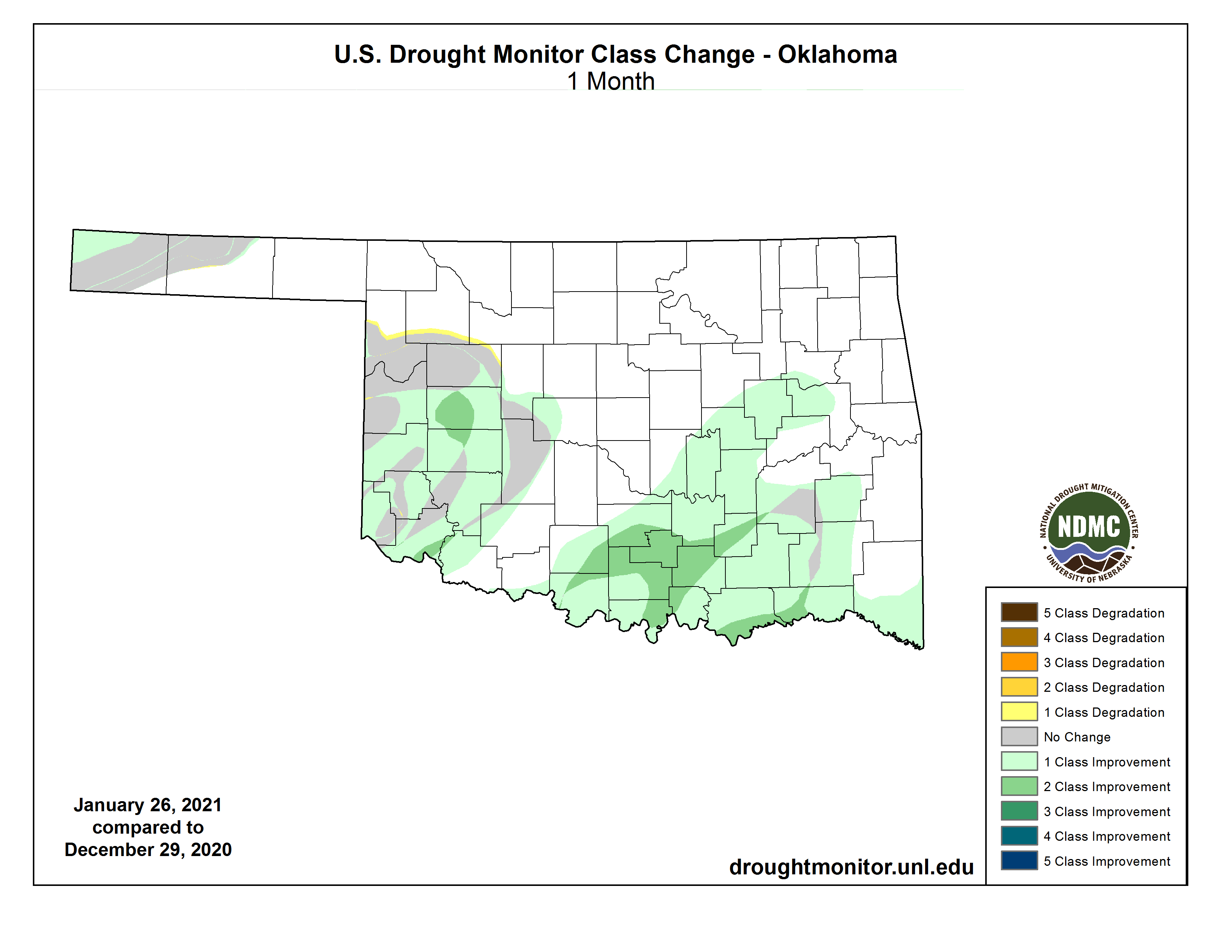
Drought took a tumble in Oklahoma during January. The wet month allowed a drop
in drought coverage from 25% at the end of December to 11% exiting January.
Drought that had been intensifying across south central Oklahoma was eradicated
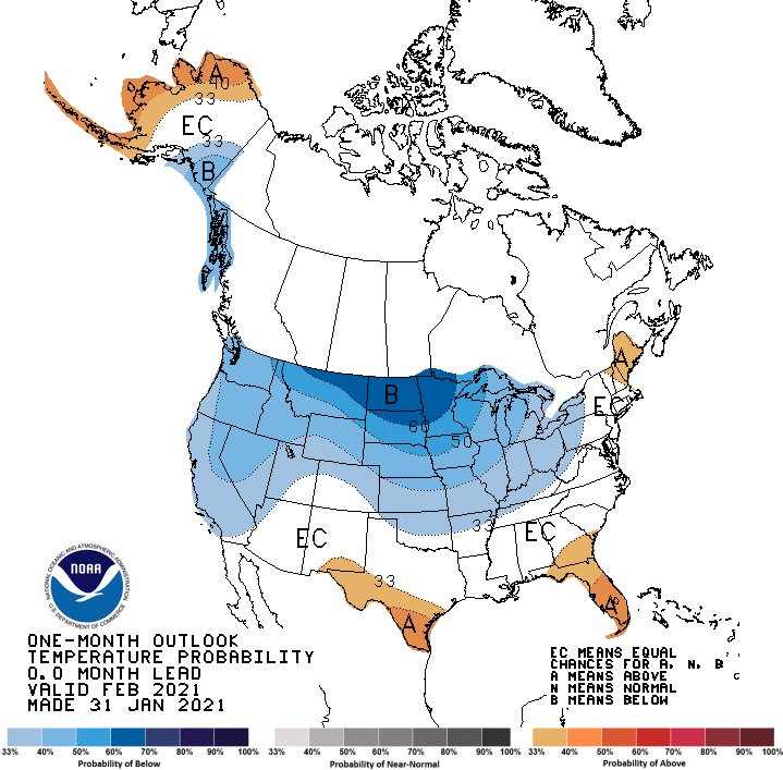
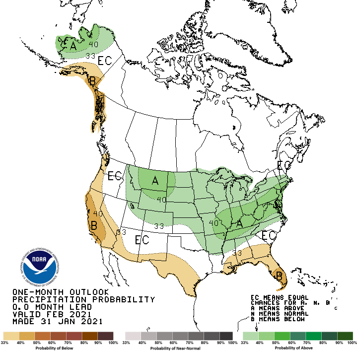
entirely. The Climate Prediction Center’s (CPC) outlooks for February see
increased odds of below normal temperatures across the northern half of the
state, and above normal temperatures across the eastern third. Outside of those
areas, equal chances exist for above-, below-, and near-normal temperatures and
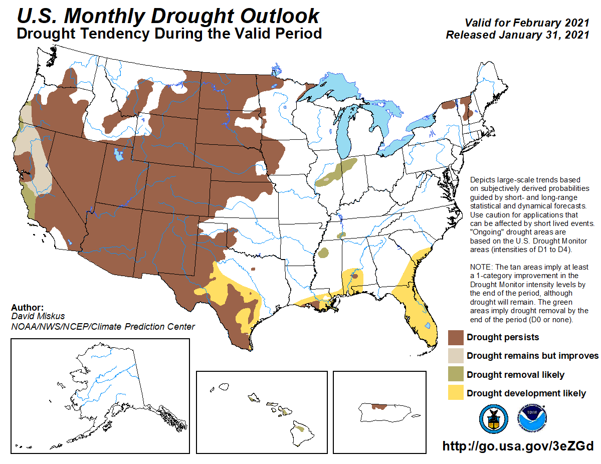
precipitation. CPC’s February drought outlook expects a static map, with neither
development nor removal of drought by the end of the month. February is
normally a relatively dry month in Oklahoma. Therefore, near- or below-normal
precipitation combined with near- or below-normal temperatures would not be
favorable conditions for drought development.
Gary McManus
State Climatologist
Oklahoma Mesonet
Oklahoma Climatological Survey
(405) 325-2253
gmcmanus@mesonet.org
February 1 in Mesonet History
| Record | Value | Station | Year |
|---|---|---|---|
| Maximum Temperature | 81°F | SLAP | 2003 |
| Minimum Temperature | -7°F | BOIS | 2011 |
| Maximum Rainfall | 1.61 inches | MTHE | 2011 |
Mesonet records begin in 1994.
Search by Date
If you're a bit off, don't worry, because just like horseshoes, “almost” counts on the Ticker website!