Ticker for January 27, 2021
MESONET TICKER ... MESONET TICKER ... MESONET TICKER ... MESONET TICKER ...
January 27, 2021 January 27, 2021 January 27, 2021 January 27, 2021
Let's talk snow
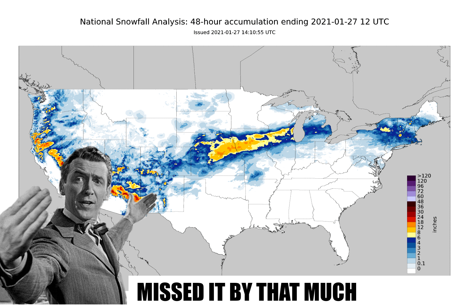
Swing and a miss! That was a classic Plains snowstorm that we just barely missed
out on; a dive to the southeast, intensification, then swinging up to the
northeast dumping a foot of snow or more along the way. The storms we saw
earlier this year would take a more southerly track, pounding us instead of KS,
NE, IA, and those other states up that way that surround those puny "Great" Lakes.
Great? HA! You ever see Ft. Supply Lake? Now THAT'S a lake.
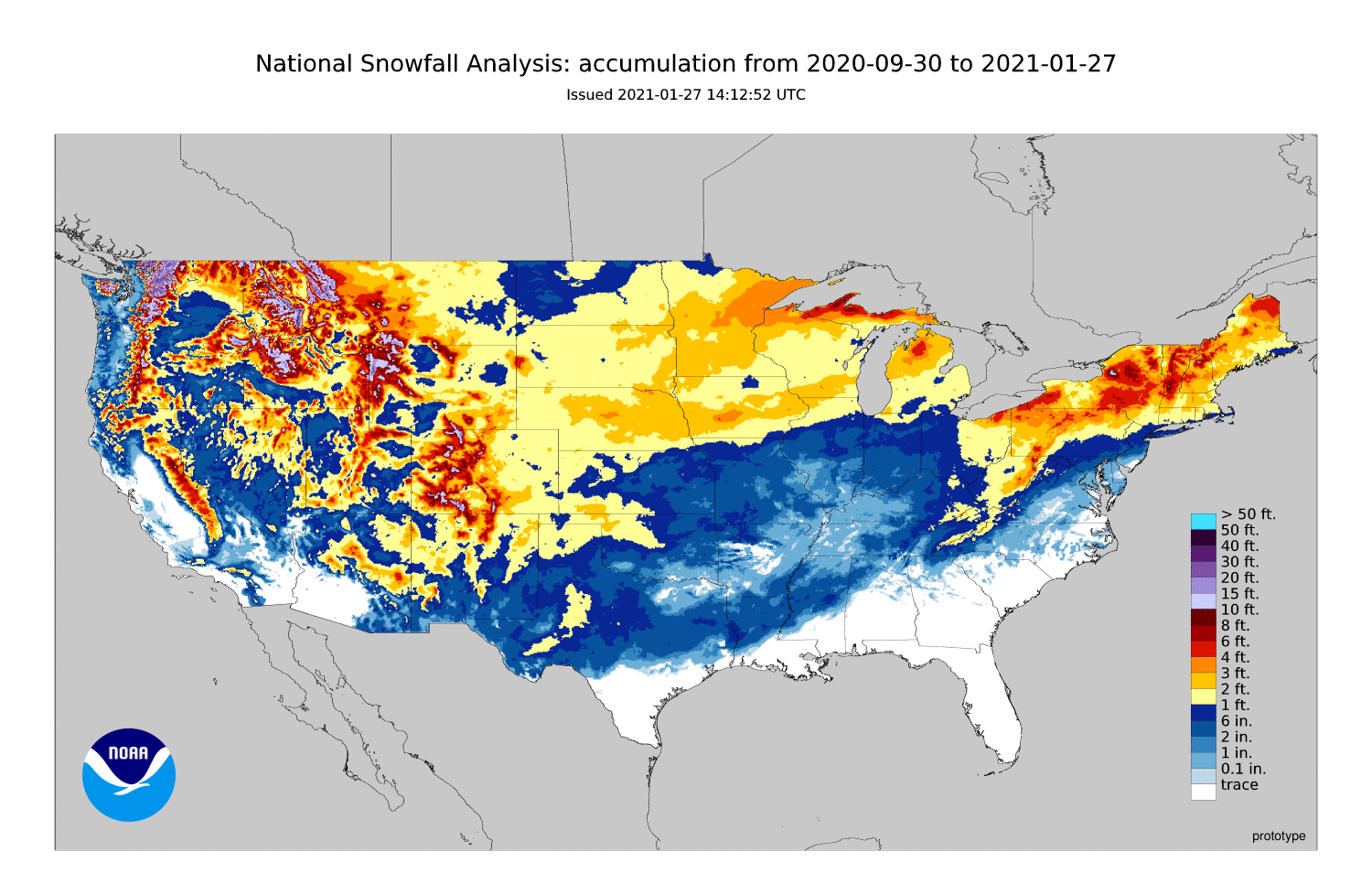
It wasn't a total miss, however. Guymon and Boise City reported about an inch
on the ground yesterday afternoon. That adds just a teeny bit more to our snowy
season thus far, that still sees parts of the Southern Plains (and Oklahoma)
besting our friends (okay, acquaintances) in North Dakota, and northern
Minnesota. Frankly (or Jerryly, if your name isn't Frank), they can keep it. I
don't know if I've ever said anything, but I'm ready for warm weather.
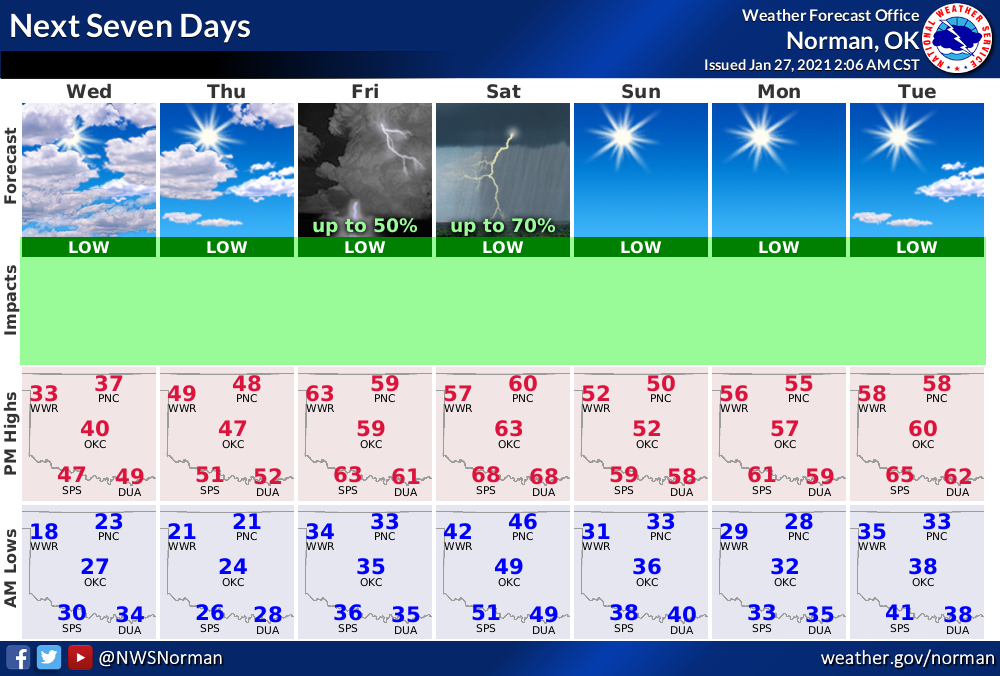
What's in store for us? We headed for more snow, or will we get a spring preview?
Well, probably a bit of both. Another cold day will be followed by a warm up
for the weekend with better rain chances, then another period of mild, sunny
weather.
After that, there is some indication that the game is afoot. Better than afinger,
but not as good as aleg. The look for early February from the Climate Prediction
Center says we might be in for a more early February-ish pattern, with more
precip in store for much of the eastern half of the US.
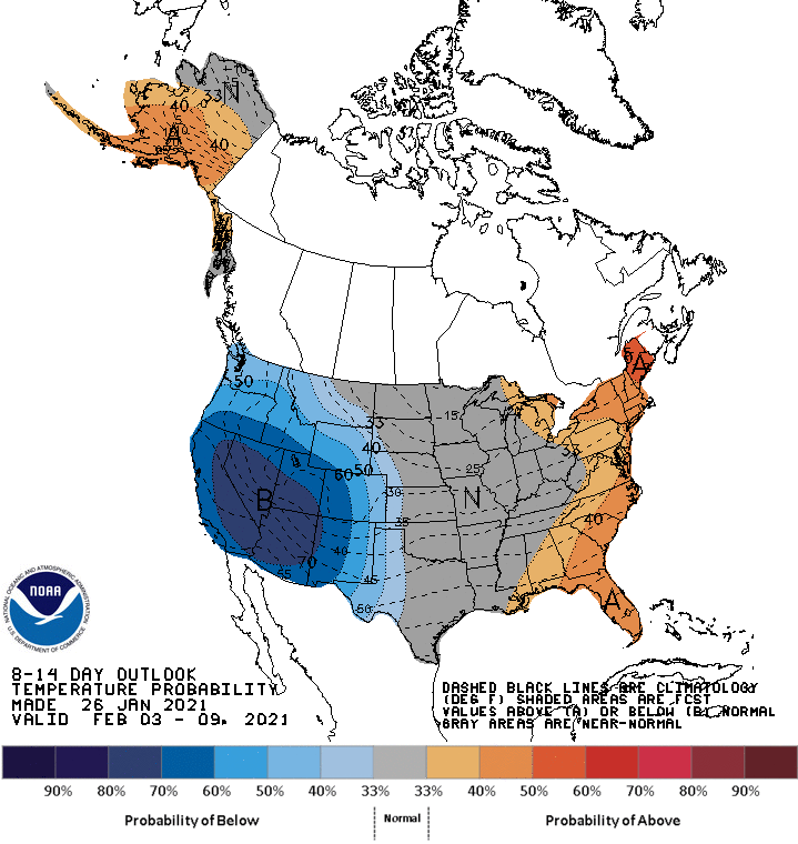
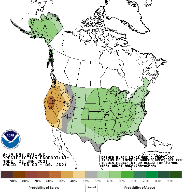
With just a hint of a pretty cold airmass also interacting with that moisture,
I'd say we're not done with winter just yet...in temperature OR precipitation.
Gary McManus
State Climatologist
Oklahoma Mesonet
Oklahoma Climatological Survey
(405) 325-2253
gmcmanus@mesonet.org
January 27 in Mesonet History
| Record | Value | Station | Year |
|---|---|---|---|
| Maximum Temperature | 84°F | ALV2 | 2015 |
| Minimum Temperature | 0°F | KENT | 2009 |
| Maximum Rainfall | 3.39 inches | SALL | 2009 |
Mesonet records begin in 1994.
Search by Date
If you're a bit off, don't worry, because just like horseshoes, “almost” counts on the Ticker website!