Ticker for January 21, 2021
MESONET TICKER ... MESONET TICKER ... MESONET TICKER ... MESONET TICKER ...
January 21, 2021 January 21, 2021 January 21, 2021 January 21, 2021
Just a little heat
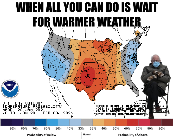
We might only be talking 60s and a few 70s here, but it would be a darned nice
preview of what's to come for spring (and then summer, and then late summer, and
then late-late-summer...and then December). I'm chilled to the bone, and I'm in
front of a heater! That's how cold it is. And it's not even really that cold, but
the lack of sun makes it seem like it's January.
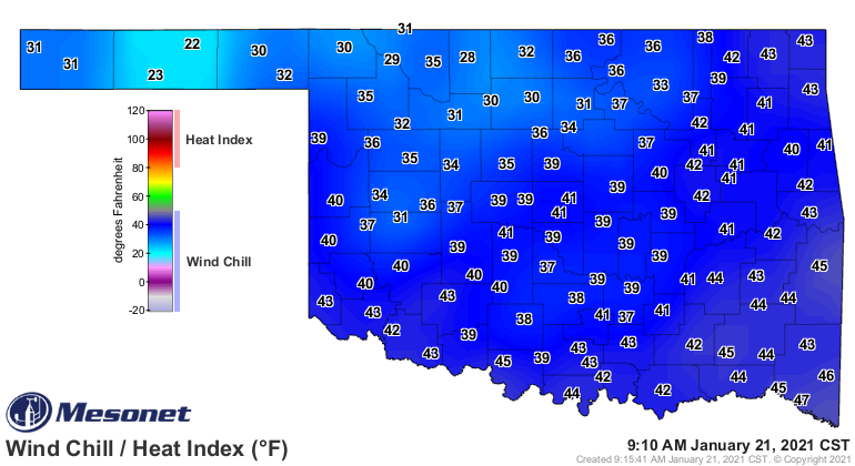
I've gotten so used to Oklahoma weather being crazy, I guess I expected 90s today.
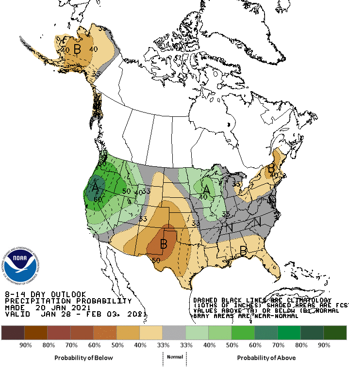
With those warmer temps comes a drier pattern, however, and that's something we
don't really need.
We are still stuck with moderate-severe-extreme drought across SW OK and the
western Panhandle, but haven't seen many changes in the last couple of weeks. So
let's take a look at the US as a whole.
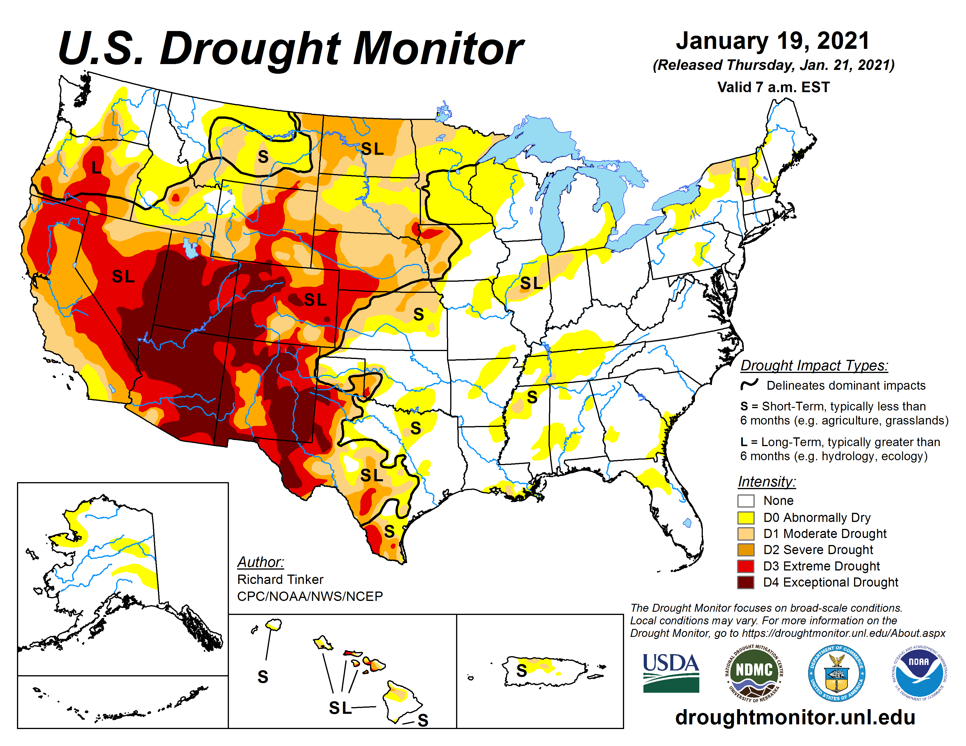
Darn, Jim! And I know most of you aren't named Jim, but think of how cool it
would be if you were. That's a lot of drought across the Southwest US, up into
the Northern Plains. We seem to be on the dividing line between the relatively
drought free eastern half of the US (save for the Northern Plains), and the
parched western half. And this is a big change in just a year. Check out the
change map for the past 52 weeks.
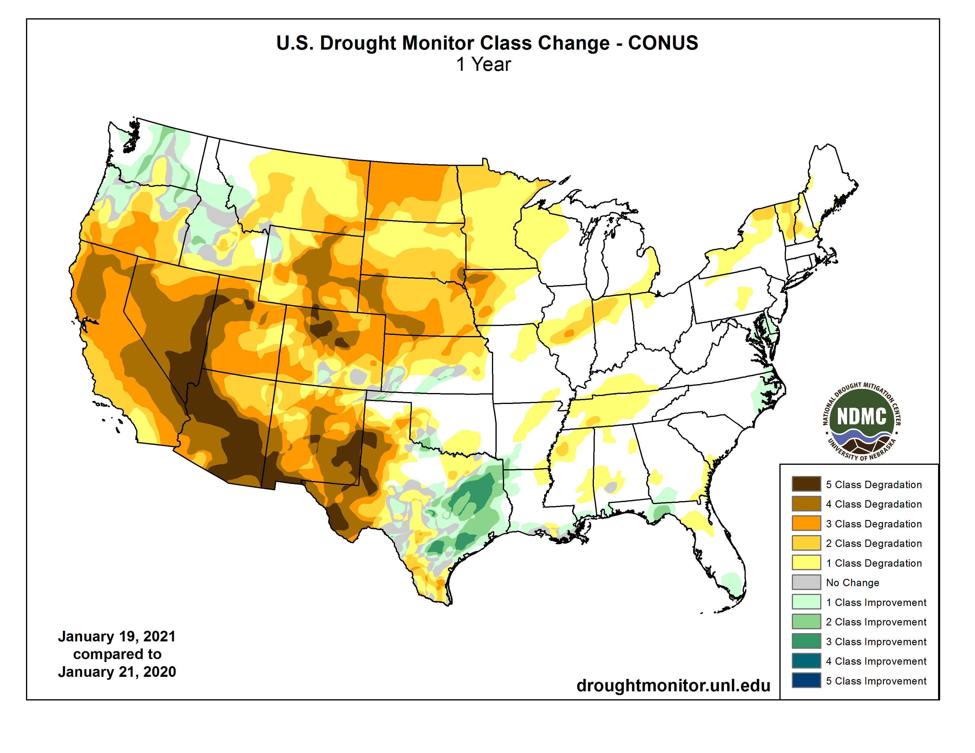
Wow, 5-class degradation in the Southwest (and we all know just how painful
THAT can be!). For Oklahoma, we've remained relatively calm, but there have
been some pretty big changes within those 52 weeks, that image being a snapshot
of the difference between this week and the distinct week one year ago. Some of
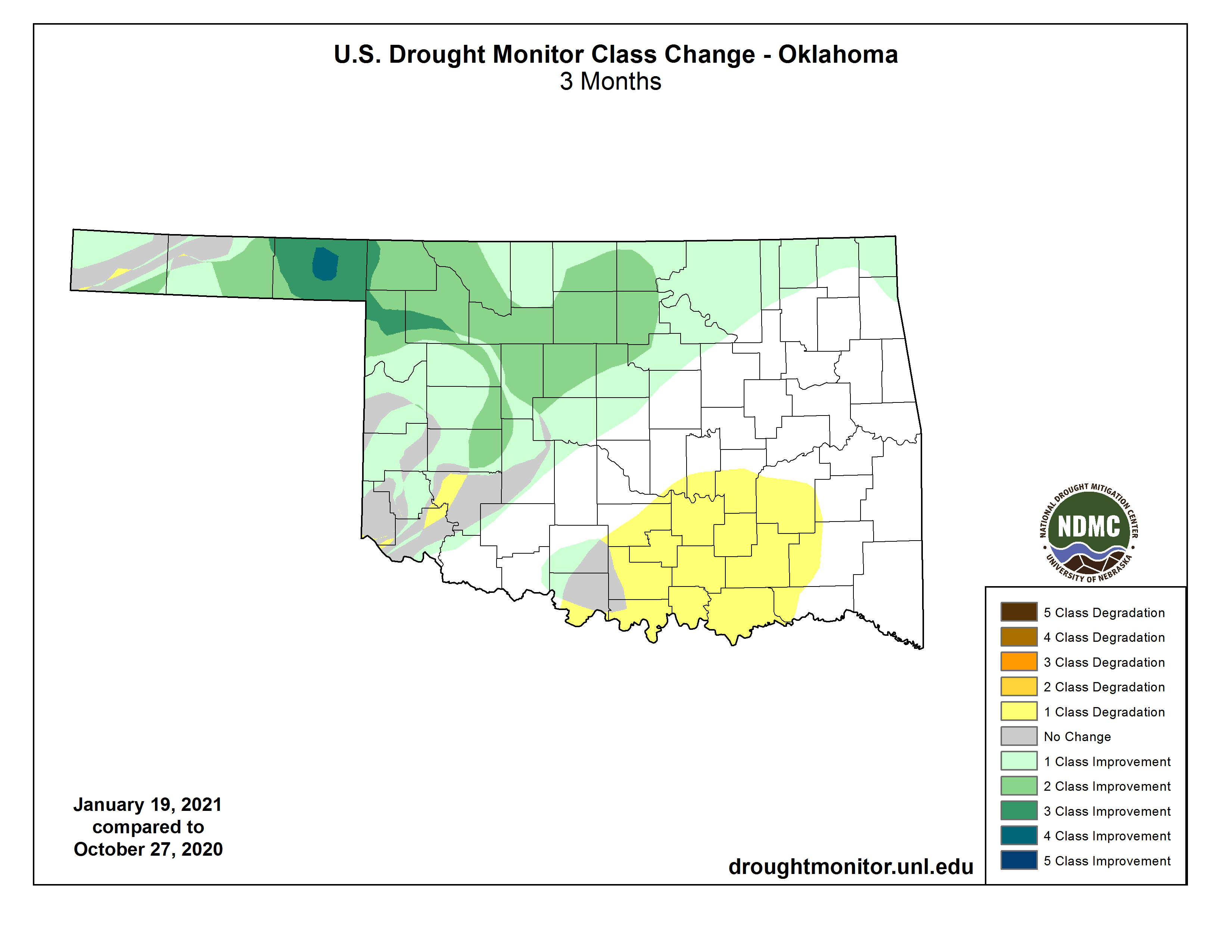
the details are lost. We did have a pretty significant flash drought during the
late summer and early fall. Cut the change map down to OK over the last three
months and we get a different picture.
We can gaze into our cubic zirconium ball (crystal has become too expensive) and
look towards the next three months. The CPC outlooks for Feb-April pretty much
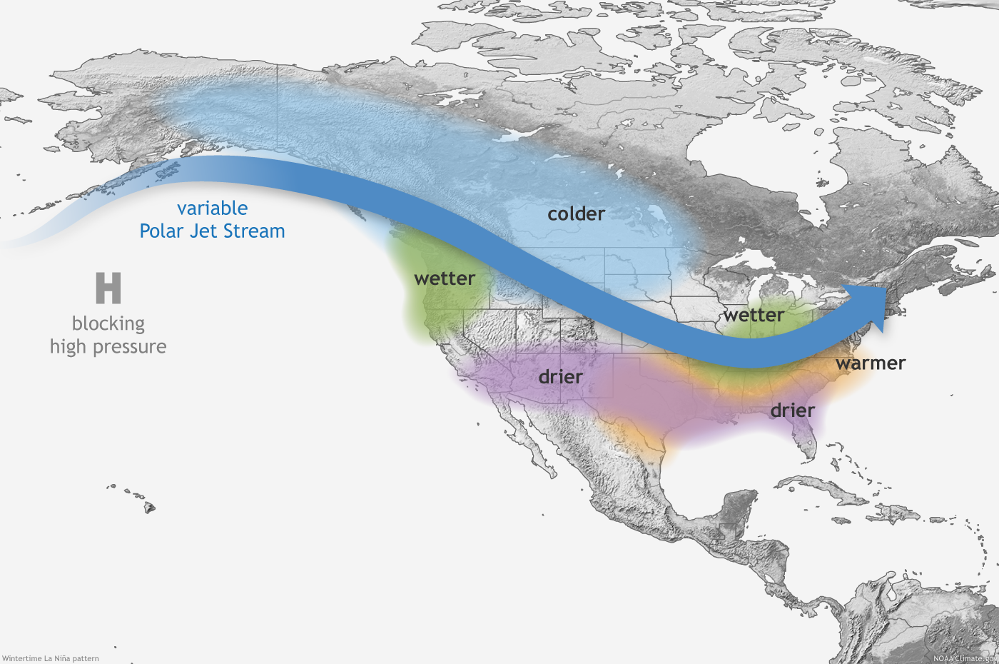
follow the La Nina expected impacts playbook. The playbook has worked "okay" so
far. La Nina impacts, remember, tend to bring the Southern Tier of the US
warmer and drier weather during the cool season, October-April. The impacts
are more pronounced/significant from December-March, however. La Nina can also
bring a wetter than normal cool season to the Midwest, and has at times
extended down into NE OK.
So if we go by the October time frame, we do see something similar to this
generalized pattern across the Southern US. I'll just show pct of normal precip
here.
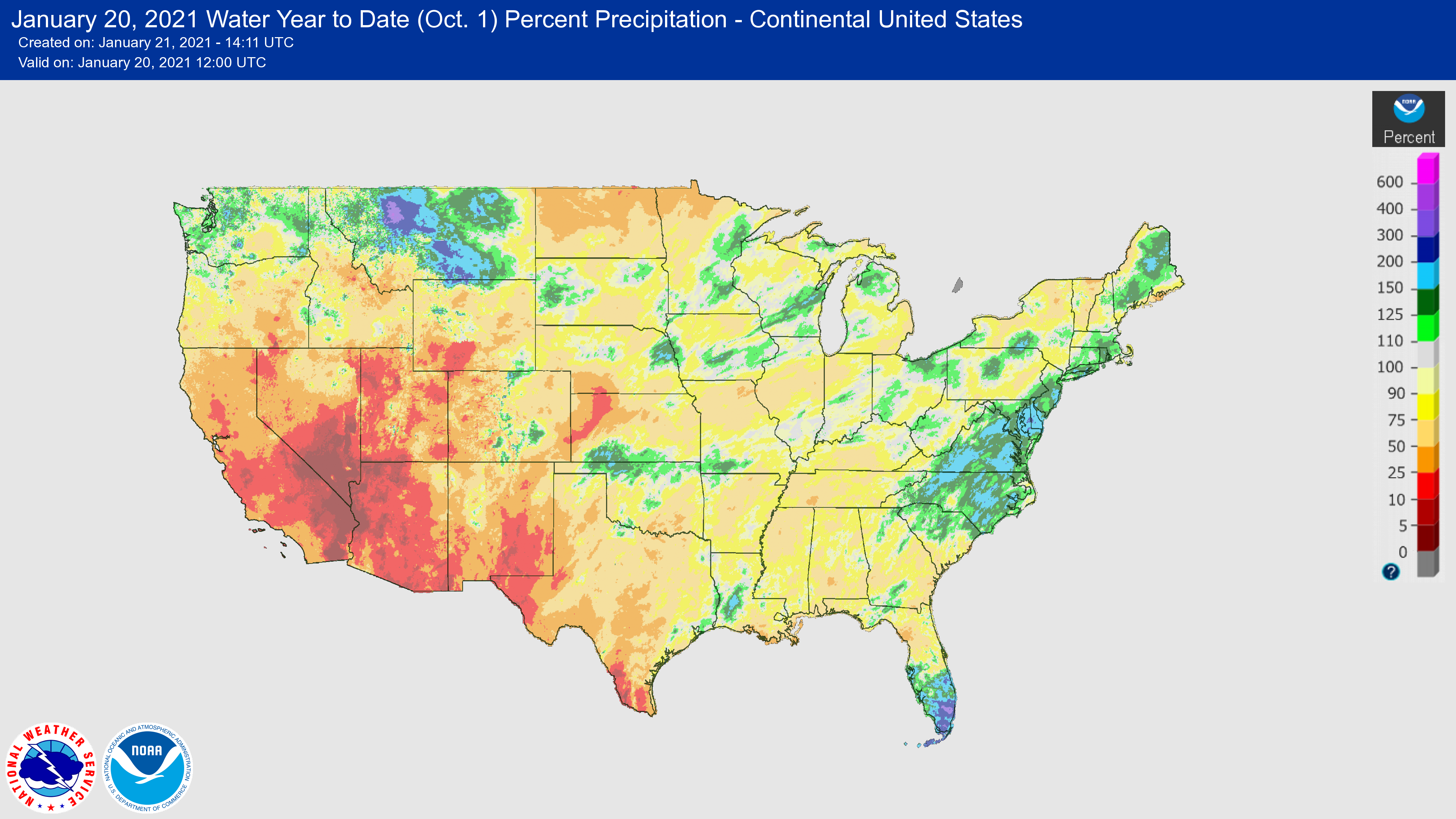
There are definitely differences in the sorta-expected pattern. The wet weather
across N OK is mostly due to snow, of all things. And the wetness across
southern Florida is unusual for La Nina. The lack of the wet blob in the
Midwest hasn't materialized either.
Now let's capture the December-present time frame by looking at the 60-day
precip pct of normal map.
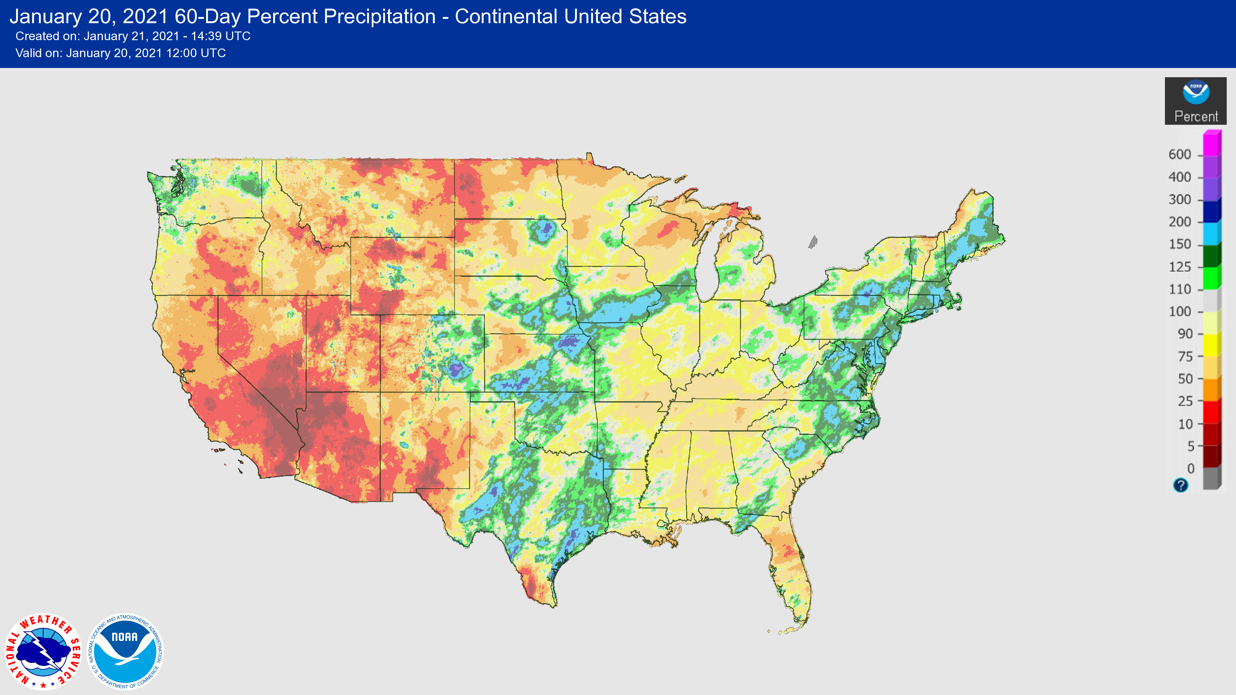
Now we see some big anomalies across the Plains, especially the Southern Plains,
including Oklahoma. And that's where our La Nina impacts went a little haywire,
especially since we expect the influence of La Nina to be stronger as we get
into December (through March). We can take a closer look at Oklahoma since
Dec. 1 and see how we have shaken out thus far.
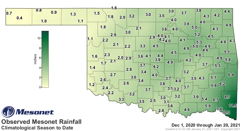
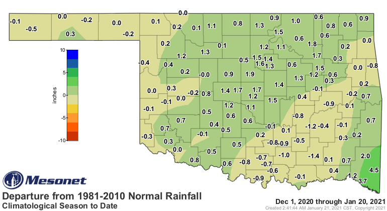
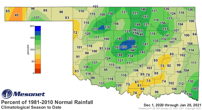
That's a pretty nice looking rainfall surplus for most of the state (and most
of that came from snow). There's nothing really shocking about this, however.
When it comes to teleconnections, we're merely seeing a tilting of the odds,
not a guarantee. Less likely outcomes have AND will occur as well. Natural
variability still plays a significant role, with ENSO rising to explain maybe
about 30% of our cool season precip and temperature outcomes.
And here's something to remember as well...winter is still only about half-way
through. We still have a ways to go, even through march, to get out of the
most dominant influences. We basically had an abnormally wet December, but the
rest of the time, abnormally dry. Just check out the pct of normal map for
January thus far.
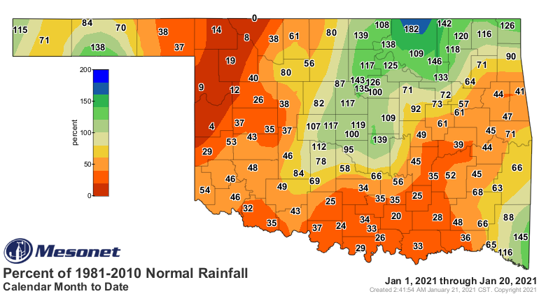
Yikes! I'd hate to see our conditions had we not had that fortunate December.
But we did, and that's how things can turn on a dime. So the final story of
this La Nina hasn't been written yet. Every La Nina (and El Nino) tends to
be different in some way, with various patterns that are more likely when you
average them together. That's the way things work with climate predictions...you
look at the average of all the previous events--in this case, La Nina impacts--
and you then bring up a "tilted odds" or "more likely" outlook from those
averaged patterns.
We definitely need rain across western and southern Oklahoma, or we're going to
be cursing La Nina again shortly.
Gary McManus
State Climatologist
Oklahoma Mesonet
Oklahoma Climatological Survey
(405) 325-2253
gmcmanus@mesonet.org
January 21 in Mesonet History
| Record | Value | Station | Year |
|---|---|---|---|
| Maximum Temperature | 78°F | WOOD | 2005 |
| Minimum Temperature | -17°F | BEAV | 2025 |
| Maximum Rainfall | 3.48 inches | CLOU | 2018 |
Mesonet records begin in 1994.
Search by Date
If you're a bit off, don't worry, because just like horseshoes, “almost” counts on the Ticker website!