Ticker for September 28, 2020
MESONET TICKER ... MESONET TICKER ... MESONET TICKER ... MESONET TICKER ...
September 28, 2020 September 28, 2020 September 28, 2020 September 28, 2020
The lucky few
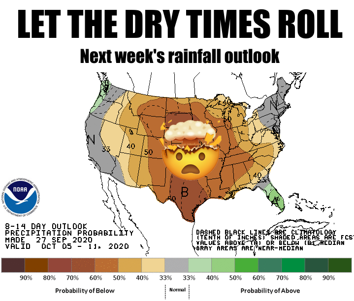
Now before you go and say "Gary, you're awesome," well, okay, go ahead and say
that. Sorry, that slipped out. Now before you go and say "WE DON'T NEED MORE
RAIN,' trust me, there are folks all across the western half or so of the state,
bleeding across much of the northern third of Oklahoma, that definitely do. I'm
not prone to run-on sentences, but that needed said. So yes, there were a few
LUCKY folks across eastern Oklahoma that needed rain and actually got it with last
night's summer-strangling cold front. Other than that, few and far between.
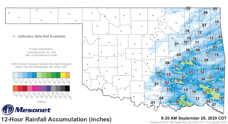
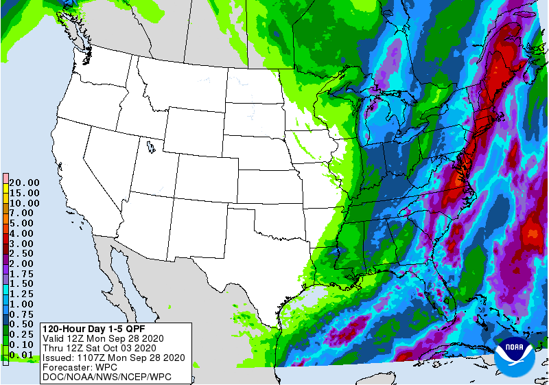
Unfortunately, that run of bad luck is going to continue for the near future.
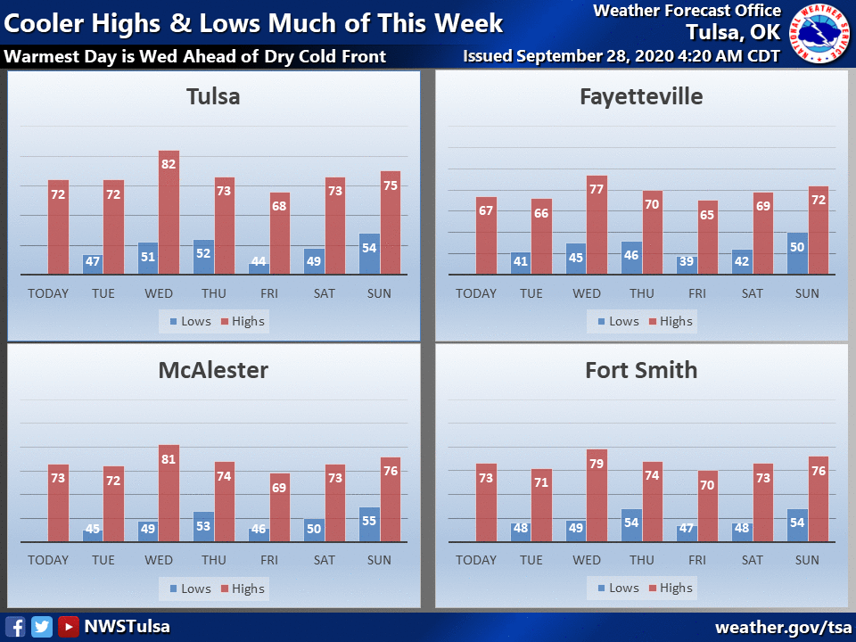
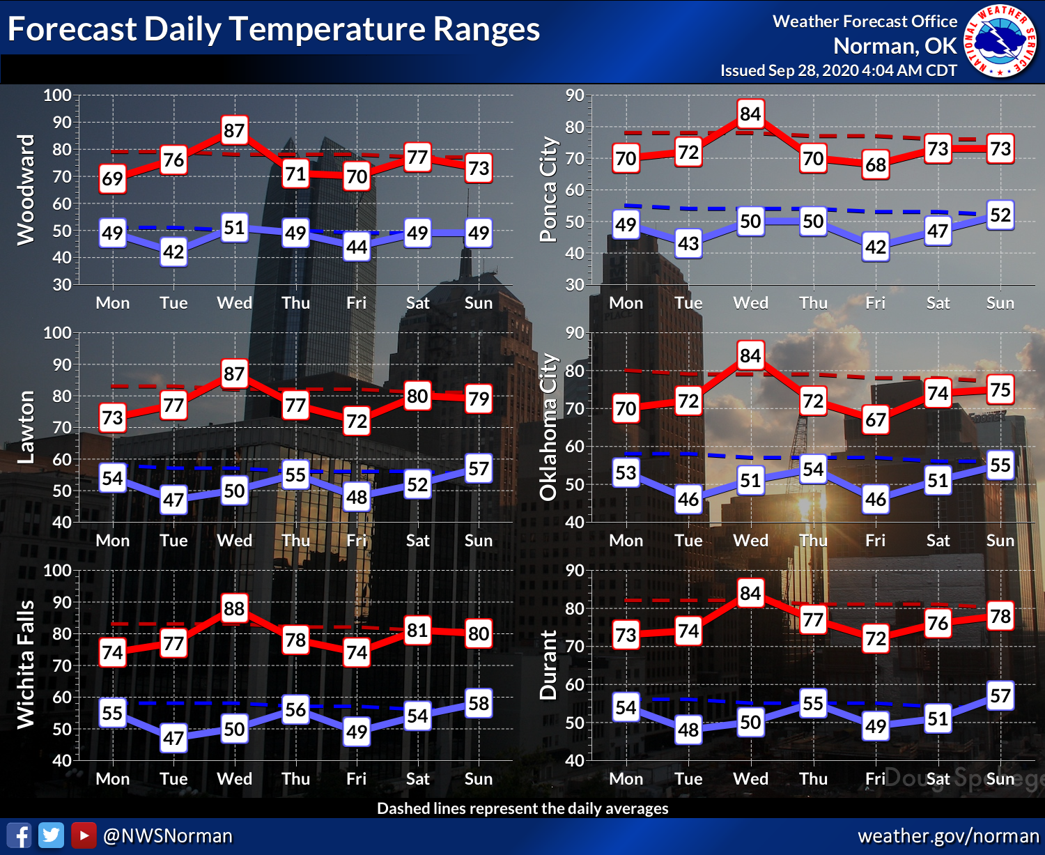
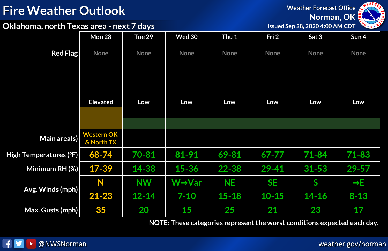
You can see next week's bad outlook, and this week is not looking too good
either, at least for western Oklahoma.
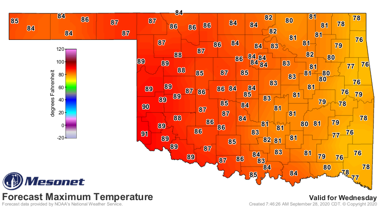
We're gonna see a slight warm up with some strong southerly winds Wednesday, then
another strong but DRY front will come through and scour us of any semblance of
warmth yet again. Our best hope is later into the weekend, but again, not a
great chance for western Oklahoma.
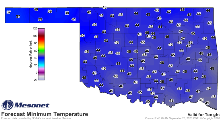
We're going to have to survive a brush with November tomorrow morning, however.
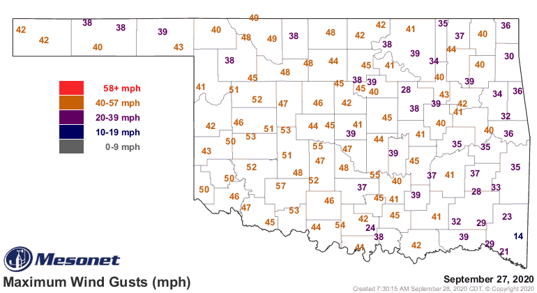
As for that front...wow. For some reason, I wasn't quite expecting such a blast.
You know, being a weather person and all, why would I?? The winds along and
behind there front were just plain dumb, and they stayed elevated for most
of the evening following the 20-degree temperature drop.
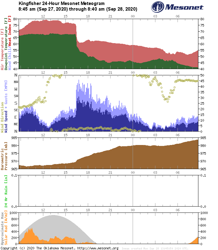
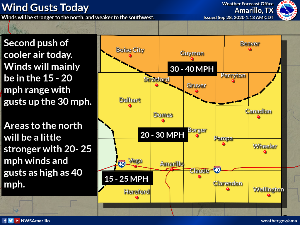
With winds continuing from the north at 20-25mph, gusting to over 35mph, there
will be fire danger concerns across western Oklahoma. This is a motif you're
going to need to get used to, I'm afraid, given our dry weather pattern and
all these dry cold fronts barrelling through.
Dry cold fronts, the Almond Joy of all air mass intrusions. Pray for moisture
return soon!
Gary McManus
State Climatologist
Oklahoma Mesonet
Oklahoma Climatological Survey
(405) 325-2253
gmcmanus@mesonet.org
September 28 in Mesonet History
| Record | Value | Station | Year |
|---|---|---|---|
| Maximum Temperature | 100°F | WALT | 1998 |
| Minimum Temperature | 35°F | KENT | 2006 |
| Maximum Rainfall | 3.03″ | SEIL | 2013 |
Mesonet records begin in 1994.
Search by Date
If you're a bit off, don't worry, because just like horseshoes, “almost” counts on the Ticker website!