Ticker for September 24, 2020
MESONET TICKER ... MESONET TICKER ... MESONET TICKER ... MESONET TICKER ...
September 24, 2020 September 24, 2020 September 24, 2020 September 24, 2020
A state divided
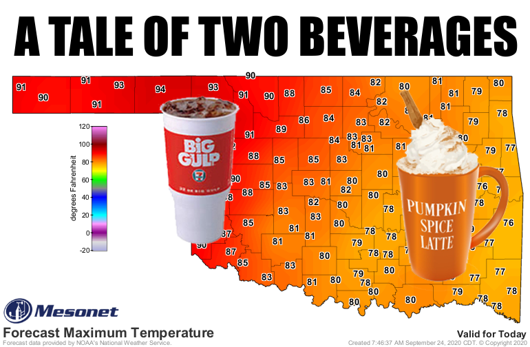
Talk about polarizing. Mother Nature has decided that western Oklahoma should take
a trip back to summer while eastern Oklahoma gets to remain in fall, at least for
the next couple of days. We have that large ridge of upper-level high pressure
once again building to our west and scooching (Okie-to-English translation:
"sliding") to the east. That will bring summer back to the state, again at least
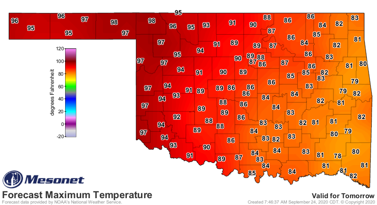
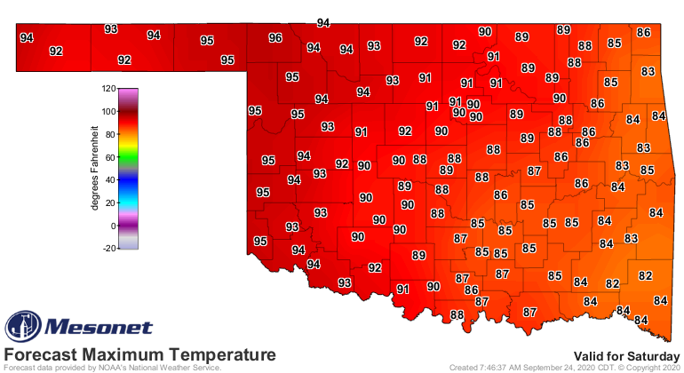
across western Oklahoma where we might even see some triple-digit temperatures
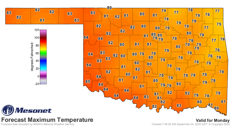
return tomorrow. The heat will spread a bit farther east but shouldn't get too
bad across far eastern Oklahoma before we see another cold front drop all of us
back into fall on Monday.
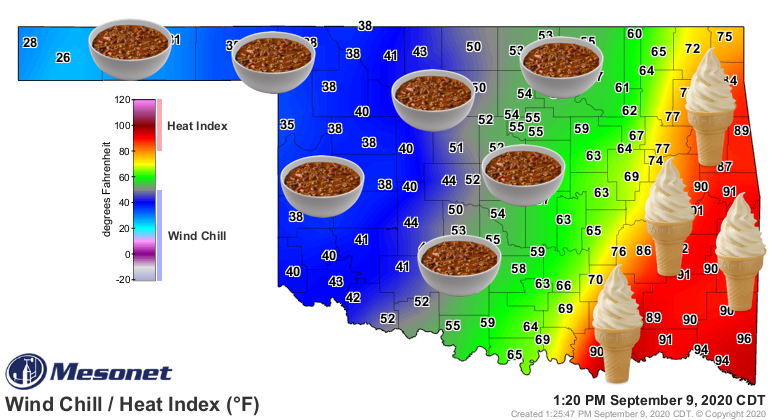
Come on now, that only fair! Remember earlier this month when you western OK folks
got winter and the southeast was basking in the warm glow of Hades?
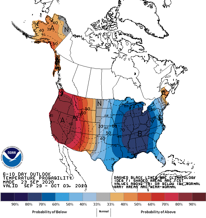
And there does look like we will see another possible big cool down next week
with another plunge of cold air across the eastern US. Once we set up with that
pattern where we have a large area of low pressure to the east and a large area
of high pressure to the west, that will set us up under northwesterly flow aloft
and allow cold fronts to occasionally plunge through the "in between" areas,
like the Southern Plains. The only question will be where that demarcation line
between the upper high and upper low sets up. Looks like right over us, however,
which is reflected in next week's temperature outlook map from CPC.
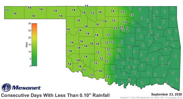
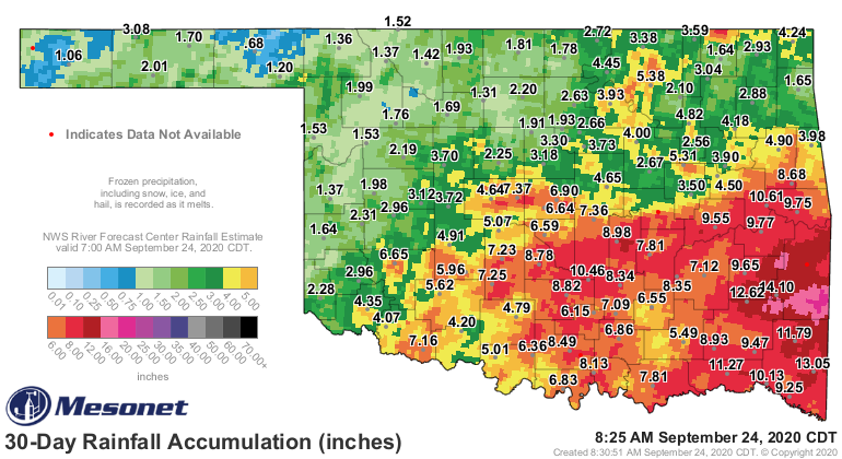
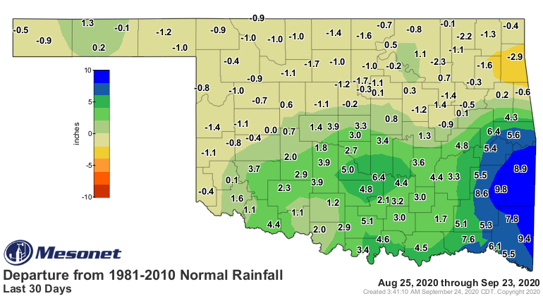
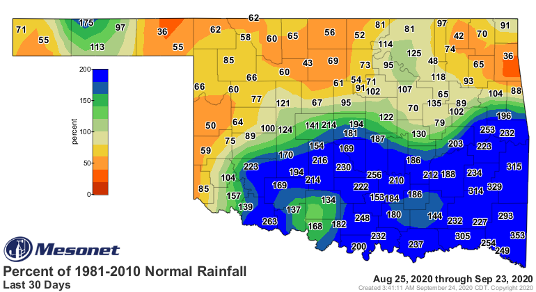
What's NOT fair, and Mother Nature knows this, is the lack of rainfall we see
across the west to go along with that heat. It's pretty obvious when you look
at the number of days without at least a tenth of an inch at our Mesonet sites.
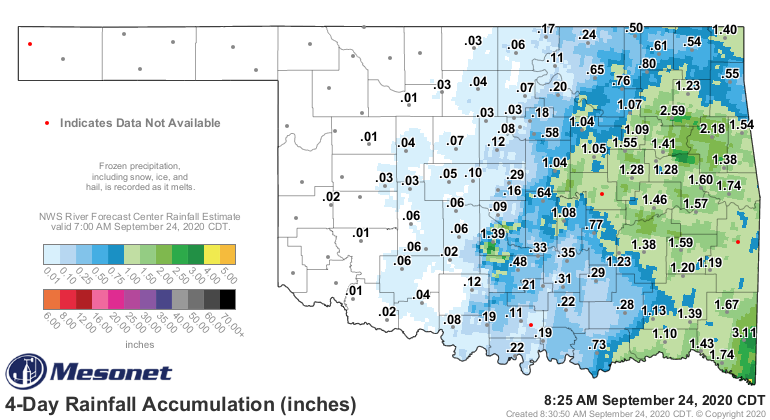
Eastern Oklahoma received some moisture from Tropical Storm Beta, whilst the
west continued getting sprayed with Arid Extra Dry. Meanwhile, we are continuing
with long-term dry conditions across far western Oklahoma, and even northern
OK is starting to dry out a bit.
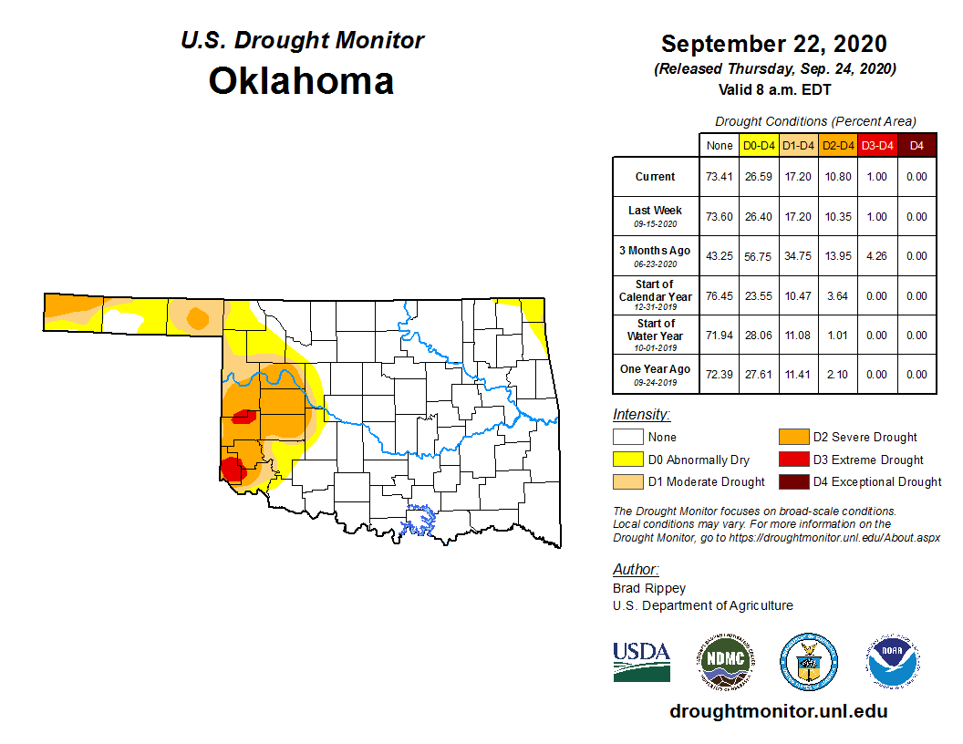
That leaves us with another week with virtually the same U.S. Drought Monitor
map. We were very close to ramping up the levels across NE OK before that Beta
moisture, but we did see an addition of severe drought in Beaver County.
Little hope for relief across western Oklahoma in the next couple of weeks. We
are going to need something of a pattern change before we see good relief in
that area.
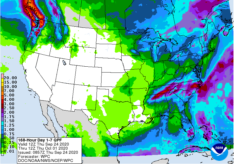
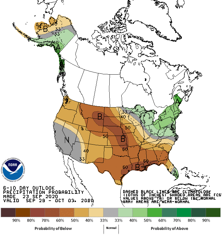
There's just not a lot of moisture to work with, and there won't be with the
pattern that is setting up. Those fast cold fronts will come through and probably
not do a lot other than make us start to worry about fire danger across western
Oklahoma.
So when you're picking a beverage, pour a little out for western Oklahoma in
solidarity.
Gary McManus
State Climatologist
Oklahoma Mesonet
Oklahoma Climatological Survey
(405) 325-2253
gmcmanus@mesonet.org
September 24 in Mesonet History
| Record | Value | Station | Year |
|---|---|---|---|
| Maximum Temperature | 101°F | BUFF | 1998 |
| Minimum Temperature | 29°F | BOIS | 2000 |
| Maximum Rainfall | 4.77″ | CLAY | 2019 |
Mesonet records begin in 1994.
Search by Date
If you're a bit off, don't worry, because just like horseshoes, “almost” counts on the Ticker website!