Ticker for July 13, 2020
MESONET TICKER ... MESONET TICKER ... MESONET TICKER ... MESONET TICKER ...
July 13, 2020 July 13, 2020 July 13, 2020 July 13, 2020
What a weekend
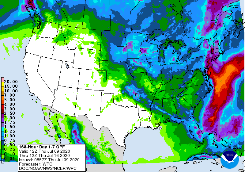
Yeah, that was a heck of a weekend (I was gonna say "hell" but I didn't want to
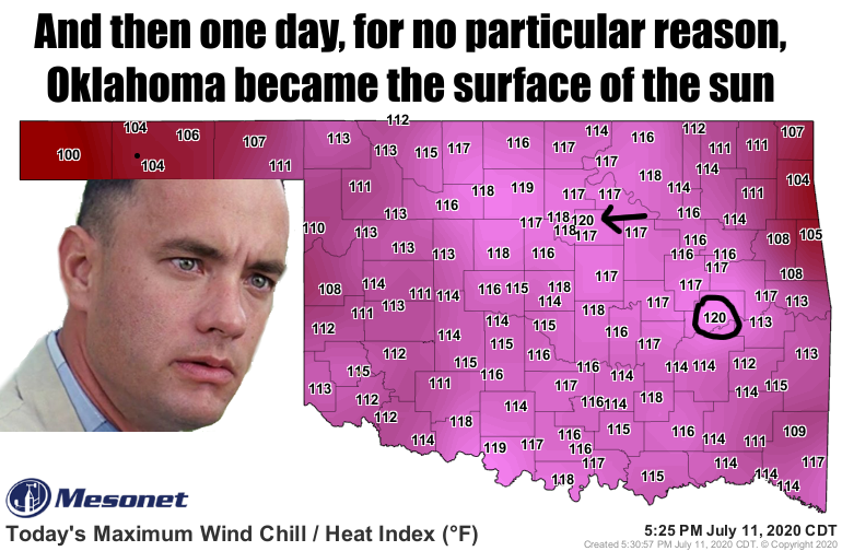
get in trouble). What we thought would happen:
What really happened!
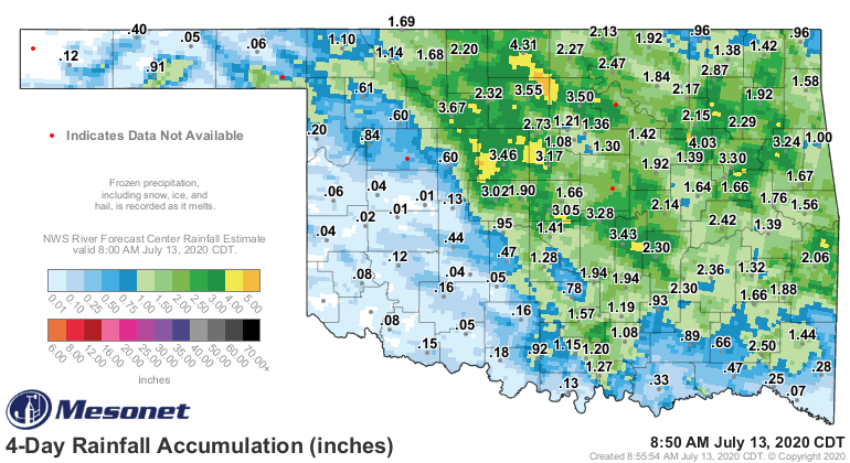
So we're so used to seeing the rainfall totals underperforming from what was
forecast, we're a bit shocked to see all those generous rainfall amounts. Even
more shocking was the generous WIND amounts, that ended up carving a swath of
damage from northern through south central Oklahoma.
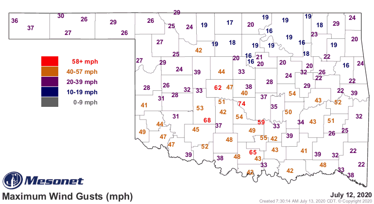
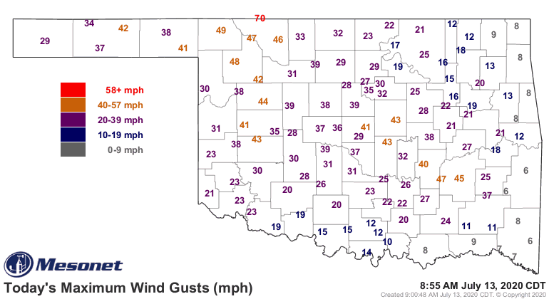
A ton of folks were left without power, and to add insult to injury, this was a
weekend where you REALLY needed an air conditioner.
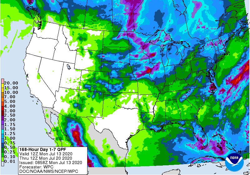
In order to enhance our rain chances, I'm going to once again post a rather
bleak 7-day forecast map. At least this one is showing some decent rains in the
Panhandle, the hardest hit drought region in the state.
There are actual forecast rain chances coming up in the middle of the week, so
we will probably see storms here and there. Maybe not the large MCS events that
we saw this weekend, but rain chances nonetheless. Other than that, the heat
dome/death ridge is still around and possibly building north, which would
limit our rain chances even further.
And heck, it's raining now!
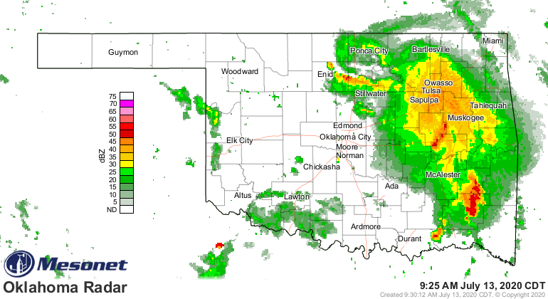
So as we go forward into the week, rainfall is possible but iffy. Heat is
guaranteed.
Gary McManus
State Climatologist
Oklahoma Mesonet
Oklahoma Climatological Survey
(405) 325-2253
gmcmanus@mesonet.org
July 13 in Mesonet History
| Record | Value | Station | Year |
|---|---|---|---|
| Maximum Temperature | 109°F | LAHO | 2003 |
| Minimum Temperature | 52°F | BOIS | 2008 |
| Maximum Rainfall | 4.29″ | CLAY | 2025 |
Mesonet records begin in 1994.
Search by Date
If you're a bit off, don't worry, because just like horseshoes, “almost” counts on the Ticker website!