Ticker for July 9, 2020
MESONET TICKER ... MESONET TICKER ... MESONET TICKER ... MESONET TICKER ...
July 9, 2020 July 9, 2020 July 9, 2020 July 9, 2020
Drought forges ahead
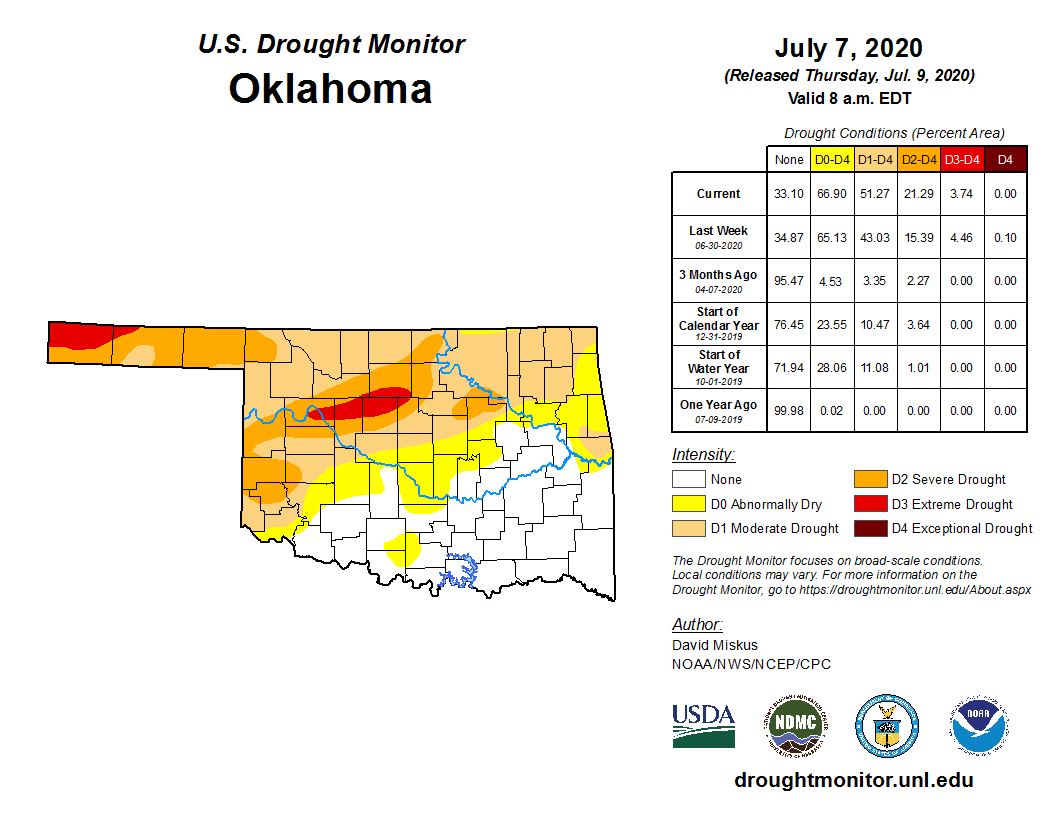
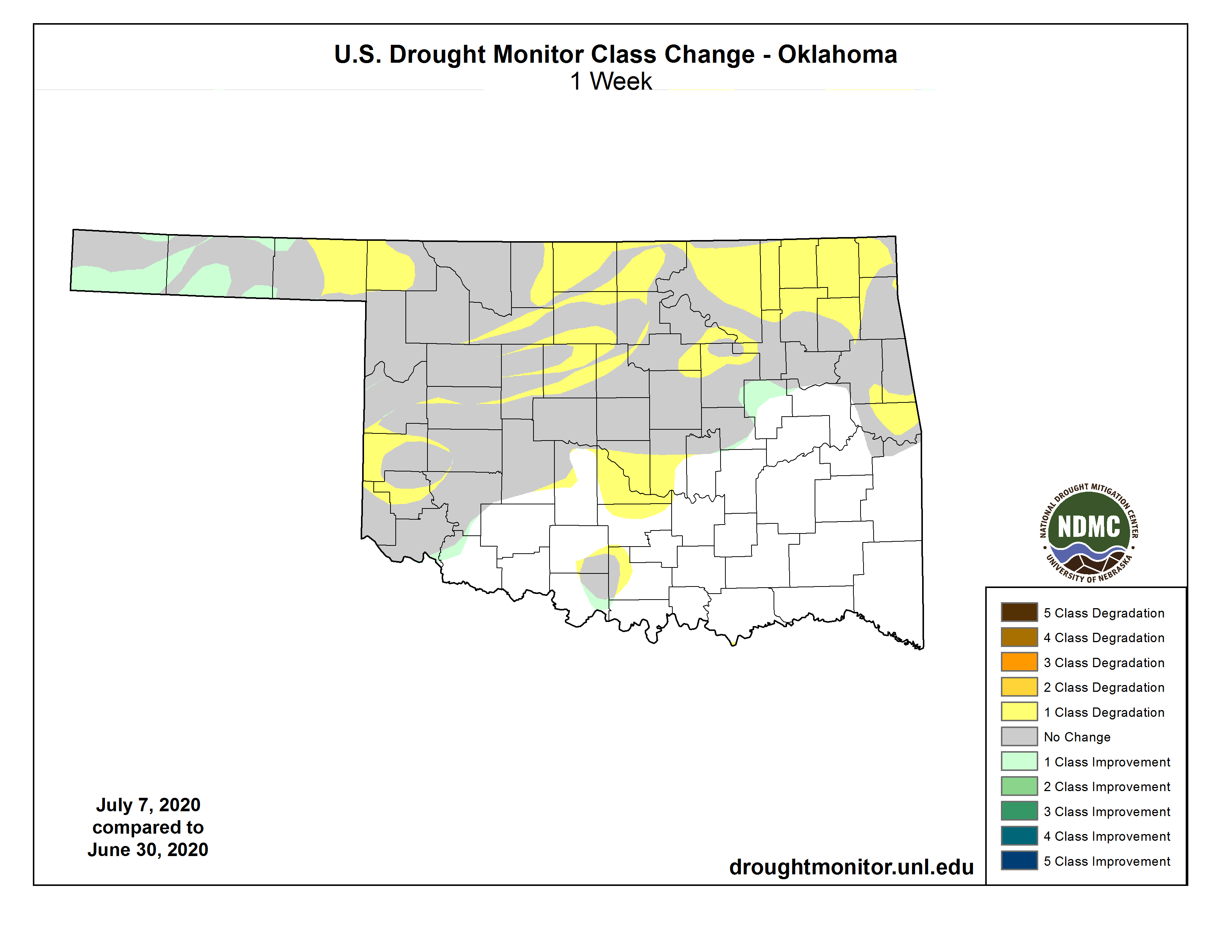
Shrugging off recent rainfall, flash drought surged to the east this week, now
covering much of northeast Oklahoma. There were some improvements in the drought
picture across the western Panhandle, but the rain still had benefits elsewhere,
mainly by stopping further development and intensification.
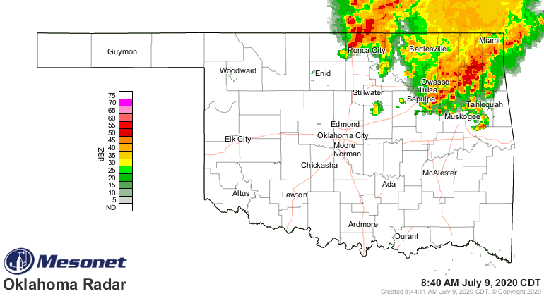
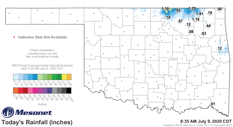
So that's some good news. And even better news...rain is falling RIGHT NOW across
those newly hatched areas of drought in northeastern OK.
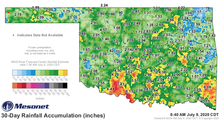
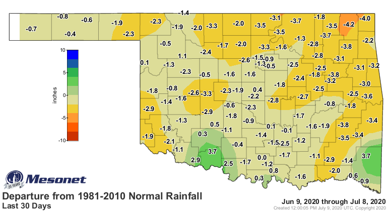
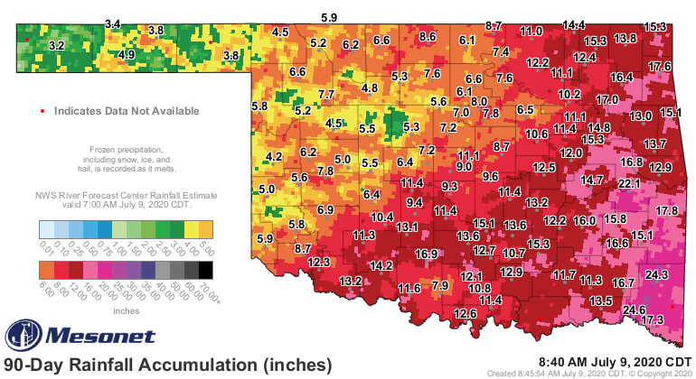
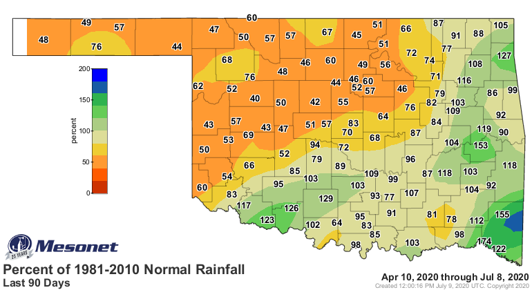
Big deficits remain across much of the northwestern half of the state when you
look at the long term picture, with more significant deficits showing up across
the far northeast as we look at the flash drought's spread. Check out the
different areas that pop out on the 30 day maps vs the 90 day maps.
30 days

90 days

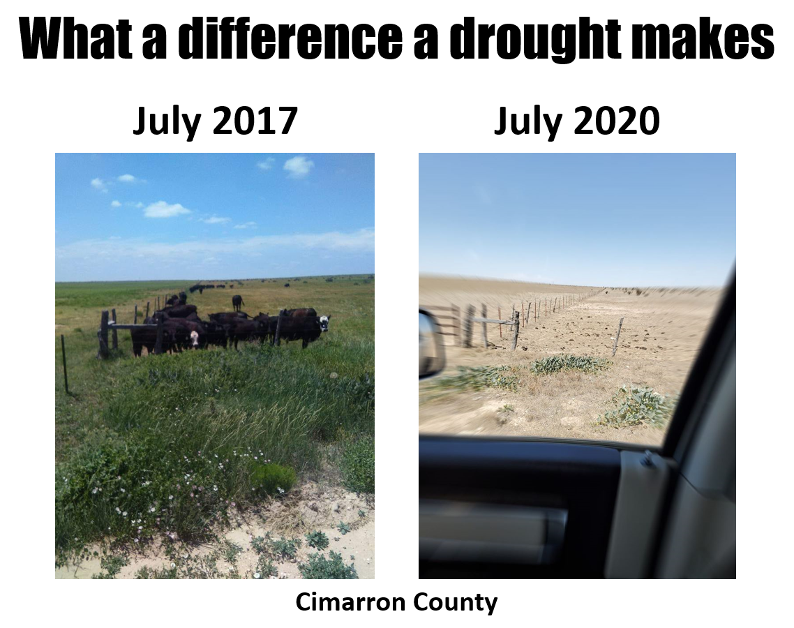
The deficits across the Panhandle go back to last fall, and the damage from
that longer term drought is evident in these pictures sent to us from a rancher
near Kenton in western Cimarron County. It's very plain to see the difference
in fortunes from times of plenty vs what we see out there this year...basically
the surface of the moon. Same location in both pics.
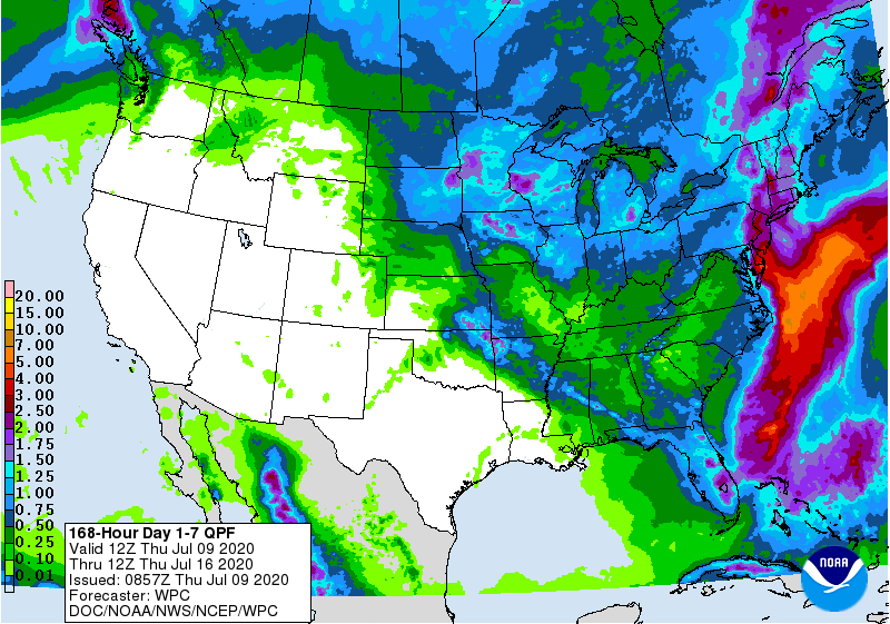
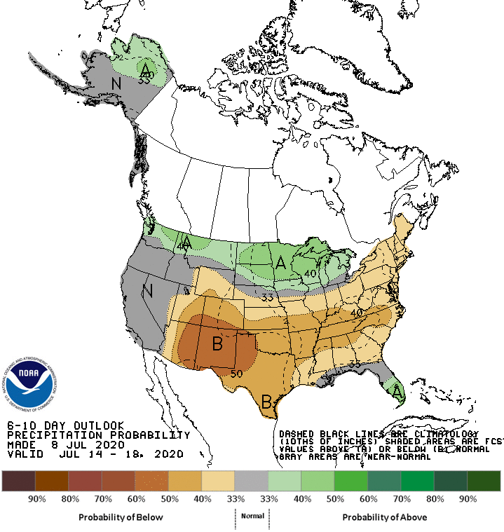
With that death dome of high pressure moving back over the state from the west,
I'm afraid the drought will worsen once again across western Oklahoma before
we see more improvements. Highs in the 100s with strong winds will make short
work of that moisture that fell, and the prospects for rain are going to be
nil for awhile.
I don't think I need to mention the heat again.
But what sort of sadist would I be if I didn't? HERE COMES THE HEAT, courtesy
of the death dome! Two droughts enter, three droughts leave.
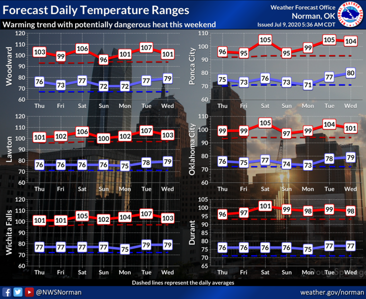
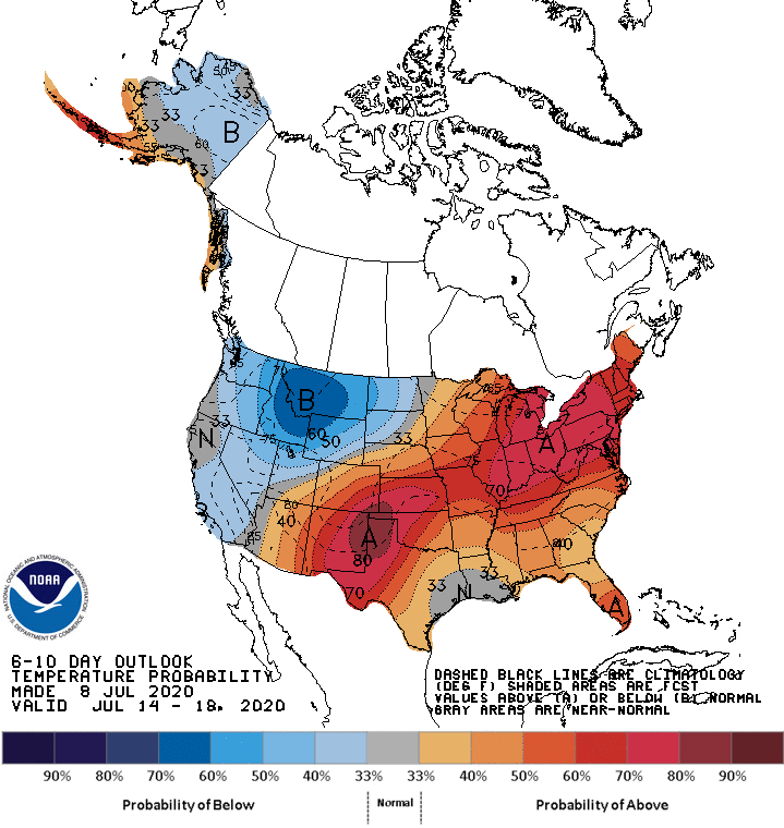
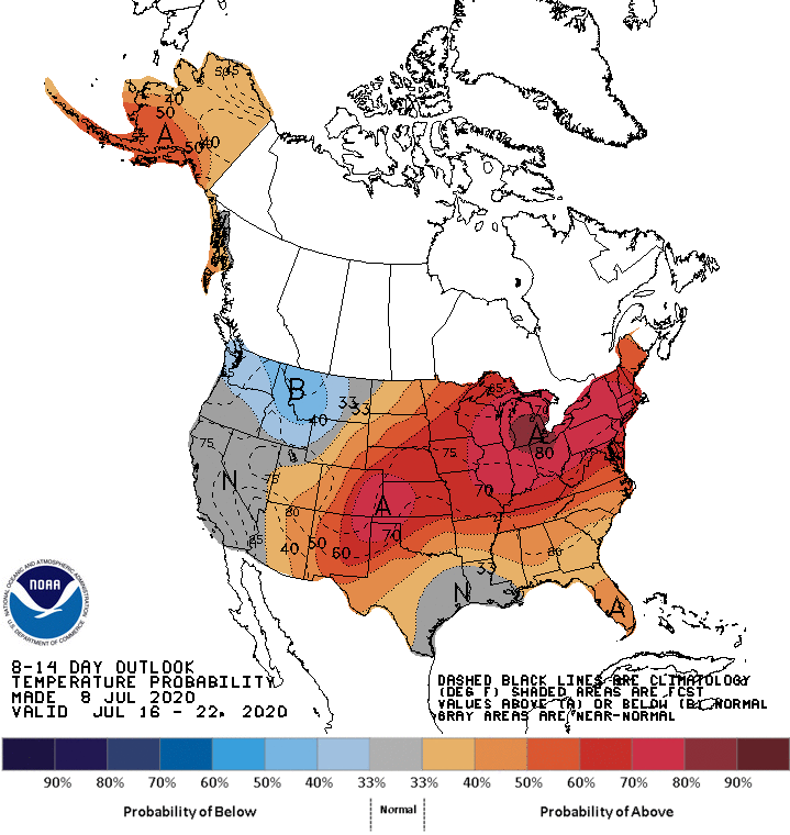
The heat starts today. The burned up moose out front should have told ya.

Summer in Oklahoma. Woe be to those years where we enter with drought already in
place.
Gary McManus
State Climatologist
Oklahoma Mesonet
Oklahoma Climatological Survey
(405) 325-2253
gmcmanus@mesonet.org
July 9 in Mesonet History
| Record | Value | Station | Year |
|---|---|---|---|
| Maximum Temperature | 115°F | BUFF | 2009 |
| Minimum Temperature | 55°F | KENT | 2015 |
| Maximum Rainfall | 3.91 inches | OKCE | 2014 |
Mesonet records begin in 1994.
Search by Date
If you're a bit off, don't worry, because just like horseshoes, “almost” counts on the Ticker website!