Ticker for July 16, 2020
MESONET TICKER ... MESONET TICKER ... MESONET TICKER ... MESONET TICKER ...
July 16, 2020 July 16, 2020 July 16, 2020 July 16, 2020
Droughtdome
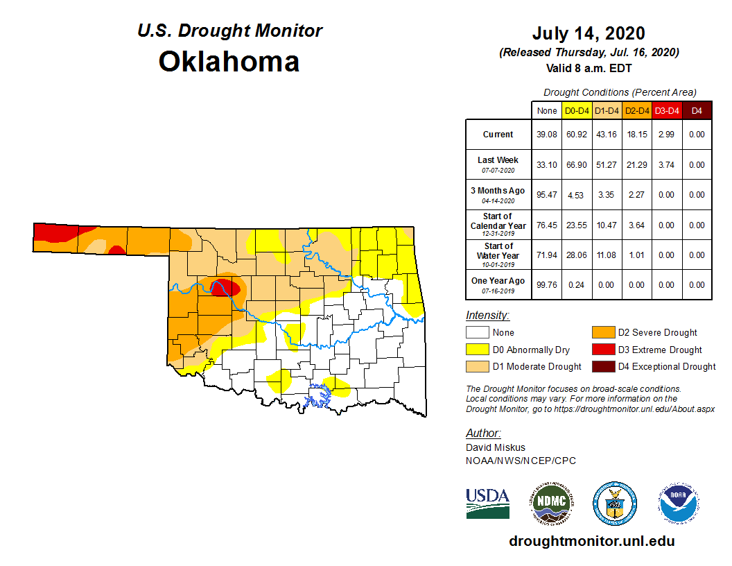
One drought enters, two droughts leave. Not exactly the order things worked in
Thunderdome, but you get the drift. Mother Nature was both Master and Blaster
over the last week. She saw fit to blast a lot of drought away in north central
and northeast Oklahoma, but in a show of force, showed us she is still master
of our drought fortunes by shutting off the moisture in southwestern Oklahoma.
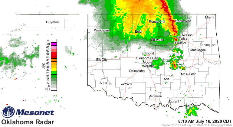
Here you can see the rainfall that helped, the lack of rainfall that hurt, and the
resulting change in the U.S. Drought Monitor map.
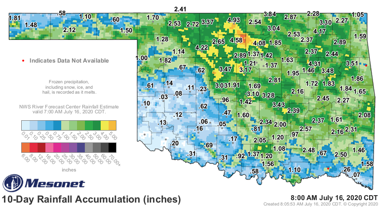
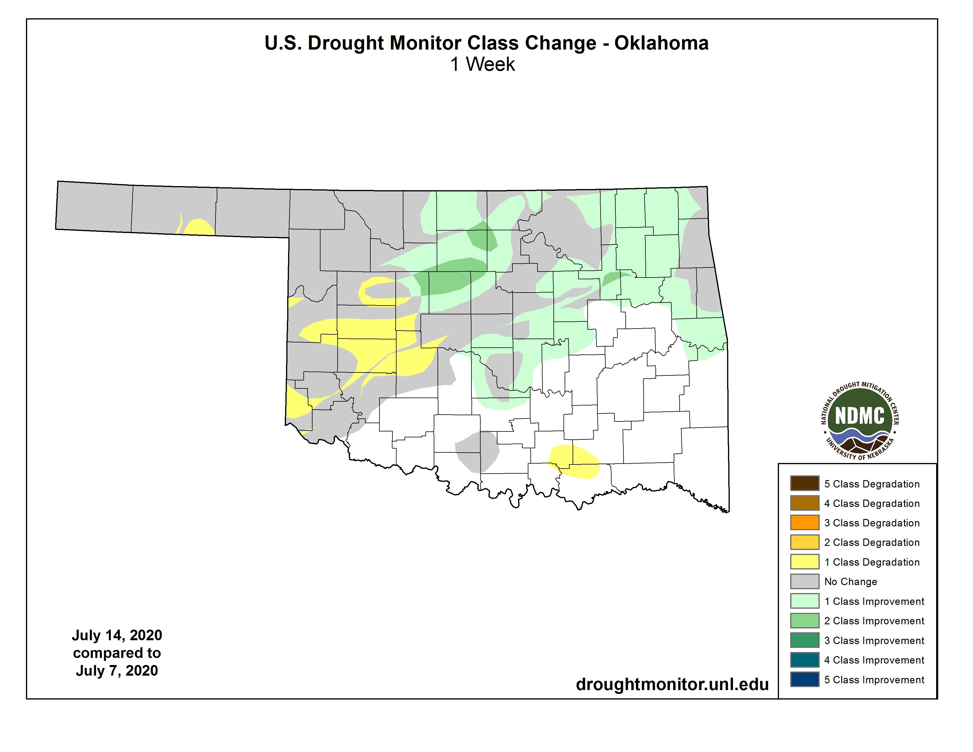
The big winner, obviously, was the Blaine/Kingfisher county region where 3-5
inches of rain fell, obliterating that region's extreme drought down with a rare
two-category improvement on the DM (Drought Monitor, not Dungeon Master...no
20-sided die roll will help here). And then you can see the somewhat broad scale
intensification across SW OK. Now remember, the DM only considers rainfall from
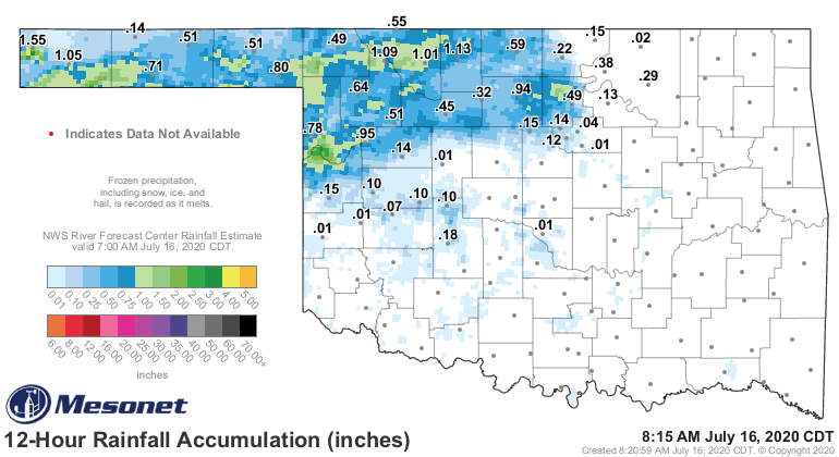
7am to 7am on successive Tuesdays, so any ran that fell after 7am (come on, stay
with me here!) Tuesday wasn't considered in the map. That includes that rain
that fell last night, and is still falling now!
So we possibly have some improvements for NEXT week's map already built in
before this week's map even came out. Nice, no? And we might see the same type
of somewhat unexpected outbreaks of drought-quenching rains coming up early
next week, although now that I have mentioned them they shouldn't be unexpected.
They are low chances for now, mainly in northern Oklahoma, but that's where
we started with this week's rain as well.
So maybe this 7-day forecast rain map won't end up as ugly as it looks?

Break a deal, face the wheel. Okay, we'll take the wheel, bring on some rain!
This Ticker brought to you by Mad Max, Aunty and the fine denizens of
Bartertown. Hey, I didn't know what "denizens" meant either, but it turns out I
guessed correctly.
Gary McManus
State Climatologist
Oklahoma Mesonet
Oklahoma Climatological Survey
(405) 325-2253
gmcmanus@mesonet.org
July 16 in Mesonet History
| Record | Value | Station | Year |
|---|---|---|---|
| Maximum Temperature | 109°F | HOLL | 2001 |
| Minimum Temperature | 51°F | JAYX | 2014 |
| Maximum Rainfall | 3.82 inches | ALTU | 2014 |
Mesonet records begin in 1994.
Search by Date
If you're a bit off, don't worry, because just like horseshoes, “almost” counts on the Ticker website!