Ticker for June 25, 2020
MESONET TICKER ... MESONET TICKER ... MESONET TICKER ... MESONET TICKER ...
June 25, 2020 June 25, 2020 June 25, 2020 June 25, 2020
Drought Modulator
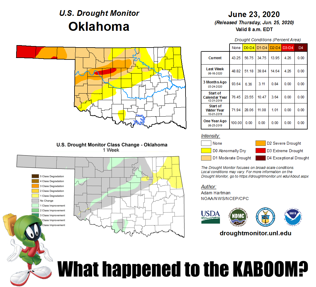
Wait, we had that big rain event, and all we reduced the drought was a measly 5%?
And wait, we had to ADD more abnormally dry conditions across the far northeast?
How much rain did we get again?
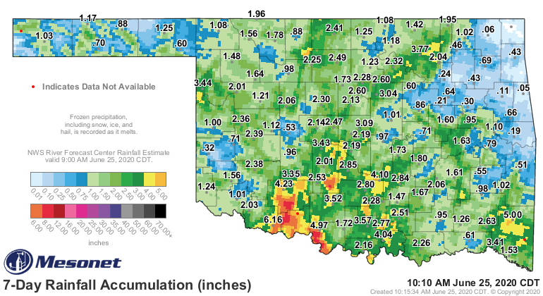
Hmmmmm, well, the northeast mostly missed out I reckon. And there is a lot of
green on that map, but not nearly enough reds and yellows, and definitely way
too much blue. The Mesonet sites are showings lots of totals beginning with "1"
(or less), which isn't really a drought-ending rain event. Flash drought
interrupting/slowing down/discombobulating, maybe. Big deficits remain, even for
June itself, and especially going out to 60-90 days.
Still not a believer? Think the drought is over? Check this out. Does this look
like a June-thus-far drought-ending rainfall map?
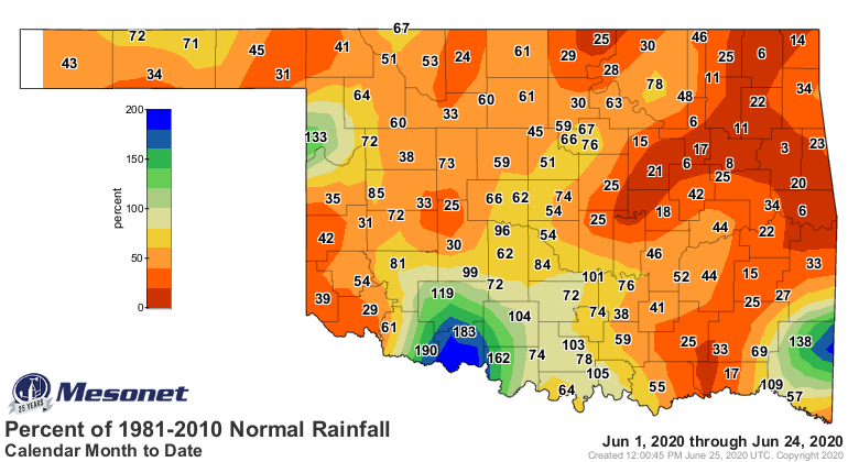
How about this one?
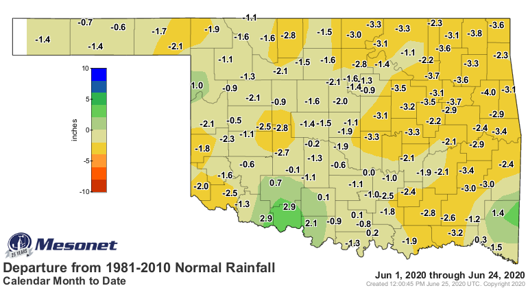
How about these maps from 60 days to 90 days, that start to see the flash
drought transform into just...well, drought?


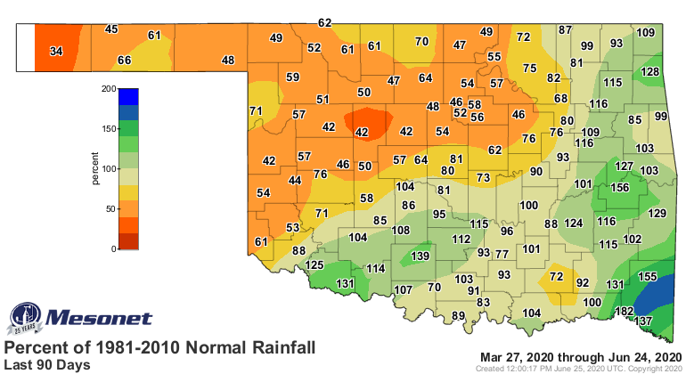
Yeah, that's still a problem. That last rain was wonderful, but what it actually
gave us was a down payment on true drought relief. Now Mother Nature has to come
through with the installment plan payments in the form of multiple rainfall
events over the next few weeks to bolster that relief. Soil moisture has
improved a bit, and that's a big start. And, it got worse in some areas.
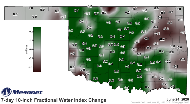
Now we face the long hot summer, and the long ridiculous moisture demands that
go along with it. The heat will increase evaporation, the plants are going to
accelerate their growth and demand more moisture, all leading to extreme
pressure on the relief that we just received. We can't wait 3 weeks, either.
If you spread the rain events out too far apart, they lose their "UMPH!" in
between events. Prospects aren't great for further relief at this time, at
least significant relief. There will be a chance across the NW tomorrow (along
with severe weather chances), and then some isolated precip possibly as we go
through parts of next week.
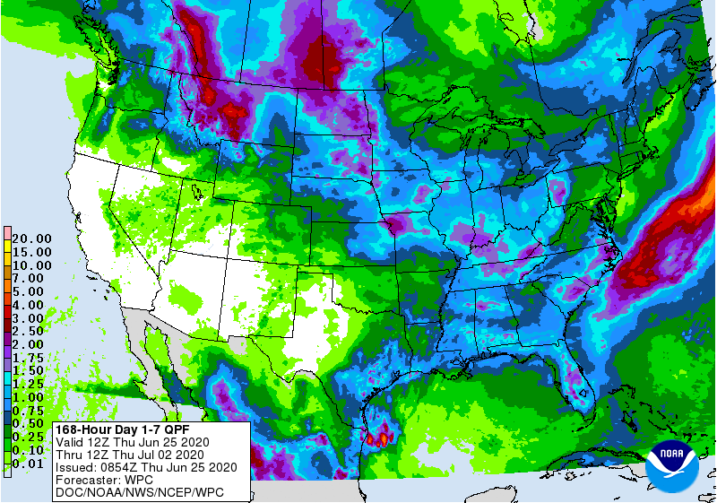
We'll watch over the next few days and see if that map starts to improve. Maybe
some of that rain to our north can sag south. Maybe the tropics can benefit
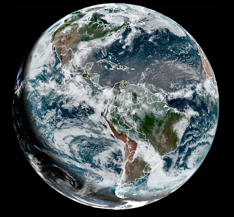
us, but that's always a long shot. But hey, at least we have the good Saharan
dust! That inhibits tropical development? DOH!
Gary McManus
State Climatologist
Oklahoma Mesonet
Oklahoma Climatological Survey
(405) 325-2253
gmcmanus@mesonet.org
June 25 in Mesonet History
| Record | Value | Station | Year |
|---|---|---|---|
| Maximum Temperature | 111°F | ERIC | 2011 |
| Minimum Temperature | 50°F | KENT | 2018 |
| Maximum Rainfall | 4.11 inches | WAUR | 1999 |
Mesonet records begin in 1994.
Search by Date
If you're a bit off, don't worry, because just like horseshoes, “almost” counts on the Ticker website!