Ticker for June 24, 2020
MESONET TICKER ... MESONET TICKER ... MESONET TICKER ... MESONET TICKER ...
June 24, 2020      June 24, 2020      June 24, 2020      June 24, 2020


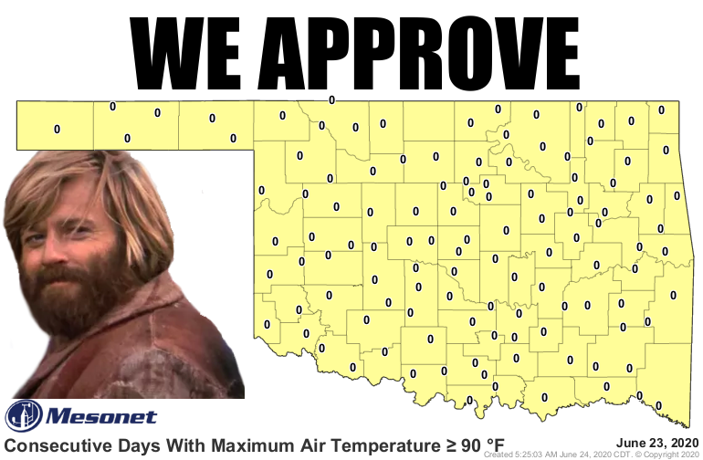
A bit of change


We're famous for our love of warm(er) weather, but when things get stagnant, a
bit of change is fabulous; especially when that change helps stop drought in its
tracks. Another benefit of the system that brought us all that rain is the cold
front that accompanied it, and the flow of reinforcing cool air from the north.
Of course, all good things must end, except an Everlasting Gobstopper, apparently.
Man, wasn't that Willy Wonka a weird guy? What's the point? It's the Ticker, there
usually isn't one. Oh right, back to what we were talking about. Well, the string
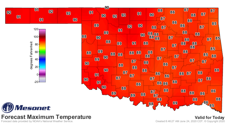
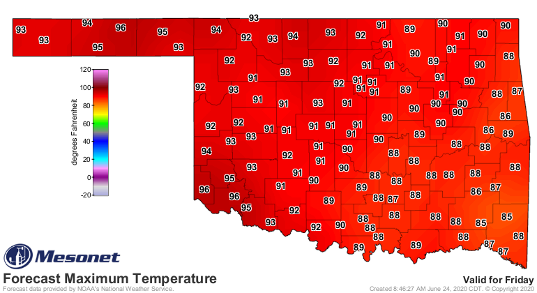
of cooler than normal days are numbered, starting today out west and culminating
in full on summer on Friday. Doesn't look that bad in eastern Oklahoma, but the
heat index will make sure those numbers are misleading.


And chances are it will stick around for awhile.


Drought is still out there, raging across western Oklahoma. Give it another dose
of the summer heat dome and it will take off again, and so will the heat. We'll
talk more about that tomorrow.

That's the end, and also proof positive that all mediocre things must end, too.

Gary McManus
State Climatologist
Oklahoma Mesonet
Oklahoma Climatological Survey
(405) 325-2253
gmcmanus@mesonet.org
June 24 in Mesonet History
| Record | Value | Station | Year |
|---|---|---|---|
| Maximum Temperature | 108°F | HOLL | 2011 |
| Minimum Temperature | 45°F | BOIS | 2019 |
| Maximum Rainfall | 5.37 inches | FAIR | 2018 |
Mesonet records begin in 1994.
Search by Date
If you're a bit off, don't worry, because just like horseshoes, “almost” counts on the Ticker website!