Ticker for June 22, 2020
MESONET TICKER ... MESONET TICKER ... MESONET TICKER ... MESONET TICKER ...
June 22, 2020      June 22, 2020      June 22, 2020      June 22, 2020


Begin again


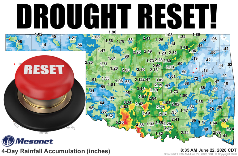
So it's *somewhat* easy to tell the winners and losers in this weekend's blast of
moisture, a statewide several-day event the likes of which we haven't seen for
months. The center of the state, from the KS to the TX border, appears to have
been the real winner. Anybody who got rain was a winner, obviously (sorry,
Miam-uh...not only does everybody pronounce your name wrong, but you went
scoreless for the weekend!), but given the giant deficits that had built through
spring, some needed more than just an inch or so.

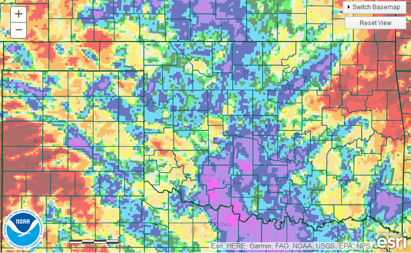
Take a gander at this up-to-date percent of normal rainfall map for the last 7
days. If you see blue, purple, green, etc...you were a winner to some degree (or
inch). If you see the orange, yellow or red -- pffffttt. Hopefully even in those
areas the precip was enough to settle the dust and improve at least the top layers
of soil moisture.


Even the deficits without last night's rain are smaller, however. Check out the
90-day deficit map from last Wednesday vs. yesterday's.


That's an understated but important improvement. Not a drought-ender, but a
drought-improver and drought-interruptor. So the spread will not continue
unabated, at least this week, and we will see improvements in some places on
the U.S. Drought Monitor map. And some places will worsen, no doubt. Northeast
Oklahoma largely missed out on the good rains, and the flash drought in that
area is very much still flashy.

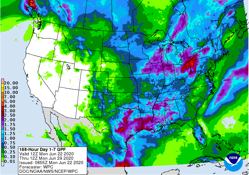
The big rain chances now past, the next 7 days will be a bit more spotty in the
rain department, save for southern Oklahoma. Look for chances today and
overnight with some severe weather possible, and then we sort of go into spotty
mode. Here is the 7-day rainfall forecast based on what had occurred through
early morning.


We are in a new weather regime for awhile where the big heat has been knocked
down. Now we await our next big statewide multi-day event. Will it be in
June, or September?

Sorry, we don't have a button for that.

Gary McManus
State Climatologist
Oklahoma Mesonet
Oklahoma Climatological Survey
(405) 325-2253
gmcmanus@mesonet.org
June 22 in Mesonet History
| Record | Value | Station | Year |
|---|---|---|---|
| Maximum Temperature | 104°F | TIPT | 1998 |
| Minimum Temperature | 49°F | BOIS | 2004 |
| Maximum Rainfall | 4.73 inches | MANG | 1999 |
Mesonet records begin in 1994.
Search by Date
If you're a bit off, don't worry, because just like horseshoes, “almost” counts on the Ticker website!