Ticker for June 11, 2020
MESONET TICKER ... MESONET TICKER ... MESONET TICKER ... MESONET TICKER ...
June 11, 2020 June 11, 2020 June 11, 2020 June 11, 2020
Flash bang
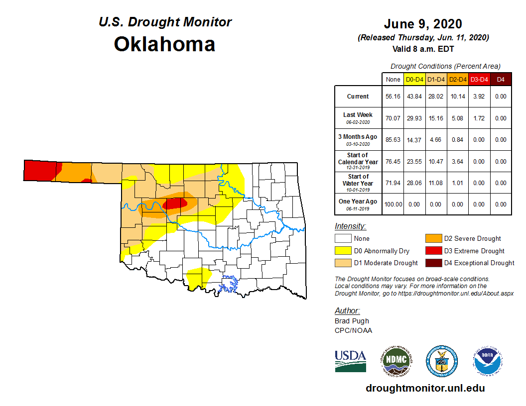
Yep, it's as bad as all those colors make it appear to be. A flash drought is
rapidly intensifying across the northwestern half of the state, and is poised
to continue spreading outside of the confines of its current footprint. A flash
drought is exactly what it sounds like. Much like a "flash flood" as opposed to
"areal flood," a flash drought is one that occurs on a more rapid scale than
your ordinary average drought situation, which can take several months and even
seasons to develop. Flash droughts are especially primed during the summer when
Mother Nature suddenly shuts off the rainfall spigot and withering heat arrives.
This causes the demands from evaporation to similarly increase, and plants are
actively growing, demanding more moisture which they obtain from the soil
moisture and then evaporate it into the air (i.e., transpiration). Thus, the
evapotranspiration demands go into overdrive and a flash drought can thusly
develop.
We have the rapid rain spigot shutoff, especially over the last couple of months.
Here are the rainfall maps for the last 60 days, detailing the reason why we've
seen that portion of drought in Dewey, Blaine and Kingfisher counties go from
moderate to extreme in just a few weeks.
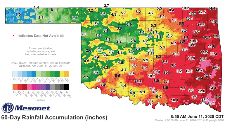
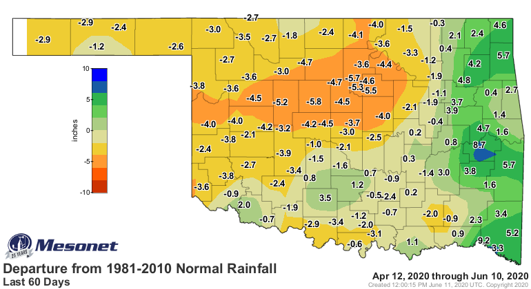
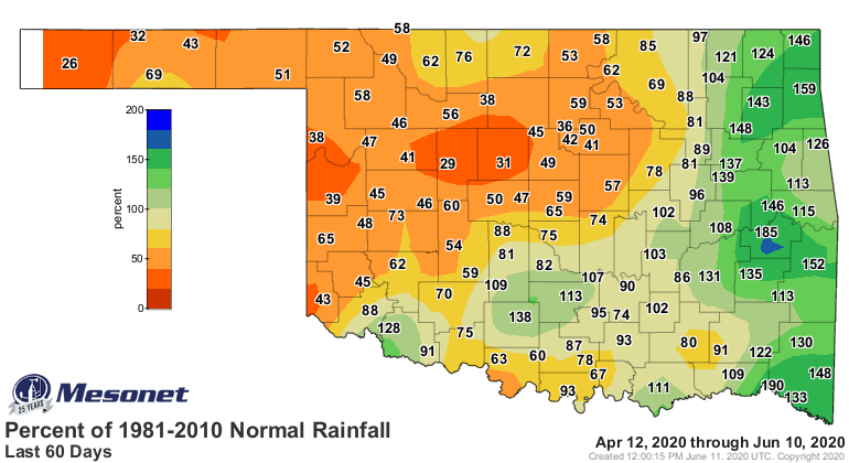
Yikes, right? Nearly all of the northwestern quarter of the state is down at
least a couple of inches over the last 60 days, but the deficits are especially
intense from west central through central Oklahoma at 20-30% of normal. These
deficits are important because they come at the wettest time of the year for
these areas, with the last of the rainy season rapidly dwindling in the rear
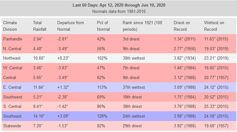
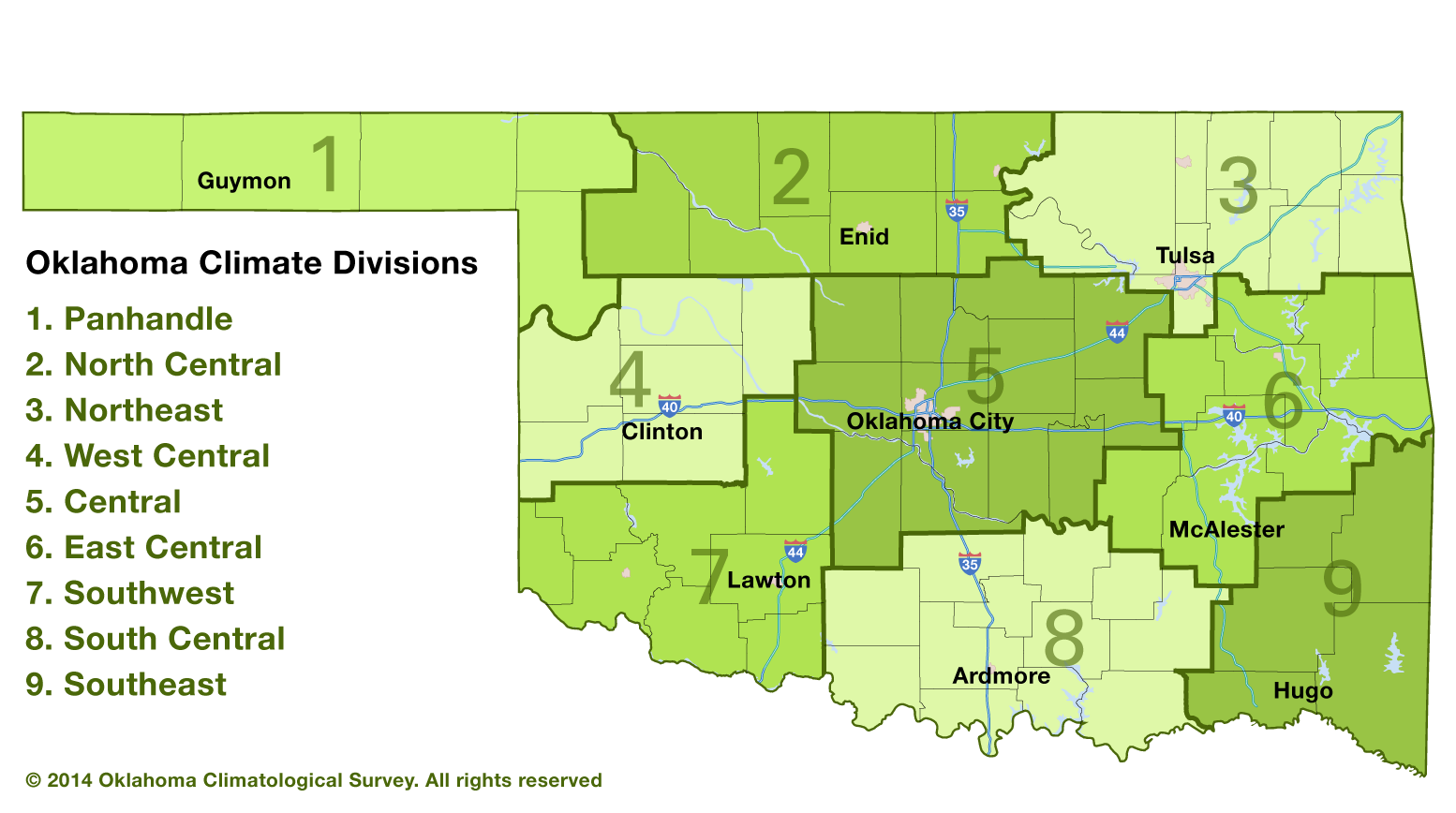
view mirror. The statistics for each climate division also reflect the somewhat
historic dryness in the area. Nearly all of the northwestern quarter of the
state has seen a top-10 driest last 60 days, dating back to at least 1921. For
the Panhandle climate division, it's the 3rd driest.
For individual stations, we're seeing the driest last 60 days on record, which
is no small feat. Watonga, for instance, has seen 2.2 inches of rain over that
60-day period. That's the driest last 60 days since accurate records began
there dating all the way back to 1927, beating out 1996's 2.57 inches for
top spot. 1996 was another horrible drought year in the area, so not a good
omen. Same goes for Arnett. The NWS cooperative observer there has reported
1.95 inches over the last 60 days, the driest for that area back to 1927. So
that's a streak of dryness from the Texas border all the way east to Payne
County spreading drought into those areas.
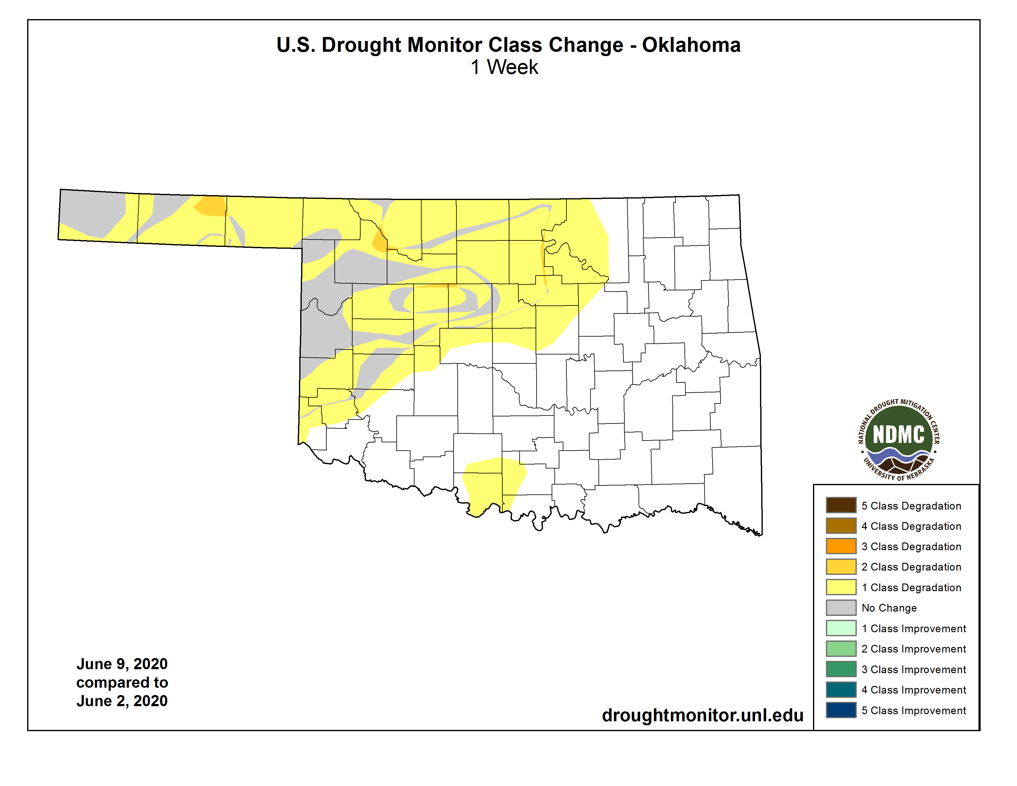
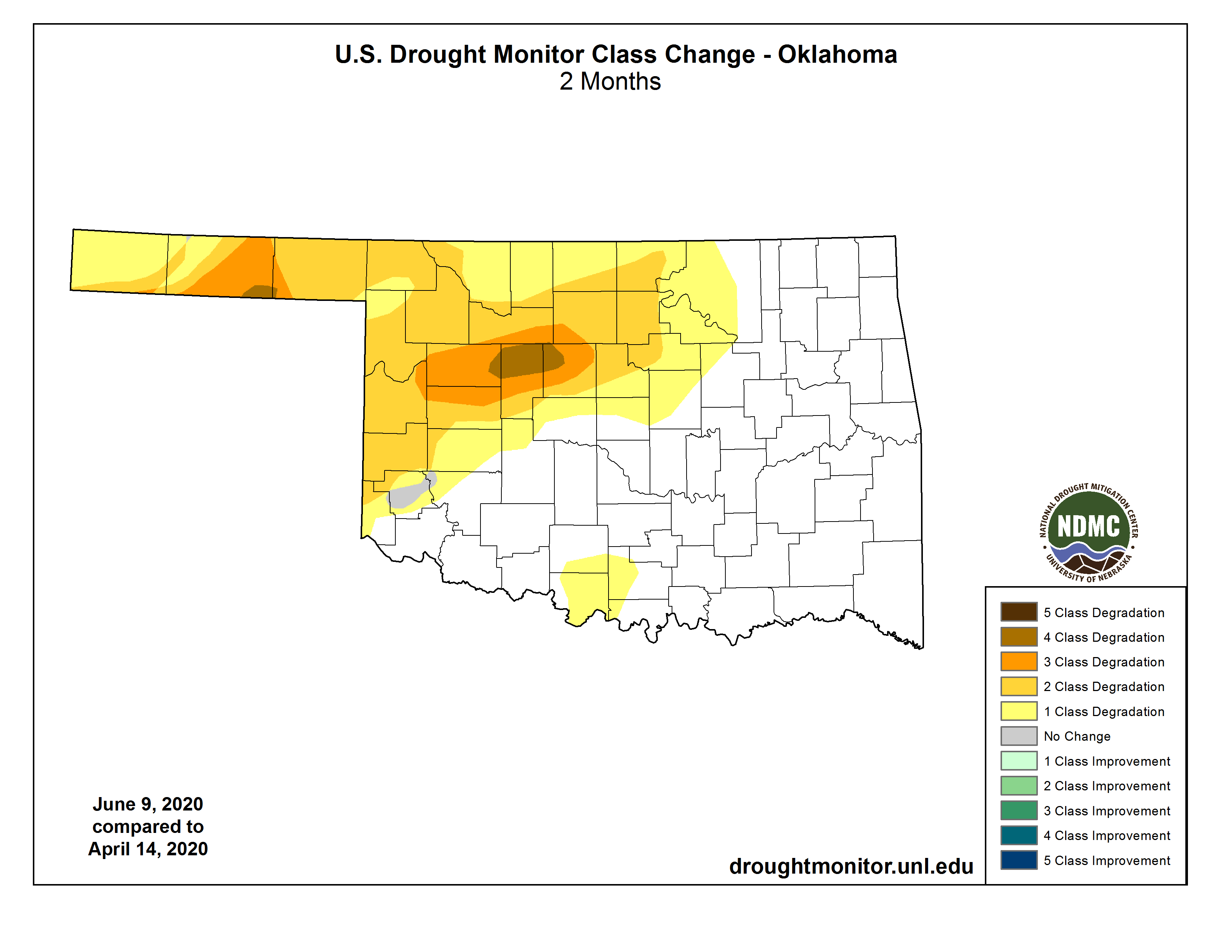
All of this, combined with antecedent dryness, has allowed a rapid transition to
drought, as you can see in these Drought Monitor change maps for the last week
and 8 weeks.
The 28% of the state covered in drought amounts to the most we've seen in the
state dating back to August 28, 2018. And unfortunately, it's going to get
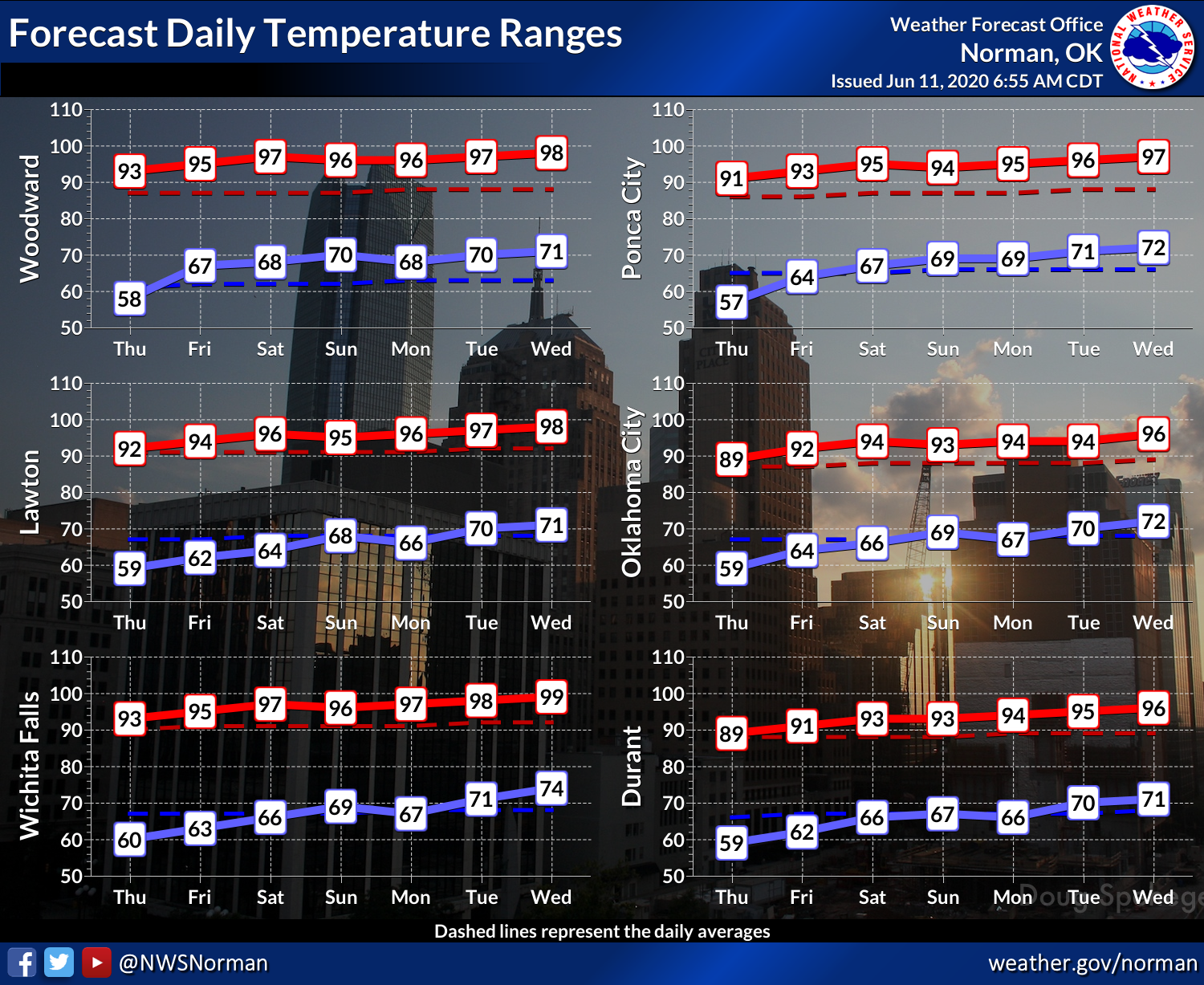
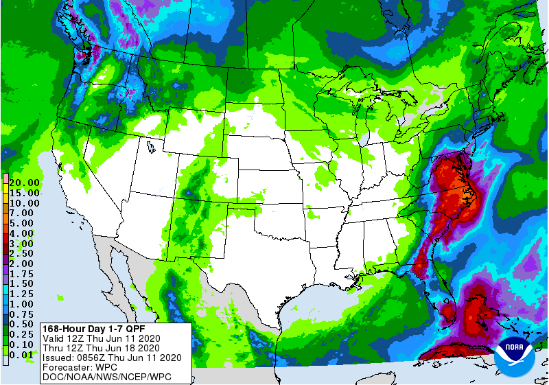
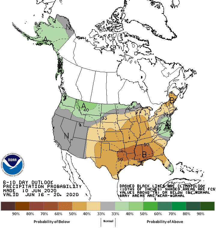
worse before it gets better. We're about to see that death ridge set up over
the state, killing any rain chances we have. The 7-day and then the outlooks
for next week show heat heat heat, and dry dry dry.

So we've got out work cut out for us in the next couple of weeks. We might
need some tropical magic to get out of this one.
Gary McManus
State Climatologist
Oklahoma Mesonet
Oklahoma Climatological Survey
(405) 325-2253
gmcmanus@mesonet.org
June 11 in Mesonet History
| Record | Value | Station | Year |
|---|---|---|---|
| Maximum Temperature | 108°F | ALTU | 2022 |
| Minimum Temperature | 44°F | KENT | 2004 |
| Maximum Rainfall | 6.05″ | COPA | 2007 |
Mesonet records begin in 1994.
Search by Date
If you're a bit off, don't worry, because just like horseshoes, “almost” counts on the Ticker website!