Ticker for June 9, 2020
MESONET TICKER ... MESONET TICKER ... MESONET TICKER ... MESONET TICKER ...
June 9, 2020 June 9, 2020 June 9, 2020 June 9, 2020
Cough Cough!
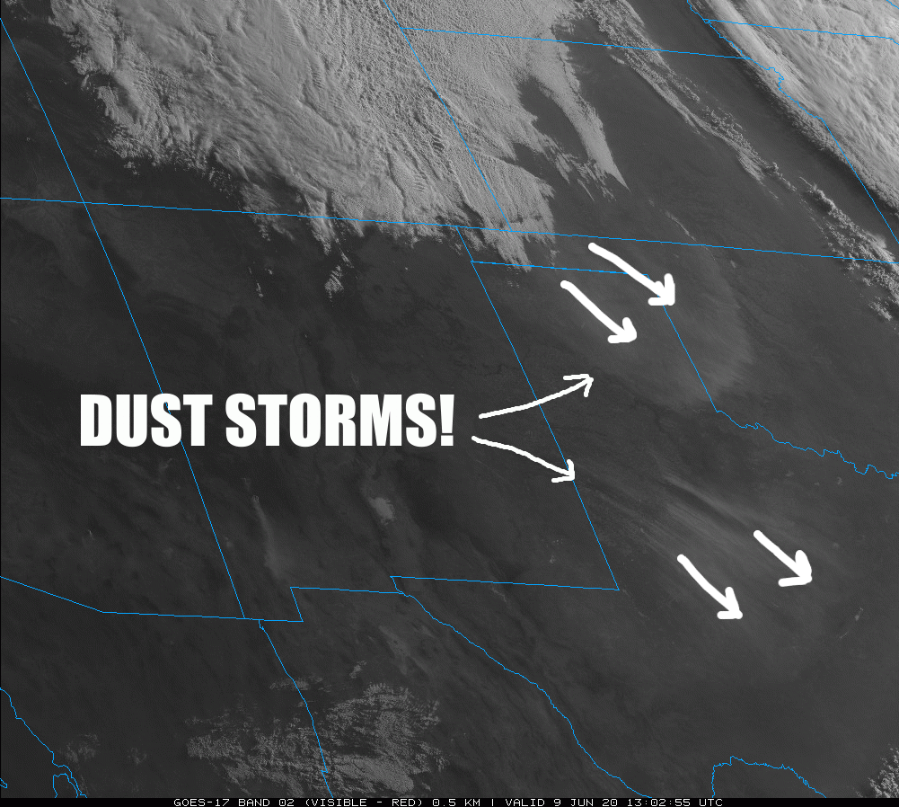
Holy 1936, Iron Man (sorry, I'm a Marvel guy)! We are getting reports across
western Oklahoma of a big duster moving in from the west, with visibilities down
to less than a mile. Not quite Dust Bowl bad, but bad enough, right? We've known
this was coming, but it's always a bit uncertain how much dust the winds could
actually pick up and carry with them. With most of the High Plains from NE Colorado
through our Panhandle and points south in extreme drought, there is simply a lot
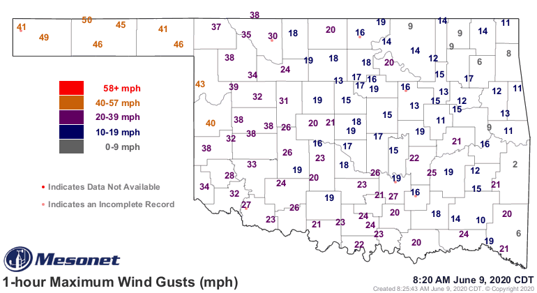
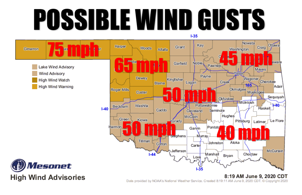
of untethered soil pick up and move. This wind is being borne on winds of 40-50
mph, and the real wind hasn't even started yet. Maximum gusts in the Panhandle
could reach 75 mph!
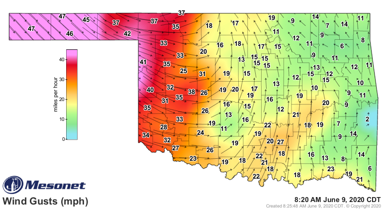
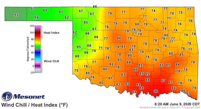
All of this comes courtesy of a vigorous low pressure system that's mixing down
strong jet stream winds to the surface, and also dragging a cold front through
the Southern Plains. Check out the Panhandle in the 50s! Shown on the heat index
map, that moist air in southern Oklahoma is about to go bye bye.
Wind warnings/advisories are out for almost the entire area, so tie down anything
that will fly away. Guys with toupees, first off...I salute your courage, but
don't look into the wind or you'll be looking for your hair in northern Texas.
Well, that's about it. Hunker down, stay indoors if you can because the air
quality is about to go south, literally.
Gary McManus
State Climatologist
Oklahoma Mesonet
Oklahoma Climatological Survey
(405) 325-2253
gmcmanus@mesonet.org
June 9 in Mesonet History
| Record | Value | Station | Year |
|---|---|---|---|
| Maximum Temperature | 104°F | ALTU | 2011 |
| Minimum Temperature | 43°F | EVAX | 2020 |
| Maximum Rainfall | 5.12″ | BOWL | 2008 |
Mesonet records begin in 1994.
Search by Date
If you're a bit off, don't worry, because just like horseshoes, “almost” counts on the Ticker website!