Ticker for June 8, 2020
MESONET TICKER ... MESONET TICKER ... MESONET TICKER ... MESONET TICKER ...
June 8, 2020 June 8, 2020 June 8, 2020 June 8, 2020
I said Cold Cold Cold
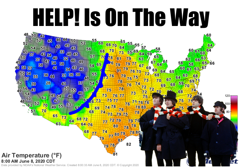
Oh, the temperature has been brutal, ya say? Well, try locating a cold front
in the mountains! We gave it our best shot. But yes, a cold front is indeed on
its way to help cool us down from what has been some of the hottest early June
weather in our history. Temperatures have been 10-15 degrees above normal for
several days in a row, coming close or even exceeding records. We've certainly
expanded these two maps.
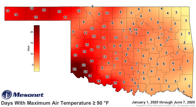
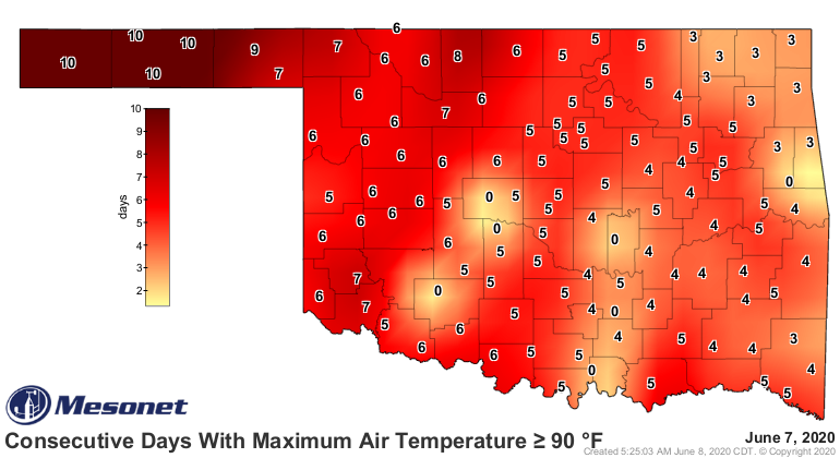
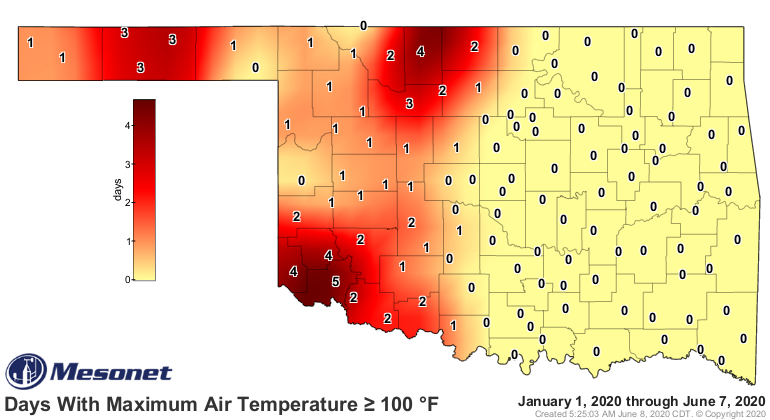
We don't have a map like this for "days above whatever" heat index values, but
it'd look just as nasty. We do have some big weather events occurring over the
next few days. Unfortunately, they don't really involve lots of rain. One sort
of does, but it's more about how big rain will miss us.
First we have the cold front that should arrive overnight into tomorrow. Look
at how it will impact northwestern Oklahoma tomorrow, as far as temperatures
go.
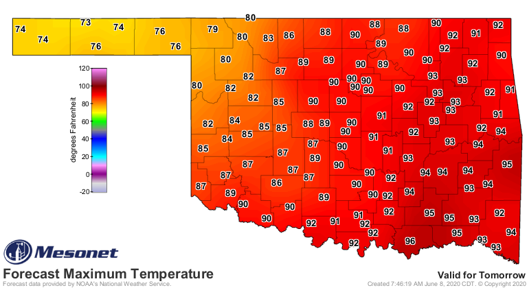
Wow, are you kidding me!?! Highs in the 70s? The rest of the state will see a
big cool down as well as the day goes on...but the northwest will miss out on
the early daytime heating. Temperatures will drop into the 70s as the front
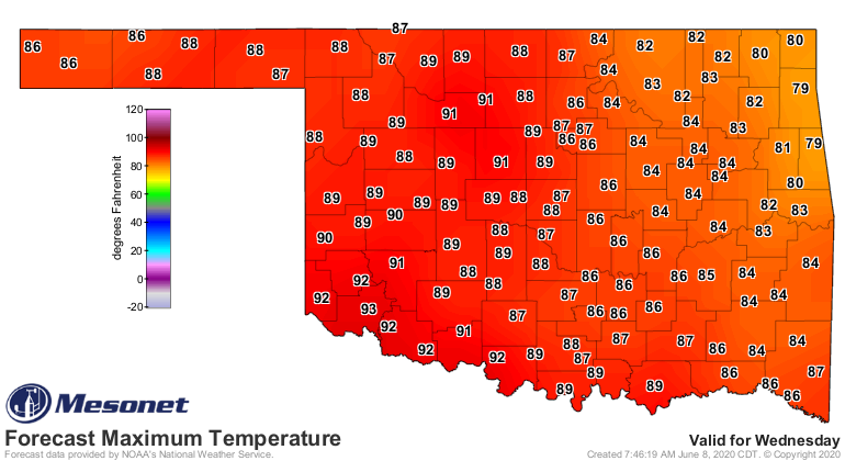
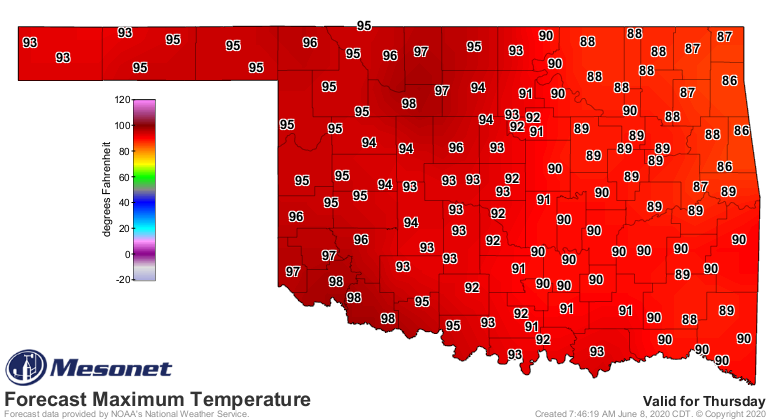
moves through your area as well. After that, Wednesday will be "normal," then
back to the frying pan afterwards.
The problem with this front is it's going to be dry...no moisture to work
with. So that means lots of wind, blowing dust, and worst of all -- fire danger.
Winds could gust well into severe categories across the northwest tomorrow,
as detailed by NWS Amarillo's description here. And wind advisories are already
out.
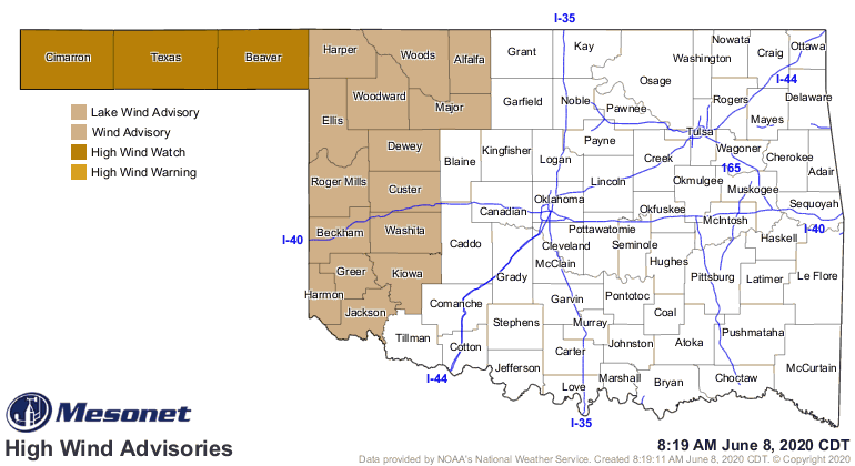
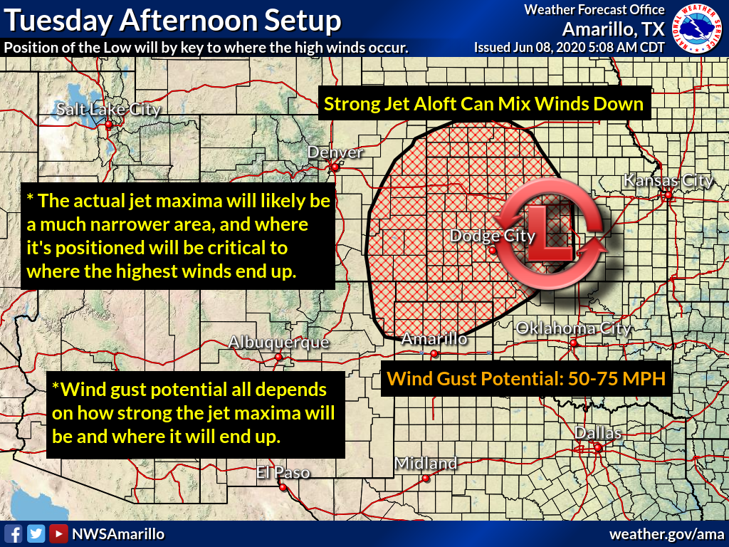
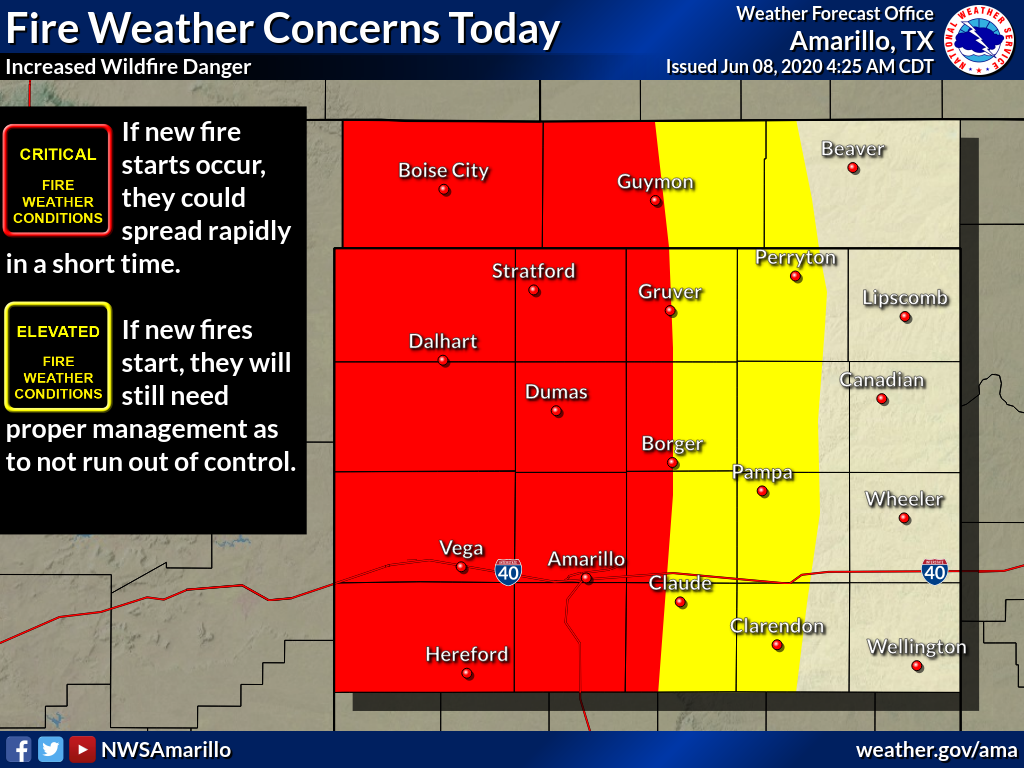
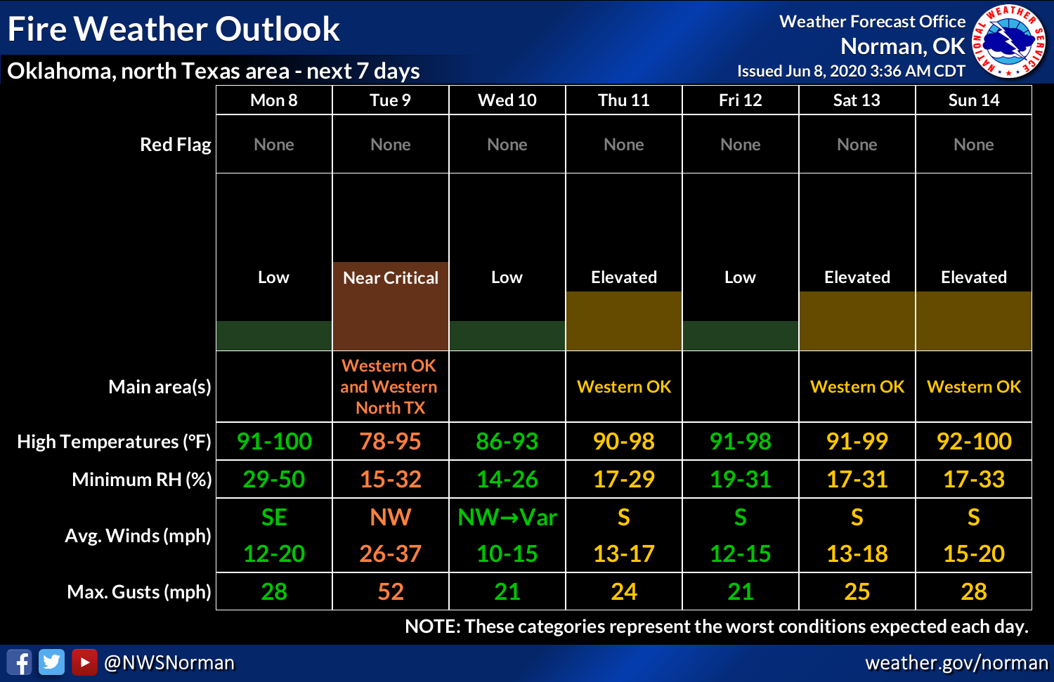
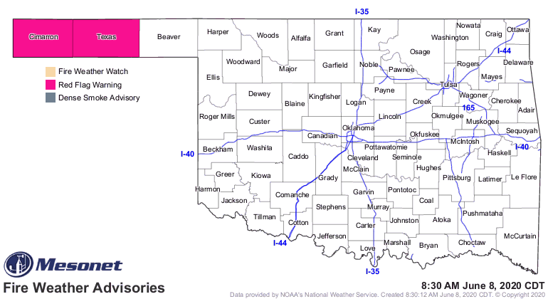
Uhhhhh, 75 mph winds? Hi, dust storms! That area of the High Plains has been in
severe/extreme drought for months. There's simply not enough vegetation to hold
the soil down. And the fire danger is going to be off the charts. That won't
end anytime soon, either. Watch for these fire alerts to expand as we get into
tomorrow.
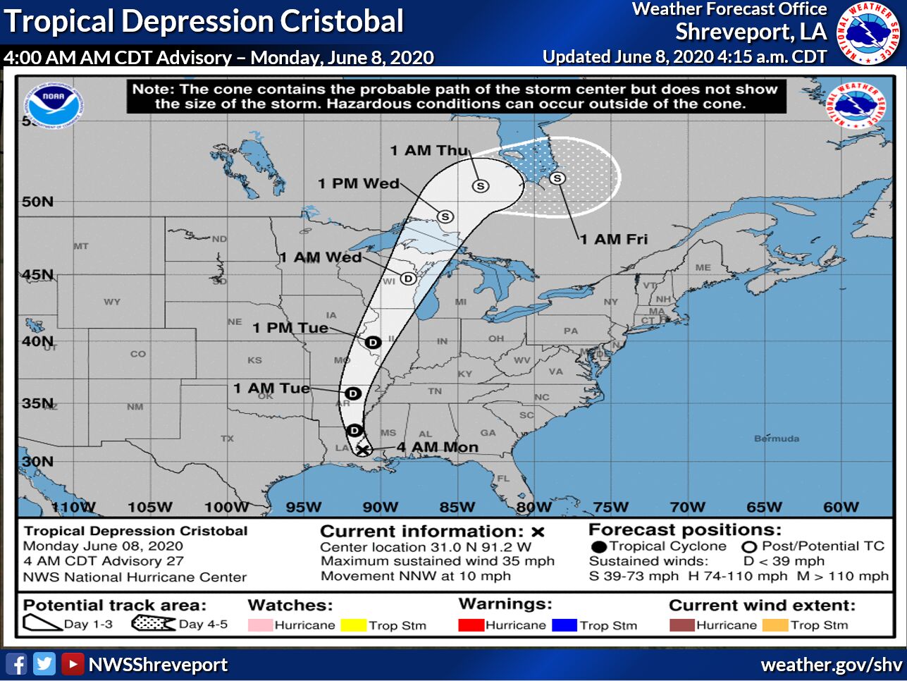
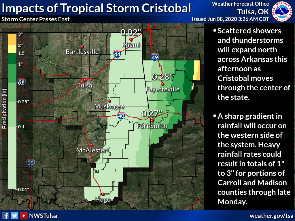
Then we come to eastern Oklahoma's (non-) news, the near miss of Tropical Storm
Cristobal. It could have at least shifted a couple hundred miles to the west
and drenched western Oklahoma, eastern Oklahoma doesn't need the rain that
badly. But, it's off into Arkansas, pushed to the east and northeast by that
front and incoming low pressure system.
We're going to be trapped for awhile in this type of pattern, brought on by an
early but persistent bout of summer doldrums. Next week isn't promising just
yet.
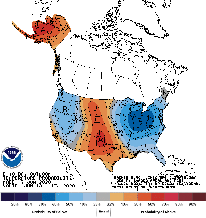
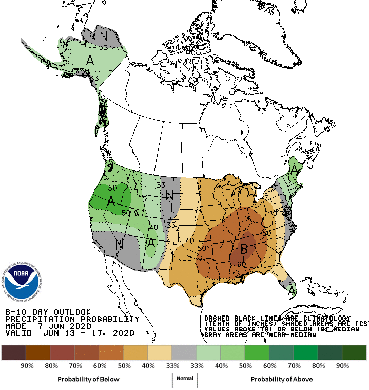
We're looking way too 2011'ish with all this heat and abrupt end of any
rainfall. So the news is "okay-to-bad" for a bit. I'll try to end on a high
note here. Here is the forecast temperature map for 7pm tomorrow from one
forecast model (brought to you by the Mesonet's OK-FIRE program):
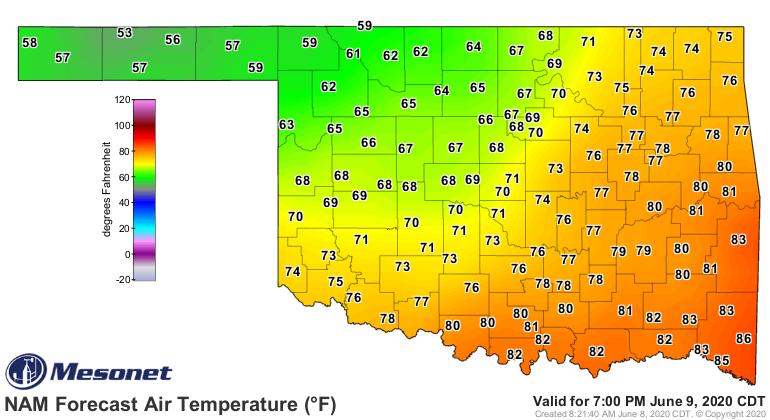
I won't show ya the winds. I said I was ending on a high note!
Gary McManus
State Climatologist
Oklahoma Mesonet
Oklahoma Climatological Survey
(405) 325-2253
gmcmanus@mesonet.org
June 8 in Mesonet History
| Record | Value | Station | Year |
|---|---|---|---|
| Maximum Temperature | 107°F | FREE | 2011 |
| Minimum Temperature | 38°F | BOIS | 2007 |
| Maximum Rainfall | 5.42″ | ALVA | 1995 |
Mesonet records begin in 1994.
Search by Date
If you're a bit off, don't worry, because just like horseshoes, “almost” counts on the Ticker website!