Ticker for June 4, 2020
MESONET TICKER ... MESONET TICKER ... MESONET TICKER ... MESONET TICKER ...
June 4, 2020 June 4, 2020 June 4, 2020 June 4, 2020
Drought Abounds
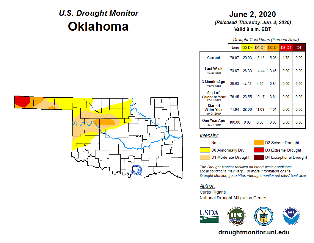
Barely time enough to Tick, but this is something we've been Tocking about for
months, and unfortunately it's accelerating, as feared...drought is now becoming
the primary weather hazard for much of northern and western Oklahoma. We can focus
on several different time frames, but just looking at the last 60 days -- a prime
rainy period in Oklahoma -- will give us a pretty darned good clue at what's going
on.
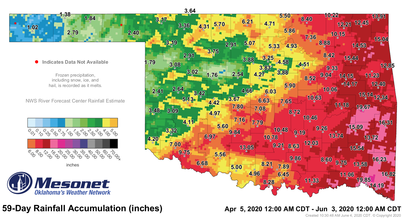
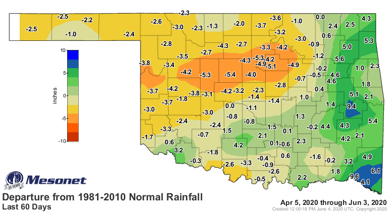
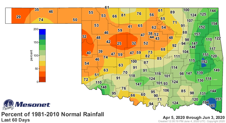
The maps speak for themselves, but never let me say I gave up an opportunity to
interrupt a good dialogue. We have long-term drought going on in the far
western Panhandle, an area that had been in severe drought going back to
February, which is why it has gone to extreme drought this week. In central
Oklahoma, that area from Dewey to Kingfisher County, and surrounding areas,
is an example of flash drought. Just like it sounds, a flash drought occurs
when we see a rapid diminishing of precipitation coinciding with an increase
in evaporative demands. With the heat we are now seeing, those two factors
combined to produce moderate to severe drought over a broad range of western
into central and northern Oklahoma.
What about prospects for relief? Well, not so great, but not hopeless, either.
We do see a chance for storms today (severe or not, bring it on!), which should
put some water down here and there across the state.
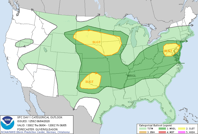
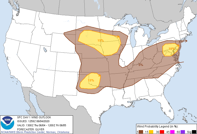
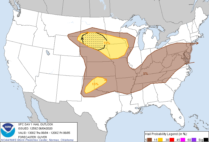
Nothing TOO bad here...some wind and hail. Again, hopefully some rain. Things
aren't looking too good for that area, however, with the 7-day rainfall forecast
looking a bit bleak out that way.
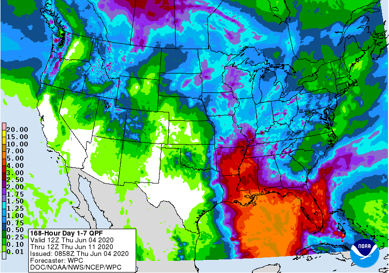
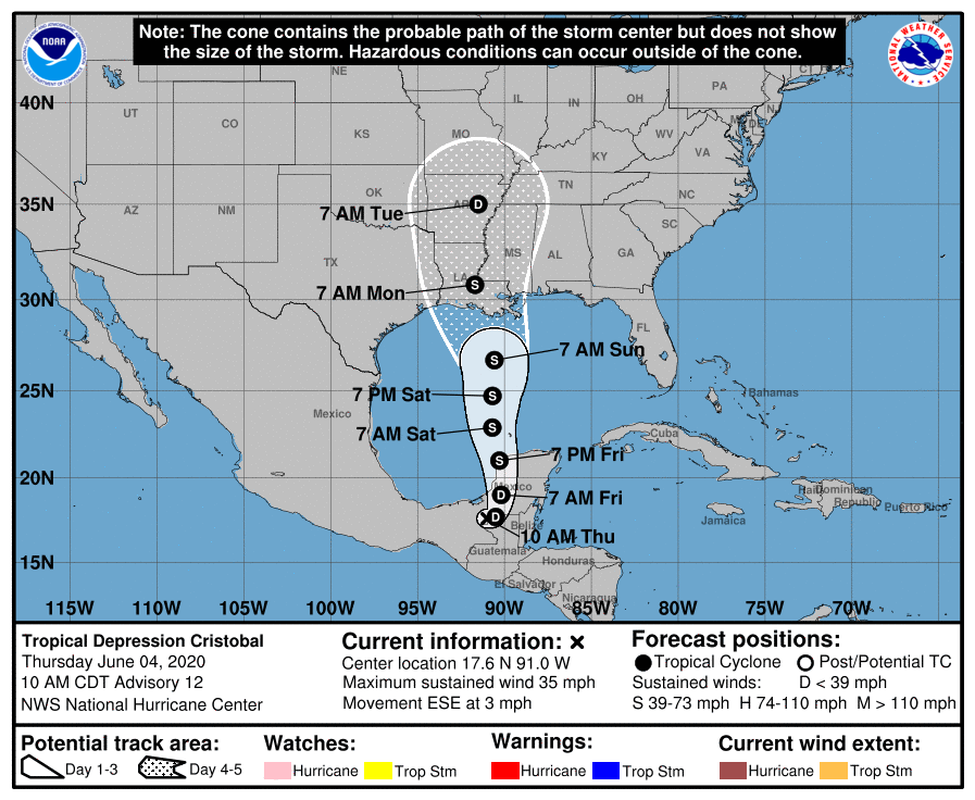
If we could get Cristobal to shift about 200 miles to the west, then we'd
be talking! That will mostly likely NOT happen, however. Arkansas will probably
receive a lot of unwanted rain for that area.
Gary McManus
State Climatologist
Oklahoma Mesonet
Oklahoma Climatological Survey
(405) 325-2253
gmcmanus@mesonet.org
June 4 in Mesonet History
| Record | Value | Station | Year |
|---|---|---|---|
| Maximum Temperature | 107°F | GRA2 | 2014 |
| Minimum Temperature | 43°F | EVAX | 2025 |
| Maximum Rainfall | 8.23 inches | GRAN | 1995 |
Mesonet records begin in 1994.
Search by Date
If you're a bit off, don't worry, because just like horseshoes, “almost” counts on the Ticker website!