Ticker for May 13, 2020
MESONET TICKER ... MESONET TICKER ... MESONET TICKER ... MESONET TICKER ...
May 13, 2020 May 13, 2020 May 13, 2020 May 13, 2020
And then all hail broke loose
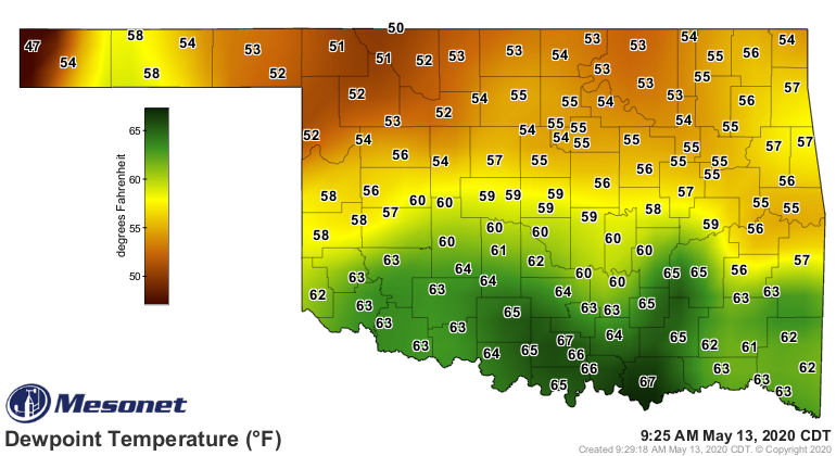
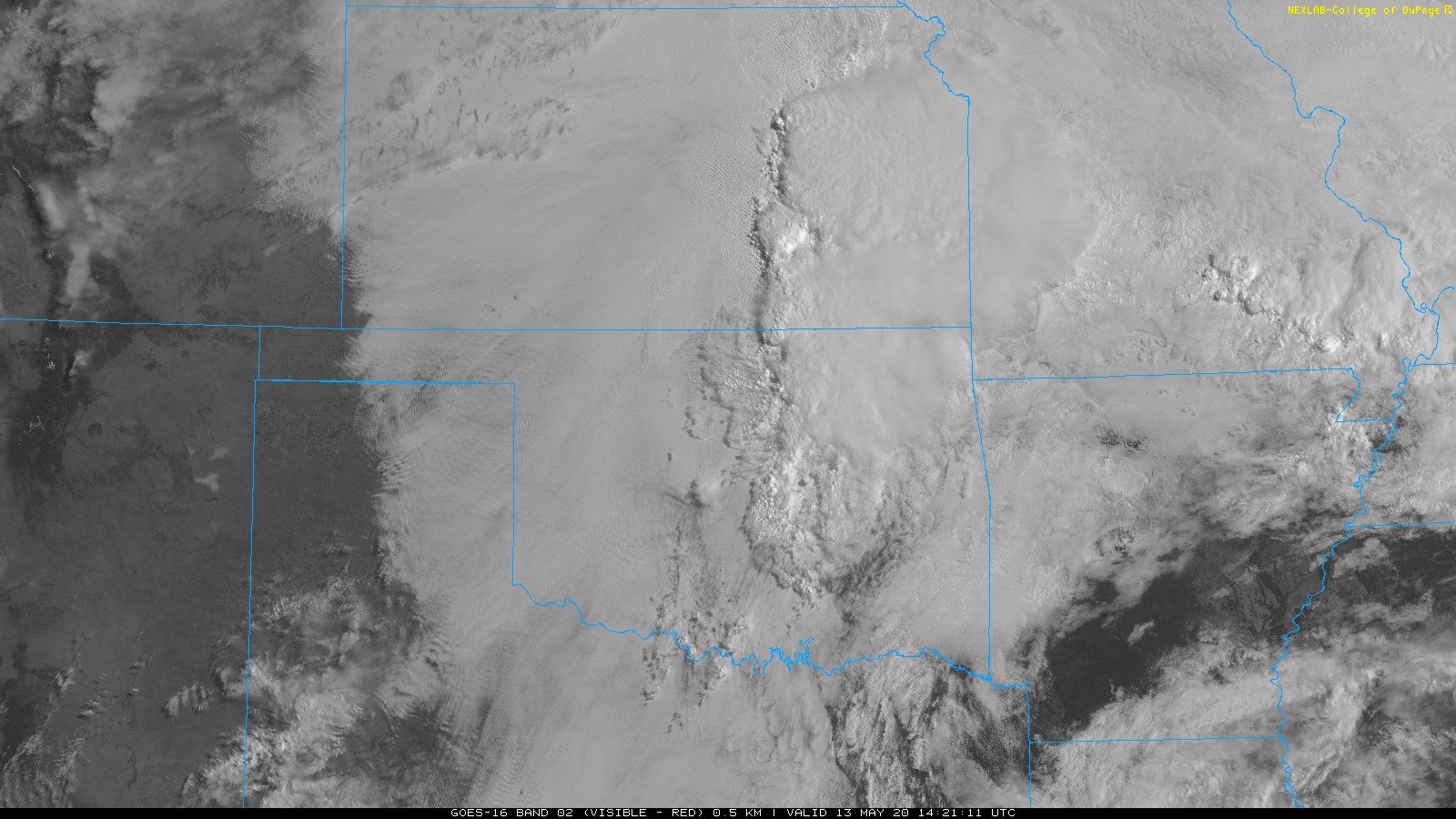
We're sitting here, socked in (better than being a shoe in, from what I
understand) with low clouds as we await the warm front across southern Oklahoma
fixing to (Okie-to-English translation: "about to") complete its trip north,
bringing that warm (duh!) moisture-rich air with it. Check out those dewpoints in
the 60s down that way; fuel for storms later on. You can also see our sockiness
on the current satellite map.
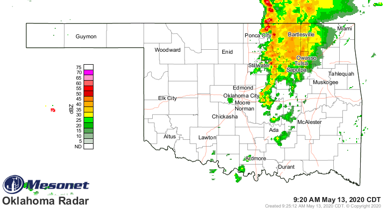
That area bubbling up there east of I35 is a round of storms moving through the
state.
The setup for today is a familiar one in Oklahoma, but more familiar this year
since we're looking at giant hail being the big baddy today. Here are the
outlooks from SPC for today's severe weather scenario.

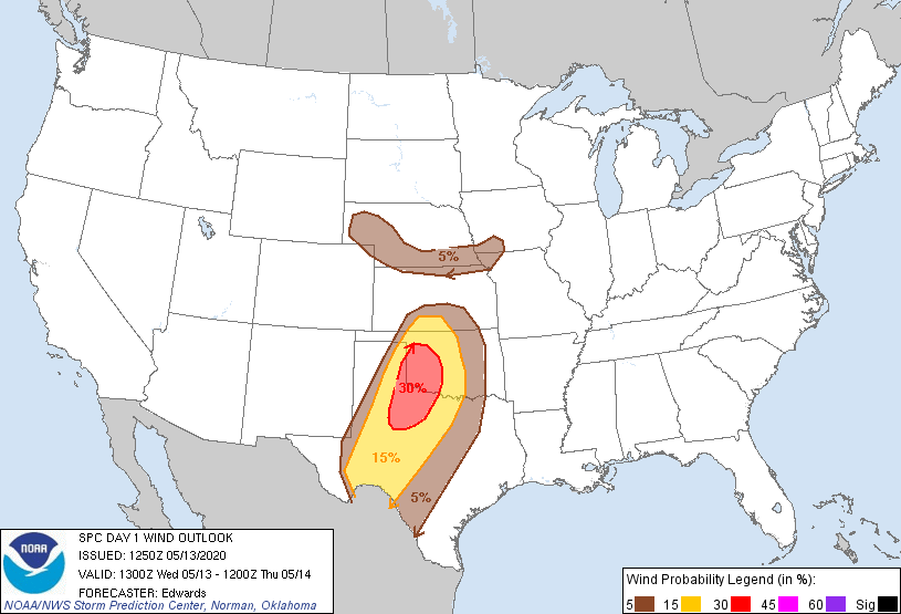
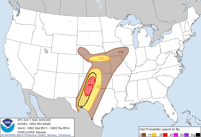
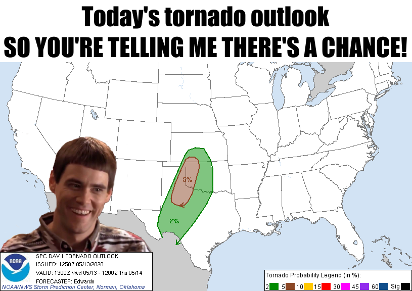
So there is a low chance for tornadoes, as evidenced by our Dumb (or Dumber)
friend at the top, but the chance for giant hail is elevated out across far
western Oklahoma. That hatched area indicates a 15-30 percent probability of
2-inch diameter hail OR LARGER within 25 miles of a single point. That area
has already had a couple of really nasty run-ins with tennis ball to softball
size hail, as has other parts of the state.
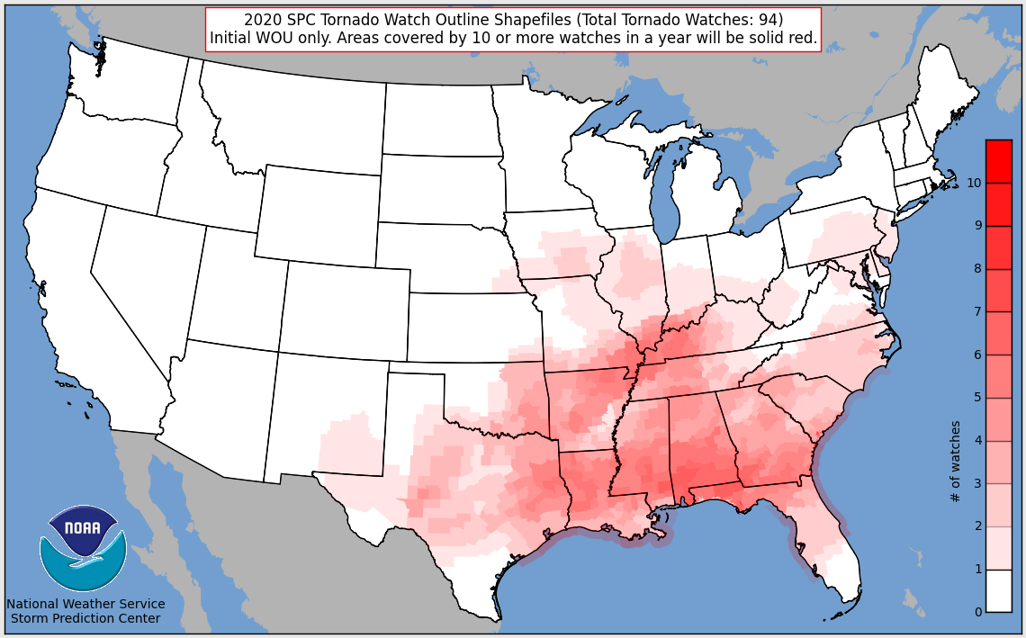
We can see from SPC's accounting of this year's tornado watches that western
Oklahoma has escaped the twister fun this year for the most part. The farthest
west tornado I can find from this year is an EF1 fella that struck near Rush
Springs in Grady County on April 21.
It's important to not take today too lightly, of course. This is a day to stay
weather aware. When new data starts pouring in as the event draws near, these
outlooks could change for the worse...or better. Best to be prepared for the
worse part and hope for the better part.
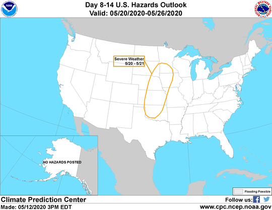
Once we get by today, there will be other chances for storms over the next few
days, but nothing as organized as today looks. Then we enter into a period of
hot, dry weather before we see another chance of storms headed into next
weekend.

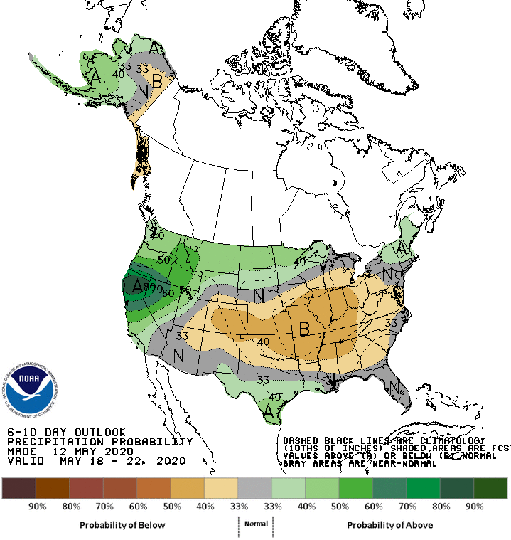
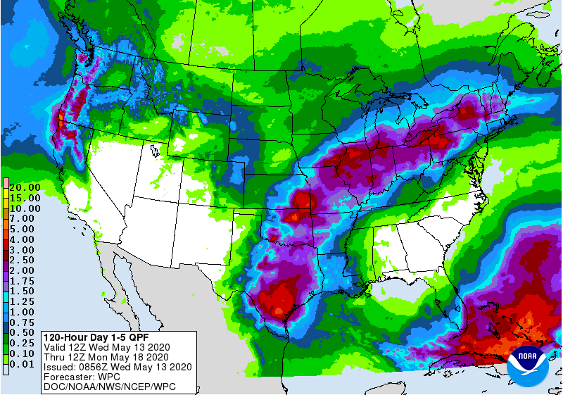
These next few days are our good chance of rain for awhile, so western Oklahoma
needs this to hit. Not so much for points east.
Best advice for today? Fire up those armored vehicles, especially across
western Oklahoma.
Gary McManus
State Climatologist
Oklahoma Mesonet
Oklahoma Climatological Survey
(405) 325-2253
gmcmanus@mesonet.org
May 13 in Mesonet History
| Record | Value | Station | Year |
|---|---|---|---|
| Maximum Temperature | 101°F | ALTU | 2025 |
| Minimum Temperature | 30°F | BOIS | 2000 |
| Maximum Rainfall | 4.41″ | JAYX | 2004 |
Mesonet records begin in 1994.
Search by Date
If you're a bit off, don't worry, because just like horseshoes, “almost” counts on the Ticker website!