Ticker for May 1, 2020
MESONET TICKER ... MESONET TICKER ... MESONET TICKER ... MESONET TICKER ...
May 1, 2020 May 1, 2020 May 1, 2020 May 1, 2020
Bring on May
Steel yourselves, ladies and gentlemen (and the rest of you...you know who you
are), April is out the door and May is here to surprise us. Better to surprise us
I guess than give us the usual May. How about NO tornadoes? How about some decent
rainfall across the west, and a lack of indecent rainfall in the east? How about
no 50s for highs, and no 100s? Okay, I'm struggling with that one. Here's one a
bit more palatable...how about no volcanoes?
Let's look back at April, as we prepare for a scorching weekend (and early next
week). April darned near had it all weatherwise...snow, heat, drought, tornadoes,
and hail so big you had to use two hands to hold it. Bring on May, it has to do
us better, right?
---------------------------------------------------------------------------------
Weather Hazards Battle for April Headlines
It’s difficult to say which weather hazard should claim top billing for April.
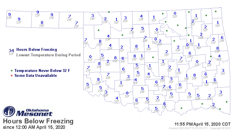
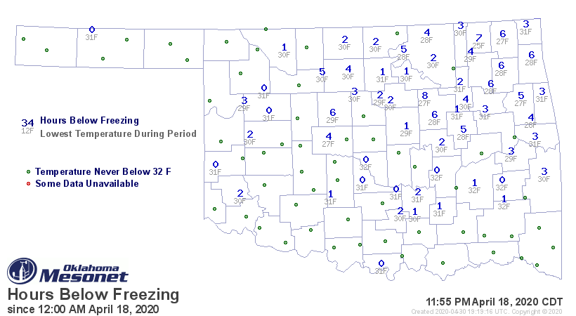
Two late season freeze events made their pitch by battering the state’s winter
wheat crop and fruit orchards, primarily on the 15th and again on the 18th.
Temperatures dropped into the 20s as far south as the Red River, with a bit of
light snow falling across the western half of the state during the extended
cold snap.
Drought also made a bid for the top spot by threatening to spread from its
confines in the far western Panhandle to a much broader area of western
Oklahoma. Some locations barely had enough moisture to wet the topsoil, further
damaging agricultural interests. A burn ban was implemented in Texas County due
to extreme fire danger, a result of the dry conditions. Despite the impacts of
those hazards, the winner of the headline battle went to the gold standard of
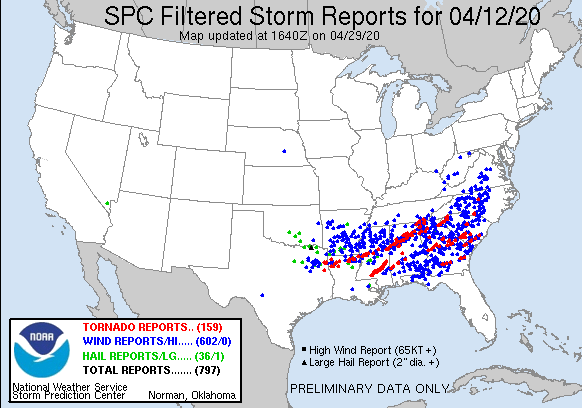
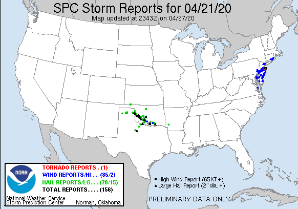
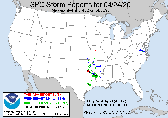
Oklahoma’s springtime hazards – severe weather. Four different storm systems
brought violent weather to Oklahoma during April, including hail from the size
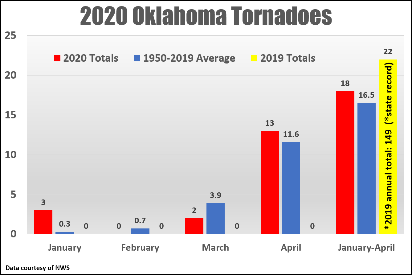
of golf balls up to softballs, damaging winds of over 80 mph, and at least 13
tornadoes.
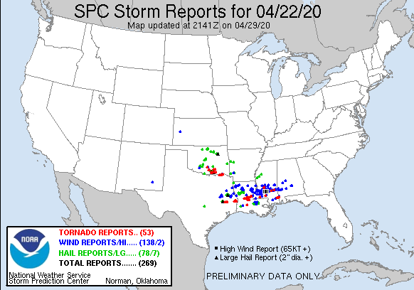
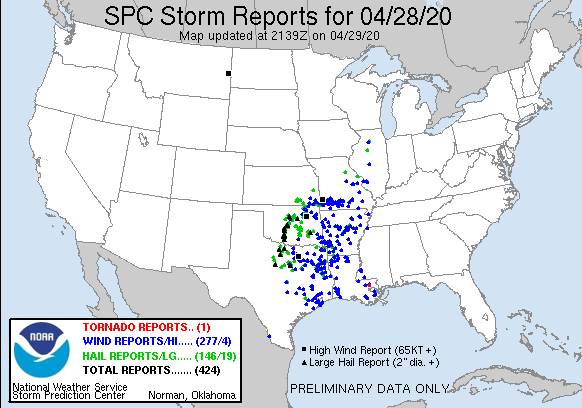
The worst of those twisters struck southern portions of Madill late on the
afternoon of the 22nd, killing two and destroying at least a dozen homes and
businesses. The tornado was rated as an EF2 by National Weather Service
investigators. Another EF2 twister touched down in McCurtain County on the
28th. The two fatalities were the first in the state due to a tornado since
May 25 of 2019, when a tornado struck El Reno. The 13 confirmed tornadoes
raised the preliminary 2020 total to 18. Average for January-April in Oklahoma
is 16.5.
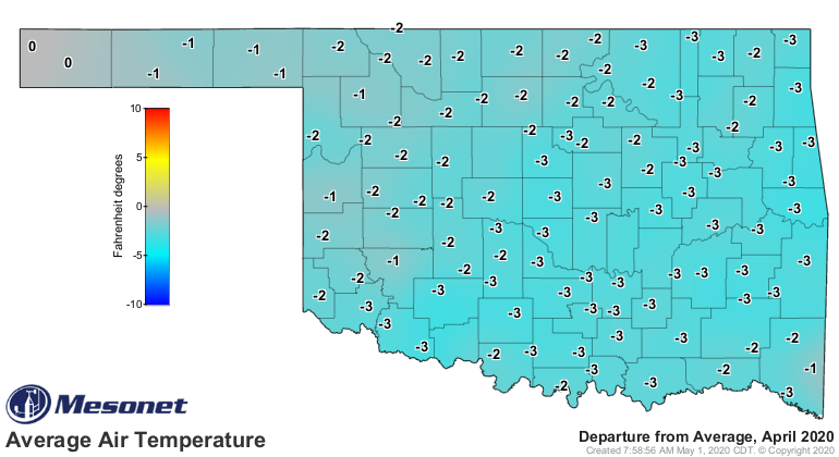
According to preliminary data from the Oklahoma Mesonet, the statewide average
temperature for the month was 57.5 degrees, 1.8 degrees below normal to rank as
the 28th coolest April since records began in 1895.
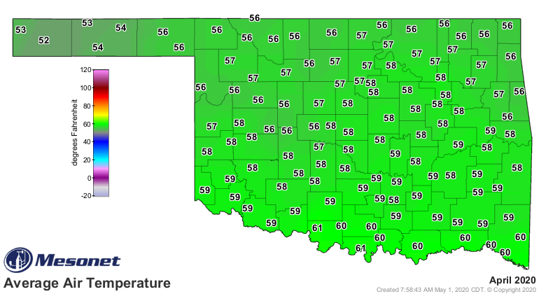
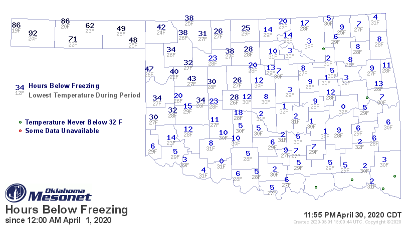
Altus recorded the month’s highest temperature of 98 degrees on the 28th.
Kenton dropped to 19 degrees during the April 15 freeze event for the state’s
lowest reading. Hours spent below freezing ranged from 92 at Boise City to
about an hour at several locations across the southeast. Six of the Mesonet’s
120 stations failed to fall below freezing during April.
The first four months of the year remained 1.9 degrees above normal at 49.3
degrees, the 20th warmest January-April on record.
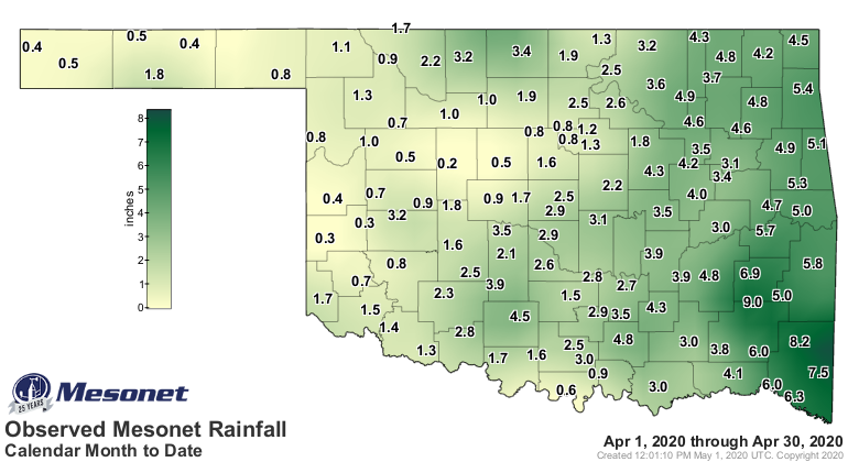
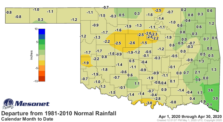
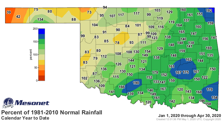
The statewide average precipitation total finished at 2.69 inches to rank as
the 43rd driest April on record at 0.57 inches below normal. Thirty-four
Mesonet sites recorded at least 4 inches of rain for the month, with 13 of
those seeing 5 inches or more. Clayton led the state with 9.01 inches.
Twenty-seven sites saw an inch or less with Watonga bringing up the rear at
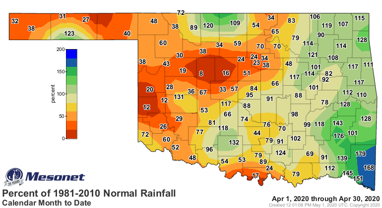
0.23 inches. The eastern quarter of the state had surpluses ranging from 1-3
inches for April, while parts of western and central Oklahoma suffered deficits
of nearly 3 inches. West central Oklahoma’s total of 0.83 inches was 1.58
inches below normal to rank as their 13th driest on record, while the southeast
saw their 32nd wettest at 6.22 inches, 1.74 inches above normal.
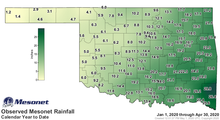
The January-April statewide average was 13.16 inches, 3.47 inches above normal
to rank as the 10th wettest on record.

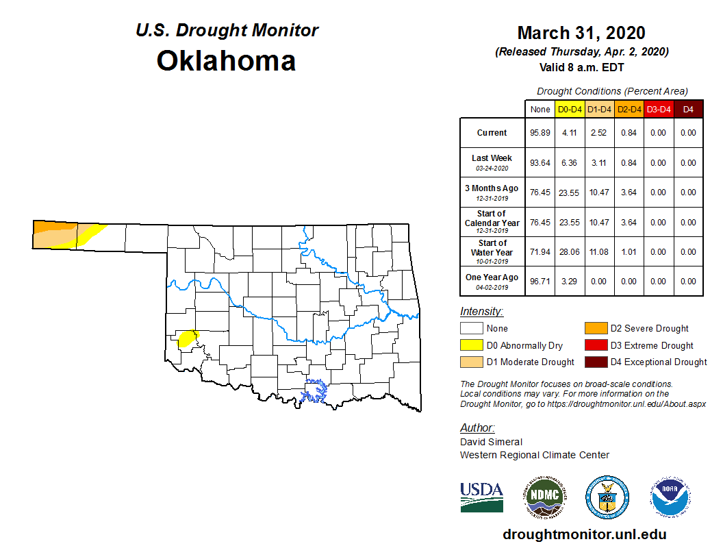
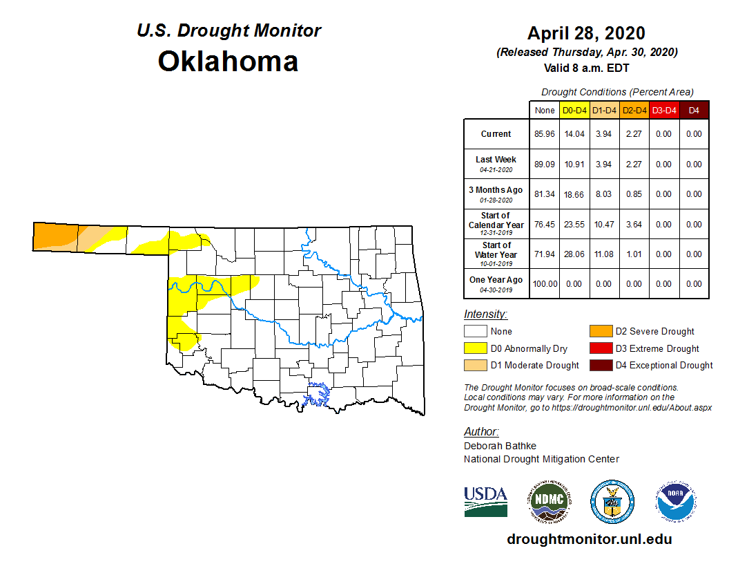
The persistent moderate to severe drought conditions across the western
Panhandle expanded slightly eastward during April, but the amount of
“abnormally dry” conditions – signifying areas in danger of drought – increased
from 4% at the end of March to 14% at the end of April. The new areas were
contained entirely within the western half of the state.
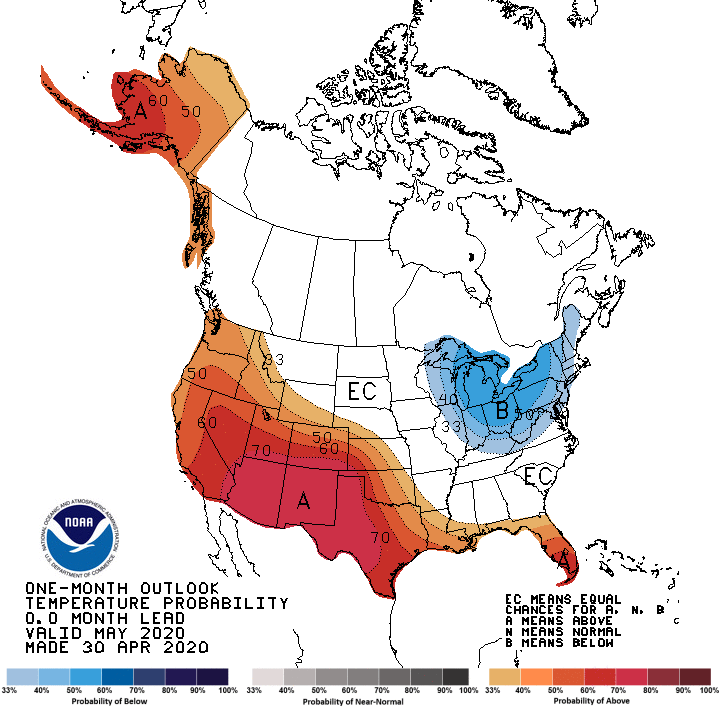
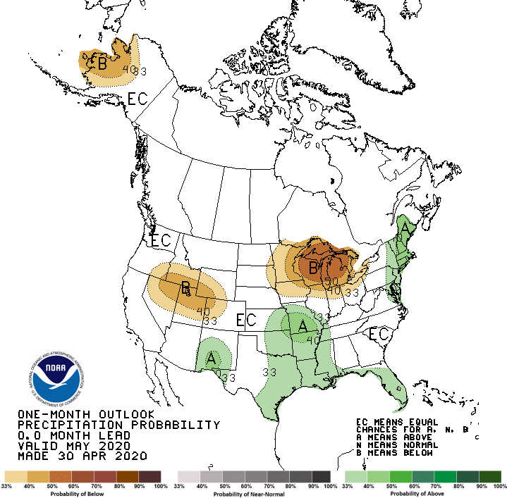
The May temperature and precipitation outlooks from the Climate Prediction
Center (CPC) don’t hold much hope for alleviating the dry areas of western
Oklahoma. Greatly increased odds of above normal temperatures are indicated
for far western Oklahoma, with increased odds for above normal precipitation
confined to the eastern two-thirds of the state. The increased heat would
exacerbate the loss of soil moisture across western Oklahoma, possibly
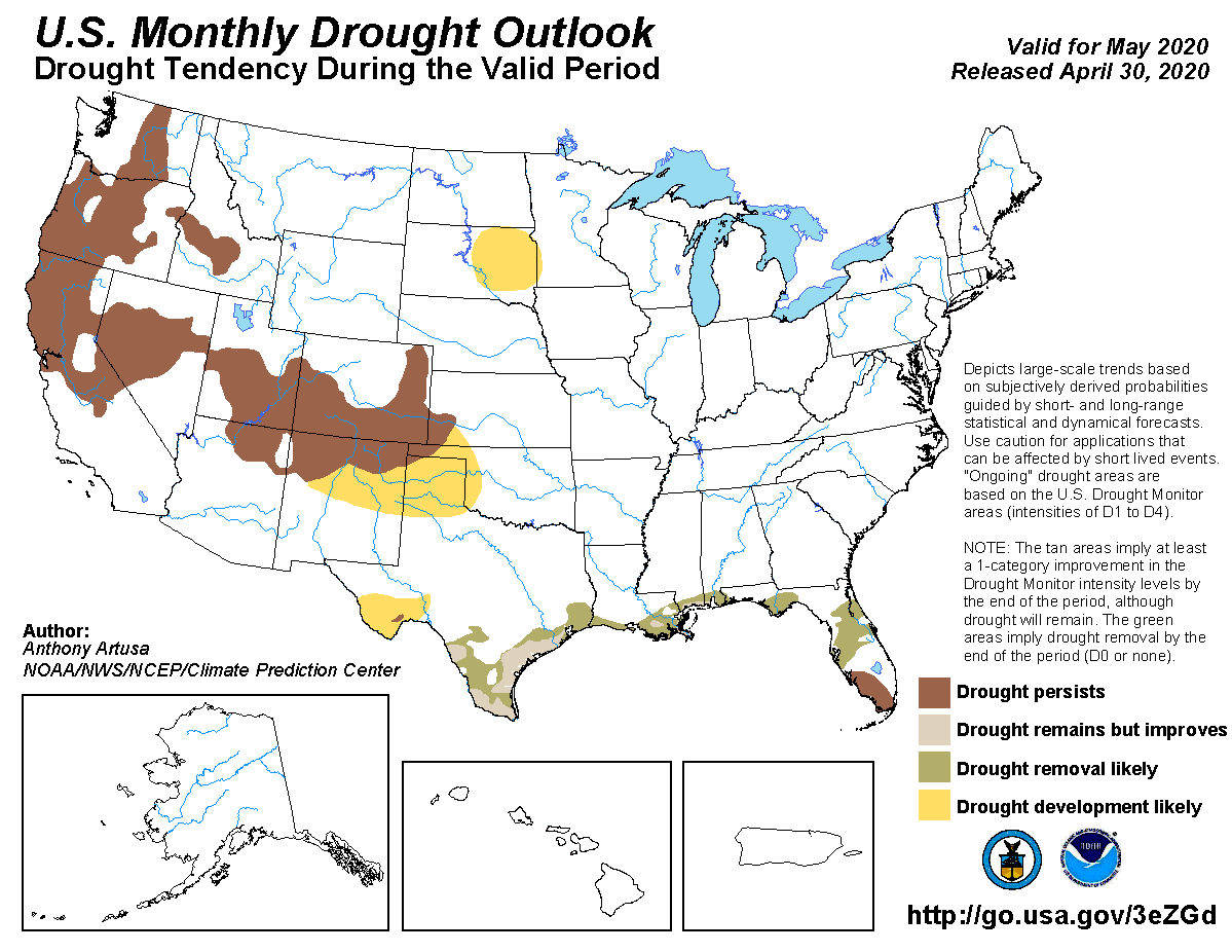
intensifying and expanding the existing drought conditions. CPC’s May Drought
Outlook reflects that thinking with the western one-quarter of Oklahoma
expected to see drought development through the month.
Gary McManus
State Climatologist
Oklahoma Mesonet
Oklahoma Climatological Survey
(405) 325-2253
gmcmanus@mesonet.org
May 1 in Mesonet History
| Record | Value | Station | Year |
|---|---|---|---|
| Maximum Temperature | 101°F | ALTU | 2002 |
| Minimum Temperature | 28°F | BOIS | 2011 |
| Maximum Rainfall | 7.70″ | PRYO | 2009 |
Mesonet records begin in 1994.
Search by Date
If you're a bit off, don't worry, because just like horseshoes, “almost” counts on the Ticker website!