Ticker for May 4, 2020
MESONET TICKER ... MESONET TICKER ... MESONET TICKER ... MESONET TICKER ...
May 4, 2020 May 4, 2020 May 4, 2020 May 4, 2020
Bye bye, spring
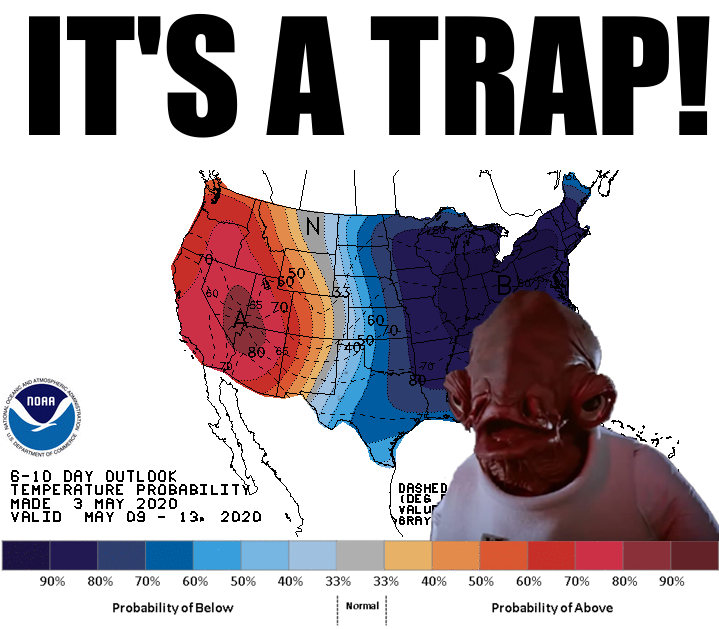
How about 50s for highs early next week?
Get it all out of your system? Geez, do ya kiss your mother with that mouth? Look
at the bright side (when you find it, show me, too!). Okay, here's an attempt:
after today's near record highs, it will be good to cool down for a few days.
Make that a week. Or a week and a half.
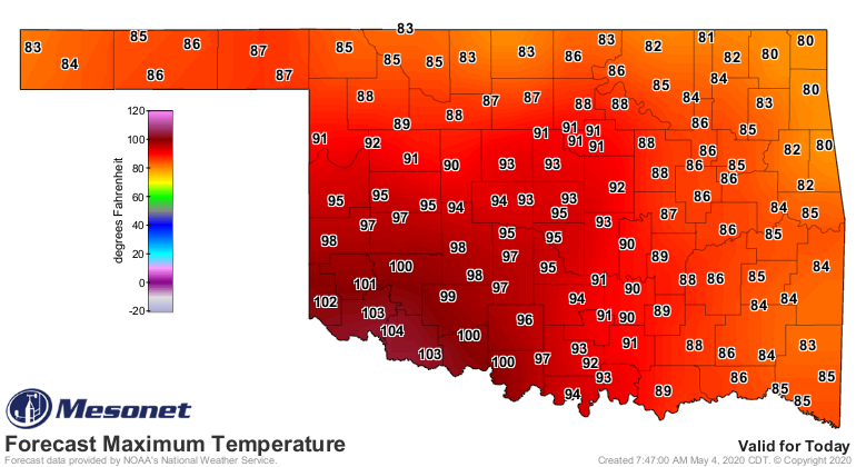
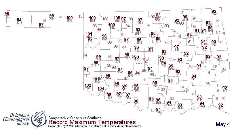
And it's not like we're going to see 50s and 60s for the next week and a half.
The front that's currently through the far western Panhandle will drop us down
10-15 degrees for awhile, but a reinforcing shot of chilly air from a cold front
early next week will really take us back to early March weather. So the 7-day
temperature outlook from our friends at the Norman NWS office still looks "okay."
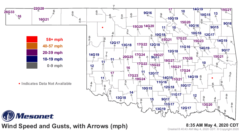
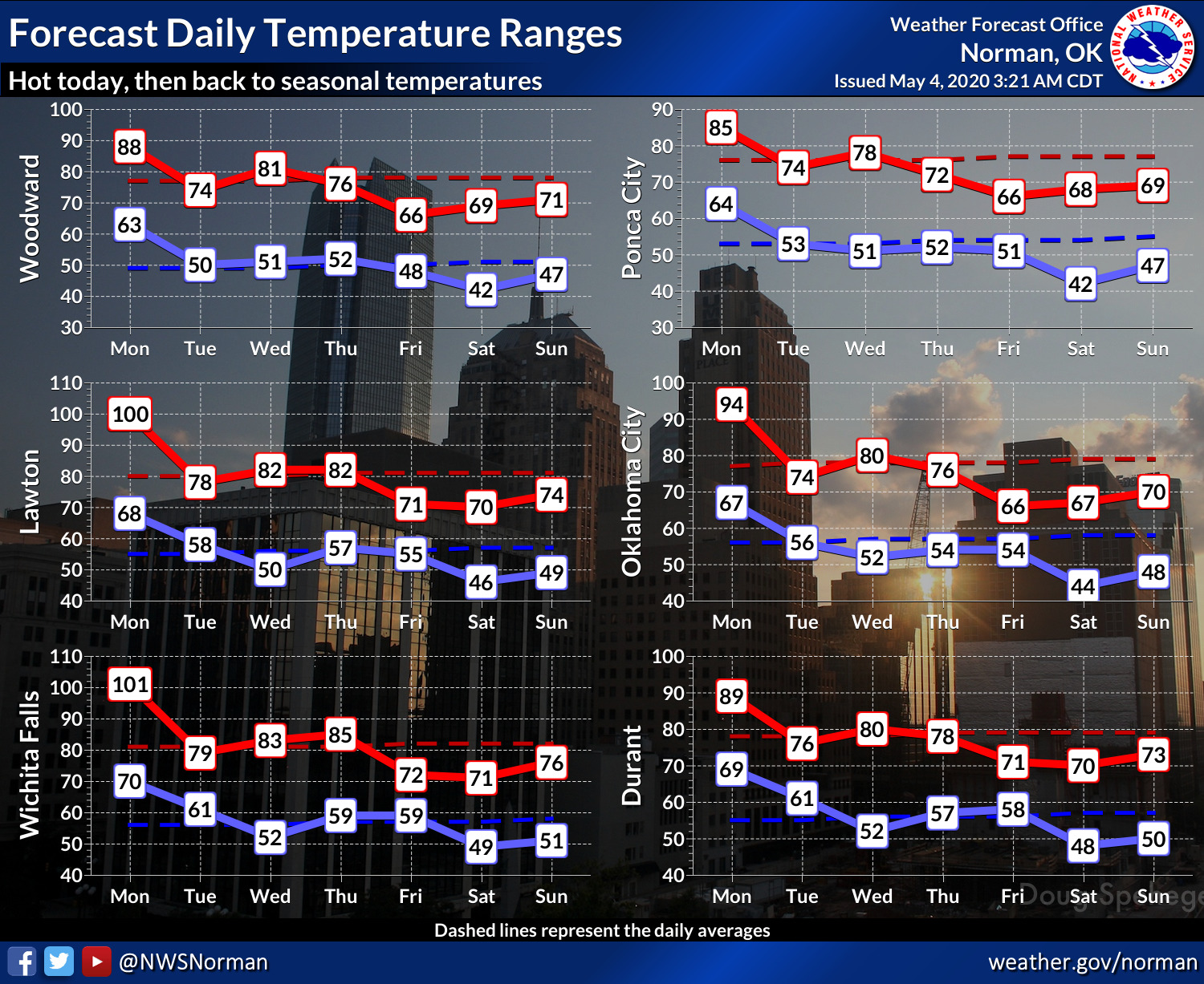
And there will also be some spicy weather with today's front, lining up and
down it's approach along and east of I35. All modes of severe weather are
possible! Stay weather aware. Heck, stay burrito aware if that will help.
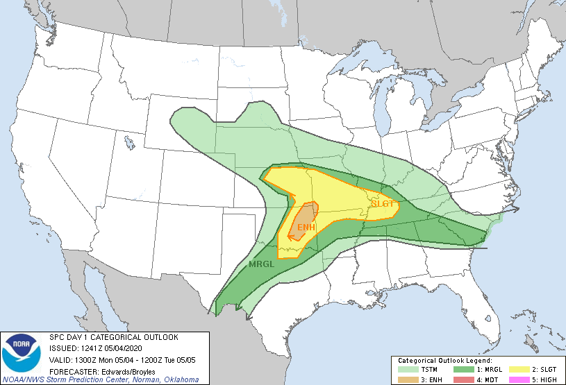
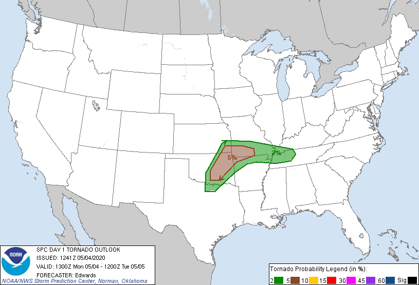

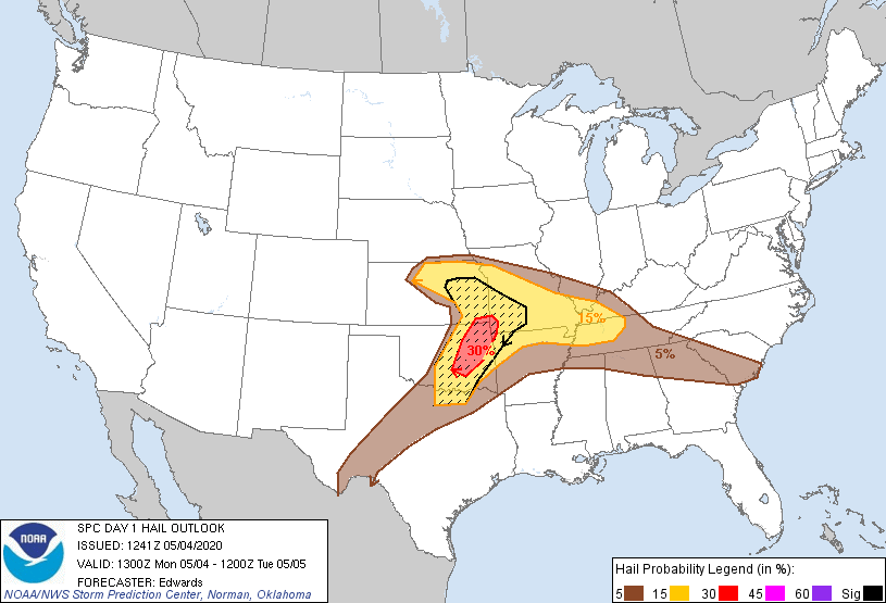
The air is juicy. Like early May juicy. That soupy air will set us up for some
big storms later today.
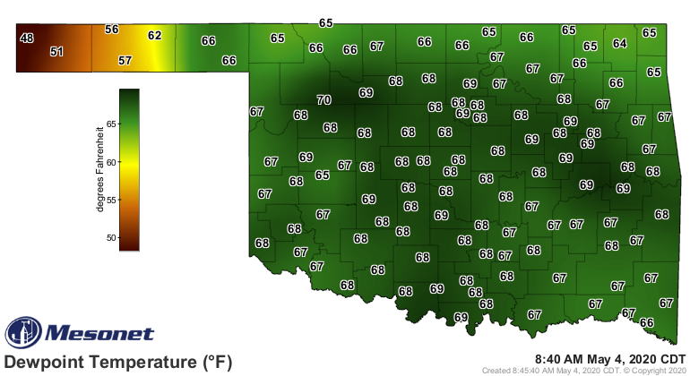
Why wait, though. We already have severe storms in the northeast.
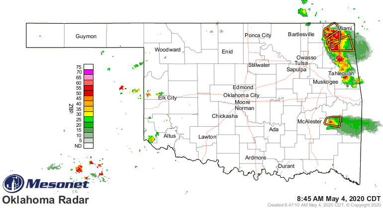
Spicy!
Another chance of rain later this week with...you guessed it, another cold
front. Then another shot of cold air next week.
Anti-Spicy.
Gary McManus
State Climatologist
Oklahoma Mesonet
Oklahoma Climatological Survey
(405) 325-2253
gmcmanus@mesonet.org
May 4 in Mesonet History
| Record | Value | Station | Year |
|---|---|---|---|
| Maximum Temperature | 106°F | ALTU | 2020 |
| Minimum Temperature | 26°F | KENT | 2013 |
| Maximum Rainfall | 5.55 inches | VINI | 1999 |
Mesonet records begin in 1994.
Search by Date
If you're a bit off, don't worry, because just like horseshoes, “almost” counts on the Ticker website!