Ticker for April 30, 2020
MESONET TICKER ... MESONET TICKER ... MESONET TICKER ... MESONET TICKER ...
April 30, 2020 April 30, 2020 April 30, 2020 April 30, 2020
Warm-up Day
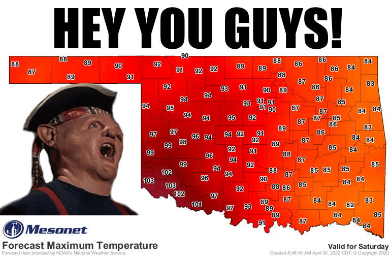
No winter-like blast is coming to take this one from us. Today might very well be
the mythical "warm-up day" I spoke about in a previous Ticker -- that day when
it gets warm and pretty much stays warm. Oh, we might have 70s for highs thrown
in there somewhere. Even some 60s. But the worries for freezes are probably over,
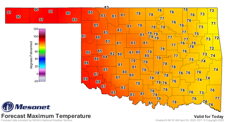
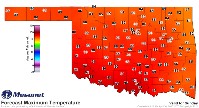
at least for the main body of the state. Just check out these forecast temps for
today through the weekend, and then into next week.

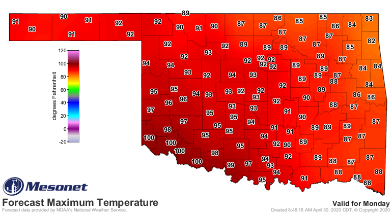
Now there are hints of a blob of cold air sinking into the Northeast that might
give us a backdoor cold front (sliding in from the northeast instead of the north
or northwest) to the latter parts of next week, but even that doesn't look to
set us back a month or two on the weather calendar like recent fronts.
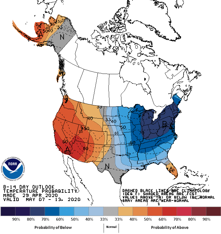
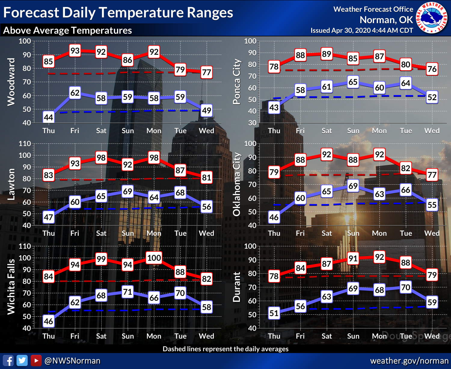
The only question on whether today is indeed warm-up day is just how far to the
west that cold air will slide. But look at it this way...after a few days of
upper 80s, 90s, and 100s, a slide back into 60s and 70s will be a welcome
retreat. One of the problems with all this heat is that it is definitely going
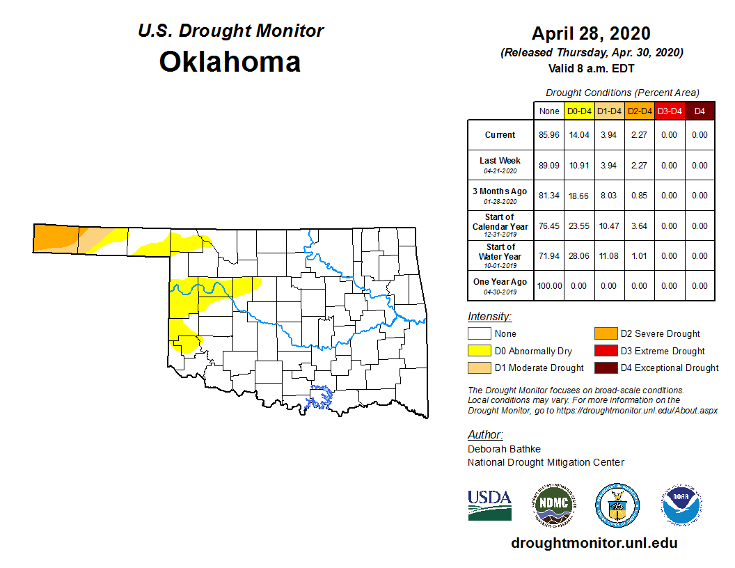
to ramp up the loss of soil moisture from our, uhhhhh, soils. We do have drought
issues building across western Oklahoma, starting with the far western Panhandle
and now spreading to the east into central Oklahoma. So far we've introduced
"abnormally dry" conditions, meaning an area coming into or exiting drought. In
this case, it would signify areas in danger of drought development.
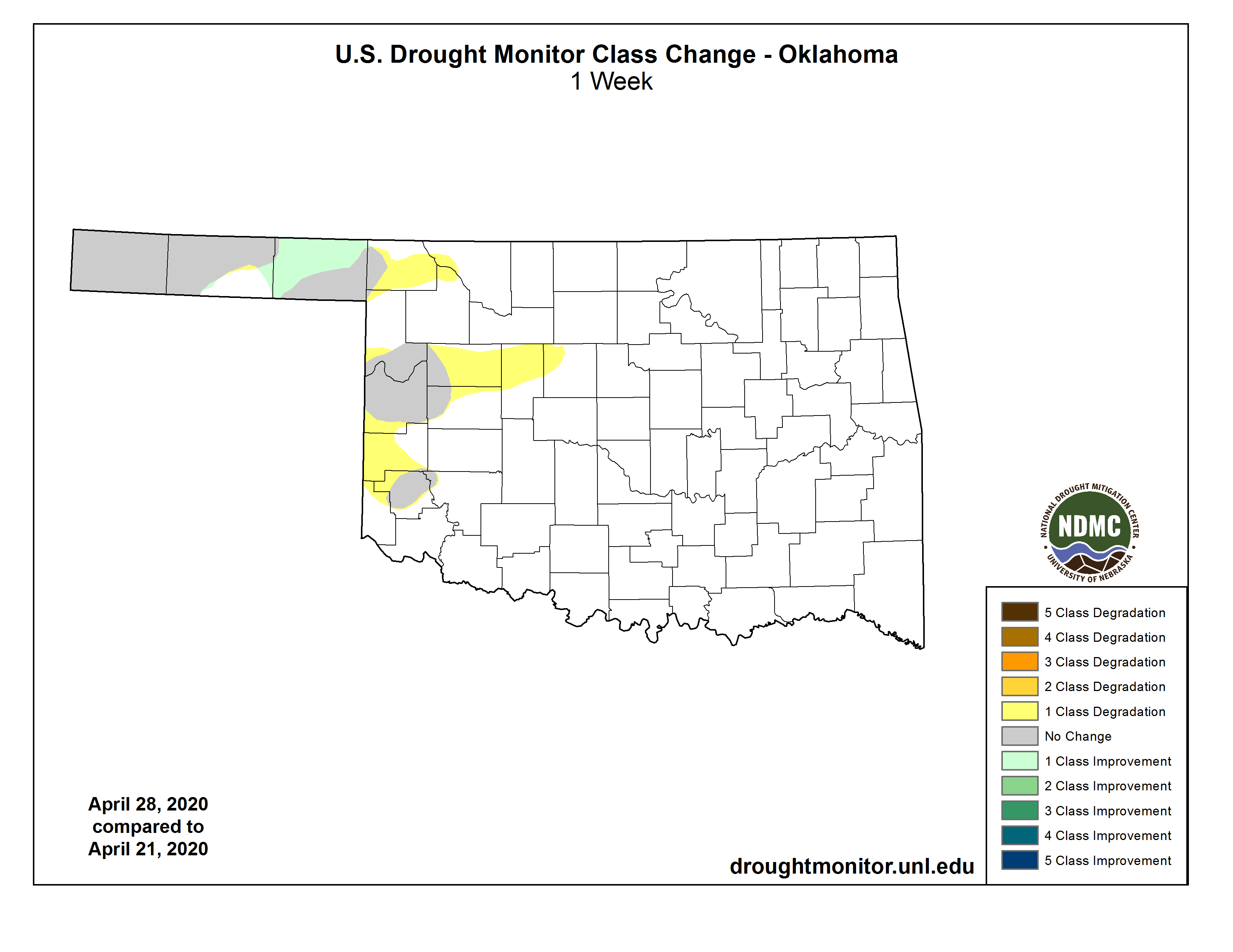
This is all building off the back of an odd dry pattern that has set up in
a swath from west central through central Oklahoma -- an area that had
inexplicably missed any of the good rainfall events over the last 3+ months.
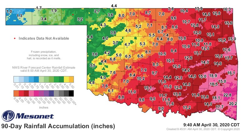
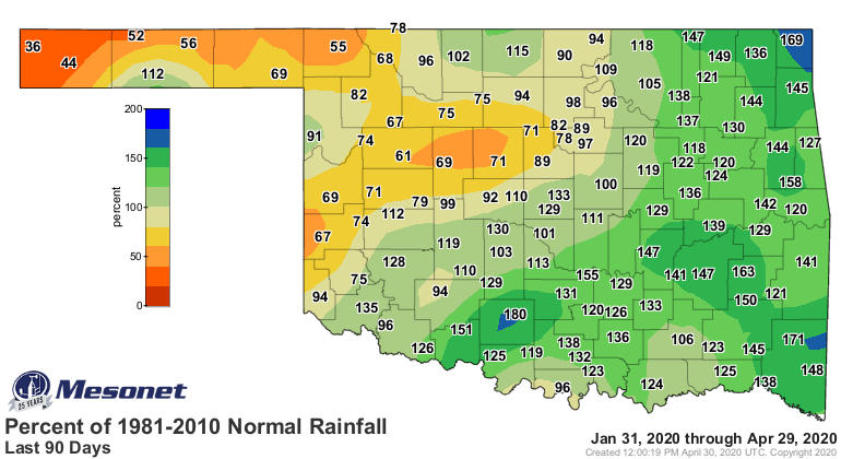
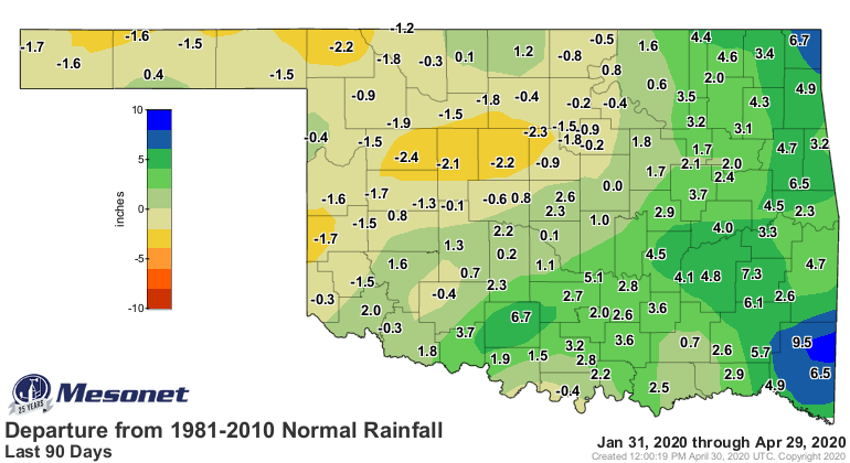
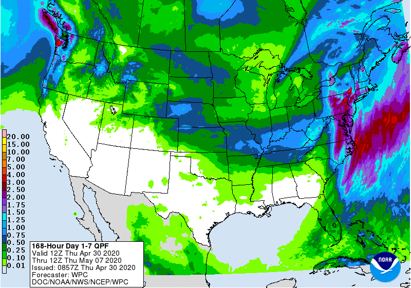
I'm afraid there's little hope for that area over the next 7 days or so, unless
another storm system sneaks up on us. You can usually see them from several days
out this time of year, and nothing is showing up just yet.
Warm-up day has arrived!
If I just jinxed it, nobody will be angrier than me!
Gary McManus
State Climatologist
Oklahoma Mesonet
Oklahoma Climatological Survey
(405) 325-2253
gmcmanus@mesonet.org
April 30 in Mesonet History
| Record | Value | Station | Year |
|---|---|---|---|
| Maximum Temperature | 96°F | BEAV | 2013 |
| Minimum Temperature | 26°F | EVAX | 2017 |
| Maximum Rainfall | 6.12 inches | NOWA | 2019 |
Mesonet records begin in 1994.
Search by Date
If you're a bit off, don't worry, because just like horseshoes, “almost” counts on the Ticker website!