Ticker for April 28, 2020
MESONET TICKER ... MESONET TICKER ... MESONET TICKER ... MESONET TICKER ...
April 28, 2020 April 28, 2020 April 28, 2020 April 28, 2020
Tennis anyone?
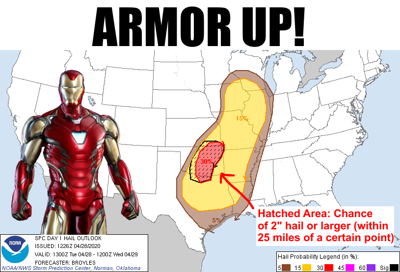
Okay, now we're forecasting with gas! No wait, that didn't sound right? See, I was
trying to make a play on the "cooking with gas" saying...not that I had beans
and -- oh never mind! We don't have time to explain unintended flatulence humor,
we have severe weather in play today. As we told you yesterday, the forecasters
at the NWS and SPC would have a better handle on things this morning. Now we're
starting to get a more clear picture of how the day could go. There is currently
a cold front plunging through the Plains towards our area. It's not a COLD cold
front, so it's not showing up on the temperature maps too clearly. But it is
making a dramatic wind shift across the Panhandle.
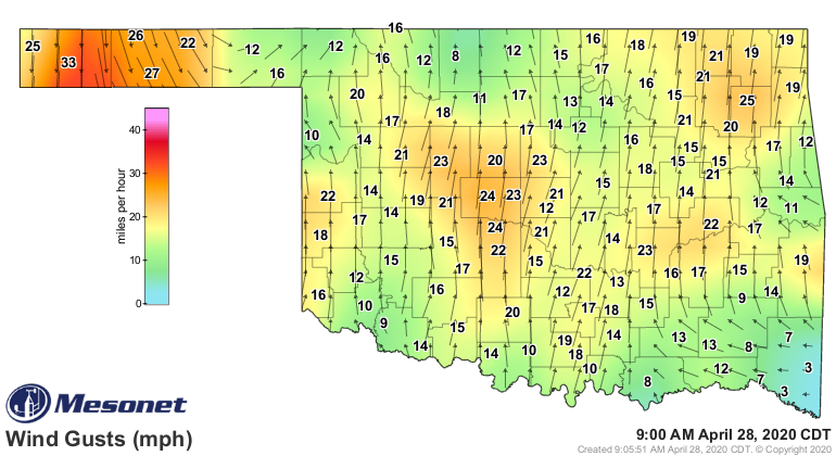
You can also see the strong southerly winds to the east that are bringing lots
of warm, moisture-laden air up from the Gulf of Mexico.
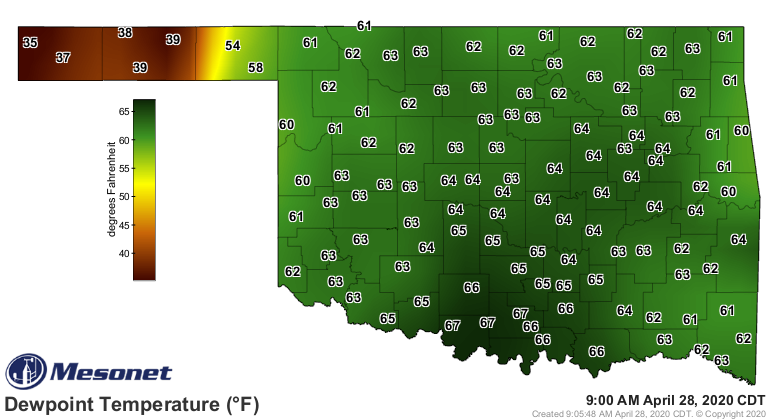
So you have fuel, and you have the mechanism for lift...now MOTHER NATURE is
cooking with gas. Today's event looks to have all modes of severe weather
possible, just depends on the timing and how things start to evolve as the day
unfolds. There will be a chance for tornadic activity if the storms stay
discrete (think social distancing for storms) and move into more favorable
conditions in eastern Oklahoma (but they can't be ruled out anywhere the storms
form and move through). And the chances for some pretty significant wind will
increase to the southeast as well (but can't be ruled out...well, you know the
rest). Here are the pertinent maps from SPC to help us out.
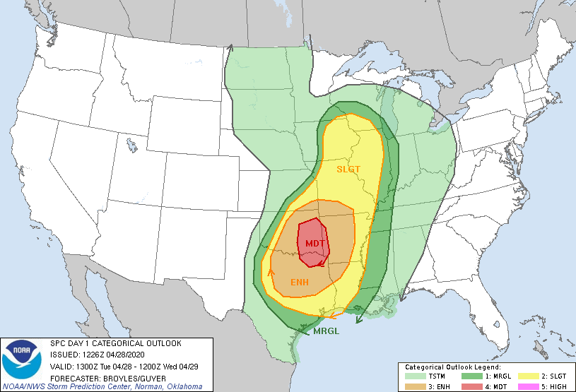
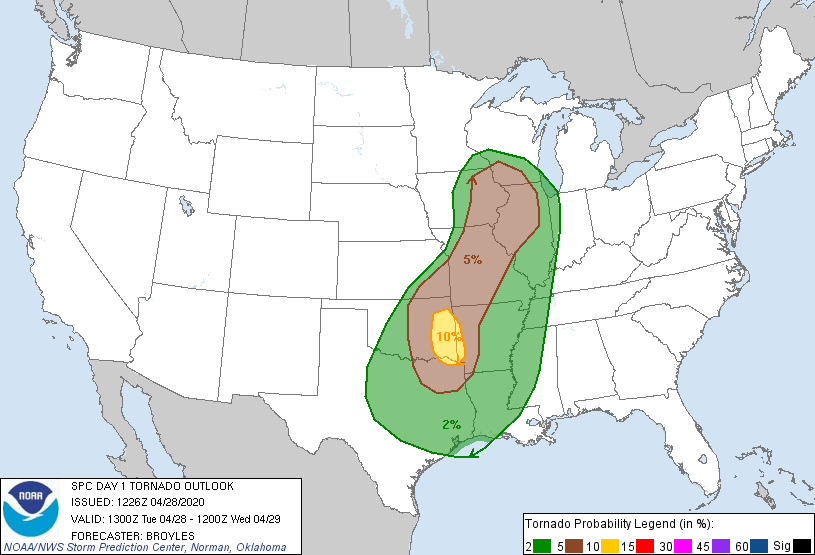


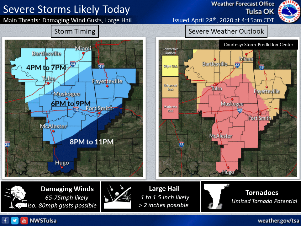
So there you can see how the timing and evolution of the event can mean
different chances for the big hazards. The tornado and wind threats appear to
be higher across southeastern Oklahoma, while the hail threat is a bit
higher to the west. And remember, this could all change as we get closer to
storm initiation, AND post-initiation. Remember last week we had what looked
like a big hail and wind event and we ended up with more than a handful of
tornadoes moving across southern Oklahoma, including the nasty EF2 Madill
twister that killed two people.
So this is indeed a day to stay weather aware, earlier in the day in the
northwest and throughout the day to the southeast.

Gary McManus
State Climatologist
Oklahoma Mesonet
Oklahoma Climatological Survey
(405) 325-2253
gmcmanus@mesonet.org
April 28 in Mesonet History
| Record | Value | Station | Year |
|---|---|---|---|
| Maximum Temperature | 98°F | ALTU | 2020 |
| Minimum Temperature | 27°F | BOIS | 2008 |
| Maximum Rainfall | 6.80 inches | MADI | 2006 |
Mesonet records begin in 1994.
Search by Date
If you're a bit off, don't worry, because just like horseshoes, “almost” counts on the Ticker website!