Ticker for April 27, 2020
MESONET TICKER ... MESONET TICKER ... MESONET TICKER ... MESONET TICKER ...
April 27, 2020 April 27, 2020 April 27, 2020 April 27, 2020
Prepare to get sprung
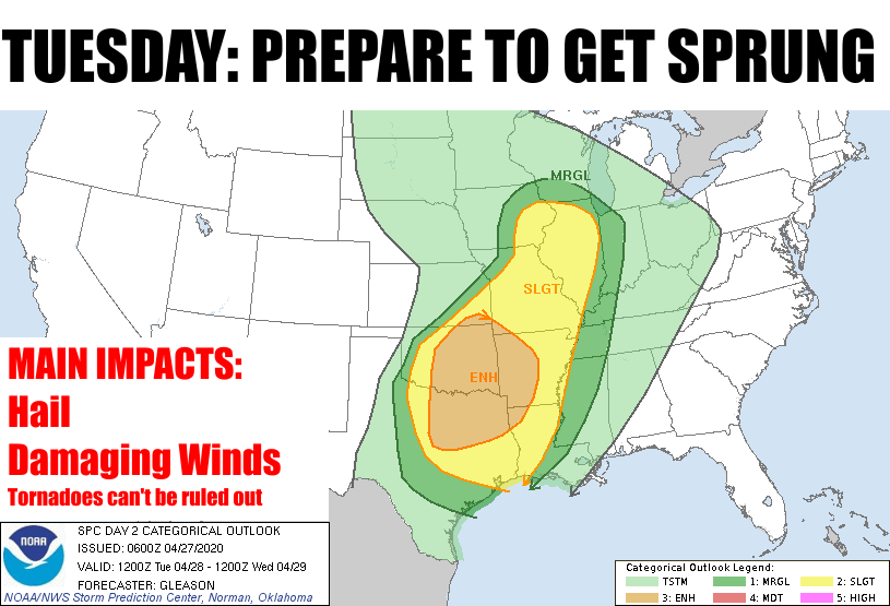
The big news this week is the chance for severe weather coming up tomorrow
afternoon and evening over much of the eastern two-thirds of the state. It's the
age-old scenario...a surface low with a nice cold front/dryline combo initiating
storms in the afternoon with discrete supercells possible early on, then possibly
lining out as the front proceeds through the state. This will give us a pretty
decent chance of large hail while the storms can stay separated, then start to
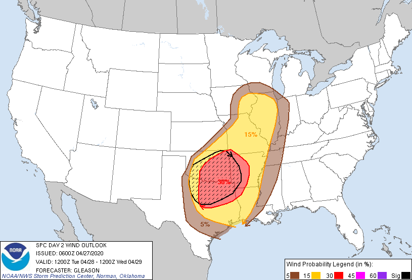
produce damaging winds as they start to fill out and merge.
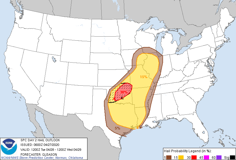
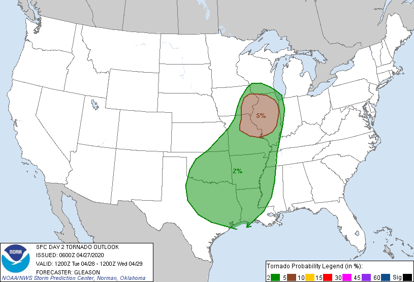
It looks like a really benign tornado threat, but that can change in a hurry.
There is still a conditional tornado threat IF storms can form along the dryline
instead of the cold front, especially closer to the surface low where wind sheer
profiles would be more supportive. Regardless of the threat of tornadoes, the
wind threat cannot be ignored, with winds of 80-90 mph possible with some of
those bowing storm formations. YIKES!
I'm afraid those still needing rainfall out west are going to be sorely
disappointed with this storm system. Almost all of the forecast moisture will
fall across the eastern half of the state.

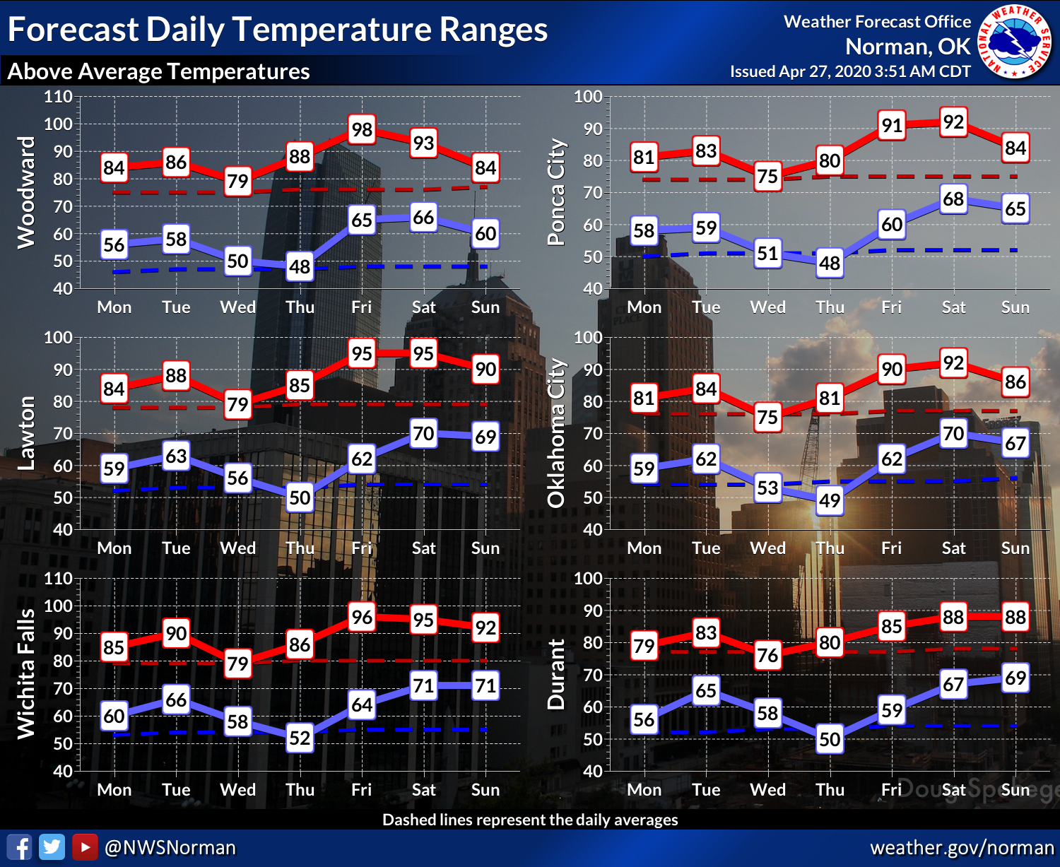
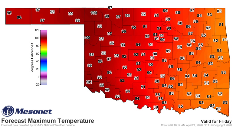
That's significant because temperatures are really going to ramp up this week,
with triple digits being forecast by Thursday/Friday.

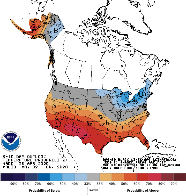
No telling where this is headed, whether we're going to head full on into
Oklahoma's spring-that-feels-like-summer, or if we might have another go at
some frigid weather, but next week looks like full on early May (play ominous
music!).

As for tomorrow, I'll just remind you that the day before last week's outbreak
here in Oklahoma, we were thinking "Oh, mainly looks like hail" and the scenario
changed to a more ominous tone soon thereafter, so STAY WEATHER AWARE!
Gary McManus
State Climatologist
Oklahoma Mesonet
Oklahoma Climatological Survey
(405) 325-2253
gmcmanus@mesonet.org
April 27 in Mesonet History
| Record | Value | Station | Year |
|---|---|---|---|
| Maximum Temperature | 96°F | GRA2 | 2012 |
| Minimum Temperature | 24°F | BOIS | 2008 |
| Maximum Rainfall | 5.85″ | BLAC | 2024 |
Mesonet records begin in 1994.
Search by Date
If you're a bit off, don't worry, because just like horseshoes, “almost” counts on the Ticker website!