Ticker for April 13, 2020
MESONET TICKER ... MESONET TICKER ... MESONET TICKER ... MESONET TICKER ...
April 13, 2020 April 13, 2020 April 13, 2020 April 13, 2020
Snow way!
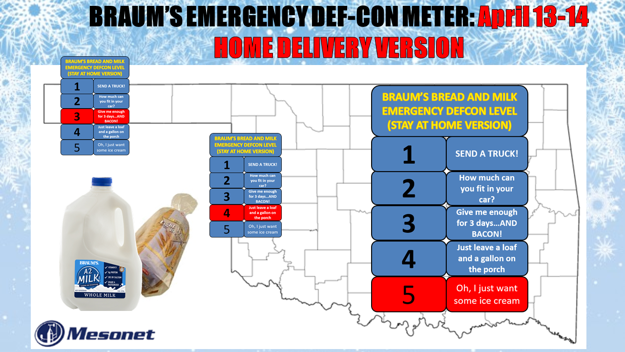
Well why not, right? If Mother Nature is going to February our April, why not
just February it all the way? Now in reality, this map is even more satirical
than usual, given that most of any snow that might fall would melt pretty quickly,
but it will be cold enough for some decent sticking in the Panhandle. And
remember, this is a HOME DELIVERY version of the Braum's DEFCON Meter.
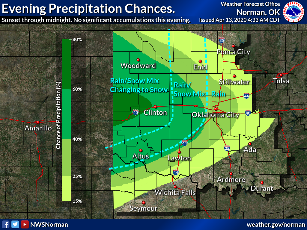
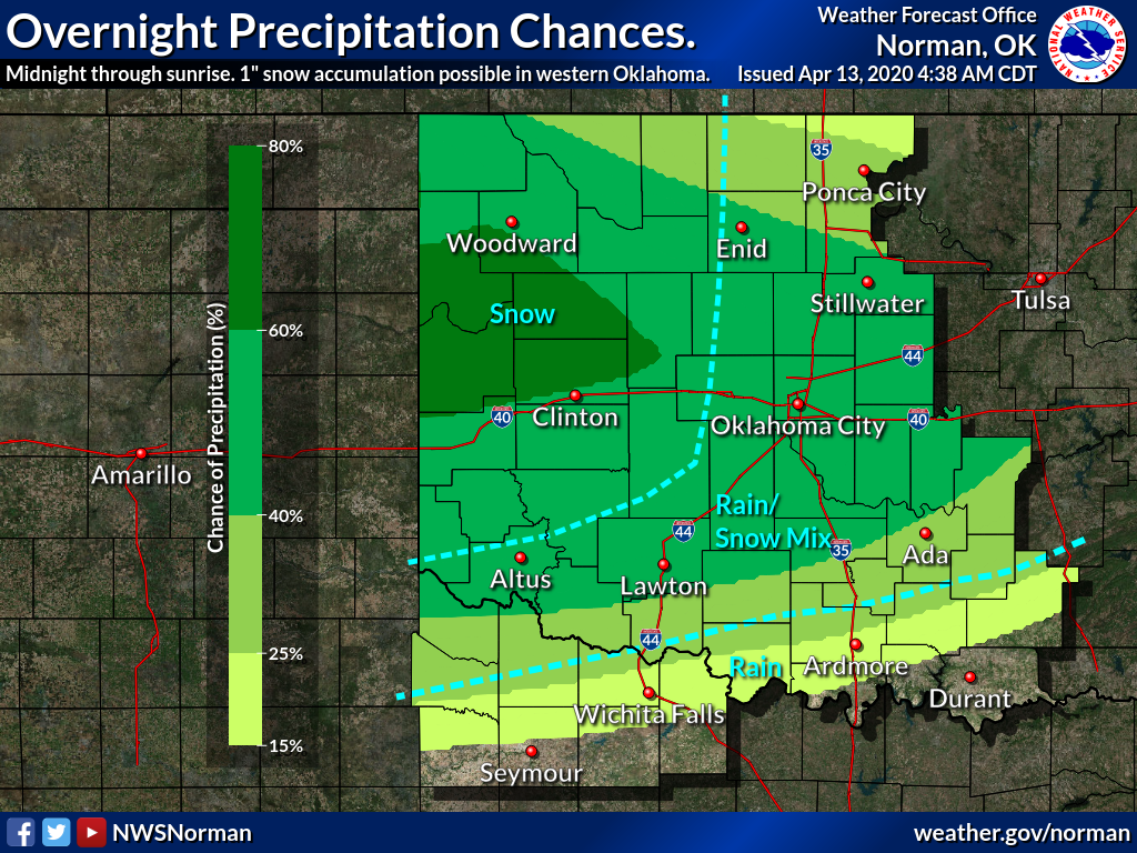
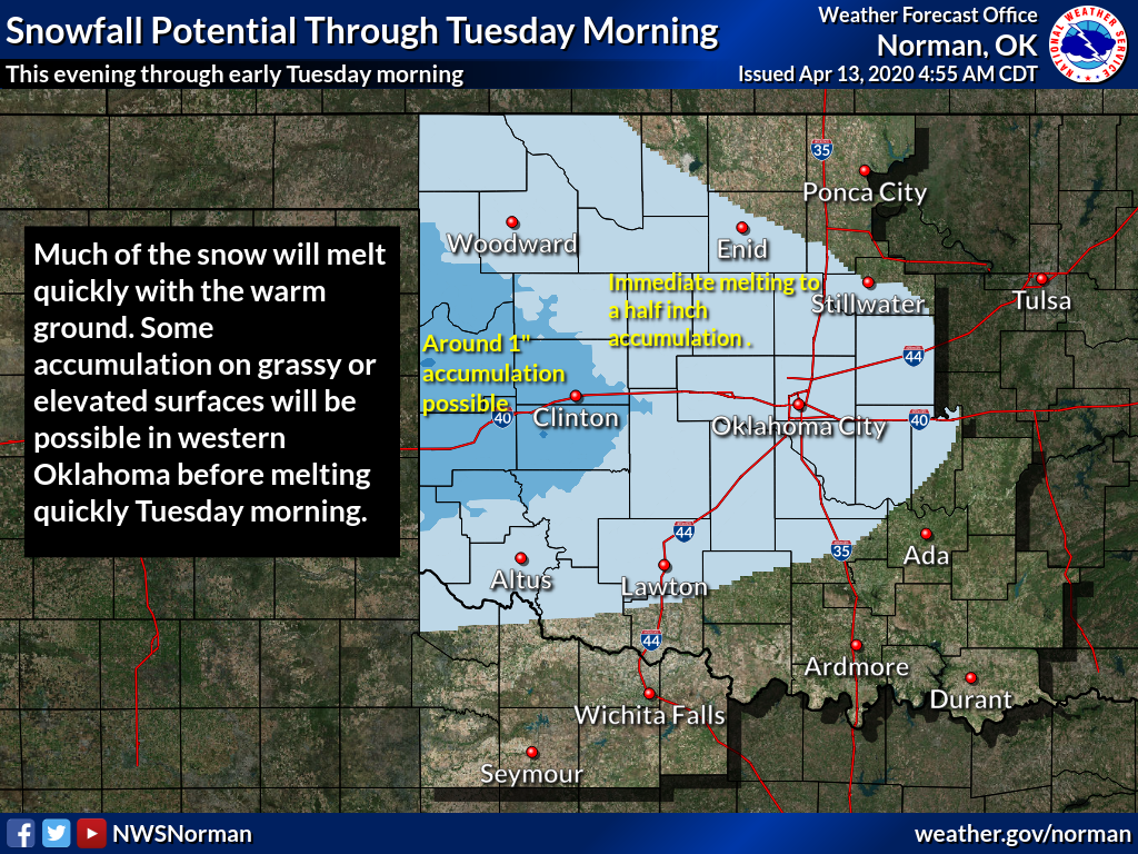
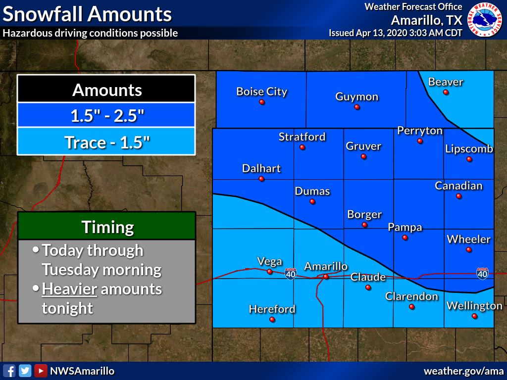
With the cold air in place, another period of lift will set up over
the state later today into tomorrow and try and squeeze out just enough moisture
to produce some snow in the Panhandle and far western Oklahoma, maybe a bit of
rain/snow mix as we get farther into central Oklahoma, then mostly rain to the
east. Sort of a sideways parabolic shape to this precipitation pattern. Here is
the thinking from our local NWS offices.
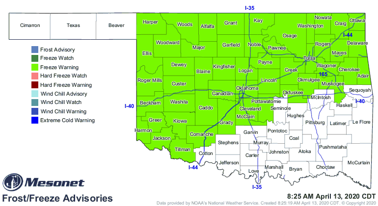
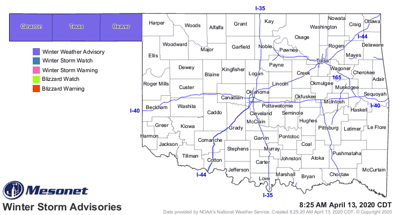
And if we're talking snow in mid-April, you know we're talking some unusually
cold weather. We did suffer a freeze overnight (it started a bit earlier in
the Panhandle), and that is expected to occur over the next two nights as well.
The Panhandle will continue to see occasional freezes over the next few weeks,
but the frigid weather is enough to produce a good sized freeze warning for
the northeastern two-thirds of the state (again, excepting the Panhandle, where
freezes this time of year are a bit more expected). And just enough snow is
expected in the Panhandle to produce some worry over travel conditions, so they
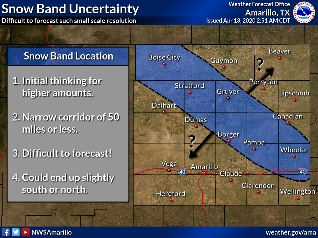
get a winter weather advisory. The Amarillo NWS office is worried about a
possible heavier band of snow setting up from NW to SE across the Panhandles, so
maybe a few higher amounts in that band, IF it sets up.
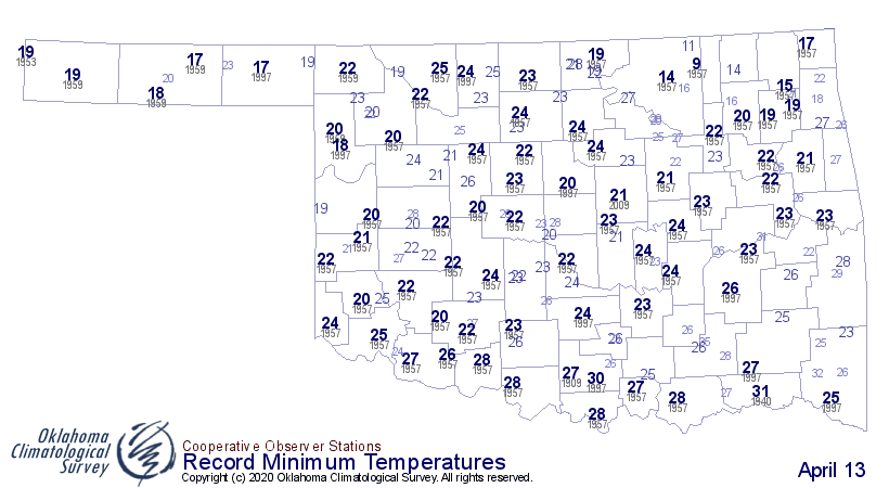
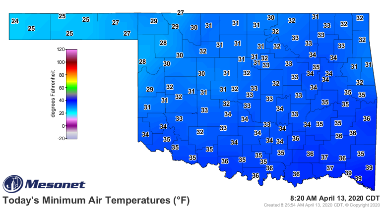
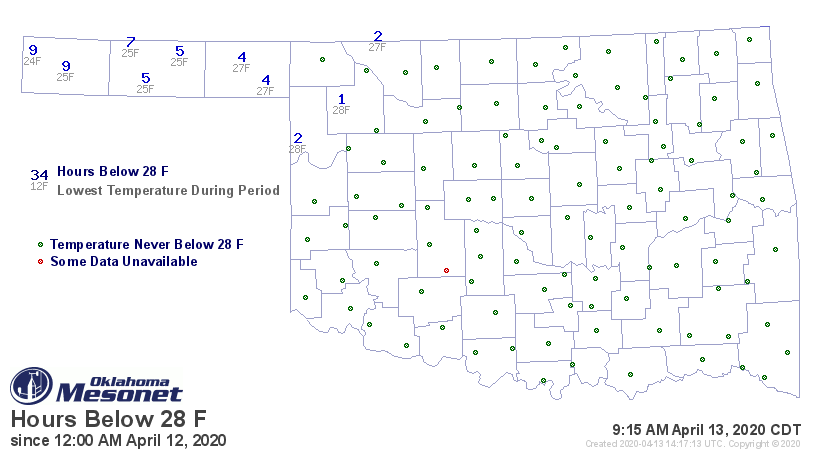
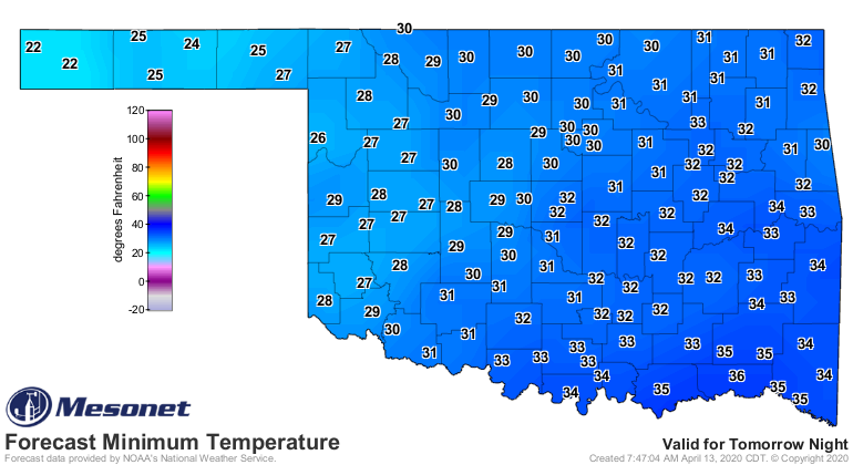
Speaking of that freeze last night, we can see from the Mesonet maps that we
got somewhat close to some record cold weather this morning. When it comes
to record cold weather, within 10 degrees is too close for my frozen taste buds!
Areas to the NW obviously spent longer in the freezing weather, but that did
extend right down into central OK.

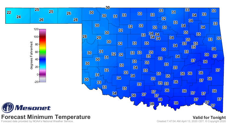
I wish that was the end of it, but we should see at least two more days with
lows below freezing before the temperatures start to moderate more closely
towards seasonable weather.
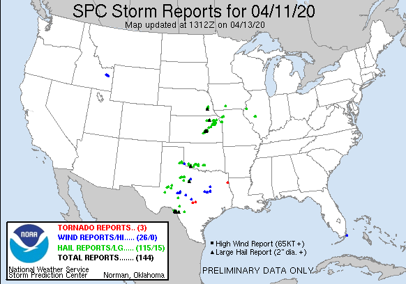
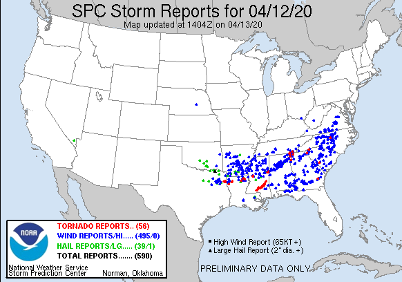
The expected severe weather outbreak across the Southeast U.S. came to fruition,
unfortunately, as did our expected severe weather over the last 2 days. I think
we can see, however, that we came out on the fortunate end compared to the folks
east of us.
Say what you want about cold weather...WHOA! You done? Wow, some of you are
angry. Say what you want about cold weather, but at least it keeps the severe
weather down after the front moves through.
It is spring. It will get warm again (and stay warm, eventually), and we will
see severe weather return. We'd sure like something in the middle between
freezes and severe weather, though.
Gary McManus
State Climatologist
Oklahoma Mesonet
Oklahoma Climatological Survey
(405) 325-2253
gmcmanus@mesonet.org
April 13 in Mesonet History
| Record | Value | Station | Year |
|---|---|---|---|
| Maximum Temperature | 99°F | ALTU | 2025 |
| Minimum Temperature | 19°F | BOIS | 2004 |
| Maximum Rainfall | 4.11″ | CHER | 1999 |
Mesonet records begin in 1994.
Search by Date
If you're a bit off, don't worry, because just like horseshoes, “almost” counts on the Ticker website!