Ticker for April 10, 2020
MESONET TICKER ... MESONET TICKER ... MESONET TICKER ... MESONET TICKER ...
April 10, 2020 April 10, 2020 April 10, 2020 April 10, 2020
There go my eggs
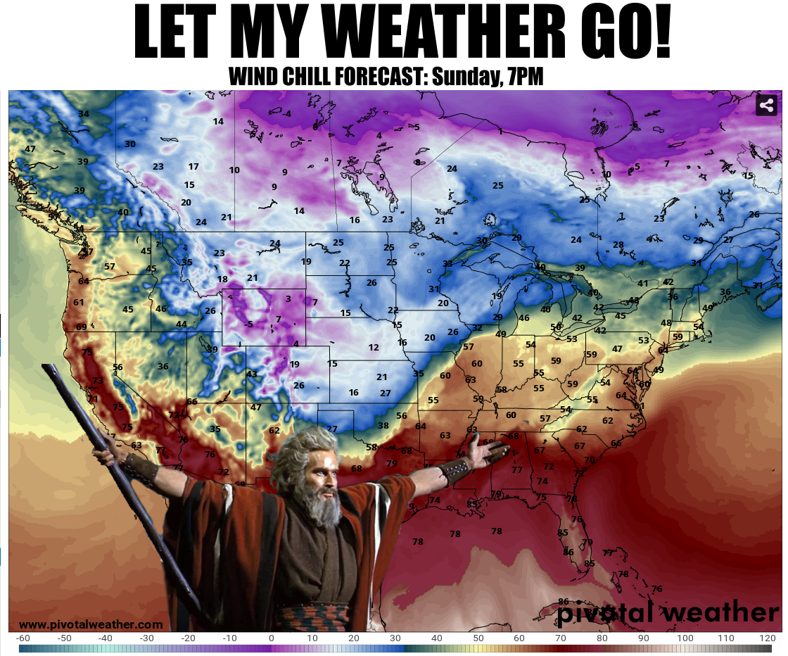
Some folks might be thinking about doing something outside in their own backyards,
with their own families, on Sunday for Easter. If that is the case, then depending
on what part of the state you live in, you might want to push that forward
(backward?) to Saturday. A strong cold front -- really for any time of the
year -- is forecast to move through the state during the morning and afternoon
on Sunday, leaving strong northerly winds and wind chills into the 20s and 30s in
its wake. That'll put your Easter bonnet into Texas in a hurry.
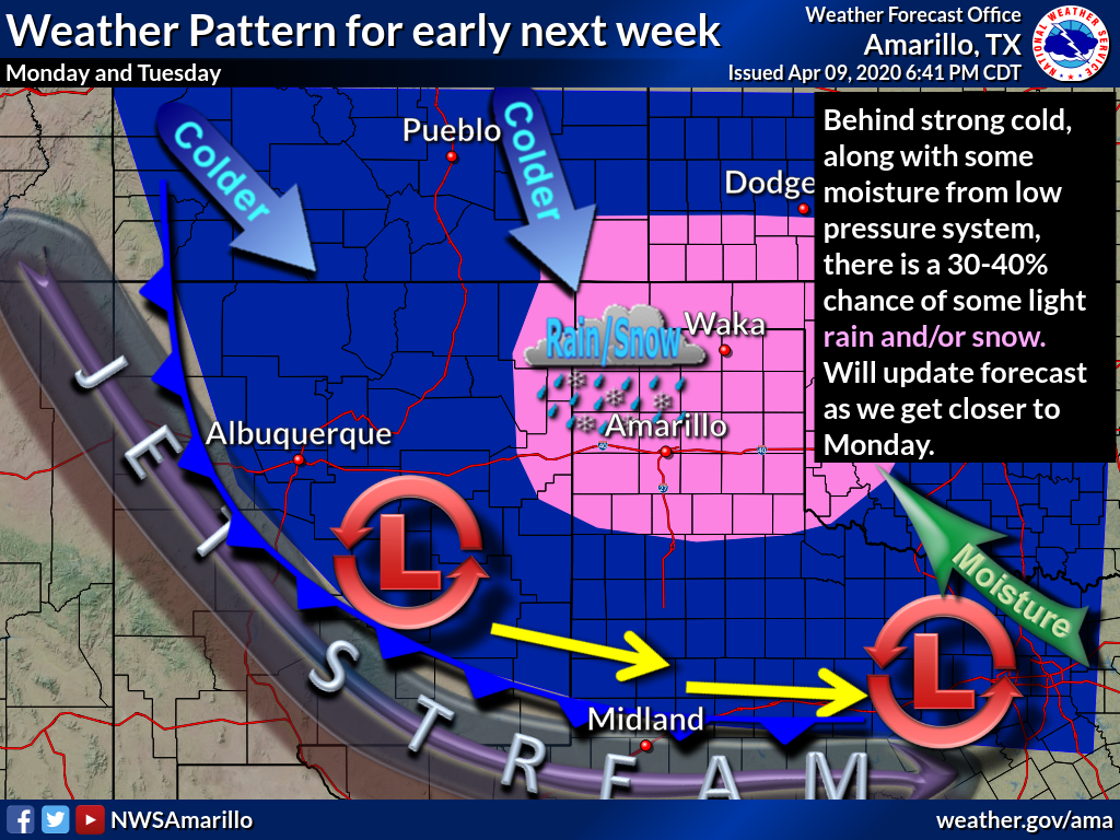
Here's the overall weather setup from our friends at the NWS office in Amarillo,
responsible for the OK Panhandle forecasts. They depict the weather system that's
bringing storms, cold, snow, and a freeze (not necessarily in that order...but it
wouldn't hurt) over the weekend through early next week.
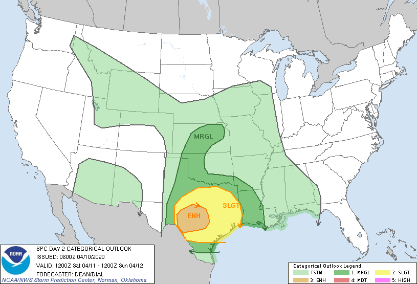
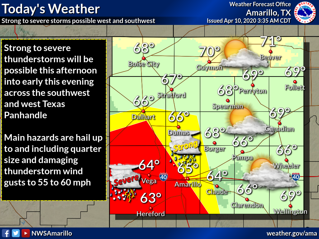
Saturday is the day. There is a chance for some severe weather that day, but
this doesn't look like a widespread area of impactful severe weather. A marginal
chance according to SPC.
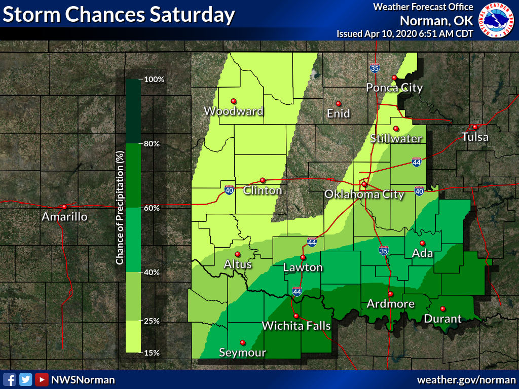
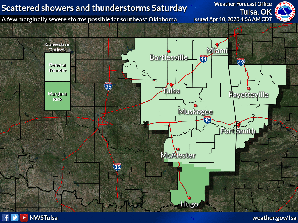
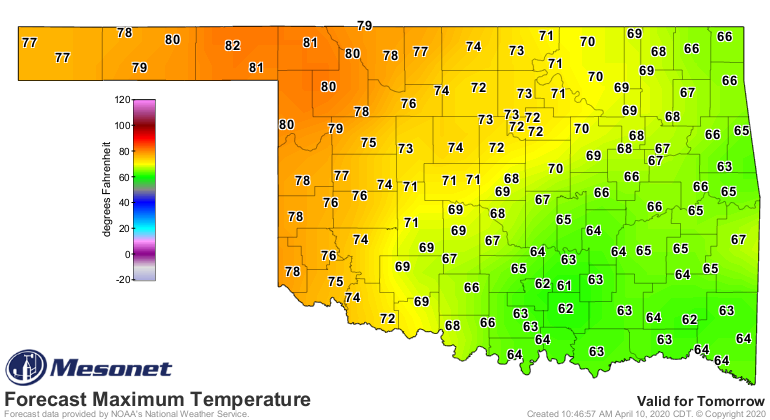
We've covered the freeze on Monday and Tuesday so much that even dead horses are
getting tired of it. BUT, there will be the possibility of a freeze on
Wednesday as well in far northern OK.
So be sure and watch the weather this weekend. Stay tuned to your favorite
media and NWS source. And keep those Mesonet temperature maps up. They'll be
tracking that cold front county-by-county, town-by-town, every 5 minutes.
Timing looks like into northern OK around daybreak or thereafter, then through
the state by evening. Hide those eggs in the easy spots this year.
Gary McManus
State Climatologist
Oklahoma Mesonet
Oklahoma Climatological Survey
(405) 325-2253
gmcmanus@mesonet.org
April 10 in Mesonet History
| Record | Value | Station | Year |
|---|---|---|---|
| Maximum Temperature | 94°F | HOLL | 2019 |
| Minimum Temperature | 14°F | BOIS | 2013 |
| Maximum Rainfall | 3.83″ | COPA | 1994 |
Mesonet records begin in 1994.
Search by Date
If you're a bit off, don't worry, because just like horseshoes, “almost” counts on the Ticker website!