Ticker for April 9, 2020
MESONET TICKER ... MESONET TICKER ... MESONET TICKER ... MESONET TICKER ...
April 9, 2020 April 9, 2020 April 9, 2020 April 9, 2020
Hubris
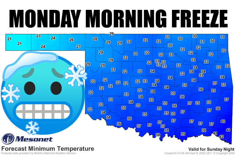
Hubris. The lack of humility in the face of Mother Nature. They say it was a
contributing factor in the Dust Bowl. I'm now prepared to say my hubris is at
least partly the cause for our move towards the arctic next week. Yeah, I MAY
have written a Ticker a month ago claiming we had possibly seen our last freeze,
at least for most of the state. The Panhandle goes its own way in that regard,
of course. And yeah, it might have been more wishful thinking than anything. But
here we are regardless. The cold front that moved through last night ended a
couple of early summerish days, and ushers in a week to a week.5 of March instead
of mid- to late-April. The forecast for lows (our maps only go out five days, so
I'll just show you the NWS forecast grids) for Tuesday show we could see two
straight days of freezing temperatures across the northern half of the state, in
addition to the western one-third.
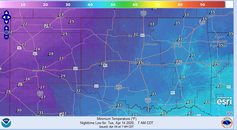
These may be a bit underdone, so don't be shocked if some of those 29s turn out
to be 24s. Yes, vice-versa is also possible. It would be lovely if we could keep
some of those 29s as 38s. The rest of next week could see a continuation of
unseasonably cool weather. It certainly won't be like what we saw the last
couple of days.
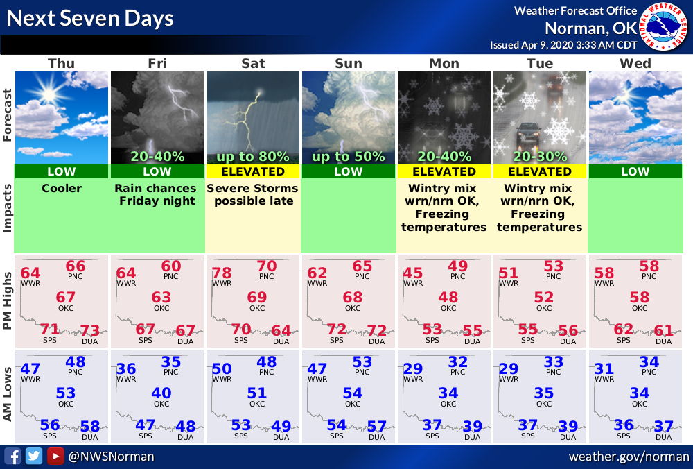
But wait, we're not in the arctic just yet. We're actually going to have a
pretty nice weekend before that arctic air arrives late on Easter Sunday. Check
out the forecast maps for a bit of a lift.
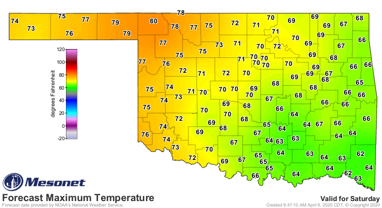
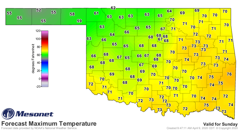
Monday will be a good day to stay indoors and raid that chocolate bunny stash.
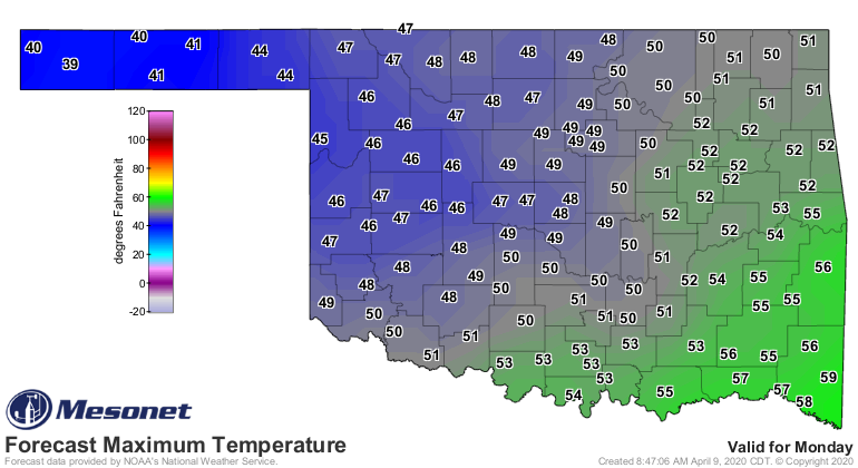
Add a bit of moisture with that cold air and there will even be a chance of
snow across northern Oklahoma.
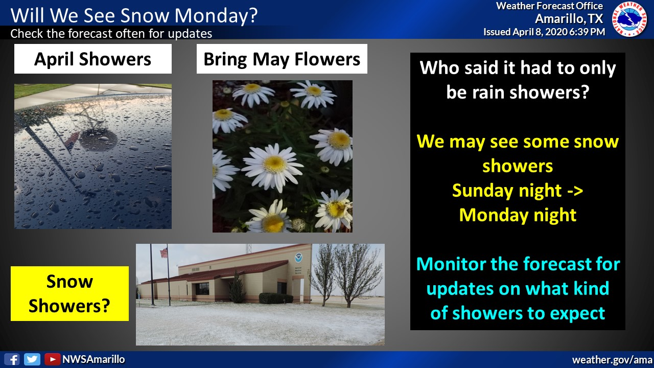
YAY, a snow day? Well, rats. What a waste. Snow looks pretty iffy anyway, and
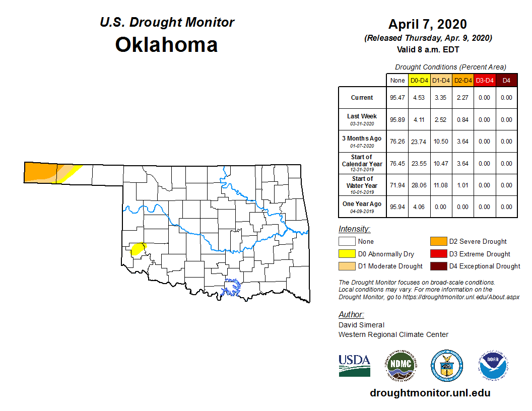
it wouldn't amount to much. Parts of the state do need that moisture. The far
western Panhandle has seen severe drought increase, covering nearly all of
Cimarron County, with moderate drought moving into Texas County -- per this
morning's U.S. Drought Monitor.
We have had a profound lack of storms during the first bit of April, and our
30-day rain maps are looking a bit sparse across the northwestern quarter of
Oklahoma.
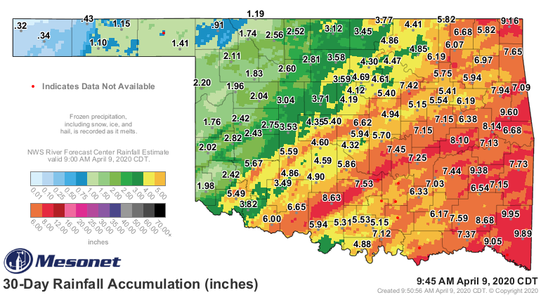
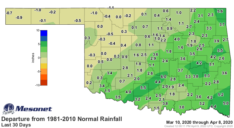
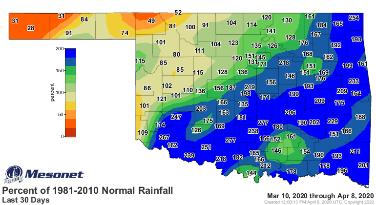
Heck, it's been over three months since the western Panhandle has seen a good
bit of moisture, at least in a single day. My glorious hometown of Buffalo,
universally regarded (by me) as the greatest place in the state, needs to get
into the act as well.


Lots to unpack over the next week or so. In actuality, this seems to be how our
Aprils go, ain't it? It was only in 2018 that we had our 2nd coolest April on
record. And in 2007 April ended up cooler than March...by 3 degrees!
Ah well, at least we haven't seen a lot of tornadoes. And I'm not making any
predictions, either, just stating facts! #humility
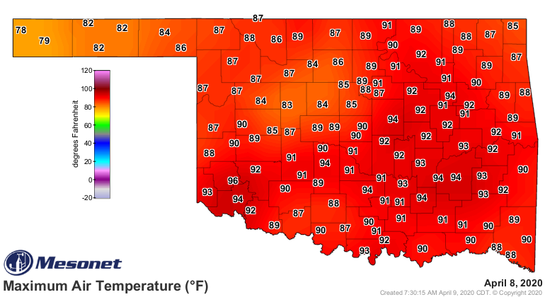
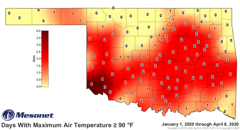
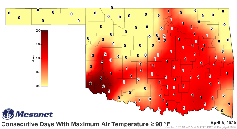
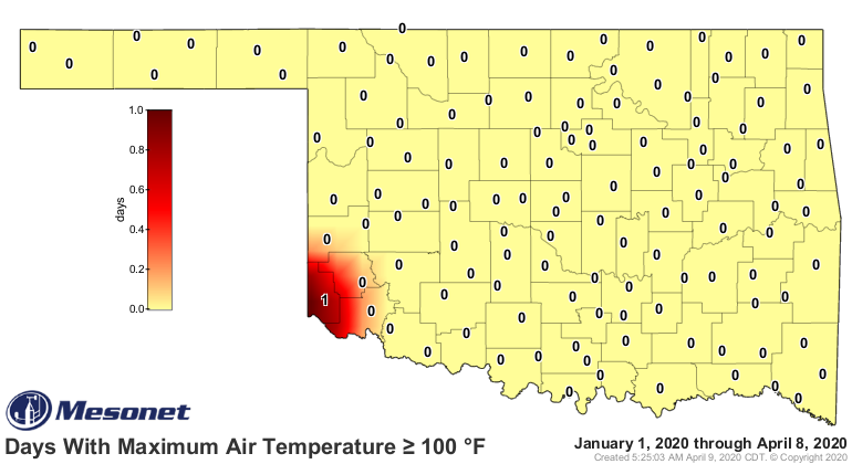
Let's end by saying goodbye to the last couple of days, as we look at a few
maps from the Mesonet in memoriam of our early summer previews we had over the
last few weeks.
I'll bet it stays cool for the rest of April. There, we'll see if that works.
Gary McManus
State Climatologist
Oklahoma Mesonet
Oklahoma Climatological Survey
(405) 325-2253
gmcmanus@mesonet.org
April 9 in Mesonet History
| Record | Value | Station | Year |
|---|---|---|---|
| Maximum Temperature | 100°F | HOLL | 2011 |
| Minimum Temperature | 18°F | KENT | 2013 |
| Maximum Rainfall | 4.69 inches | GUTH | 2008 |
Mesonet records begin in 1994.
Search by Date
If you're a bit off, don't worry, because just like horseshoes, “almost” counts on the Ticker website!