Ticker for April 8, 2020
MESONET TICKER ... MESONET TICKER ... MESONET TICKER ... MESONET TICKER ...
April 8, 2020 April 8, 2020 April 8, 2020 April 8, 2020
Badfellas
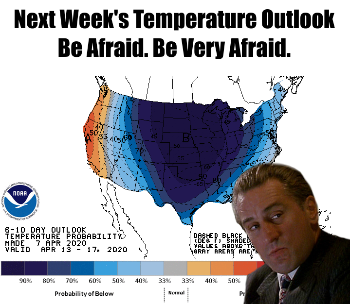
Here, let's give us near record heat today, but then yank the rug out from under
us next week (and maybe longer?). Well, that's what we're faced with. I guess
this is par for 2020. Let's look at the good news first. Although I know there
are some of you out there that will hate today, just trust that there are just as
many of us that are going to hate next week!
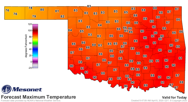
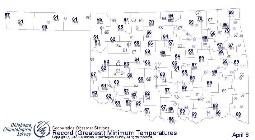
Here are today's record highs for reference. I still think we might see a few
jump over those marks today as we get later in the day. A front coming in, winds
getting more westerly. I wouldn't be shocked if some flirted with 100.
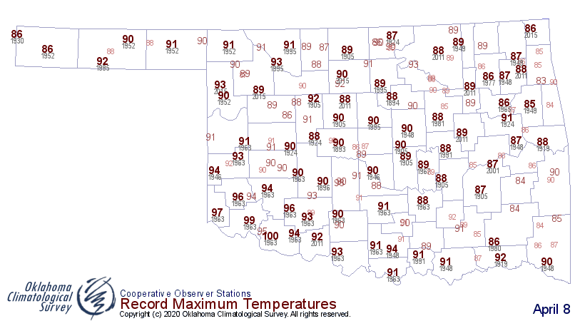
Heck, some of today's lows weren't that far of from being as warm as they've
ever been on this date. I'm still trying to figure out a way to say warmest
lows, highest lows, or whatever...you know, that "jumbo shrimp" deal. It's the
same problem I have when I look at a hairbrush.
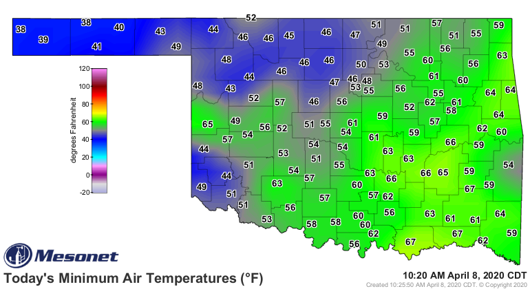
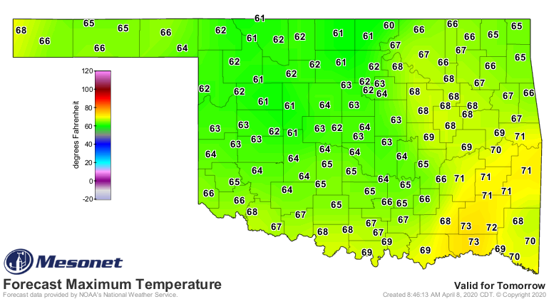
Now for the not-so-pretty side. My left side. AND next week's weather. It
really starts tonight when a cold front pushes through the state. See tomorrow's
highs. Not so bad, right? That's near appropriate for this time of year.
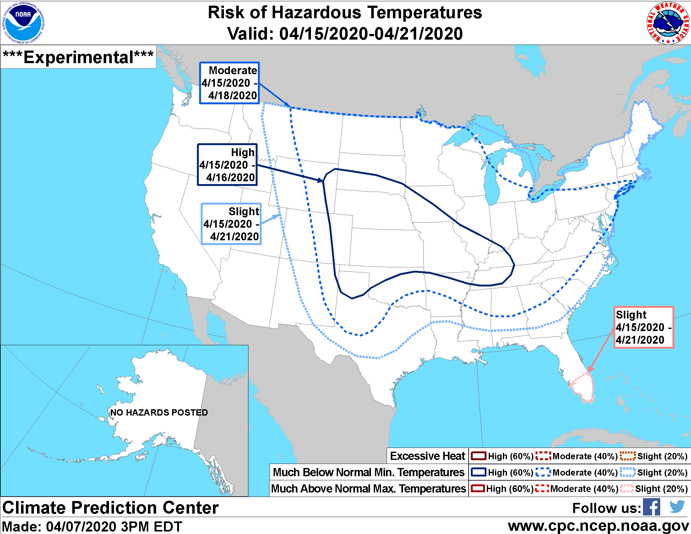
A reinforcing shot of cold air comes in right after Easter, dropping us back
down to "hey, this isn't bad for February" territory. A freeze is definitely
possible across the northern half of Oklahoma. In the past with these types of
events, don't be shocked if an area of freezing weather extends down into
southwestern Oklahoma as well. That's not guided by any forecasts just yet,
just a bit of experience. Even the CPC has the NW quarter of the state with
a HIGH chance of much below normal minimum temperatures for April 15-16, and
then they extend a MODERATE chance into most of Oklahoma for April 15-18. Note
that this doesn't mean they are saying a freeze is coming, just the likelihood
that the minimum temperatures will be much below normal.
So don't shut Netflix down just yet. Next week we might be indoors binge
watching for awhile longer.
Gary McManus
State Climatologist
Oklahoma Mesonet
Oklahoma Climatological Survey
(405) 325-2253
gmcmanus@mesonet.org
April 8 in Mesonet History
| Record | Value | Station | Year |
|---|---|---|---|
| Maximum Temperature | 96°F | MANG | 2020 |
| Minimum Temperature | 17°F | JAYX | 2007 |
| Maximum Rainfall | 3.22″ | BIXB | 2008 |
Mesonet records begin in 1994.
Search by Date
If you're a bit off, don't worry, because just like horseshoes, “almost” counts on the Ticker website!