Ticker for April 3, 2020
MESONET TICKER ... MESONET TICKER ... MESONET TICKER ... MESONET TICKER ...
April 3, 2020      April 3, 2020      April 3, 2020      April 3, 2020


Well that escalated quickly


Done in by the dreaded wet bulb effect, that plunge of arctic air invaded the
state overnight and just enough moisture fell to allow temperatures to drop into
the mid-to-upper 20s across much of northern and western Oklahoma. That freezing
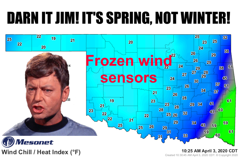
rain/drizzle was enough to impact our wind sensors and cause our wind and wind
chill maps to look a little vacant. The maps will stay
impacted until we warm back up enough to make sure the accumulated ice isn't
impacting those anemometers (essentially weighing and slowing them down).

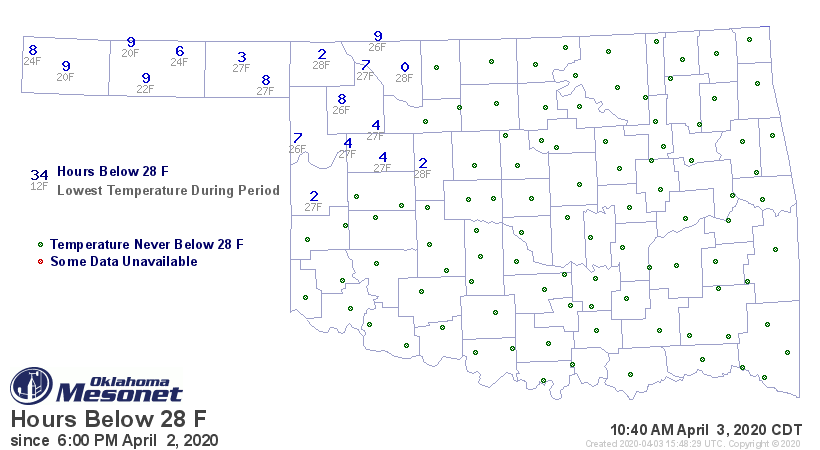
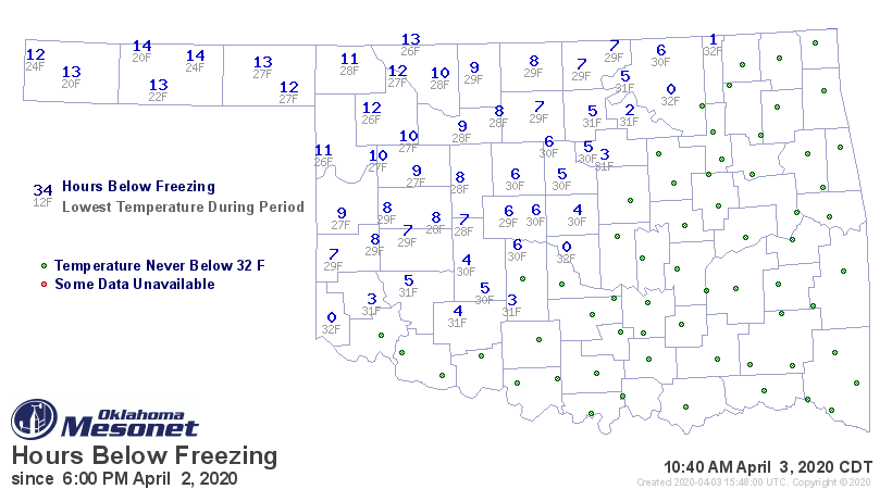
More importantly, much of that same area has had a significant freeze event, both
at the 32-degree mark and to a lesser extent, the 28-degree mark.


Hopefully this won't result in a lot of freeze damage, especially to our state's
most important agricultural crop, hard red winter wheat.

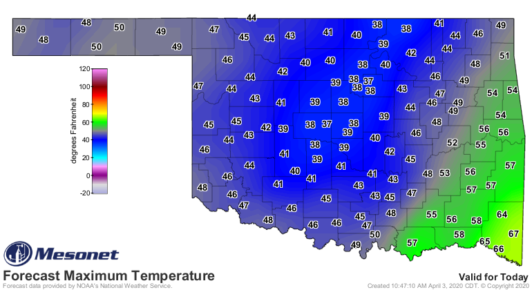
Temperatures should be on their way up throughout the day,but the damage (if
any) has already been done.


Gary McManus
State Climatologist
Oklahoma Mesonet
Oklahoma Climatological Survey
(405) 325-2253
gmcmanus@mesonet.org
April 3 in Mesonet History
| Record | Value | Station | Year |
|---|---|---|---|
| Maximum Temperature | 103°F | ALTU | 2011 |
| Minimum Temperature | 15°F | KENT | 2002 |
| Maximum Rainfall | 3.12″ | WAUR | 2012 |
Mesonet records begin in 1994.
Search by Date
If you're a bit off, don't worry, because just like horseshoes, “almost” counts on the Ticker website!