Ticker for April 1, 2020
MESONET TICKER ... MESONET TICKER ... MESONET TICKER ... MESONET TICKER ...
April 1, 2020 April 1, 2020 April 1, 2020 April 1, 2020
Marching back
APRIL FOOL! Yes, me.
We're mostly talking March on today's Ticker, although some folks say we're
mostly talking gibberish. But that's darned near every day.
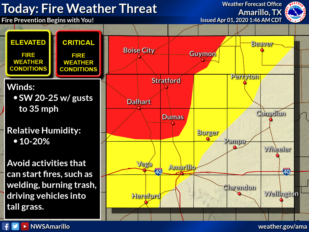
The most interesting aspect of today's weather is the warm/windy/dry conditions
in the far western Panhandle, setting those folks up for high fire danger. There
is a Red Flag warning for that area as winds are expected to be gusting over
35 mph, temperatures will be near 80, and RHs down into the 11-15% range.

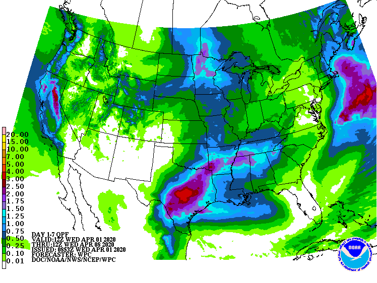
Unfortunately, little in the way of rain is forecast for that drought plagued
area, at least over the next week.
Well, we'll deal with tomorrow's weather tomorrow, when our forecast will be a
lot more present...I mean accurate. Let's talk March. Did you know that
parts of southern Oklahoma have probably seen their last freeze already? And
did you know that occurred back in February?
Well, read on, Macduff.
---------------------------------------------------------------------------------
Spring Steps Forward During March
April 1, 2020
Winter seemed to take a final bow after February in Oklahoma, leaving March with
a warm and wet transition to spring. Areas of southern Oklahoma failed to see
temperatures dip below freezing, and Hollis managed to hit 100 degrees on one of
the earliest dates in state history. The lack of wintry weather was replaced by
active spring weather. Severe storms were not prevalent, but there were three
distinct storm systems that brought damaging weather to the state. Severe
storms on the 19th spawned at least two tornadoes according to preliminary data
from the National Weather Service. The first twister touched down just after
midnight on the 19th near Olive in Creek County, damaging trees and a few
structures. The second tornado struck later that morning near Okemah in
Okfuskee County, again damaging trees and a few structures. The two confirmed
tornadoes became the fourth and fifth the state has seen thus far in 2020,
equaling the 1950-2019 average for those three months.
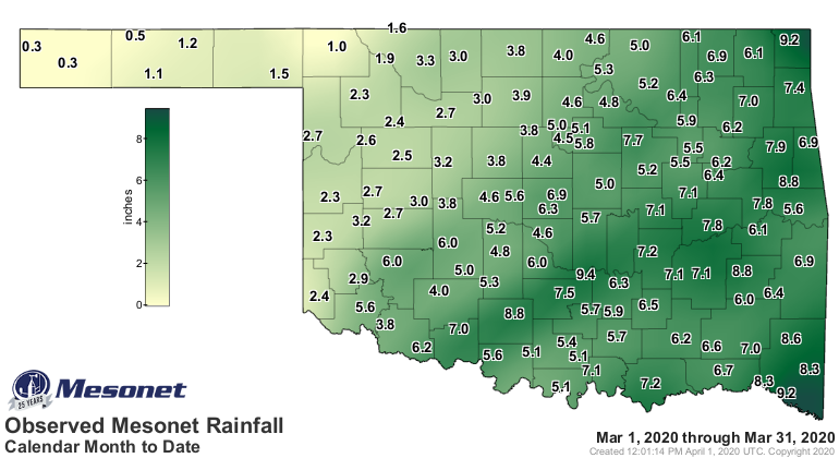
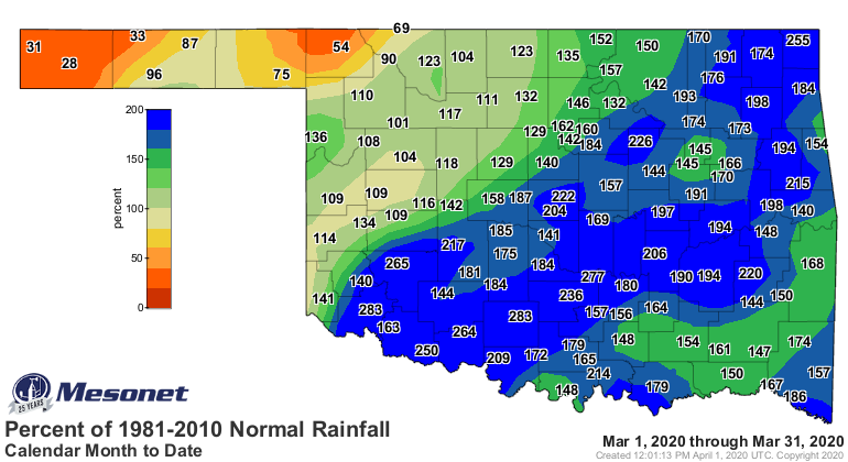
According to preliminary data from the Oklahoma Mesonet, the statewide average
rainfall total was 4.93 inches, 1.89 inches above normal to rank as the fifth
wettest March since records began in 1895. As is usually the case in Oklahoma,
the heftiest totals were primarily across eastern sections. Totals from 6-9
inches were common southeast of Interstate 44, with Byars leading the way at
9.44 inches for the month. Of the Mesonet’s 120 sites, 74 had at least 5 inches
of rain, and 25 of those sites had at least 7 inches. The only stations that
failed to reach at least an inch were in the far northwest, including three of
the sites in the drought plagued western Panhandle. Kenton had the lowest March
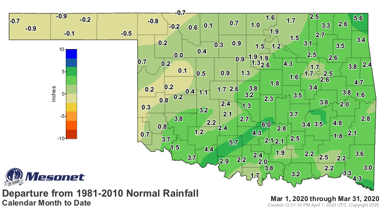
total with 0.32 inches. The far northwest was the only area of the state with a
moisture deficit – generally less than an inch – while surpluses generally grew
to 1-3 inches elsewhere. Southwestern and south central Oklahoma saw their third
wettest Marches on record at 2.42 inches and 2.94 inches above normal,
respectively.
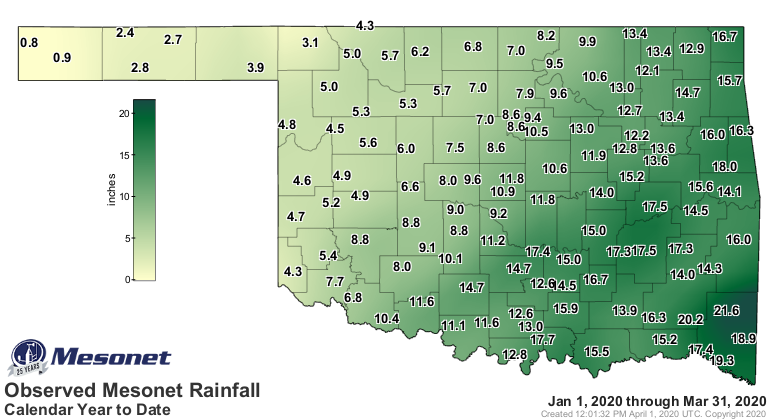
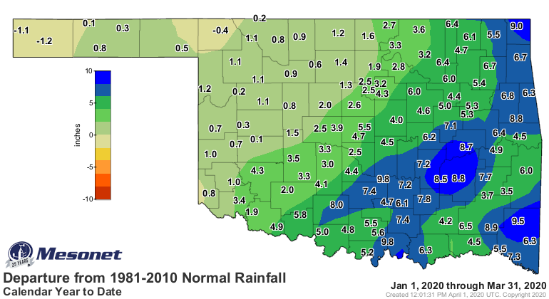
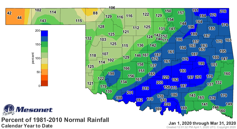
The first three months of the year finished with a statewide average of 10.21
inches, 3.78 inches above normal to rank as the fifth wettest January-March
since 1895.
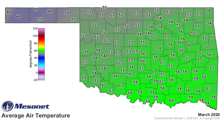
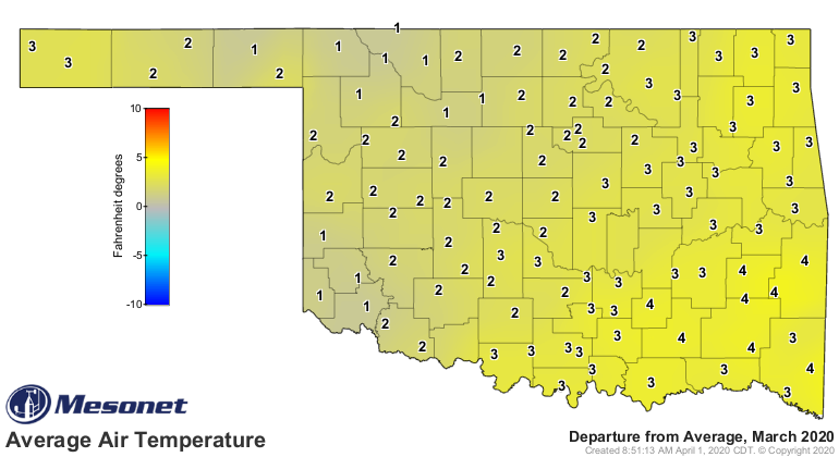
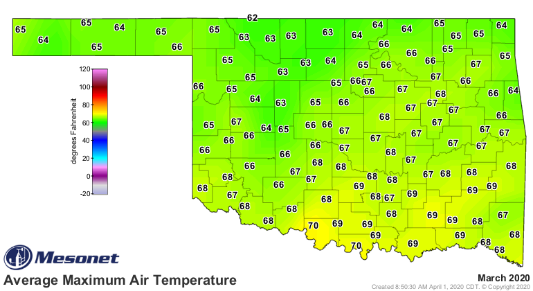
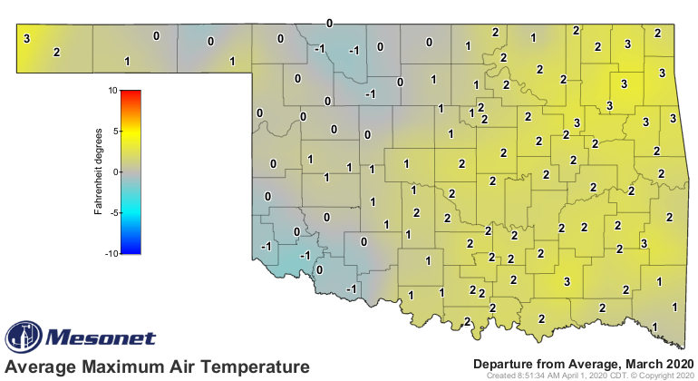
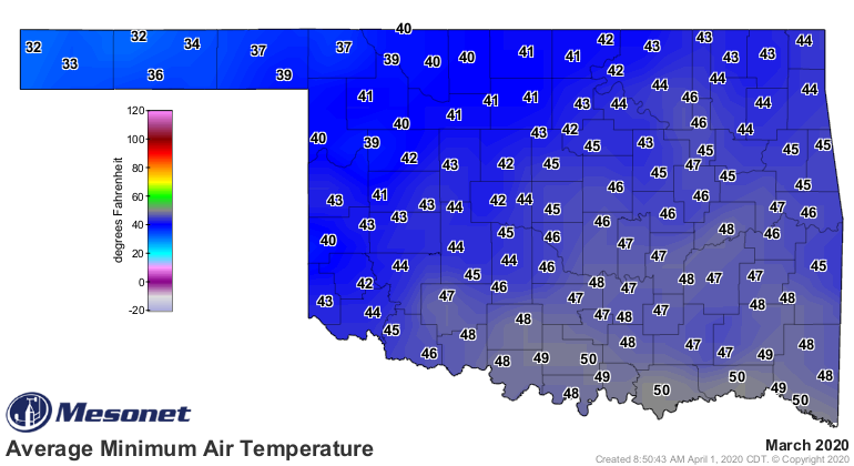
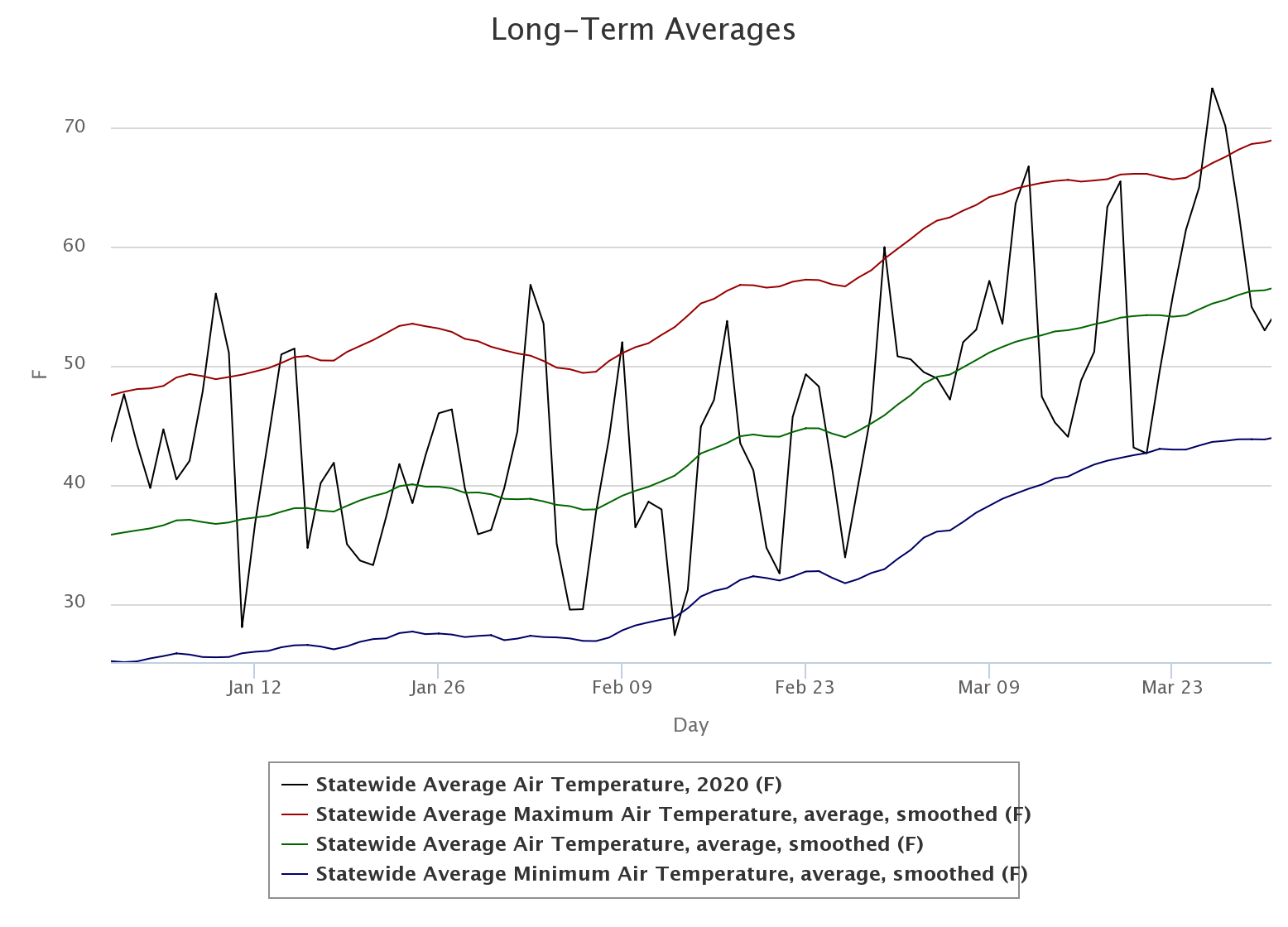
The statewide average temperature was 54.9 degrees according to the Mesonet,
4.5 degrees above normal to rank as the 12th warmest March on record. That
lofty ranking was owed as much to the lack of cold weather as to an abundance
of warm weather.

Fifteen Mesonet sites failed to dip below freezing during the month, and more
than half spent less than 10 hours at or below 32 degrees. Eva led the state
with 76 hours below freezing.
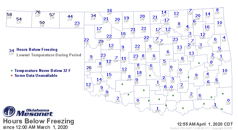
The month’s lowest temperature of 20 degrees occurred at three different sites
over two days. The month’s highest temperature was a record breaker. Hollis
reached 100 degrees on the 26th for 2020’s first triple-digit temperature, the
last dating back to Sept. 27, 2019. It also set the mark for the highest
temperature ever recorded on any March 26 in Oklahoma history. The
January-March statewide average temperature was 46.4 degrees, 2.9 degrees above
normal to rank as the 16th warmest such period since 1895.
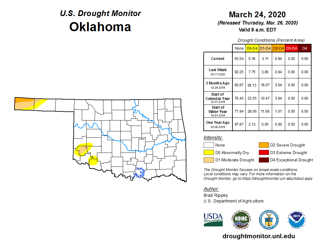
Very little drought remained in the state at the end of March, although the
heaviest precipitation failed to hit the most stricken area. The far western
Panhandle remained in moderate-to-severe drought, virtually unchanged since
the beginning of last fall. Smaller areas of persistent drought in the far
southwest received enough precipitation to be improved to the point of
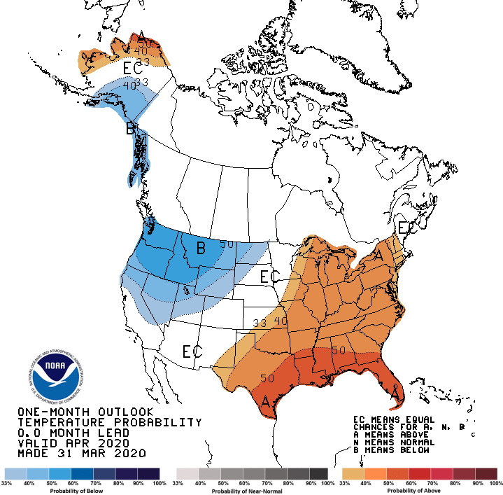
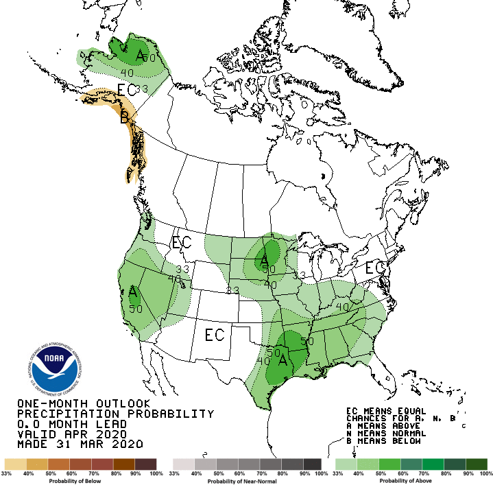
elimination. The April temperature and precipitation outlooks from the Climate
Prediction Center (CPC) do not provide much hope for drought relief in the
western Panhandle with increased odds of above normal temperatures and
precipitation over much of the state, but no such indications in that area.
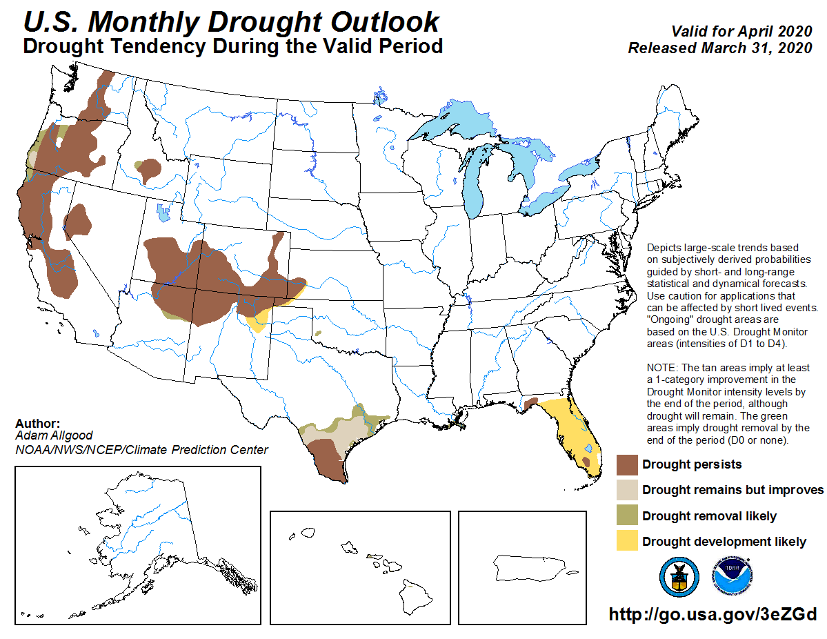
Given those outlooks, CPC’s April drought outlook expects some relief for the
remaining dry conditions in the far southwest, but persistence and possibly
even more development southeastward in the western Panhandle.
Gary McManus
State Climatologist
Oklahoma Mesonet
Oklahoma Climatological Survey
(405) 325-2253
gmcmanus@mesonet.org
April 1 in Mesonet History
| Record | Value | Station | Year |
|---|---|---|---|
| Maximum Temperature | 98°F | ALTU | 2012 |
| Minimum Temperature | 19°F | EVAX | 2023 |
| Maximum Rainfall | 2.57 inches | TIPT | 2006 |
Mesonet records begin in 1994.
Search by Date
If you're a bit off, don't worry, because just like horseshoes, “almost” counts on the Ticker website!