Ticker for March 30, 2020
MESONET TICKER ... MESONET TICKER ... MESONET TICKER ... MESONET TICKER ...
March 30, 2020 March 30, 2020 March 30, 2020 March 30, 2020
What the hail?

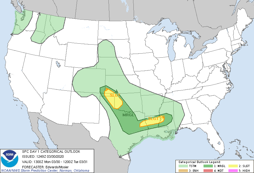
Ready or not, here it comes. Mother Nature is going to give us some rain today
and tonight (more in some places than others), but with that rain we're going to
have a bit of a severe weather threat. It doesn't look too bad as of now, unless
you're in the eastern Oklahoma Panhandle. There we'll see, at least from the
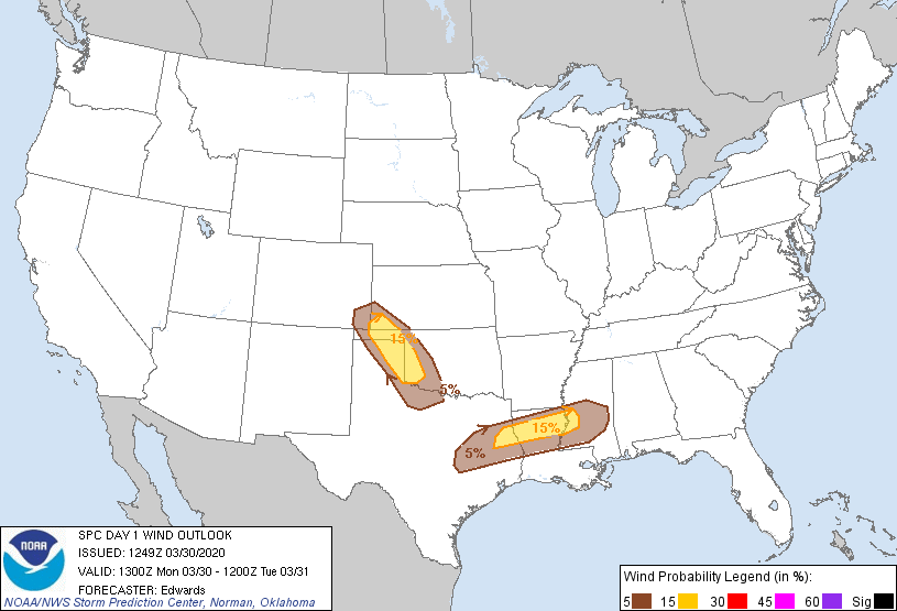
current data and high resolution model forecasts, an increased chance of large
hail, 2" or larger. Now there will be a chance of large hail across much of
western Oklahoma, but that spot in the panhandle in particular could possibly
have the proper dynamics to see those hailstones boosted higher for longer, and
thus grow to scary sizes. We're talking past golf ball sized up or higher. Here
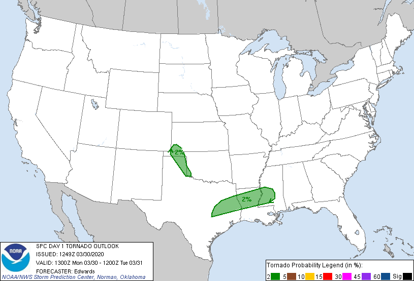
are the rest of the Storm Prediction Center threat maps for today. Tornado
threat appears to be LOW.
We mentioned the rain with this system. Forecasts right now are looking like
we'll see a half-inch to an inch across the main body of the state. A bit more
possibly in the east. Twas ever thus.
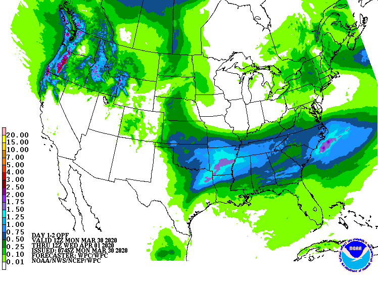
Heck, it's raining now in southern Oklahoma. If you're there, look outside.
If you're there and outside, come in for crying out loud...it's raining!
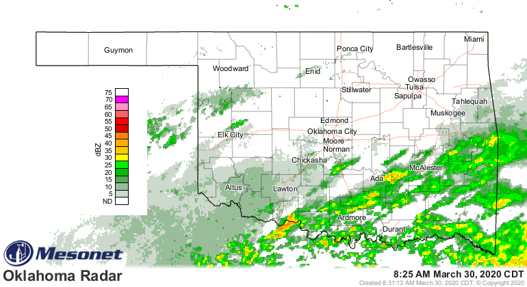
Amounts have been extremely light thus far, but that rain will enhance later
today and spread over the state with more moisture that will stream up from
the south, and as a storm system passes by.
Later this week, we'll see another storm system or two. First on Wednesday into
Thursday, then Saturday into Sunday. Both will give us rain chances. Nothing
too nasty on the horizon just yet. Oh yeah, another cold front on Saturday.
BOO!
I swear the older I get the more impatient I get for "warm up day." What is
warm up day, you ask? Oh, you didn't ask? Well, I'll tell you anyway. It's the
day in Oklahoma when you can always count on it getting warm and STAYING warm.
At least until fall. What day is that, you ask? Well, I've always considered it
to be May 5. I didn't mean to confuse it with Cinco de Mayo, it just happened
that way.
Hmmmm, if there were some way for me to prove that. Some sort of -- let's call
it "data" -- that I could go and run statistics on and show what day "warm up
day" actually fell on. I'll be right back!
Gary McManus
State Climatologist
Oklahoma Mesonet
Oklahoma Climatological Survey
(405) 325-2253
gmcmanus@mesonet.org
March 30 in Mesonet History
| Record | Value | Station | Year |
|---|---|---|---|
| Maximum Temperature | 92°F | ARNE | 2010 |
| Minimum Temperature | 20°F | ANTL | 2003 |
| Maximum Rainfall | 5.20 inches | IDAB | 2002 |
Mesonet records begin in 1994.
Search by Date
If you're a bit off, don't worry, because just like horseshoes, “almost” counts on the Ticker website!