Ticker for March 26, 2020
MESONET TICKER ... MESONET TICKER ... MESONET TICKER ... MESONET TICKER ...
March 26, 2020 March 26, 2020 March 26, 2020 March 26, 2020
Are you thirsty Dad?
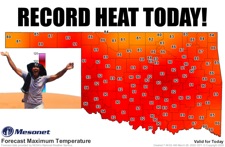
I'll be darned if we didn't go and summer this place up. Oh, it might have only
lasted for two days, including today, but darned if we didn't need it right about
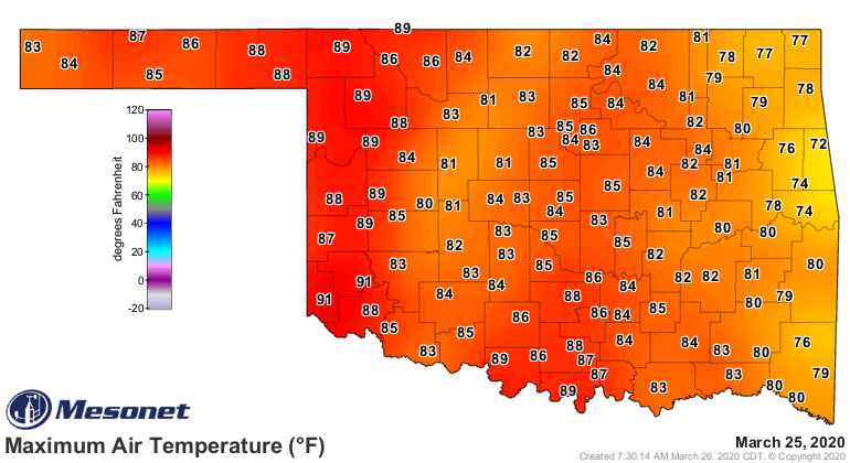
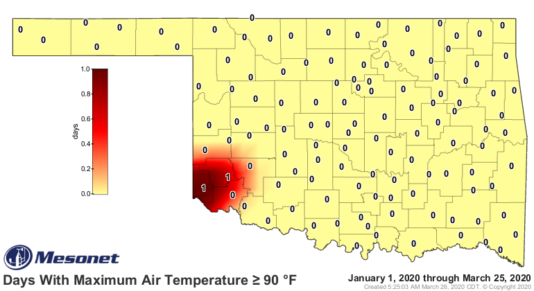
now. Yesterday we saw our first temperature of at least 90 degrees in the state
since Oct. 20, 2019. And today, I'm thinking we might actually come close to
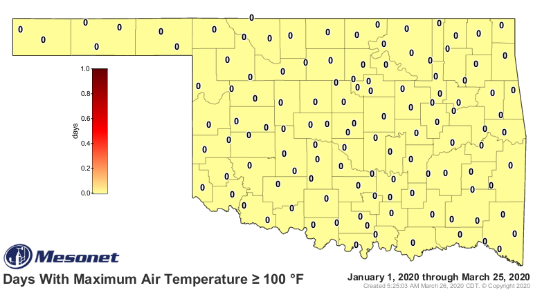
triple-digits. Hollis, Altus? Somebody, speak up. When these maps start showing
up, anything can happen!
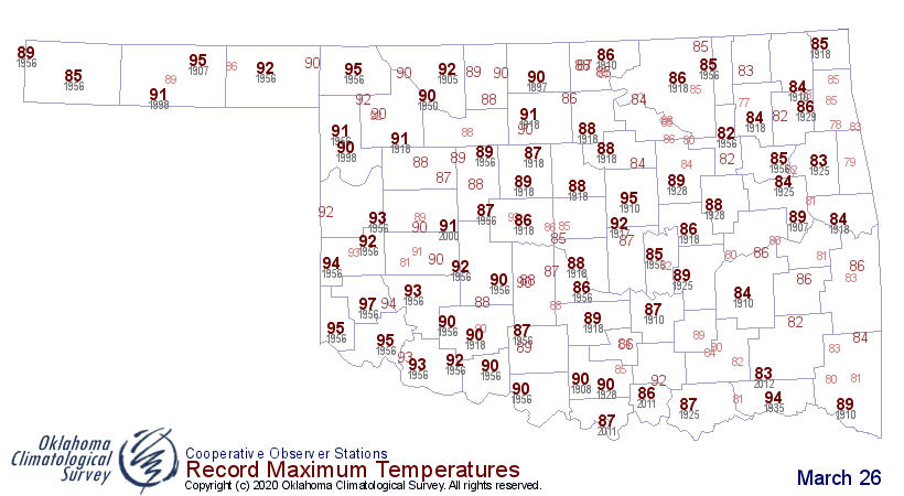
As we get more than 30 degrees (!!) above normal in parts of the state today,
obviously we're looking at record-breaking territory. The highest temperature
ever recorded on this date in Oklahoma, going back to the 1880s, was 99 degrees
at the Sac & Fox Agency way back in 1910. We'll keep an eye out because there's a
chance that record could fall somewhere in the state. Here's a look at the
historical record highs for today. Check the one in your area and then keep
track on the Mesonet high temperature map today. Okay, then I'll do it for you!
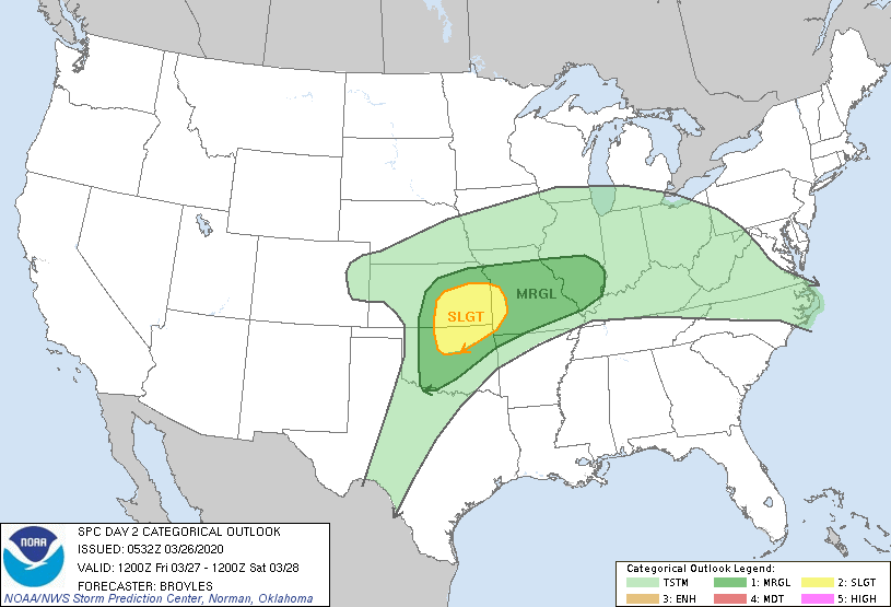
Then tomorrow we get a system moving through which will cool things down and
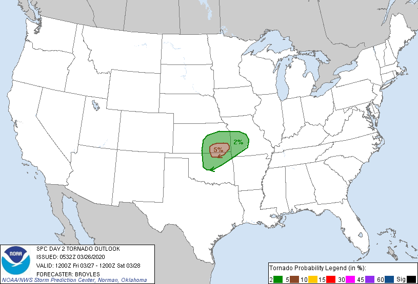
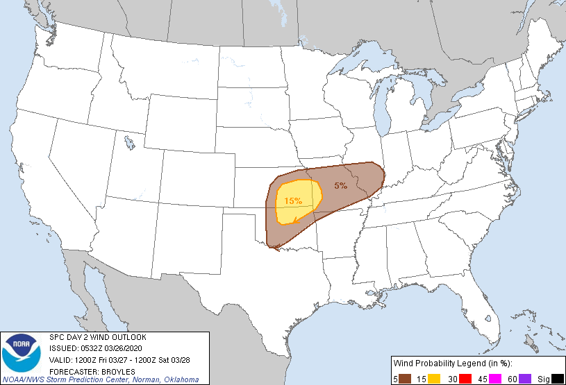
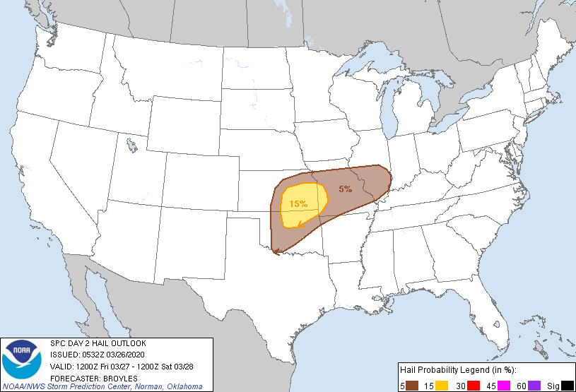
give us a chance of some weather. There will be a risk of severe storms,
especially in the northeast. Main threats will be winds and large hail, although
there is a conditional risk for tornadoes; conditional in that if this and
that happen to occur, then the storms could become tornadic. I'd tell ya the
this and that, but then you'd know. Best to just stay weather aware throughout
the day tomorrow into Saturday morning. Here are the risk maps from SPC.
Speaking of cool downs, we're going to get a freeze in the Panhandle come
Sunday morning, and close to a freeze in northern Oklahoma.
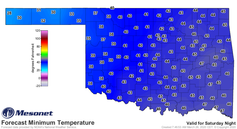
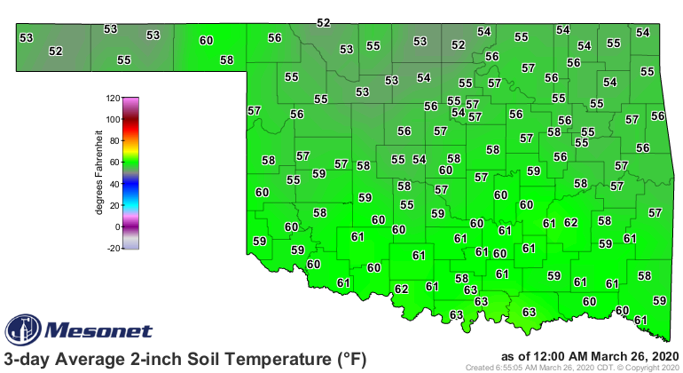
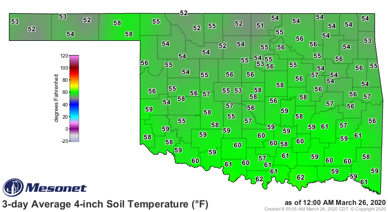
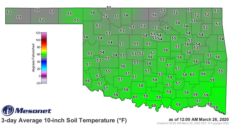
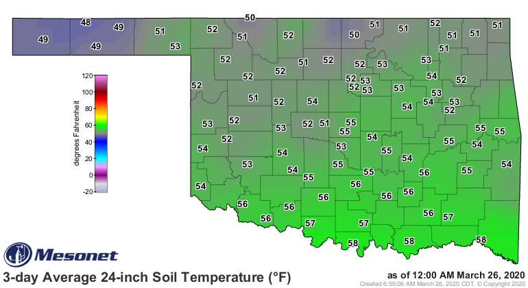
Yeah, we're not out of the woods in that department just yet. Soil temperatures
are soaring right now, at least in the upper levels of the soil, but it will
still take some time for those lower levels to catch up (but also they won't
drop as fast either).
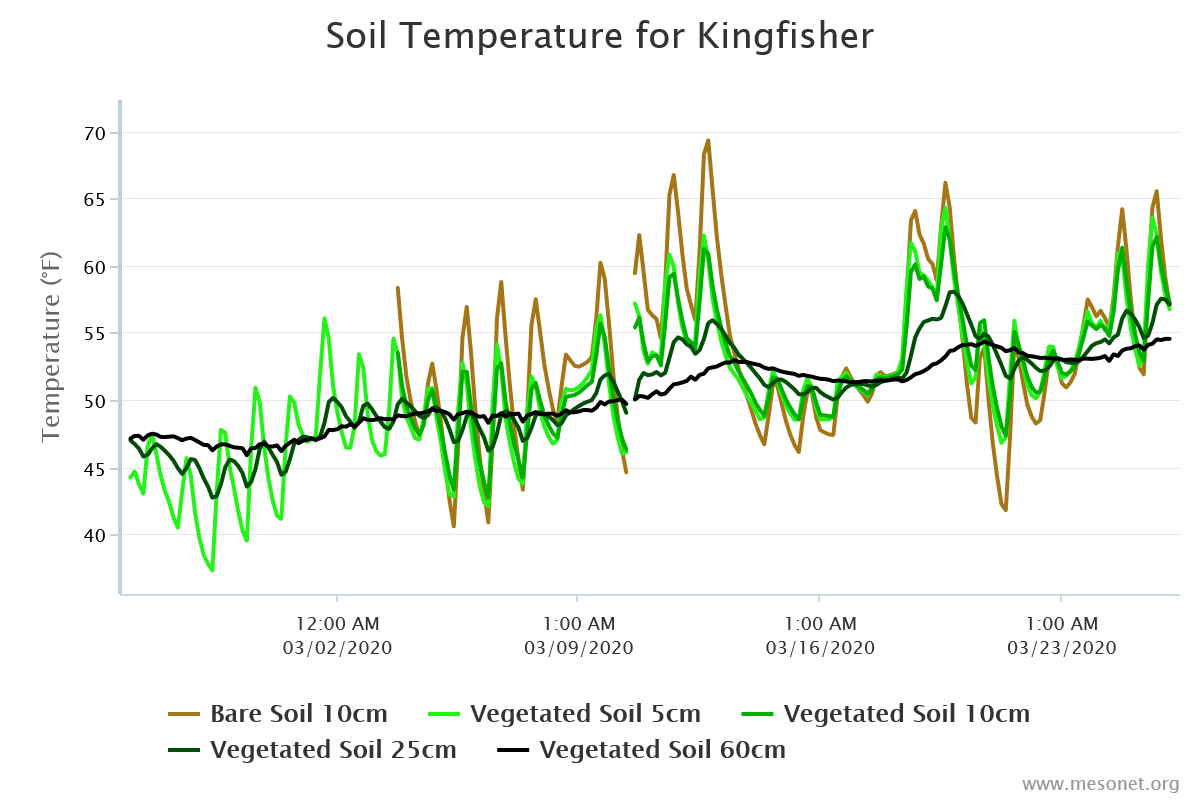
Here you can see the change in soil temperatures at different levels at
Kingfisher over the last 30 days. This is representative of what's going on
at each Mesonet site. The daily extreme highs and lows occur under bare soil
at 10cm, obviously, without that protective cover above it. The other layers
protected by the vegetation don't see those diurnal extremes, with additional
protection in the deeper levels by more insulating soil.
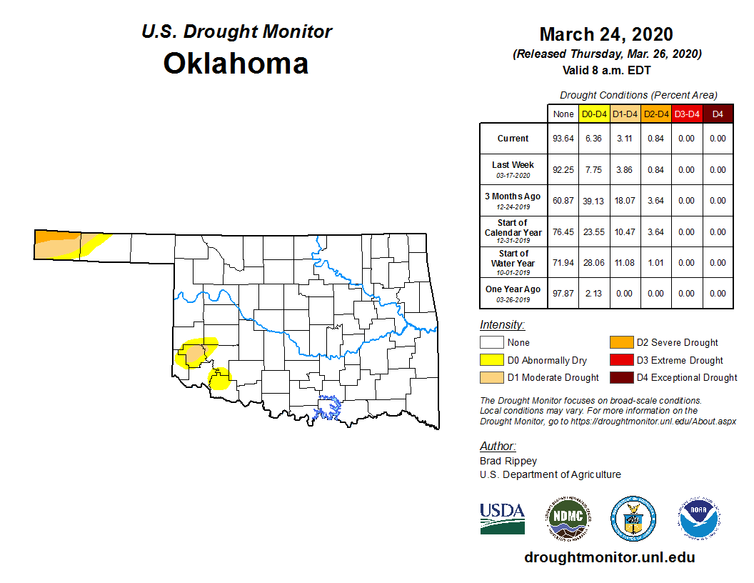
The heat won't help out drought situation out much, but that problem continues
to shrink. Just a smidgen of drought left in the far southwest, but more
persistent and severe drought in the western Panhandle.
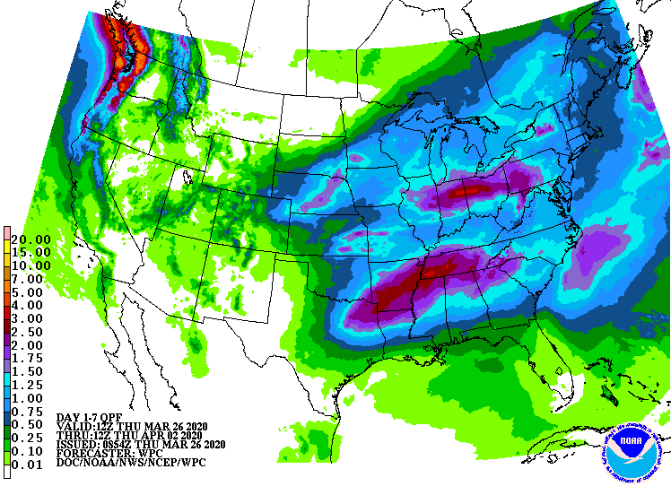
There won't be much help from rain in those areas either, although there could
be enough to keep the dust down, hopefully.
That's it. Have a fun summer today! Check this map tomorrow. Maybe, just maybe.
Gary McManus
State Climatologist
Oklahoma Mesonet
Oklahoma Climatological Survey
(405) 325-2253
gmcmanus@mesonet.org
March 26 in Mesonet History
| Record | Value | Station | Year |
|---|---|---|---|
| Maximum Temperature | 100°F | HOLL | 2020 |
| Minimum Temperature | 11°F | BOIS | 2024 |
| Maximum Rainfall | 2.35″ | BYAR | 2018 |
Mesonet records begin in 1994.
Search by Date
If you're a bit off, don't worry, because just like horseshoes, “almost” counts on the Ticker website!